
Stop 3 of 10
Into the Bluegrass and Wilderness, 11 November 1806
Lewis and his party, including Pierre Chouteau and the Osage Indian delegation, departed Louisville on 11 November 1806, following today's U. S. 60 to Frankfort, KY. The party would pass through Middletown, founded 1797, Shelbyville, founded 1792, to Frankfort, founded 1786.
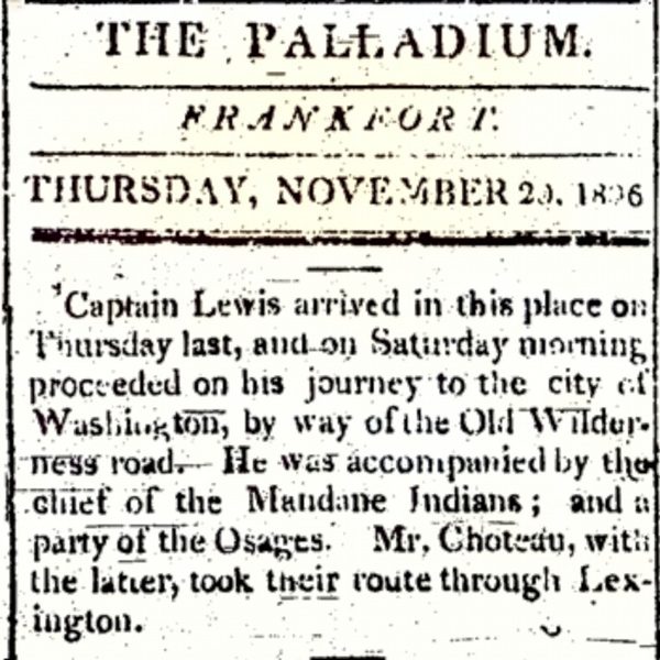
Courtesy: Filson Historical Society
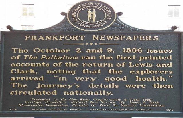
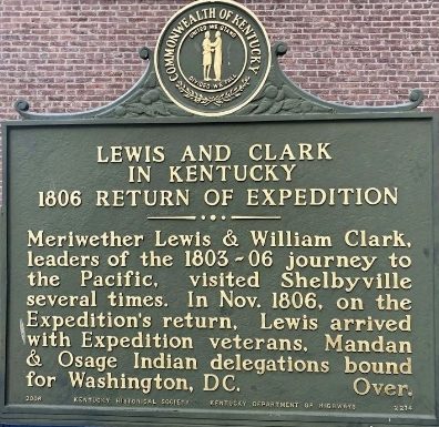
Courtesy: Lewis and Clark Trust
The party of Osage Indians and Pierre Chouteau left Frankfort and traveled to Lexington, KY then followed the Buffalo Trace to Maysville, KY, taking the northern route to Washington, D. C. via Wheeling and Winchester, VA. We have found no reason why the two groups separated. Possibly it was easier to find food and lodging for the smaller groups.
Road from Limestone to Frankfort in the state of Kentucky
Victor Collot, 1797. https://www.davidrumsey.com/maps5601.html
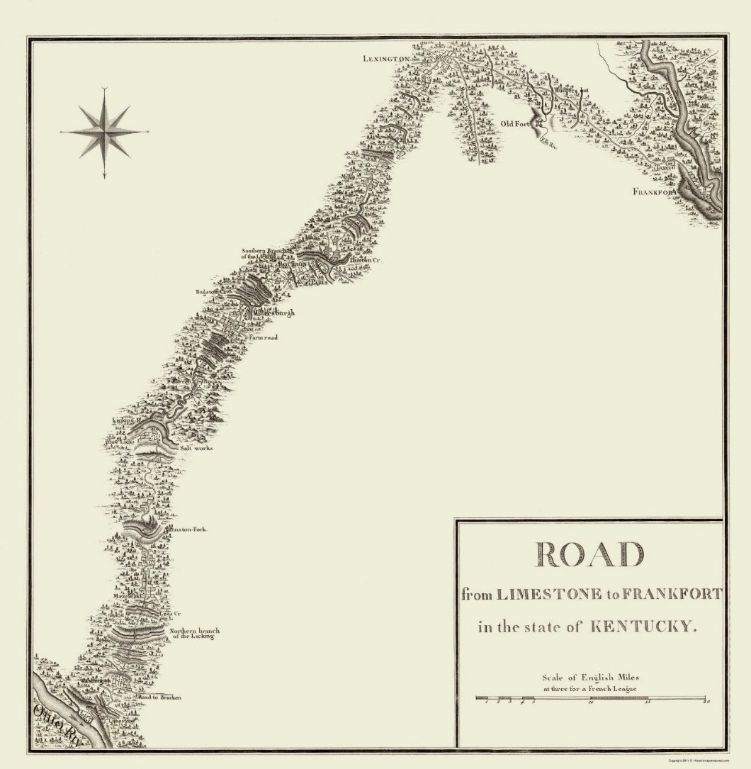
Courtesy: Historic Maps of Kentucky, University of Kentucky 1979
Clark did not leave Louisville until early December. He was preparing for his courtship with Julia Hancock when he reached Fincastle, Virginia. With York, Clark would travel the Wilderness Road from Louisville through Middletown, founded 1797, Shelbyville, founded 1792, Bardstown, founded 1770, Springfield, founded 1782, to Danville, founded 1785, where Clark checked on his nephew John O'Fallon, attending school.
Abraham Bradley, Jr. Postal Map 1804
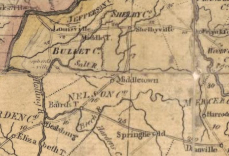
https://www.loc.gov/resource/g3700.ct004551/?r=0.32,0.345,0.065,0.039,0Courtesy
Courtesy: Library of Congress
At some point in their travel and possibly at Danville, York was directed to return to Louisville and purchase corduroy or dark velvet for of sherryvallies, overalls that buttoned on the outside to cover other clothing.
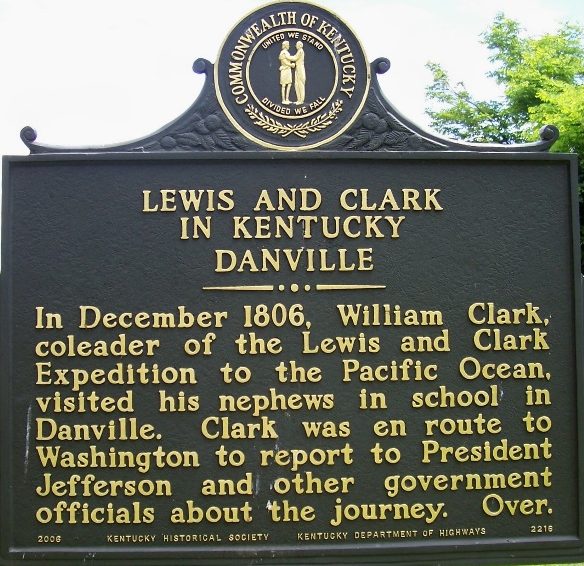
Constitution Square, MainStreet, Danville, KY
Courtesy: Lewis and Clark Trust
Lewis, Sheheke and party had traveled through Danville, KY a few weeks earlier on their way to Washington. (1)
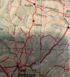
Following the Wilderness Road, US 150, Clark and York would have joined the Boone Trace, the first trail into Kentucky cut by Daniel Boone and his group of axmen in March 1775. The Wilderness Road and Boone Trace join at Hazel Patch, South of Oakley and near KY490, in Laurel County following the corridor of U. S. 25, KY 229, and U. S. 25 E, South through the Cumberland Gap. (2)(3)(4)
Boone Trace- Wilderness Road
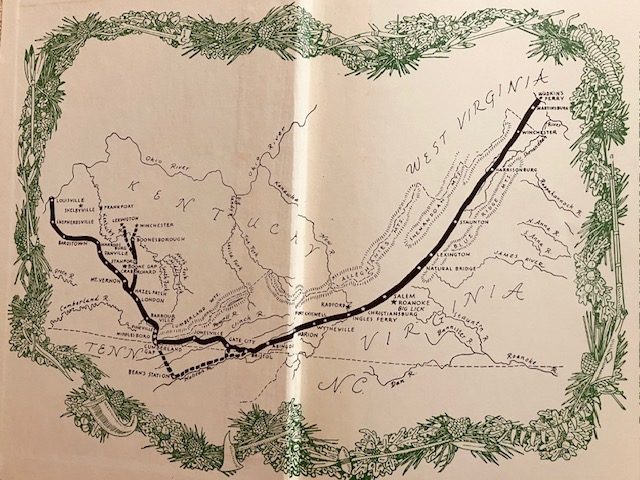
The Wilderness Road, by Robert Kincade, Map inside cover
Courtesy: Lewis and Clark Trust
Kentucky Historical Marker
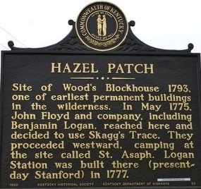
Courtesy: Duane Hall
Intersection KY 490 & Patton Road 37°13.794’N 84° 6.132W
Hazel Parch A.K.A. Wood’s Blockhouse
(Location under historical marker, above)
Courtesy: Danny Hinton
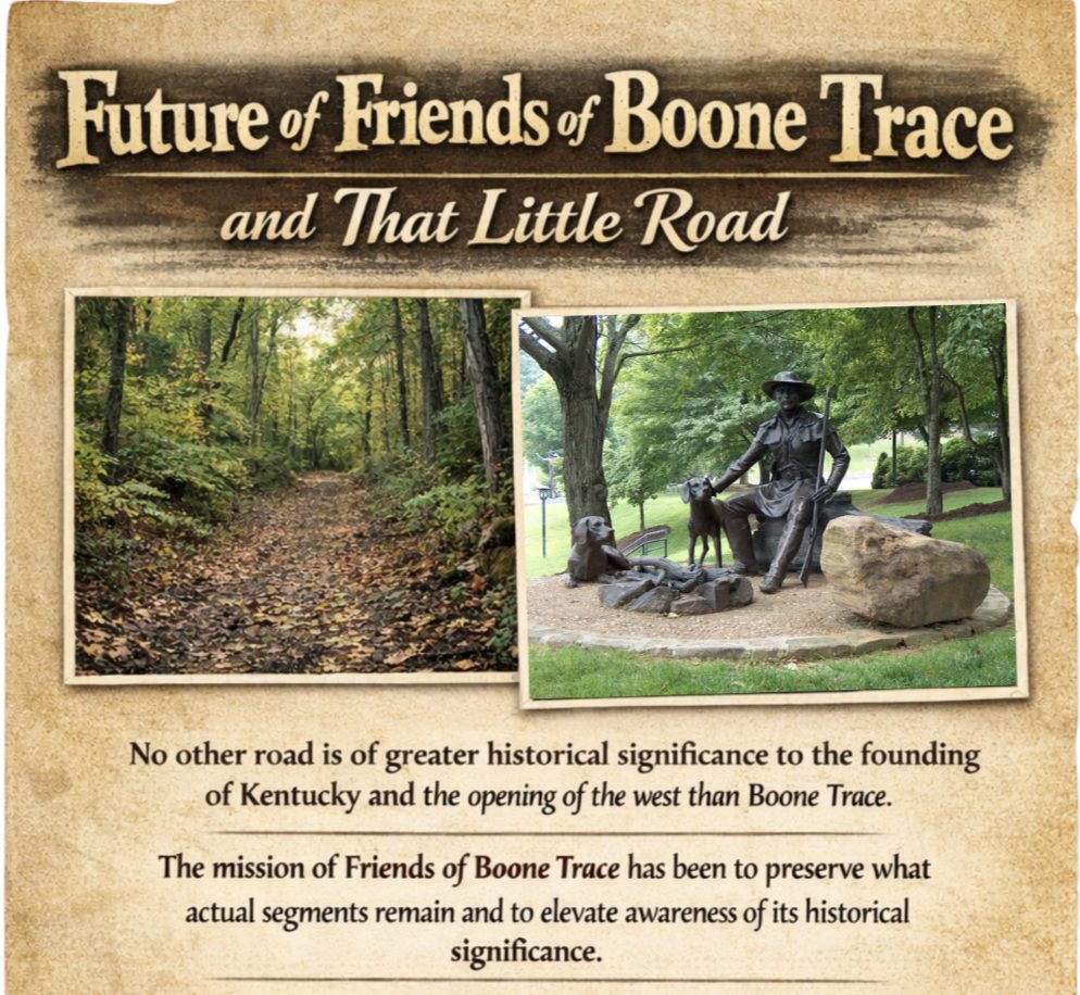
https://www.boonetrace1775.com/
Courtesy: Friends of Boone Trace
Lewis was leading his party along a route he had traveled before. On 24 July 1797, Lewis wrote to his mother, Lucy, from Shelbyville, KY and advised that he would be in Frankfort the next day to arrange payment for property tax on land in present day Estill and Powell County, KY. This was land inherited by the children of William Lewis. Meriwether further explained that he would “set out for Georgia the next day.” His trip to Georgia would be related to settling John Mark’s estate and property owned by the Marks children. (5)
In 1806, Lewis and his party, including Sgt. John Ordway, arrived at Cumberland Gap on or before 20 November 1806. Revolutionary War veteran, Col. Arthur Campbell, on learning of the Lewis party being in the area visited with them and provided John Ordway with a letter of introduction to Jedidiah Morse, geographer, concerning the publication of Ordway's Journal, a journal later purchased by Lewis and Clark. (6)
Lewis may have thought that his celestial observations were over when he reached the mouth of the Columbia River. While at Cumberland Gap, Col. Campbell prevailed on Lewis to make a celestial observation to help settle a dispute concerning the location of the Walker Line, the state line between Virginia and North Carolina and Kentucky and Tennessee. With Lewis' Survey Certificate we know that he was still at Cumberland Gap on 23 November 1806, one of the most hallowed historic locations on the North American Continent. (7) (8)
“This day in compliance with the request of certain gentlemen, I undertook to settle the latitude of a line usually denominated Walker’s line, formerly dividing the states of Virginia and North Carolina. The position selected for this observation was near the habitation of a Mr. E. Walling, two hundred yards south of said line, and about two miles distant from Cumberland Gap. The instruments used in this observation were a Sextant on the most approved plan, with a reversing Telescope for an eye piece [sic], and a good micrometer, and artificial horizon, in which water was used as the reflecting surface. With these instruments, I took the meridian altitude of the sun’s lower limb, and calculated the latitude; from which it appeared that the place of observation was in North latitude 36° 38’ 12 1-10; if, therefore, the charters of the states of North Carolina and Virginia call for a parallel of latitude at 36° 30’ N. as a boundary between them, the line of Walker is nine miles and 1,077 yards North of its proper position.
This statement, I have given to Colonel Arthur Campbell, at his request, to be presented to the public view, in any manner he may think proper.”
As we will see, Meriwether Lewis and William Clark crossed this impediment to travel on numerous occasions during their public service to the America people.
Cumberland Gap
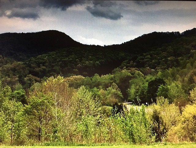
Cumberland Gap from Entrance at Cumberland Gap National Historical Park.
Courtesy: Lewis and Clark Trust
Today, we can follow Clark and York corridor from Louisville, through Bardstown, Springfield, Danville, Stanford, Crab Orchard, KY along U. S.150, connecting to U. S. 25 in Mt. Vernon, KY, Kentucky 229 to U. S. 25 E Southeast of Corbin, KY, Barbourville, and Middlesboro, through the Cumberland Gap National Historical Park.
Source:
(1) Jones, Landon, William Clark and the Shaping of the West, Hill and Wang. NY, 2004, page 154.
(2) Kincaid, Robert, The Wilderness Road, Bobbs-Merrill Co., 1966, Page Map on inside covers.
(3) Myer, William, Indian Trails of the Southeast, Extract from the Forty-second Annual Report of the Bureau Of American Ethology, 1924-1925, page 760.
(4) Delorme, Kentucky Atlas & Gazetteer, Yarmouth ME, 1997, page 87.
(5) Letter, Meriwether Lewis to Lucy Meriwether Lewis Marks, Missouri Historical Society-St. Louis, ML Papers, Collection A0897, Box 5.
(6) Oman, Kerry Serendipity, We Proceeded On, Journal of the Lewis and Clark Trail Heritage Foundation, November 2001, page 8.
(7) Hainesworth, Lorna, Meriwether Lewis 's Survey at Cumberland Gap, self-published by Lornalment Press, 2011, 18 pages.
(8) https://www.academia.edu/24183110/Meriwether_Lewis_Survey_at_Cumberland_Gap