Subject 4 The Clarks Travel East

William Clark’s 1809 Journey to Washington and Back to St. Louis

1809 37 stops, all on this page

Start at stop 1

From stop 3: Poor Roads and Questionable FoodCourtesy: National Park Service- Trail of Tears
Jump to a stop 37
  1. 1William Clark’s 1809 Journal, St. Louis to Washington DC and Back
  2. 2To Washington by Carriage with three servants
  3. 3Poor Roads and Questionable Food
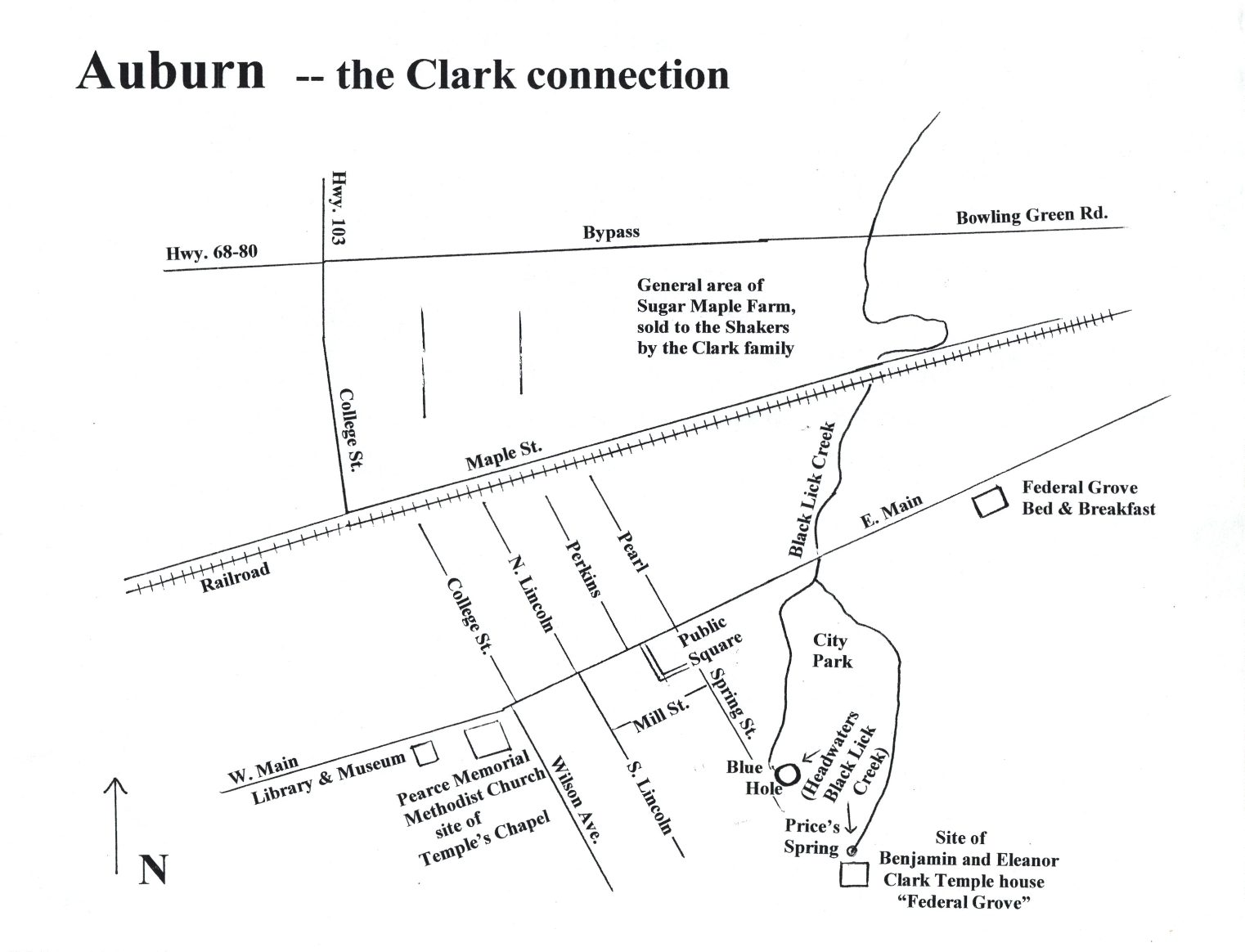
  4. 4Visit with the Benjamin Temple Family
  5. 5Breakfast with Mr. Vance, Bowling Green (KY)
  6. 6Traveling A Well-Established Road to see the Large Clark Family in Louisville
  7. 7The Clark’s 1809 Louisville Homecoming
  8. 8Very Bad News While Traveling in a Beautiful Country
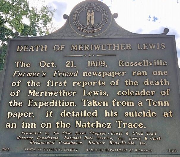
  9. 9Confirmation that Governor Lewis is Dead
  10. 10A Heavy Heart and a Great Deal of Work in Lexington
  11. 11South on the Lexington Branch of the Wilderness Road, 31 October 1809
  12. 12A Broken Carriage Strap Caused Delay
  13. 13Rain and Mud in the Wilderness
  14. 14A Wilderness with Cold Muddy Roads
  15. 15A Night at the edge of a Meteorite Strike
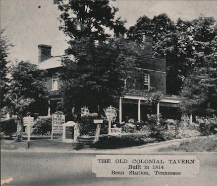
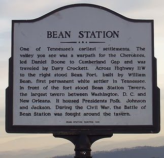
  16. 16South on the Old Kentucky Road to Bean Station
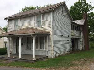
  17. 17East to Rogersville
  18. 18Miles to Go With Little Rest
  19. 19The Western End of the Great Valley Road
  20. 20Rain, Cold and Wet, Again
  21. 21Preston Hospitality
  22. 22On the Road Again
  23. 23Where did the Clarks Stay in Christiansburg?
  24. 24A Contagious Disease
  25. 25To Washington by Horse
  26. 26Facing a Difficult Conversation with the Marks Family
  27. 27Guidance from Mr. Jefferson
  28. 28To Richmond, VA
  29. 29Merry Oaks to Richmond
  30. 30From Merry Oaks to Washington
  31. 31Sunday with Old Friends at Fredericksburg
  32. 32All Night on A Stage Coach
  33. 33Meeting with the Secretary-of -War
  34. 34Bills-of-Exchange Settled and Expedition Journals Secured
  35. 35Homeward Bound via the Kanawha River (Present-day West Virginia)
  36. 36Securing and Protecting the Lewis and Clark Journals for future Generations
  37. 37The End of an Era

Stop 1 of 37

William Clark’s 1809 Journal, St. Louis to Washington DC and Back

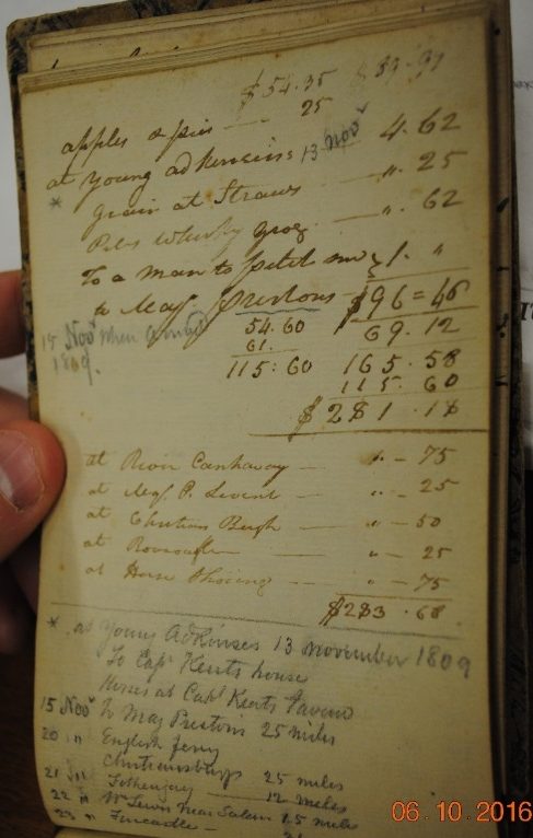
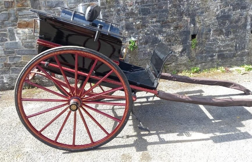
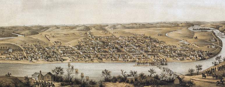
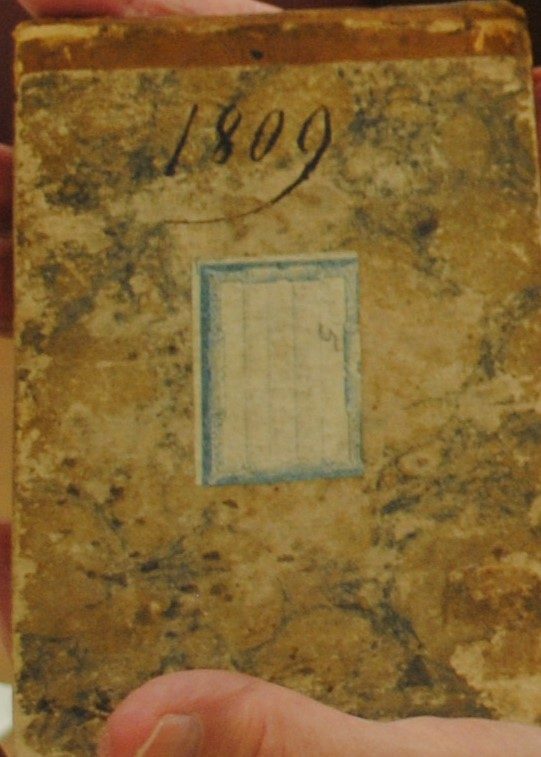
As Lewis is floating toward Chickasaw Bluffs (Ft. Pickering), William, Julia, 8-month-old Meriwether Lewis Clark and enslaved servants Scott, Chloe, and their daughter Rachel, leave St. Louis on 21 September 1809, in their carriage. (1) William’s eventual destination was Washington D C, where he planned to meet Lewis to settle their rejected Bills of Exchange and address other business pertinent to the Upper Louisiana Territory. Lewis’ work would include publication of the expedition journals, a work he would never complete.

Fortunately, William, with Julia’s occasional additions, kept a journal of their travel and related expenses. This phase of the website narrative will follow the chronology of their trip. For a full reading of the Clark’s 1809 Journal, owned and preserved by the State Historical Society of Missouri and digitized with the financial assistance of the Lewis and Clark Trust, please see:

https://digital.shsmo.org/digital/collection/frontier/id/1042/
605 Elm Street; Columbia, MO 65201; Phone: 573-882-708; https://shsmo.org (picture 1 of 2)
605 Elm Street; Columbia, MO 65201; Phone: 573-882-708; https://shsmo.org (picture 2 of 2)

Courtesy: State Historical Society of Missouri

605 Elm Street

Columbia, MO 65201

Phone: 573-882-708

https://shsmo.org

A testimony to the significance of the 1809 William Clark Journal comes from an address by the late Dr. Donald Jackson at the Society of Manuscripts 1972, Winter Meeting. “A Footnote to the Lewis and Clark Expedition” is an outstanding view of the journal and the importance in understanding William Clark’s thinking and actions after he learns of Meriwether Lewis’ death. (2) Jo Ann Trogdon, The Unknown Travels and Dubious Pursuits of William Clark, opens the window further to understand the complicated man, William Clark and the international political intrigues of the era. Her examination of Clark’s 1798 business trip to New Orleans then to the east coast by sailing ship and the overland return to Louisville shows his cartographic skills and journal writing before the Western Explorations with Meriwether Lewis. (3)

Reading Clark’s 1809 Journal can be an interesting challenge. Grammar and spelling conventions were still in a state of considerable disagreement. Samuel Johnson’s A Dictionary of the English Language, (4) and the later Noah Webster’s dictionary first appeared in 1806. William Clark had little time to use the dictionary, even if he had the copy he purchased in 1792 in Frederick, MD or Pittsburgh, PA. (5) The 1809 Journal is a forerunner to Gideon Davidson’s The Fashionable Tour, published in 1822 or Duncan Hinds, Adventures in Good Eating or Hinds’ 1957 Lodging For A Night. Clark’s comments on the quality of their lodging and food is a true socioeconomic commentary on the regions they traveled through. Many writers have commented and been amused with Clark’s spelling and penmanship, yet his 21 September 1807 letter to Thomas Jefferson describing the Big Bone Lick (KY) excavation, shows clear penmanship and thoughtful language. (6) He did have a habit of writing fast when under pressure to get a letter or note written. In his letter to brother Jonathan Clark on 28 October 1809, William ended with, I hope you will excuse my hasty scraul (scrawl). (7) Albert Furtwangler said, “combining words to say something memorable or exact was a difficult labor, which we have already seen both of these men could perform astonishingly well”. (8) The Clark Journal is a compilation of notes by date and must read as notes and not a manuscript. In many respects, the 1809 Journal is akin to Clark’s Field Notes - 13 December 1803-3 April 1805, edited by Ernest Staples Osgood, Yale University Press, 1964 or the Elk Skin Journal of 1805, Missouri Historical Society, ID # A0289-20305.

History is about people - their struggles, joys, sorrows, virtues, short comings, and migrations. William Clark’s 1809 Journal is filled with all of these including his ownership of enslaved people, a situation we recognize today as abhorrent. Yet we also see a husband, father, and friend to his fellowman that labors daily to be of service to all.

For reasons unknown, Clark divided the journal into two parts. Section one (1) is the brief account of the day after day travels. Section two (2) is a list of day-to-day expenses and miles traveled. The two sections provide a clear picture of their travel experience and his state of mind. Additionally, William has recorded notes to himself that relate to the Federal Fur Factory business and the price of products sent to the factories for trade or operation of the several fur trade factories. Equally interesting, we can see the lack of financial institutions or a standardized credit system. William’s trustworthiness is reflected when his father-in-law asked him to exchange a $700.00 bank note and silver for delivery to General Preston. A Bank Note and cash in the early era is unusual when barter was generally accepted for financial transactions. The infant banking system was filled with state-chartered banks and in most cases those banks were chartered without gold or silver reserves to back the paper transactions. The 1818/1819 financial crash eventually brought about a long-needed restructuring of financial institutions. (9)

Congressman Henry Clay was a champion of a National Road System, partially based on his travel on frontier trails. If Clay had read Clarks 1809 Journal, he would have been an even stronger advocate for public road improvements. (10) Clark details the drastic need for public roads to accommodate commerce, postal routes, and personal travel were all part of the need for better roads in-addition to a stronger banking system.

We hope you will take the time to read the full 1809 Journal to understand the man who lived in the shadow of Meriwether Lewis. While Lewis promised Clark an equal rank and sharing of honors, a promise he kept, Clark was viewed by President Jefferson as a “second in command” during the western exploration. After Lewis’ tragic death, Clark quickly grasped and accepted his responsibility in securing the Journals and other high priority documents needed to preserve the exploration history and to defend Meriwether Lewis’ integrity. As readers of the journal and this website will see, Jefferson added immensely to Clark’s securing the journals and other documents that helped vindicate Meriwether Lewis and the financial affairs relating to the Upper Louisiana Territory. The 1809 Journal is a window to Clark’s recognition that the journals, he and Lewis had prepared, were now his obligation to see through to publication.

During the period immediately following Lewis’ death, Clark was urged to seek the position of Territorial Governor, a position he did not desire in part because he was aware of the personal objectives of the St. Louis bureaucrats and people with strong personal political interest. Raised during the Period of Enlightenment, Clark kept his focus and reasoned priorities in order, culminating in a successful publication of the Lewis and Clark Journals in 1814. The fact that he never received compensation for the publication and his difficulty in getting a copy does not seem to be of lingering concern to Clark.

When Clark was appointed Governor of the Upper Louisiana Territory in June 1813, he did a splendid job at a time of great change in the American West. Clark, while still a relatively young man, became a “Citizen Senior” in the West and in Washington D C. (11) The age-old question, “does the time make the man or does the man make the time”, will be debated forever but Clark had been trained from early in life to accept responsibility as a “Citizen Senior” and served admirably as Governor. (11)

Source:

(1) Jones, Landon, William Clark and the Shaping of the West, Hill and Wang, New York, 2004, page 177.

(2) Jackson, Donald, A Footnote to the Lewis and Clark Expedition, The Manuscript Society, Winter 1972, page 3 21.

(3) Trogdon, Jo Ann, The Unknown Travels and Dubious Pursuits of William Clark, University of Missouri Press, Columbia, 2015, Preface xvii-xxi.

(4) Ostler, Rosemarie, Founding Grammars: How Early America’s War Over Words Shaped Today’s Language St. Martin’s Press 2015, page 129.

(5) Foley, William, Wilderness Journey: The Life of William Clark, University of Missouri Press, Columbia, 2004, page 28.

(6) William Clark to Thomas Jefferson, see photo below.

(7) Holmberg, James J., Dear Brother: Letters from William Clark to Jonathan Clark, published in association with The Filson Historical Society and Yale University Press, New Haven, 2002, page 216-218.

(8) Furtwangler, Albert, Acts of Discovery: Visions of America in the Lewis and Clark Journals, university of Illinois Press, 1993, page 169.

(9) Clark, Thomas D., Frontier America, Charles Scribner’s Sons, New York, 1959, page 330-333.

(10) Ibid, page 339-345.

(11) Strauss, William and Howe, Neil, The Fourth Turning: An American Prophecy, Three River Press, New York,1997, page 323.
Stop 2 of 37

To Washington by Carriage with three servants

A Journey of many changes and adjustments

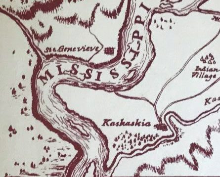
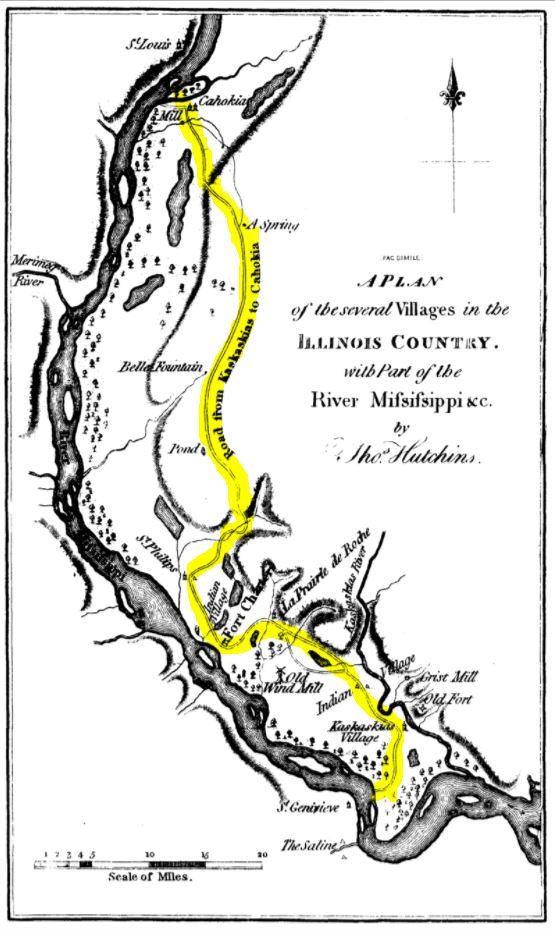
Traveling in a carriage on 21 September, the Clarks family left St. Louis, accompanied across the Mississippi River to Cahokia, IL by Major David Delaunay, Adj. General of the Militia; Major Clement Penrose; Militia Colonel Pierre Chouteau and his family; Sheriff Jeremiah Connor and others. A party of friends and family traveling a short distance with a departing family member or traveling to meet the guest is not an unusual occurrence in the early 1800’s, a similar situation seen later in Clark’s 1809 Journal.

The Clark group stayed in Cahokia the evening of the 21st then took the old French Colonial Military Road through Prairie du Rocher to Kaskaskia, IL arriving late on 23 Sept.

To Washington by Carriage with three servants

Courtesy: The Digital Research Library of Illinois History

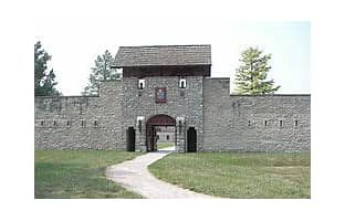
Clark would have viewed the old Fort de Chartres, completed in 1720, as they traveled to Kaskaskia (1). It is possible that William would have remembered viewing the fort in 1803 as he and the crew moved the keelboat up the Mississippi River.

Lewis and Clark National Historic Trail (picture 1 of 2)
Lewis and Clark National Historic Trail (picture 2 of 2)

Courtesy: National Park Service Courtesy: Wikimedia

Lewis and Clark National Historic Trail

Kaskaskia was the first State Capital of Illinois and a pivotal town in George Rogers Clark’s Revolutionary War successful winning of the Northwest for the United States. We can reasonably assume that Clark remembered his earlier visits to Kaskaskia in connection with settling George’s war debts and the visit to the Fort to recruit troops for the expedition in 1803. It is likely that the Clark Family and enslaved servants stayed with William Morrison that evening. William Morrison was a partner with Clark and others in the St. Louis Missouri Fur Company. http://morrison.chester.lib.il.us/

To Washington by Carriage with three servants

Courtesy: Il.statehistory.org

The flood of 1881 changed the channel of the Mississippi River when it cut through to the Kaskaskia River. That flood and subsequent floods destroyed the colonial community of Kaskaskia on the north side of the Kaskaskia River. (2) (3)

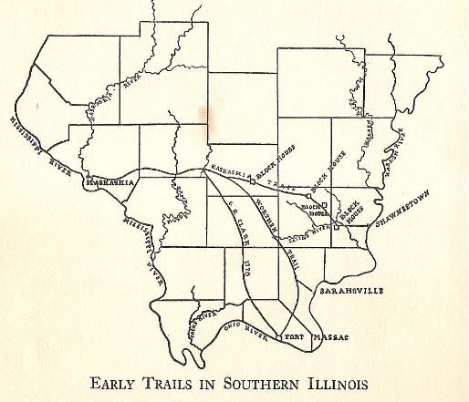
Leaving Kaskaskia on the 24th, the Clark party traveled the Kaskaskia Trail and the Worthen Trail through Randolph, Perry, Franklin, Williamson and Pope Counties, IL, arriving at Lusk Ferry, (Sarahsville in some reports) on the Ohio River, 24 September. Today, a large part of this trail is within the Shawnee National Forest. (4)(5)

To Washington by Carriage with three servants

Courtesy: Wikimedia.org/Wikimedia/commons

Source:

(1) Brown, Margaret K. and Dean, Lawrie C., The French Colony in the Mid-Mississippi Valley, American Kestrel Books, Carbondale, IL, 1995 page 25.

(2) Personal Letter from Mark Wagner, Director, Center for Archaeological Investigations, Professor in Anthropology, SIU, Carbondale & President, Eastern States Rock Art Research Assn. ESRARA.

(3) http://onlinedigeditions.com/publication/?m=35671&i=645260&p=18

(4) Early Trails in Southern Illinois. https://upload.wikimedia.org/wikipedia/commons/e/e0/Early_Trails_in_Southern_Illinois.JPG

(5) Staff of the Mitchell-Carnegie Public Library, A History of Saline County, Journal Illinois State Historical Society (1908- 1984) Vol. 27, No. 1 (April, 1934) Page 31-54.

Stop 3 of 37

Poor Roads and Questionable Food

Few, Five Star Rated Accommodation’s

After several day of poor roads, poor lodging and food, William noted, on 29 September, rose late horse a little better. He gave a good rating to Sarah Lusk Thompson’s Tavern, paid $3.00 for lodging and food plus $1.00 for forage. At the close of the previous day, he commented good family pleasant man. William was feeling better. Lusk Ferry, later Berry’s Ferry, was a familiar crossing point for William and Julia. In 1808, York, Clark’s enslaved servant and the first recorded African American to traverse the North American Continent, had taken the carriage across country to St. Louis from Lusk Ferry. (1)

After crossing the Ohio River on the Lusk Ferry, Clark made his first purchase in Kentucky, a quart of whiskey and reported that the house was dirty. Was he trying to alleviate the pain of the past several days or preparing for the future?

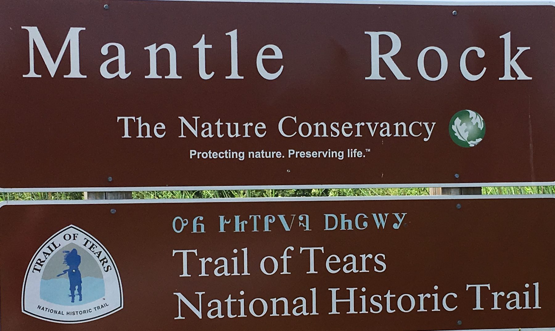
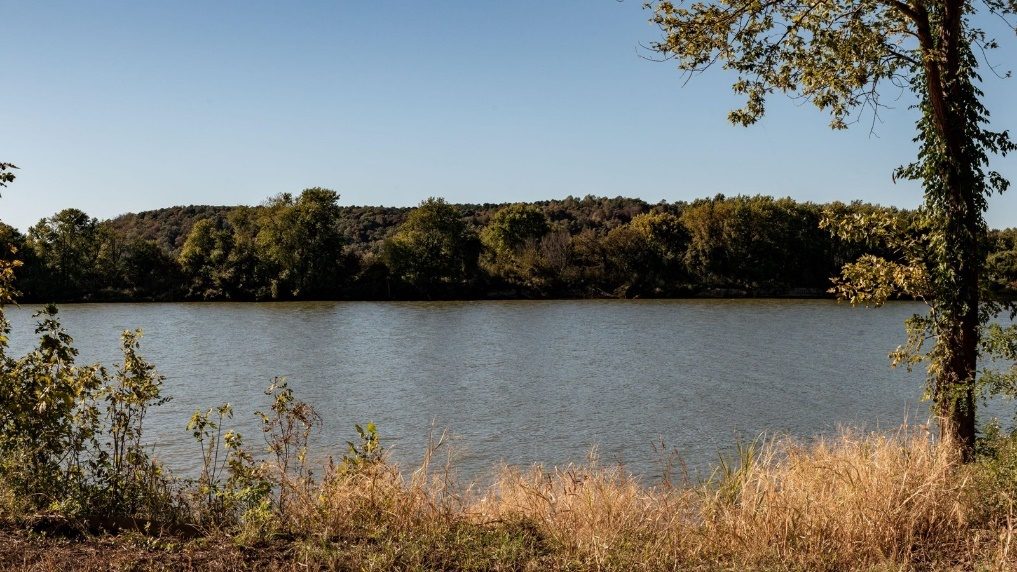
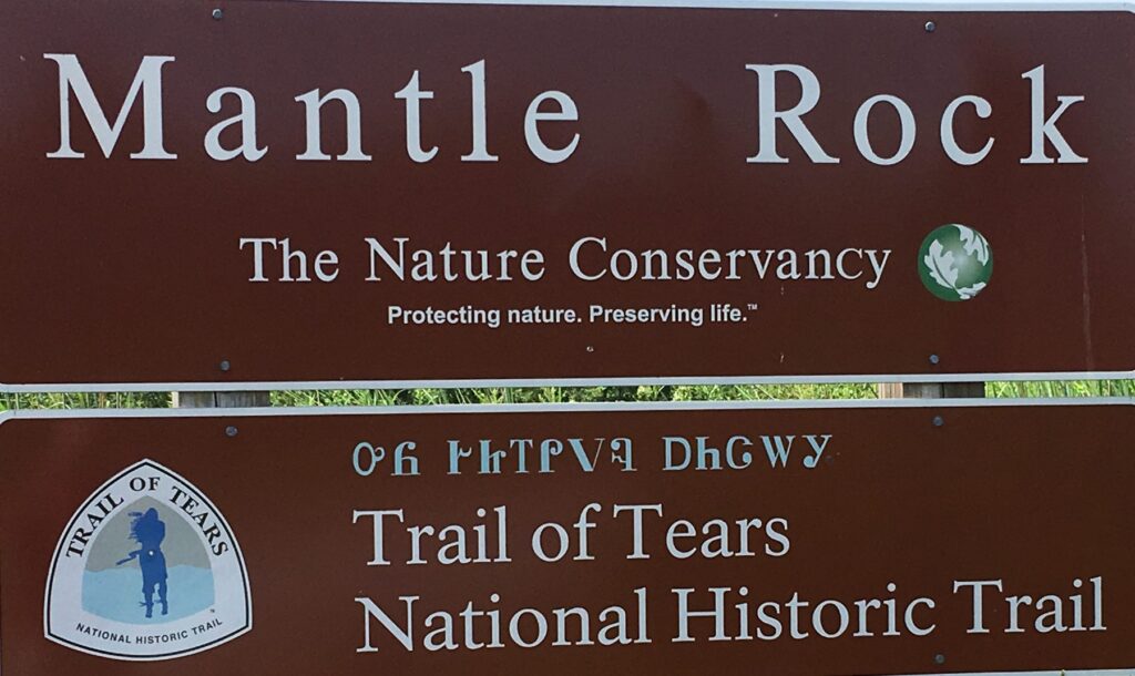
As the Clark’s traveled in a Southeasterly direction along present-day KY 133, they were within a few yards of Mantle Rock. The historic significant trail, across western Kentucky, would be followed in the 1837-38, as part of the future National Park Service -Trail of Tears. As a Superintendent of Indian Affairs, the primary Federal Agent responsible for relocating thousands of Cherokees, Chickasaw, Choctaw, Creeks, and Seminole to the “Indian Territory”, Clark was navigating a trail that would become a forced migration route.

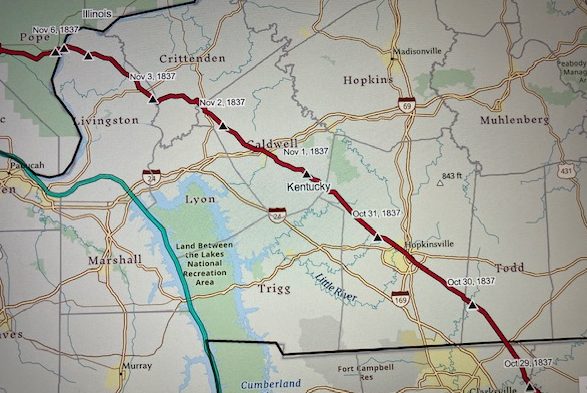
In October 1837, Lieutenant B. B. Cannon would lead a volunteer group of Cherokee Indians northwest along same route the Clark’s had traveled. The Cherokee were relocating to their new home in the Indian Territory. (2) In 1838-1839, Captain Peter Hilderbrand would lead a Cherokee detachment along the same route. They would be forced to spend two bitterly cold weeks in the Mantle Rock Area because the Ohio River ice prevented the ferry from operating. (3)

https://www.nps.gov/trte/planyourvisit/index.htm (picture 1 of 2)
https://www.nps.gov/trte/planyourvisit/index.htm (picture 2 of 2)

Courtesy: National Park Service- Trail of Tears

https://www.nps.gov/trte/planyourvisit/index.htm

Lieutentant B. B. Cannon 1837 Route, following the same corridor the Clark Party used in 1809 from Hopkinsville to the Ohio River.

Chris.Dunn@GeoVelo.com

Courtesy: Chistopher W. Dunn, Esq.

Chris.Dunn@GeoVelo.com

The Clarks traveled through Salem, Centerville, present-day Fredonia, KY, and eventually to Judge William Prince’s at the “Big Springs”, present-day Princeton, KY. (4) They were following the Saline Trail used by Indigenous People for centuries to move salt or other trade items from the salt springs in Southern Illinois to the southeast or other regions. (5)

The Clark party was also traveling the corridor George Drouillard would have used in November 1803, to Ft. Southwest Point, TN (35°.860632 -84°.5291008) The trail crossed the Ohio at Lusk’s Ferry, later Berry’s Ferry, then following a trail that crossed streams at or near their head waters to the vicinity of present-day Guthrie, KY to Mansker’s Station, near Goodlettsville, TN. (6) With a stop at Craigfont, Castalian Springs, TN (7) and followed the well-established Avery Trace (8) a.k.a. Tollunteekee Trail to Ft. Southwest Point, Kingston, TN. (9) Drouillard did not keep a known journal nor do we know if Lewis provided a map. We do know that George Drouillard was successful in his first mission for Lewis and Clark escorting recruits to the first winter camp on Wood River, Il. (10)(11)

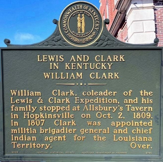
On 2 October 1809, Clark arrived in Hopkinsville, KY and paid $1.75 for breakfast at Mr. Alsberrys (Thomas Allsberry Tavern) before proceeding to Colonel (Anthony) New’s home and stayed all night.

Hopkinsville, KY Historical Marker

Hopkinsville, KY Historical Marker

Courtesy: KY Lewis and Clark Bicentennial Commission

and several Hopkinsville Community Organizations

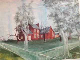
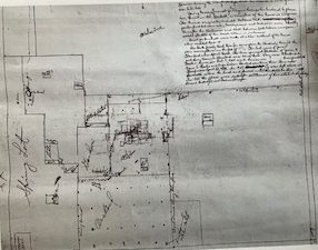
Colonel New’s Dunheath

Colonel New’s Dunheath (picture 1 of 2)
Colonel New’s Dunheath (picture 2 of 2)

Painting and drawing of Colonel New’s Dunheath, Elkton, KY. Named for ancestorial homes in VA and Scotland.

Painting and drawing Courtesy: Charline Standard Ring and provided by Historic Todd County, KY.

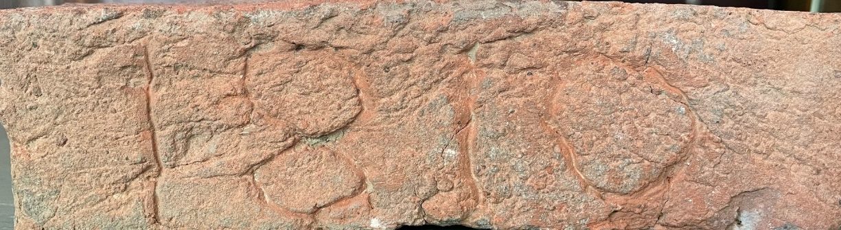
Hand-made brick from Dunheath. Fired from clay on site.; Welcome Center 1 Public Square; Elkton, KY 42220; 270-265-7070

Hand-made brick from Dunheath. Fired from clay on site.

Courtesy: Historic Todd County (KY)

Welcome Center 1 Public Square

Elkton, KY 42220

270-265-7070

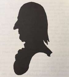
Col. Anthony New, silhouette

Col. Anthony New, silhouette

Courtesy: Wingfield’s History of Virginia

The New plantation was approximately equal distance between Hopkinsville and Russellville, KY on present-day Business U S 68/KY 80 just west of downtown Elkton, KY. Colonel New, trained as an attorney, had been member of the Virginia Militia 1780-1781, and was a U. S. Representative in Congress 1793-1805 in Virginia’s 11th and 16th District. (11) After moving to Kentucky, he served as the 1st and 5th District Representative 1811 to 1823. Col. New had lived in Caroline Co. VA, birthplace of William Clark, giving the two men a common thread of conversation. Clark did not comment on the home, Dunheath, or food. (12)(13)(14)(15)
Source:

(1) Holmberg, James, Dear Brother: Letters from William Clark To Jonathan Clark, Yale University Press, New Haven, 2002, page 246, note 4.

(2) https://geovelollc.maps.arcgis.com/apps/webappviewer/index.html?id=4174853b702f4ad7b9e80e6912eed5666 n-4.

(3) https://www.nps.gov/trte/learn/historyculture/mantle-rock-preserve-exhibits.htm

(4) Kleber, John, ed. The Kentucky Encyclopedia, University of Kentucky Press, 1992. Page 150.

(5) Meyer, William E. Indian Trails of the Southeast, Extract from the 42nd. annual Report Bureau of American Ethnology, 1924-1925, Trails # 40 and 40B, Page 810.

(6) http://www.cityofgoodlettsville.org/114/Manskers-Fort

(7) https://en.wikipedia.org/wiki/Cragfont

(8) https://tennesseeencyclopedia.net/entries/historic-trails/

(9) https://tennesseeencyclopedia.net/entries/fort-southwest-point/ (

(10) Fort Southwest Point Archaeological Site, Kingston, TN: Multidisciplinary Interpretation, Edited, Smith, Samuel, & Prouty, Fred, TN Department of Environmental and Conservation Research, Series # 9, 1993, page 107, note 14; Moulton Gary, The Journals of the Lewis and Clark Expedition, University of Nebraska Press Lincoln, 1986, Vol. 2, Page 139.

(11) Moulton, Gary, The Journals of the Lewis and Clark Expedition, University of Nebraska Press, 1986, page 139.

(12) Windfield, Marshall, History of Caroline Co. Virginia, The Dietz Press, Richmond, VA, 1954, page 492.

(13) Personal correspondence: Gary Violette, Architect, 2020.

(14) Williams, Frances M., The History of Todd County Kentucky 1820-1970, 1972, page 434.

(15) https://en.wikipedia.org/wiki/Anthony New

(16) https://archive.org/details/franheitmanreg00bernrich/page/412/mode/2up?q=Col.+Anthony+New , page 412

(15) 10I 4E4R he History of Todd County Kentucky 1820-1970 by Frances M. Williams, Page 434

Stop 4 of 37

Visit with the Benjamin Temple Family

Description of Russellville, KY 1809

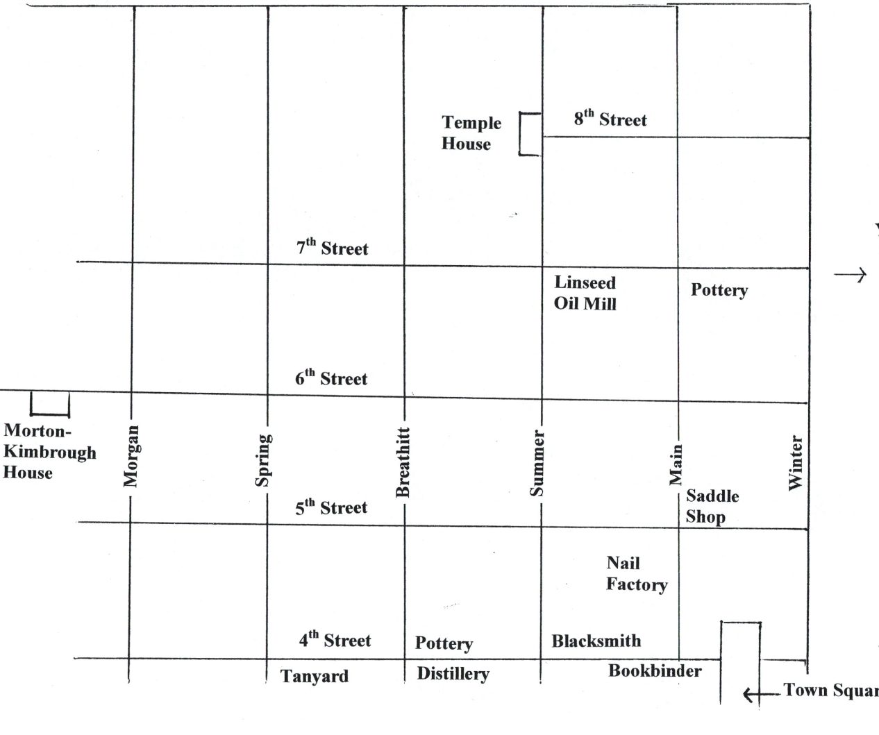
3 October, traveling to Russellville from Colonel New’s, the axletree on the Clark’s carriage broke. The priority when they reached the Temple home was finding a repair shop for the carriage. Was the repair completed at the blacksmith, on 4th Street near the Town Square?

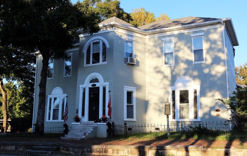
9th Street, O’ Bannon House

515 Main Street

515 Main Street

Courtesy: Logan County (KY) Library, Mark Griffin.

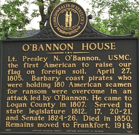
The Lewis and Clark Story is full of stories within the larger story of Lewis and Clark. Russellville, KY is part of the United States interesting historical fabric and the parallels we still experience today as a free people willing to fight for freedom throughout the World. One of Thomas Jefferson first initiatives as President, included confronting, with military force, the Barbary Pirates in North Africia. After diplomatic efforts failed, First Lieutentant Presley Neville O’Bannon leading a small force of Marines and assorted other forces on 28 May 1805, routed the Tripoli Pirates and planted the United States Flag on foreign soil and eliminating the pirates. Resigning from the Marine Corp in 1807, O’Bannon moved to Russellville, build the house at 515 Main Street (corner of 9th and South Main Street). Today the beautifully restored and preserved home honors Lt. O’Bannon and his courage. President Jefferson’s visionary use United States forces to stop piracy and launch the Lewis and Clark Exploration are a large part of the fabric of United States freedom for all people.

Today, explore historic Russellville and the O’Bannon House only 2 blocks from the site of the Benjamin Temple house Site.

O’Bannon House

O’Bannon House (picture 1 of 2)
O’Bannon House (picture 2 of 2)

https://obannonhouse.org/history

Courtesy: O’Bannon House Preservation Foundation, Inc.

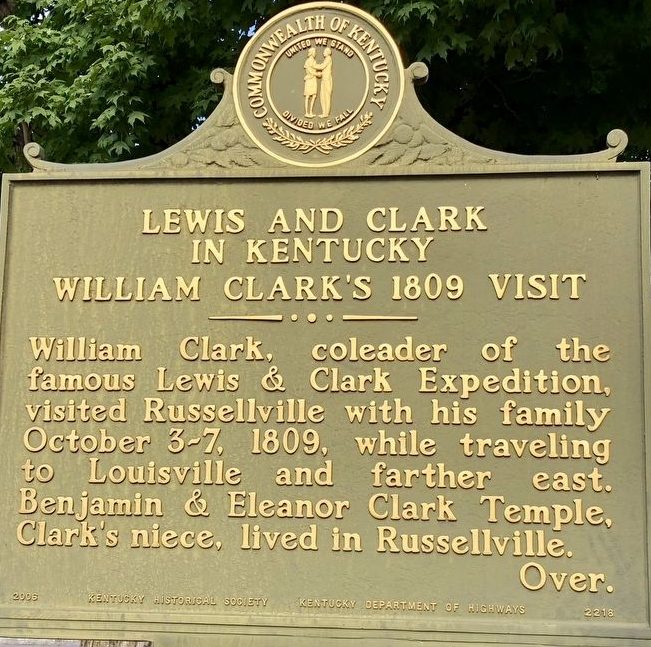
Russellville, KY Historical Marker

Russellville, KY Historical Marker (picture 1 of 2)
Russellville, KY Historical Marker (picture 2 of 2)

Courtesy: Lewis and Clark Trust.

Benjamin Temple was the son-in-law of Jonathan Clark, William’s older brother Jonathan Clark. Temple had moved to Logan County by 1808 after marrying Eleanor Eltinge Clark in 1801 (1) William’s usual short comments turned into a lengthy description of Russellville and included a recipe for “Mrs. Temples Sweet Meats”.

Nelly Temples Recipe for Sweet Meats Recipe

Let your(cu)cumbers of muskmelons (or such fruit as you wish)

Lay in salt water until they turn yellow. Then boil them in spring Water until they Cook plump. If they will not green as deep as you want them throw a small bit of alum in while boiling. Have your cirrup ready to lay them in before they get cold or else they will all draw up. The ginger must be soaked well before it is put in.

The Temples lived in Russellville and owned a 1700 Acre farm, Federal Grove, near Auburn, 10 miles to the east on old U. S. 68. (2) In addition to being a farmer and business owner, Benjamin Temple became a lay minister and ordained deacon in the Methodist church in 1817. (3)

See Federal Grove, near Blue Hole and Price Spring, above.

See Federal Grove, near Blue Hole and Price Spring, above.

Courtesy: Logan County (KY) Library, Mark Griffin

On Saturday 7 October, Clark reported the weather is fine and he paid $11.50 for the carriage repair plus other expense for his horse(s) and “sat out at 6 o’clock from Russellville”. He stopped at Mr. Bell’s, and paid $.75 for rope, then stopped at Mr. Temple’s Mill in Auburn. They stayed all night at Mr. Reeds, where he met Judge Tompkins (4) and Dr. Todd, after traveling 19 miles. They had passed the beginning of South Union Shaker Village. Unfortunately, the future Shaker community was not fully organized until 1810 for food service and lodging. (5)

South Union Shaker Village, 896 Shaker Museum Road, Auburn, KY 42206

South Union Shaker Village, 896 Shaker Museum Road, Auburn, KY 42206

https://southunionshakervillage.com/

Courtesy: South Union Shaker Village

Source:

(1) Holmberg, James J., Dear Brother: Letters of William Clark to Jonathan Clark, Yale University Press, 2002, page 37, note 15.

(2) https://www.federalgrove.com/

(3) Holmberg, James J., Dear Brother: Letters of William Clark to Jonathan Clark, Yale University Press 200, New Haven, page 37, note 15.

(4) Judge George Tompkins, born 1780 in Caroline Co, VA, school teacher in KY and studied law before settling in St. Louis in 1809, https://en.wikipedia.org/wiki/George_Tompkins

(5) https://www.southunionshakervillage.com/

Stop 5 of 37

Breakfast with Mr. Vance, Bowling Green (KY)

Enlightenment Philosophy meets the Great Revival of 1800

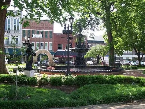
Sunday 8 October, the Clark party sat out early and eat breakfast at Mr. Vance’s Tavern, today’s corner of Main and 10th, AKA College Street, Bowling Green, KY. The house rating was good but there was no comment on the quality of the food, costing $1.75.

Mr. Vance is described in an 1835 travel journal as weighing 393 pounds, the exact weight is interesting if not questionable. The article also described him as having the gait of an elephant. (1)(2)

Mr. Vance’s Tavern was a central meeting location and used for religious service for Bowling Green’s population of 29 whites and 14 slaves, in 1809. By 1810, the census reported 154 white people. The tavern, located at the corner of College and Main Street near the Court House and Jail, near today’s Fountain Square Park in Bowling Green.

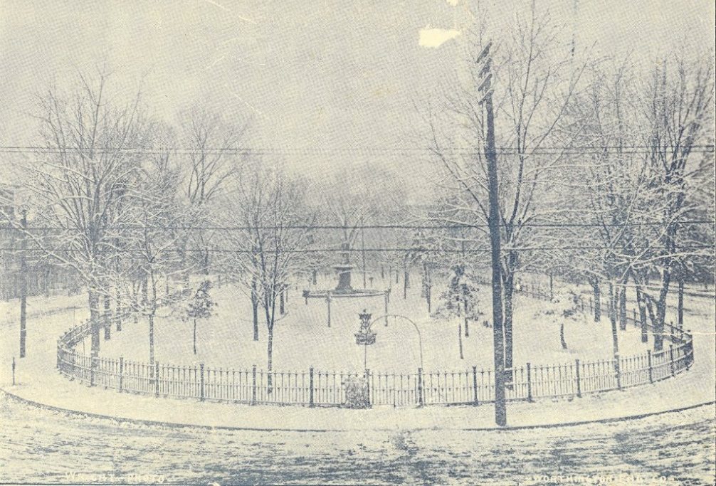
Fountain Square, Bowling Green, KY

Historical context:

Historical context:

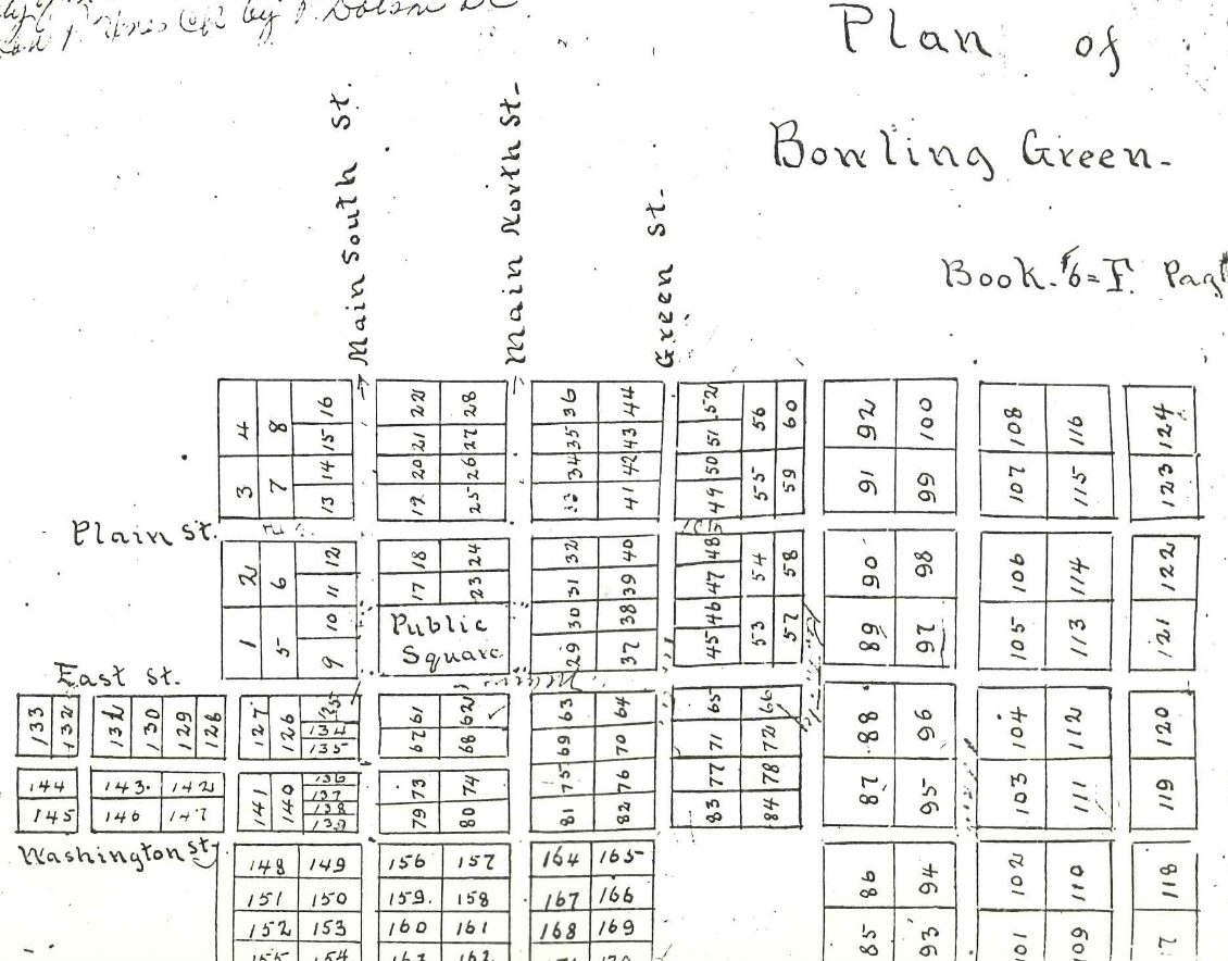
Fountain Square Park was created in the 1870s from the old courthouse square. The surrounding streets—Main, Plain, Bridge, 10th/College—have remained central to the city’s layout and identity. These names reflect both the city’s early development and its preservation of historic landmarks.

If you are navigating the area, Main Street, Plain Street, Bridge Street, 10th Street (College Street), and the Park/Frozen Row are the primary public square street names to know for Fountain Square Park.

Early Plat for Bowling Green, KY- Fountain Square remains in the same location.

Courtesy: Kentucky Museum, Western Kentucky University

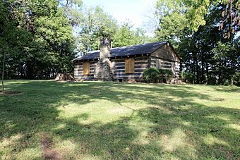
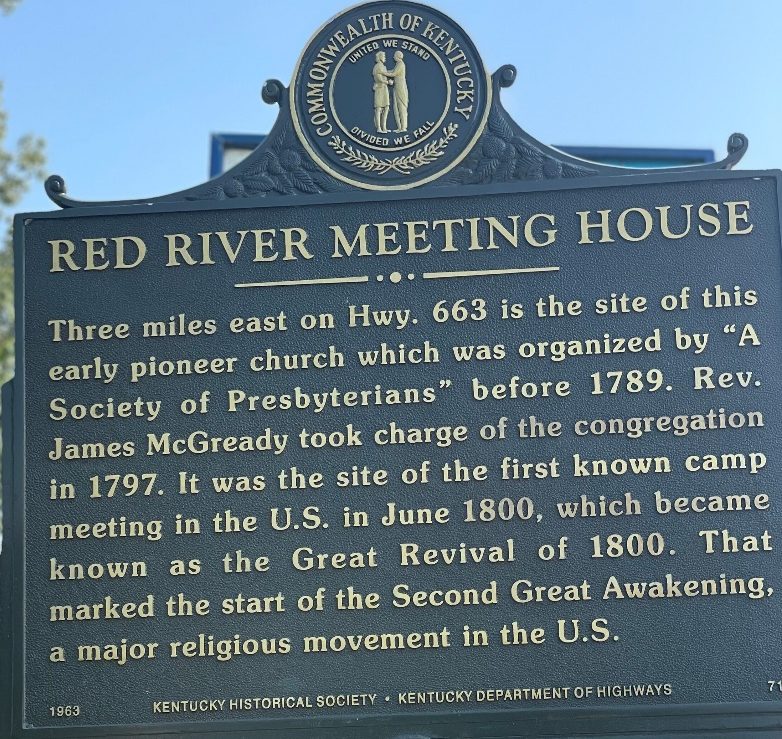
For several days the Clark party had been traveling through the region where the Great Revival of 1800, started at the near-by Red River Meeting House, creating an ecclesiastical storm that eventually raged through the Nation. (3) Local church history indicates that Mr. Vance was not sympathetic to the church meetings in his tavern and rang a bell to interrupt the services. Clark did not indicate that this disruption took place during the breakfast or that his Enlightenment View of the World conflicted with the regional religious excitement.

Red River Meeting House Facts for Kids (picture 1 of 2)

Courtesy: KentuckyFaithTrail.com

Red River Meeting House: Birthplace of the 2nd Great Awakening — Jen Miskov (picture 2 of 2)

Courtesy: Kentucky Historical Sign data base

Leaving Bowling Green and heading north required the crossing of the Barren River at the Lawless Ferry, near the present-day I-65 bridge. (4)

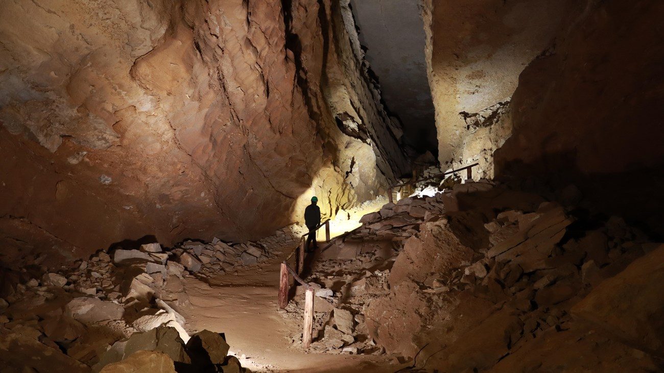
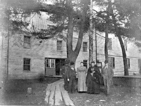
Traveling approximately 23 miles, the Clarks arrive at the Dripping Springs near Sunset. They met several people with their property headed to Louisiana. William Clark was meeting people migrating to cheap productive land with bright business opportunities in the Louisiana Territory. A land stampede, gripping the Nation, referred to as “Louisiana Fever”. At this point they were within 8 miles of the Mammoth Cave and were truly in “Cave Country” (5)

Mammoth Cave National Park

Mammoth Cave National Park

Courtesy: National Park Service, Mammoth Cave National Park

https://www.nps.gov/maca/index.htm

Mammoth Cave Hotel Kentucky Mammoth Cave National Park Postcard

Courtesy: Kentucky Library and Museum, Western Kentucky University. Date unknown.

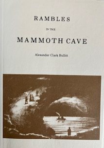
In 1839, William Clark’s nephew Dr. John Croghan, the son of Lucy Clark and William Croghan, purchased Mammoth Cave as an investment and potential treatment center for consumption, Tuberculous. While the medical aspects of the investment did not turn out as envisioned, the tourism possibilities flourished. Dr. Croghan promoted Mammoth Cave tourism and built a new road leading directly the hotel. He enlarged the hotel which was near the cave entrance. (6) A significant part of the cave tourism development, came from exploration and mapping conducted by Stephen Bishop, an enslaved servant of Dr. Croghan. Many of the present-day cave routes were found, named, and mapped by Stephen. During January 1842, Stephen was at Locust Grove drawing and inking his cave map, published in 1845. (7) (8)

Eastern National Books Store at Mammoth Cave https://cavecountrytrails.com/ (picture 1 of 2)
Eastern National Books Store at Mammoth Cave https://cavecountrytrails.com/ (picture 2 of 2)

Eastern National Books Store at Mammoth Cave https://cavecountrytrails.com/

Source:

(1) History of the State Street Methodist Church (Bowling Green, KY)., http://www.statestreetumc.org/history#3

(2) Personal Letter, Jonathan D. Jeffrey, Department and Head Manuscripts & Folklife Archives Coordinator Dept. of Library Special Collections, West Kentucky University.

(3) Merrill, Boynton, Jefferson’s Nephews: A Frontier Tragedy, Princeton University, 1976, page 191 & 193

(4) Person letter, Jonathan D. Jeffrey, Department and Head Manuscripts & Folklife Archives Coordinator Dept of Library Special Collections, West Kentucky University.

(5) https://cavecountrytrails.com/

(6) Potts, Gwynne T. & Thomas, Samuel W. George Rogers Clark: Military Leader in the Pioneer West & Locust Grove: The Croghan Homestead Honoring Him, Historic Locust Grove, Louisville, 2006, page 112.

(7) Harold Meloy, Rambles in Mammoth Cave, Introduction to the Reprint Edition, 1973, Original Book published by Morton & Griswold, Louisville, 1845, Page xxii.

(8) https://www.nps.gov/maca/index.htm

Stop 6 of 37

Traveling A Well-Established Road to see the Large Clark Family in Louisville

Current day I-65 and U. S. 31 W Corridor

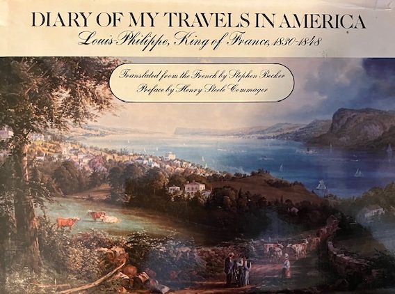
9 October, the Clark party was leaving the Barrens, a region in south central Kentucky known for open savannahs. Willian recorded timber increasing, and they passed the fork in the road leading to Lexington. The road to Lexington, was taken by future King of France, Louis Phillippe and his brothers as he traveled in America during 1796-1797. (1)

Translated from French by Stephen Becker, 1977, Delacorte Press, NY

Translated from French by Stephen Becker, 1977, Delacorte Press, NY

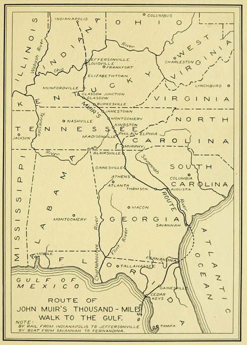
In 1867, the same route was traversed North to South by John Muir on his 1000 Mile Walk, Indianapolis to the Gulf Coast. Muir’s route passed through Louisville then crossed the Salt River into West Point, ascended Muldraugh Hill before passing through Elizabethtown, Munfordville, Horse Cave to Mammoth Cave. (2)

map showing route of walk

Courtesy: John Muir Legacy Trail

The road from Bowling Green (549 ft. above sea) to Elizabethtown (758 ft. above sea) is a gradual incline used by large animals including the American Bison (Buffalo). While Clark did not record seeing any Buffalo (Bison), Hart County Kentucky reported the last Buffalo in Kentucky in 1820, along the same route Clark was traveling. (3)(4)

The future Louisville and Nashville Railroad, chartered in 1850, followed the same general route. The gradual incline was important to the large animals, the railroad and assisted William Clark. The route is today’s I-65 and U. S. 31 W.

9 Oct. Monday Set out early, took the left hand road at 8 miles leaving to the right, one leading to Lexington & the other to the same per a man Southerly route 119 miles. We proceeded ot the road to Louisville, Breakfast at gills (Gills, $1.50) the 12 miles Mr. groves (Groves) and paid $1.50 proceeded on Day hot to Mr. Rich(ar)d munford (Munford) N(orth) of Green River, crossed that river at Amos’s Ferry, water about 18 inches deep

The Clarks had arrived at Munfordville, KY, named for Richard J. Munford, on the north side of the Green River (4) after crossing the Amos Ferry, operated 1790-1860s, 37°53.21’ N - 85°53.21’W. (5) The Old Munford Inn is located one block east of main Street. Based on the cost, $2.75, the Clarks stayed all night. (6)

Munfordville, KY

Munfordville, KY (picture 1 of 2)
Munfordville, KY (picture 2 of 2)

https://npgallery.nps.gov/GetAsset?assetID=09510ab5-7fe5-4ba3-95d0-fa748be27dbc

Left: Munford Inn Owned by the Munfordville Women’s Club Right: Munford Inn pre 1953, exact date unknown

10 October Breakfast at Mr. W(illiam) gages (Gages, $1.25) on nolin. Stayed all night 1 mile north of nolin, at a good little house ($2.50)

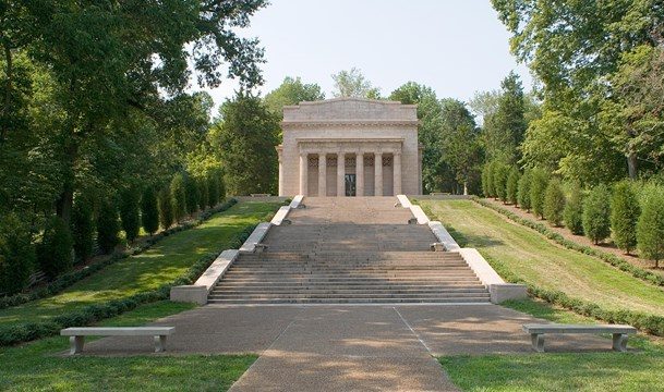
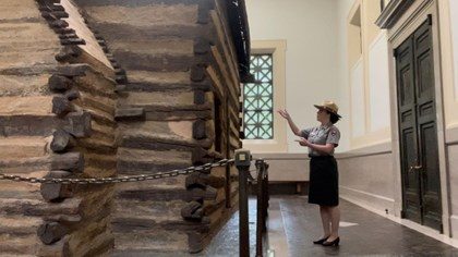
At the Nolin River crossing the Clarks were 10 miles from Hodgenville and the birthplace of Abraham Lincoln on 12 February 1809. (7)

The First Lincoln Memorial and Boyhood Home

The First Lincoln Memorial and Boyhood Home (picture 1 of 2)
The First Lincoln Memorial and Boyhood Home (picture 2 of 2)

Courtesy: National Park Service

11th October Breakfast at Elizabethtown (KY) ($1.75)

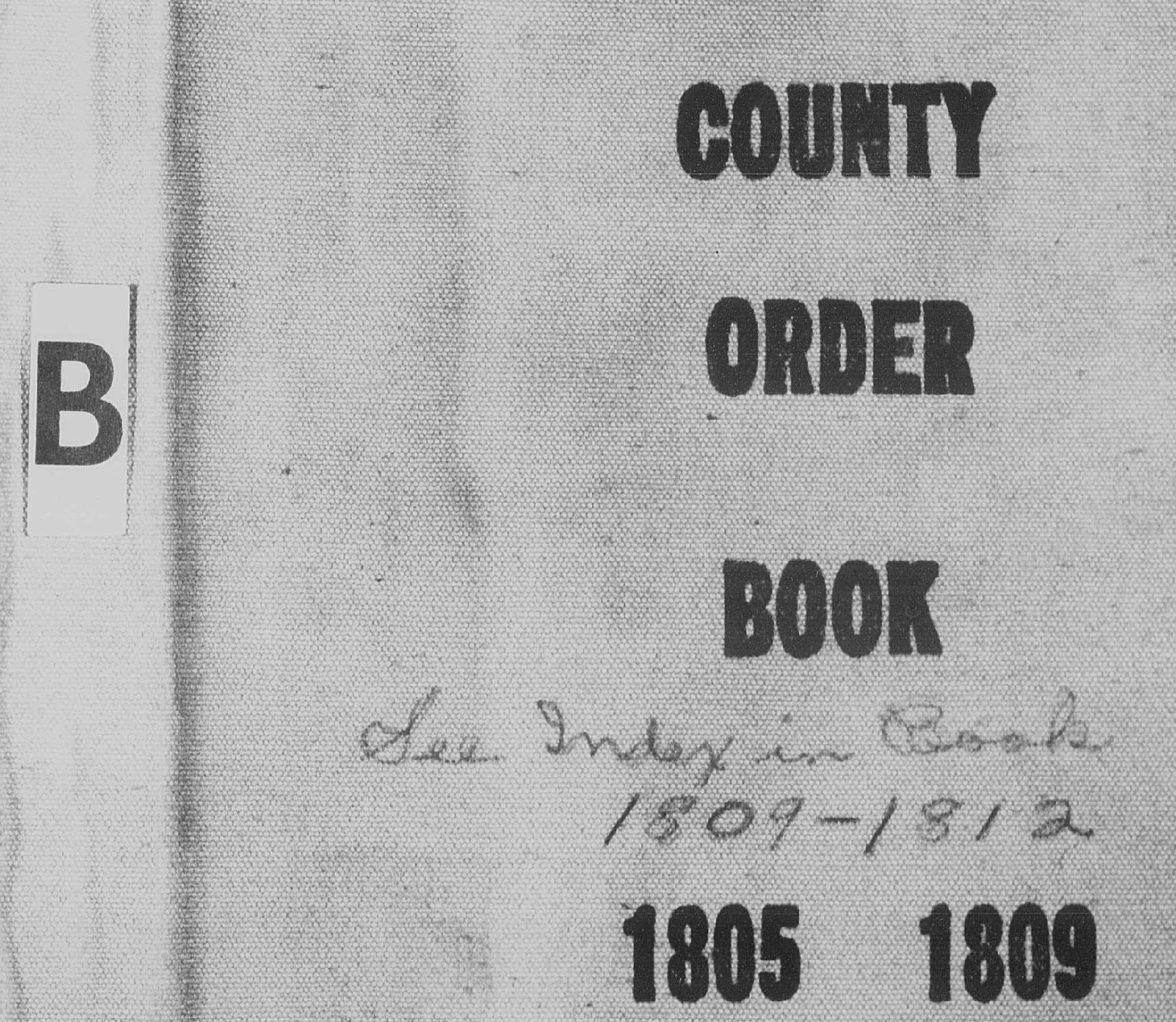
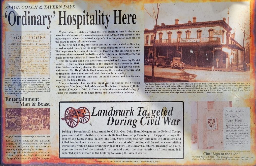
While Clark did not describe the breakfast location in Elizabethtown, a list of licensed taverns removes some of the mystery. The Hardin County (KY) Sheriff issued license to operate a tavern. License records are preserved by the Hardin County, County Court Clerk in Court Order Book “B” 1805-1812. On 10 April 1809, page 298, a license was issued to Benjamin Ogden. Ogden was also the County Jailer, located on the town square adjoining the courthouse. Today the town square is at South Main Street and US 31W (KY 61) and approximately one block from the intersection of US 62 and 31W. The Clark party had been following the corridor of US 31W after leaving Bowling, KY on 8 October and passed through the center of town. Did the Clark party have breakfast at the Jail? Or the Sign of the Lion, later the Smith Hotel.

Other licenses were issued in 1808 to: Joseph Chalfan, (11 July 1808, page 234), Denton Geoghegan (28 March 1808, page 224), Jacob Vanmatre (28 January 1808, page 204), Daniel Waide (12 July 1808, page 243) and Benjamin Ogden (1808, page 206). Chalfan (Sign of the Bear), Ogden and Waide, (Eagle House) are listed as “Elizabethtown” the others are “in the county”. There is no certain location for the breakfast but we do know that the breakfast in Elizabethtown cost $1.75.

Hardin County Court Order Book Hardin County Historical Marker- Smith Hotel

Hardin County Court Order Book Hardin County Historical Marker- Smith Hotel (picture 1 of 2)
Hardin County Court Order Book Hardin County Historical Marker- Smith Hotel (picture 2 of 2)

Courtesy: Harden County Court Clerk, Meranda Caswell, Deputy and Hardin County Historical Society, Ann Sipes, Docent

The morning of 11 October William Clark had no way of knowing the tragedy that had occurred with his friend and partner in discovery, Meriwether Lewis, on the Natchez Trace. They were not only separated by approximately 200 miles, but by death.

Leaving Elizabethtown, the Clarks followed the corridor of today’s KY 61/US 62. Near Boston, KY, state route, KY 61 turns to a northernly direction and is the western or Louisville branch of the Wilderness Road.

….. and stayed all night at a little house, much pestered with flies and mosquiyoes. Chentek Tavern 2.255.

William Clark’s spelling once again presents a challenge. The tavern is most likely Chapeze Tavern located on the Long Lick Creek, Bullitt County, KY near the ford on the creek crossed by KY 61.

Dr. Henry Chapeze, a French expatriate, had served as a surgeon during the American Revolution. The large Chapeze family of 10 children built an extensive business presence in the region that included 1000 acers on Long Lick Creek. Later generations built the Chapeze Distillery at Limestone Springs, (near todays Clermont, KY) producing Old Charter Bourbon.

An interesting side note for the Long Lick Creek area: in 1808 Robert Pryor, brother of Sergeant Nathaniel Hale Pryor of the recently completed Lewis and Clark Exploration, was appointed District Patroller (Deputy Sheriff).

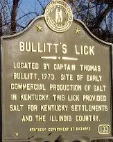
12 Oct breakfast at Shepherdsville $1.75. The Clark’s had arrived at Shepherdsville, Bullitt County, KY, traveling along KY 61, Wilderness Road, and todays Preston Highway, crossing the Salt River on the ferry. Bullett County issued eight (8) tavern license in 1809, with two being in Shepherdsville. Did they eat breakfast in the Ben Withers or the Daniel Donaldson Tavern?

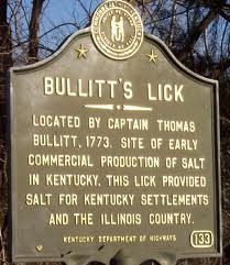
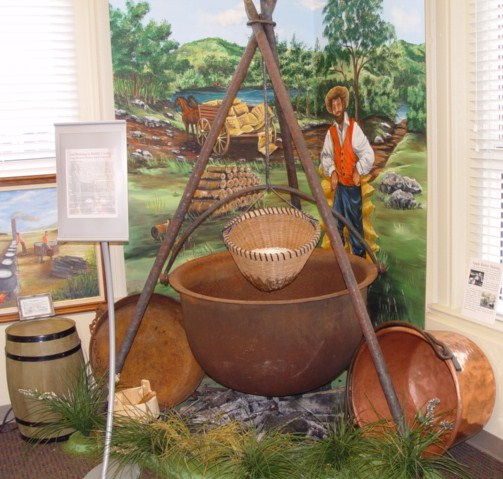
Shepherdsville was the center of the first commercial industry in Kentucky. The essential element of salt equaled the value of gold in an era of tanning hides and preserving meat for human consumption. Area salt springs had a high concentration of brine water to dry salt (1000 gallons to 3 or 4 bushel of dry salt). It was a labor intense industry requiring wood for the furnace and brine water around the clock.

Joseph Field and salt making is another “stories-within-the-story” of Lewis and Clark. Joseph was a highly efficient and productive member of the recently finished exploration of the west and is believed to have known the process of boiling salt water to produce the dry salt. He had lived in the area before the expedition and was one of the expedition members sent to the Pacific Ocean during the winter of 1805/06, to produce salt from sea water. The salt operation on the Pacific coast was as intense as the Bullitt County salt production. (8) The Bullett County History Museum -300 South Buckman St. Shepherdsville, KY- is an excellent site to learn about salt making. (9)(10)

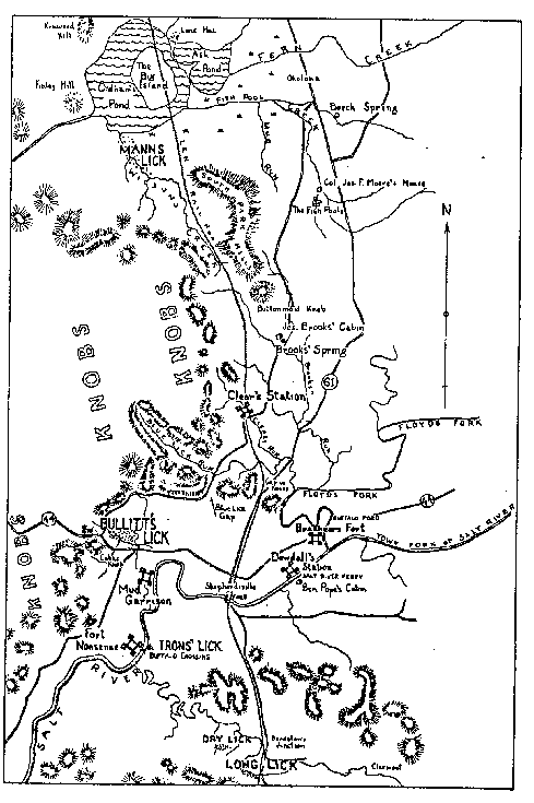
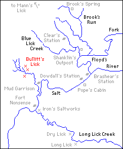
Salt Furnaces, Bullitt Co. KY 1779-1780 Salt River Watershed, Salt Springs, and Frontier Stations

Salt Furnaces, Bullitt Co. KY 1779-1780 Salt River Watershed, Salt Springs, and Frontier Stations (picture 1 of 2)

Courtesy: Filson Club History Quarterly, Vol.30, page 2240-249

Salt Furnaces, Bullitt Co. KY 1779-1780 Salt River Watershed, Salt Springs, and Frontier Stations (picture 2 of 2)

Courtesy: Library of Congress

Kentucky Historical Marker

Kentucky Historical Marker

Courtesy: HMdb.org- by Duane and Tracy Marsteller

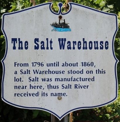
Salt making in Bullett County’s salt industry is further tied to the Lewis and Clark Expedition through the salt being shipped down the Salt River to warehouses in West Point, KY, home of the Lewis and Clark Education and Research Center.

West Point, KY Salt Wearhouse

West Point, KY Salt Wearhouse

Courtesy: HMdb.org

The intense use of trees as a fuel for the salt furnaces, striped hundreds of acers of forest in the salt spring region. Early iron furnaces in the area further denuded the frontier forest. Restoration of 12,000 acers of forest began with the vision and philanthropic contribution of Issac Wolfe Bernheim, Bernheim Brothers Distilling Company. Today, the Bernheim Forest and Arboretum, originally designed by Frederick Law Olmstead, encompasses 16,000 acres of privately supported lands used for education, research, and recreation - “connecting people with nature”. The 3-mile drive along KY 61 and KY 245, (South Preston Highway) to Bernheim Forest is an opportunity to experience the “Bernheim Way”- “Curiosity-Wonder, Intentionality, and Belonging”. (11)

Bullet Salt Works, Bullett County, KY

Bullet Salt Works, Bullett County, KY (picture 1 of 2)
Bullet Salt Works, Bullett County, KY (picture 2 of 2)

Courtesy: Bullet County History Museum

Note: The Lewis and Clark Trust extends a special salute of gratitude to the Bullett County History Museum for articles by Charles Hartley and research assistance by Jim Holmberg, Curator- Filson Historical Society.

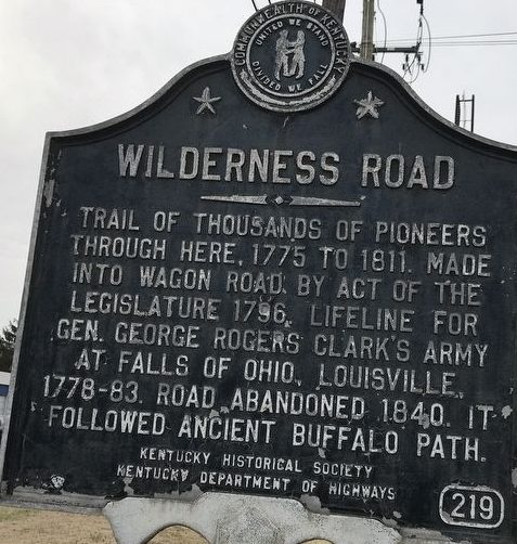
When the Clarks reached Louisville, they had traveled more than 25 miles on a corridor that is todays KY 61, from Shepherdsville to Louisville. This route is also the final leg of the historic Wilderness Road that Bison had followed for eons to the Falls of the Ohio. A Kentucky Historical marker number 219, at the intersection of Preston Highway (KY61) and Blue Licks Road in Okolona describes the significance of the route.

Wilderness Road Historical Marker in Okolona, KY

Wilderness Road Historical Marker in Okolona, KY

Courtesy: Kentucky Historical Society & Duaine and Tracy Marsteller

Anticipation in reaching their beloved family was incentive to keep the Clarks traveling. They arrived at Bro(ther) Jonat(han) at sun set. Can you hear the joy and excitement when they arrived at Trough Spring, the home of Jonathan and Sarah Hite Clark?

Source:

(1) Louis Phillippe, Diary of My Travels in America, Translated from French by Stephen Becker, Delacorte Press, NY, 1996, page 116-117.

(2) https://www.gutenberg.org/files/60749/60749-h/60749-h.htm#chap01

(3) Kleber, John, The Kentucky Encyclopedia, University of Kentucky Press, Lexington, 1992, page 138.

(4) Collins, Lewis, Kentucky; Its History, Antiquities, and Natural Curiosities, Geographical Statistical, and Geological Descriptions with Anecdotes of Pioneer Life, Lewis Collins, Maysville, KY 1847, page 344.

(5) Amos Ferry- https://www.hmdb.org/m.asp?m=40020

(6) https://www.hmdb.org/m.asp?m=39989

(7) Appleman, Roy E., Abraham Lincoln From His Own Words and Contemporary Accounts, U. S. DOI-National Park Service, 1946, page 1; Angle, Paul, The Lincoln Reader, Rutgers University Press, Rutgers, NJ, 1947, page 6.

(8) https://lewisandclarkinkentucky.org/kentucky-people/the-nine-young-men-from-kentucky/joseph-and-reubin-field/

(9) https://bullittcountyhistory.org/memories/saltmaking.html; The Filson Club History Quarterly, Vol 30, No. 3, p 241-269.

(10) https://bullittcountyhistory.com/location.html

(11) https://bernheim.org/visit/about-bernheim/

Stop 7 of 37

The Clark’s 1809 Louisville Homecoming

Family Fun, a New Baby and Business

The large Clark Family at the Falls of the Ohio, Louisville, KY was very close knit, sharing happiness, work, and sorrow. Julia had expressed her homesickness and desire for letters from the Clark family in Louisville. (1) As they had traveled east with 8-month-old Meriwether Lewis Clark, we must wonder if William reflected on how Sacagawea had cared for Jean Baptiste during the exploration of the West with only the assistance of York. There is little doubt that Julia had her hands full with a baby, even with help from Chloe and Rachel.

We can only speculate about the activities for William and Julia in Louisville, no notes were entered in the 1809 journal. Through other sources, we can be sure the next 13 days was a busy period and William and Jonathan discussed William’s duties as Federal Indian Agent and personal business. Williams’s letter of 26 August to Jonathan clearly reflects a concern for the sensitive nature of his thoughts and the need for private conversations. (2)

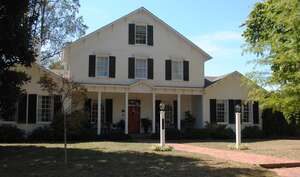
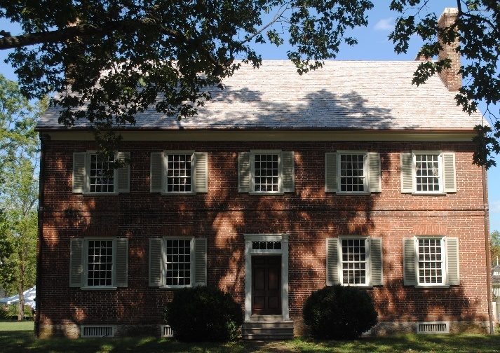
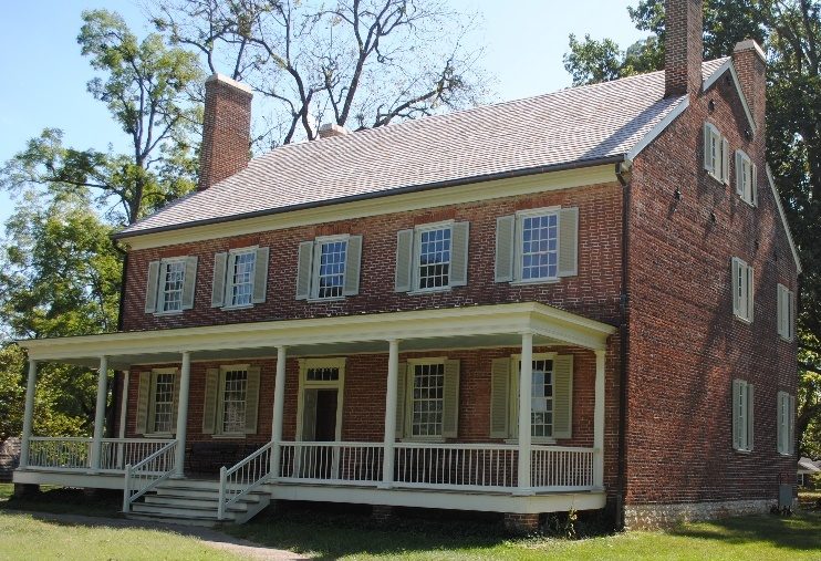
Trough Spring, build 1802 for Jonathan Clark, supervised by William Clark

Trough Spring, build 1802 for Jonathan Clark, supervised by William Clark (picture 1 of 2)
Trough Spring, build 1802 for Jonathan Clark, supervised by William Clark (picture 2 of 2)

L: Private Home, please respect private property R: Trough Spring & Dundee Road

Louisville, KY

Courtesy: Lewis and Clark Trust

Assuredly, there was an extended visit to Locust Grove, the home of William Clark’s sister Lucy Clark Croghan and William Croghan, where brother George Rogers Clark lived after his leg was amputated in February of 1809. William had been closely involved in attempting to settle Brother George’s financial affairs, including land ownership, before the western exploration. William had grown-up listening to Brother George’s accomplishments during the Revolutionary War including George’s skills dealing with the American Indians. (3) In 1797 William wrote to Jonathan: “Our bro G’s business is in a disagreeable situation”. “I have rode for Bro Geo in the course of the past year upwards of 3000 miles”. (4) George was eventually awarded a $400 per year pension by Virginia. Unfortunately, the expenses for the Revolutionary War, winning of the Old Northwest, by George was never paid by the State of Virginia or the U. S. Government. We can see this failure on the part of the State and Federal Government weighing on William’s mind when he is considering Meriwether Lewis’ similar situation with rejected bills of exchange.

Historic Locust Grove

Historic Locust Grove (picture 1 of 2)
Historic Locust Grove (picture 2 of 2)

L: Front View R: Rear View

Courtesy: Lewis and Clark Trust

The close relationship between George and William was a source of William’s education in other fields. In a letter to Thomas Jefferson, dated 12 December 1802, George assured the President that “William (has) every information in my power on this, or any other point which may be of Service to the Administration”. (5)(6) The letter strengthened the reasoning that Lewis selected Clark as his Co-leader for the western exploration.

Did William or Julia make any purchases at the Fitzhugh and Rose Store while in Louisville? What did Scott, Chloe and Rachel do, did they have extended families in the Falls area to visit? Were special foods or recipes shared like Mrs. Temple’s Sweat Meats? Did William visit Mulberry Hill and his parent’s graves? Unfortunately, infant Meriwether Lewis Clark contracted a bad cold during the visit in Louisville. (7) The very busy pace during the 13 days is partially seen in William’s letter to Jonathan on 28 October 1809, I have missed my Corduroy bag of Small money of forty odd dollars. He also had left letters received at Jonathan’s, letters that he asked to be forwarded to him by family members. One of those letters was written by Meriwether Lewis from New Madrid, MO and has never been found. (8) All of these questions are lost in the news that William learns on 28 October after leaving “Bro Jon on the 26th and proceeding to Col. Andersons”. The interesting social custom of family and friend traveling with a family member as they depart or arrive is seen once again as Jonathan Clark traveled with William to the Andersons. (9)

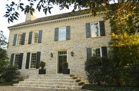
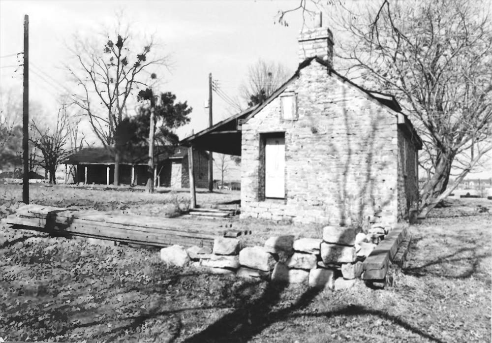
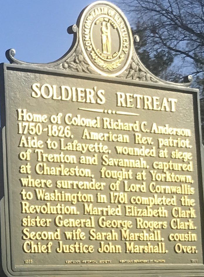
Col. Anderson was Richard Clough Anderson, husband of William’s sister, Elizabeth Clark Anderson. (10) Soldiers Retreat was approximately 10 miles east of Louisville and near present-day Hurstbourne Lane between I-64 and US 60. The Anderson family cemetery and some outbuildings remain but the present house was built near or atop the original location. (11)

Col. Richard Clough Anderson House

Col. Richard Clough Anderson House (picture 1 of 2)
Col. Richard Clough Anderson House (picture 2 of 2)

L: Private Property, please respect owner R: One of the Out buildings at Soldiers Retreat- National Register

Courtesy: Lewis and Clark Trust

The Clark’s 1809 Louisville Homecoming

Courtesy: MHdb.org- Duane and Trach Marsteller

A Lewis and Clark tour in Louisville is deserving of a visit to The Filson, a Certified Site on the Lewis and Clark National Historic Trail, at 1310 3rd Street, Louisville, KY 40208.The privately supported historical society, holes a very significant collection of original letters written by Lewis and Clark and material from the expedition. Scholarly research is available by appointment.

Filson Historical Society

Filson Historical Society

Courtesy: gotolouisville.com

Source:

(1) Holmberg, James, Dear Brother: Letters of William Clark to Jonathan Clark, Yale University Press, New Haven, 2002, page 211.

(2) Ibid, page 213 note 10 & page 215.

(3) Carstens, Kenneth and Nancy Son, Edited, The Life of George Rogers Clark 1752-1818, Praeger Publishers, West Port CT, page 5.

(4) Bodley, Temple, George Rogers Clark: His Life and Public Service, Houghton Mifflin Co., Boston, 1926, Page 358 & 359.

(5) Jackson, Donald, Letters of the Lewis and Clark Expedition with Related Documents 1783-1854, University of Illinois Press, Urbana, 1978, page 7 & 8.

(6) Bodley, Temple, George Rogers Clark: His Life and Public Service, Houghton Mifflin, Boston, 1926, Page 360.

(7) Holmberg, James, Dear Brother: Letters of William Clark to Jonathan Clark, Yale University Press New Haven, 2002, page 216.

(8) Ibid, 218

(9) Ibid, page 220, note 3.
(10) Ibid, page 52, note 22.
(11) https://www.jstor.org/stable/pdf/23368553.pdf or Register of KY State Historical Society, Sept. 1919, Vol. 17, # 5, page 65-77.

Stop 8 of 37

Very Bad News While Traveling in a Beautiful Country

Leaving the Anderson’ Soldiers Retreats, on 27 October, William was traveling through the Outer- Bluegrass Region in the direction of Frankfort along the corridor of today’s U S 60. The first notation in Clark’s Journal, boy sick all last night, a bad cold, sat out at 12. The comment reflects on his never-ending concern for his family. This was a late start for William Clark but the day would be one of those days of “life defining moments” one never forgets.

Fortunately, they traveled along a dry road, a road described as nearly impassable in wet weather during the early 1800s, especially in a carriage. (1) Their route would take them through Middletown, established in 1797, retraining its colonial charm even today. They spent the night at Mr. Smith, east of Simpsonville and rated the house as good, $4.75. (2)

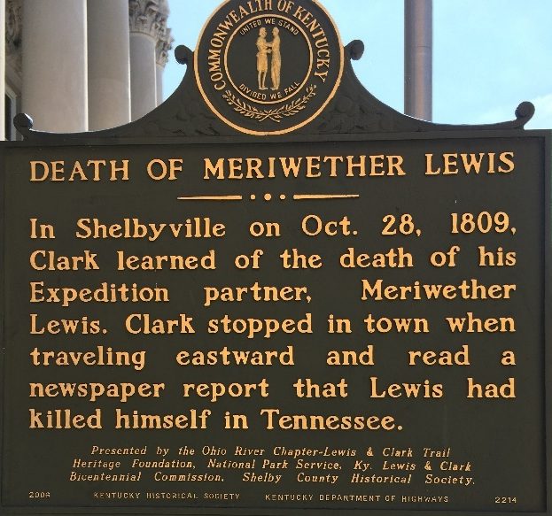
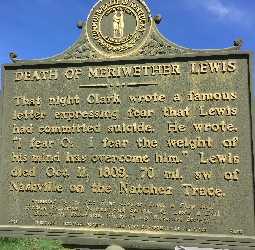
The next day, 28 October, the Clark party stopped for lunch in Shelbyville, William purchased a copy of the Argus of Western America newspaper (3) in which William Clark learns for the first time that Meriwether Lewis is dead. That evening from John Shannon’s Tavern near Peytona (U S 60 & KY 395), William wrote to Jonathan the letter, referred to by historians as the I fear O! I Fear Letter, in which William told Jonathan that he has learned of Meriwether Lewis death. (4) After expressing his concern for the truth of the story of Lewis’ death, he asked Jonathan to send him all the letters he had received at Jonathan’s home. That request would have included the letter written by Lewis from New Madrid. The letter is believed to revealed information on the state of Lewis’ health. Those letters were received by William, acknowledging receipt in his letter to Jonathan on 12 January 1810 from Washington DC. (5) From the letter at Shannon’s on 28 October 1809, we see William Clark’s emotional state of mind and his immediate understanding that he must secure the documents carried by Lewis, including the Western Exploration Journals, and Lewis’ financial documents. Clark is clearly determining what needs to be done and how to do it. He will adjust his TO DO LIST as he receives additional information over the next several weeks but his focus is on his family and securing Lewis’ documents and the Exploration Journals. His action clearly reflects his life time of rational thinking.

Shelbyville, KY

Judicial Center, Main Street (U S 60 & 5th Street)

Very Bad News While Traveling in a Beautiful Country

Courtesy: Lewis and Clark Trust, Inc.

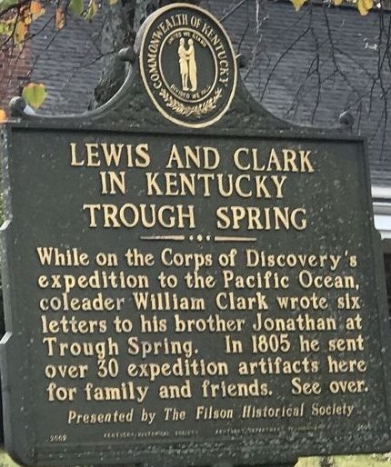
Lewis and Clark in Kentucky Historical Marker- U S 60 & KY 1472, Grafenburg, KY

Lewis and Clark in Kentucky Historical Marker- U S 60 & KY 1472, Grafenburg, KY

Marker located in the vicinity of John Shannon’s Tavern in 1809 (No relation to George Shannon)

Courtesy: Lewis and Clark Trust

William finished the letter with a description of the room, people and where they were sleeping that evening. Shannon’s Tavern did not get a high rating for the $3.25 paid for the night’s lodging.

Source:

(1) Clark, Thomas, A History of Kentucky, page 182

(2) Holmberg, James, Dear Brother: Letters of William Clark to Jonathan Clark, Yale University Press. 2002, page 216,

(3) Ibid, page 216

(4) Ibid, page 218.

(5) Ibid, page 233, & 234 Note 1.

Stop 9 of 37

Confirmation that Governor Lewis is Dead

Clark’s 1809 Journal, 29 October, sat out early after breakfast for Frankfort (KY) and met Mr. (Dennis) Fitzhugh, who confirmed the death of Governor Lewis. Dennis Fitzhugh was William Clark’s brother-in-law and a trusted friend. The letter written by William on 30 October, Lexington, KY, clearly describes his situation. We arrived here this evening all in the Same State of health we were when we parted with you, but not in the Same State of mind. (1) William Clark clearly expressed his and no doubt Julia’s, shock at learning of the death of Meriwether Lewis.

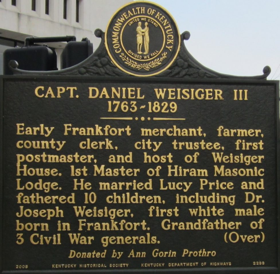
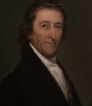
Captain Daniel Weisinger III

Captain Daniel Weisinger III (picture 1 of 2)
Captain Daniel Weisinger III (picture 2 of 2)

Marker Number 2299

Location:

Main and Ann Street, Frankfort, KY

Capt. Daniel Weisiger III, 1763-1829- Early Frankfort merchant, farmer, county clerk, city trustee, first postmaster, and host of Weisiger House, 1st Master of Hiram Masonic Lodge. He married Lucy Price and fathered 10 children, including Dr. Joseph Weisiger, first white male born in Frankfort. Grandfather of 3 Civil War generals.

Reverse Description:

Weisiger House, “at the Sign of the Golden Eagle”- Tunstall’s Tavern was enlarged to become Weisiger House, ca. 1790s. Social & political gathering place in Frankfort. On May 9, 1825, a grand ball was held to honor Gen. Lafayette. After Daniel’s death, Lucy managed inn & stage stop for over a decade. City bought it in 1852 & built Capital Hotel here.

Dedicated August 7, 2009.

In Frankfort the Clark’s dined and saw Mr. Allen (2) Hardin (3) Bibb (4) Trigg (5) and Governors Scott (6) and Greenup. (7) This was a significant group of Kentucky political leaders to see at one location. The meal and meeting most likely occurred at Capt. Daniel Weisinger’s Inn and Tavern. The inn, at Main and Ann Street, was near the Capitol, today’s “Old Capitol”. In addition to the rooming and dining facilities, the tavern was a place to discuss politics, making it akin to the Willard Hotel in Washington D. C. where the term “lobby” was “coined”. Like the Willard, the Weisinger Inn had its own share of political intrigues, that included Gen. James Wilkinson and the Burr conspiracy.

Kentucky Capitol in 1809, today’s “Old Capitol”

Kentucky Capitol in 1809, today’s “Old Capitol”

https://history.ky.gov/visit/old-state-capitol-experience

Courtesy: Lewis and Clark Trust

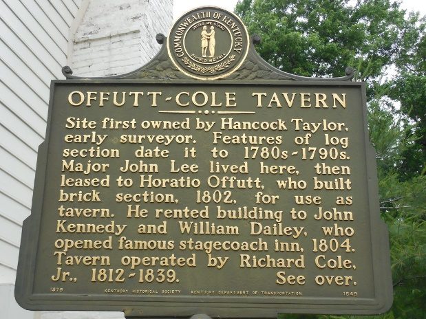
Dailey’s Tavern- later Offutt-Cole Tavern

Dailey’s Tavern- later Offutt-Cole Tavern (picture 1 of 2)
Dailey’s Tavern- later Offutt-Cole Tavern (picture 2 of 2)

William Dailey owned the tavern in 1809. Today, Offutt-Cole Tavern, intersection of U S 62 and KY 1681, (Old Frankfort Pike) Woodford, Co. KY.

Courtesy: Lewis and Clark Trust and Duane and Tracy Marsteller, HNdb.org

Leaving Frankfort, the Clark’s proceeded to Daley’s via the old Frankfort Pike (KY-1681) and stayed all night. Today, “Daleys” is referred to as the Offutt-Cole Tavern and is owned by the Woodford County Historical Society. (8) The historical structure is at the intersection of the Old Frankfort Pike (KY 1681) and U S 62 and two miles from picturesque Midway. (9)

The Clark Family was spending the evening less than 12 miles from the home and birth place of Matthew Harris Jouett, the future painter of General George Rogers Clark and Thomas Jefferson. The Jouett painting of George Rogers Clark is counted as one of the best likenesses of the “Hannibal of the West”. Today the original painting can be seen at the Filson Historical Society and a print at Historic Locust Grove, both in Louisville, KY. (10)

After the purchase of a quart of whiskey at Lusk Ferry on the KY side of the Ohio River no further notation is made of whiskey. However, the Clark party has been traveling through the future Bourbon Capital of the World for several days. (11)

Source:

(1) Holmberg, James, Dear Brother: Letters of William Clark to Jonathan Clark, Yale University Press, New Haven, 2002 DB, page 224.

(2) Possible Thomas Allen (1757-1833) KY politician, served in Revolutionary War and KY Militia. Kleber, John, Kentucky Encyclopedia, University of KY Press, 1992, page 16.

(3) https://politicalgraveyard.com/geo/KY/FR-buried.html

(4) https://www.infoplease.com/biographies/government-politics/george-mortimer-bibb-ky

(5) Mr. Trigg, is an uncertain person. Possibly William Trigg, Jr. brother of Col. Stephen Trigg.

(6) Charles Scott, 4th Governor of Ky, served in the French and Indian War, Revolutionary War, and Indian Wars of the Old Northwest.

(7) Christopher Greenup, 3rd Governor of KY, served in the Revolutionary, served as a Trustee of Transylvania University

(8) https://www.woodfordcountykyhistoricalsociety.com/

(9) https://www.meetmeinmidway.com/

(10) http://jouetthouse.org/

(11) https://kybourbontrail.com/map/

Stop 10 of 37

A Heavy Heart and a Great Deal of Work in Lexington

Meeting with George Shannon 30 September 1809

William Clark was returning to Lexington along the Old Frankfort Pike, a town of 4400 people and a place he had visited on a militia recruiting mission in 1792. (1)

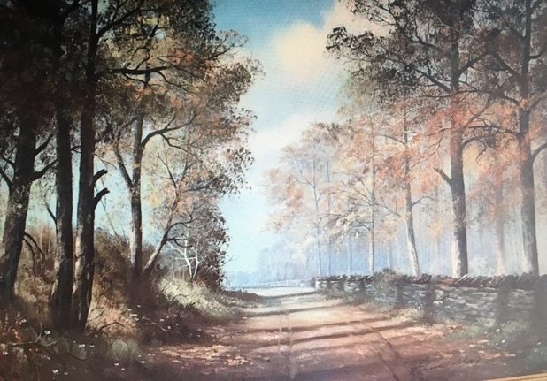
Old Frankfort Pike National Scenic By-Way

Old Frankfort Pike National Scenic By-Way

https://www.oldfrankfortpike.org/

Courtesy: Lewis and Clark Trust

Old Frankfort Pike Painting

Old Frankfort Pike Painting

Memory Lane by Russell May, published 1975.

Courtesy: Russell May Family

Approaching the Athens of the West, they passed McConnell Springs where William McConnell and his party of surveyors, hunters, land speculators and adventures had camped during 1775.The Pennsylvania men learned of the battle of Lexington in Massachusetts while at the site and returned four year later to be part of the founders of Lexington. Today the 26-acer McConnell Springs Park contains three artesian springs first discovered by the McConnell party. (2)

416 Rebmann Ln, Lexington, KY 40504; https://mcconnellsprings.org/

416 Rebmann Ln, Lexington, KY 40504

https://mcconnellsprings.org/

Courtesy: Lewis and Clark Trust

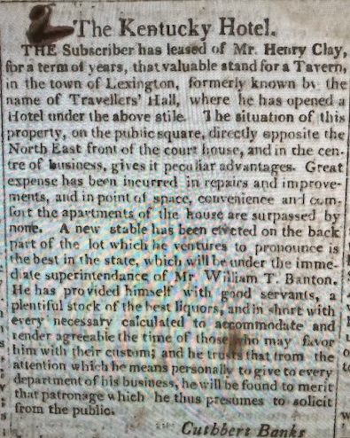
The Clark carriage passed the William McConnell limestone house (3) over-looking Town Branch, the Middle Branch of Elkhorn Creek, before arriving at Travelers Hall, present-day corner of Short and Upper Streets, Lexington. The hotel was owned by Senator Henry Clay, managed by Cuthbert Banks, and considered the finest hotel in town and possibly the finest hotel the Clarks used during their trip east. Cost for the night was 7.00 plus .25 cents servant and $2.00 a Book.

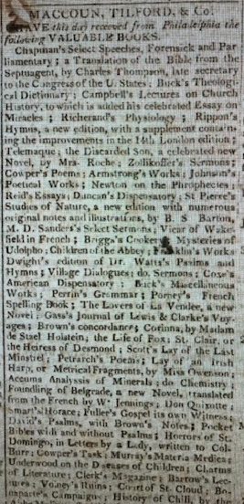
Kentucky Gazette

Lexington, KY Tuesday 10 October 1809

Lexington, KY Tuesday 10 October 1809 (picture 1 of 2)
Lexington, KY Tuesday 10 October 1809 (picture 2 of 2)

https://ia600503.us.archive.org/31/items/xt72804xhb1x/xt72804xhb1x_text.pdf

William Clark’s purchase of a book is interesting. Maccoun, Tilford, & Company of Lexington, offered for sale several books, including “Gass’s Journal of the Lewis and Clark Voyages” in the same issue of the Kentucky Gazette. Was William Clark’s book purchase for $2.00 the Gass Journal?

Travelers Hall was located two blocks north of Town Branch and away from a stream that flooded frequently in the early 1800s. Today, Town Branch Commons is developed as a walking and bike trail, starting at the Isaac Murphy Memorial Art Garden. The trail links two other urban trails, the Legacy Trail, and the Town Branch Trail, totaling 26 miles and connecting the urban core with the Bluegrass farm land. (4)

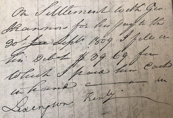
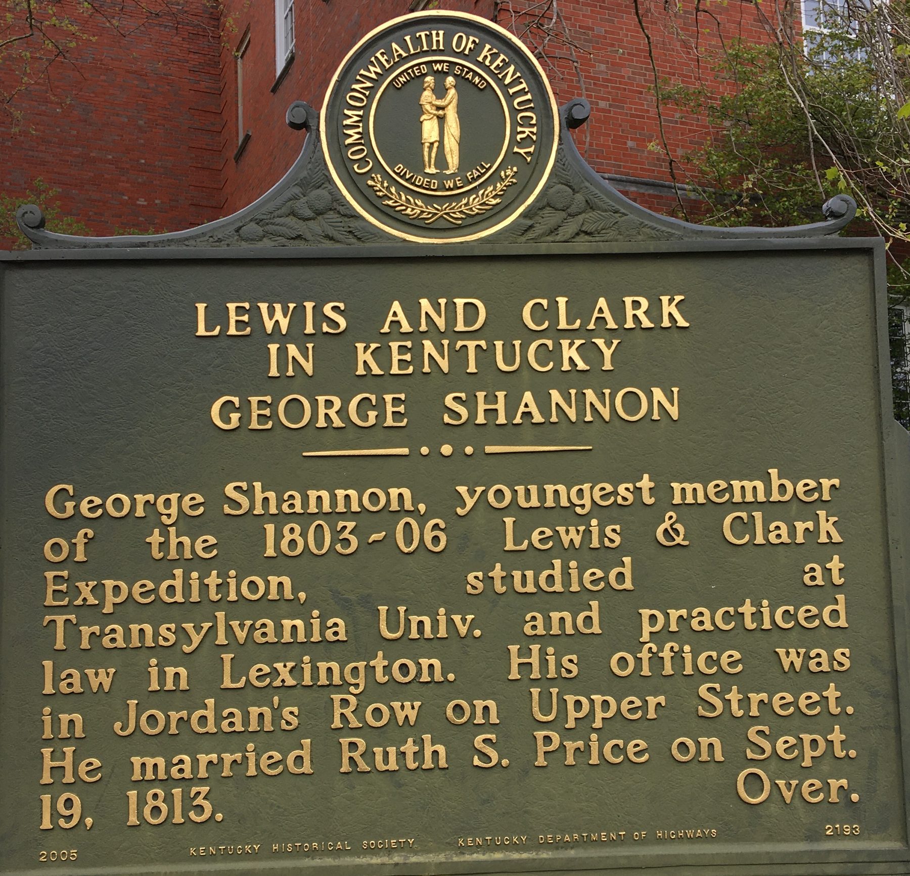
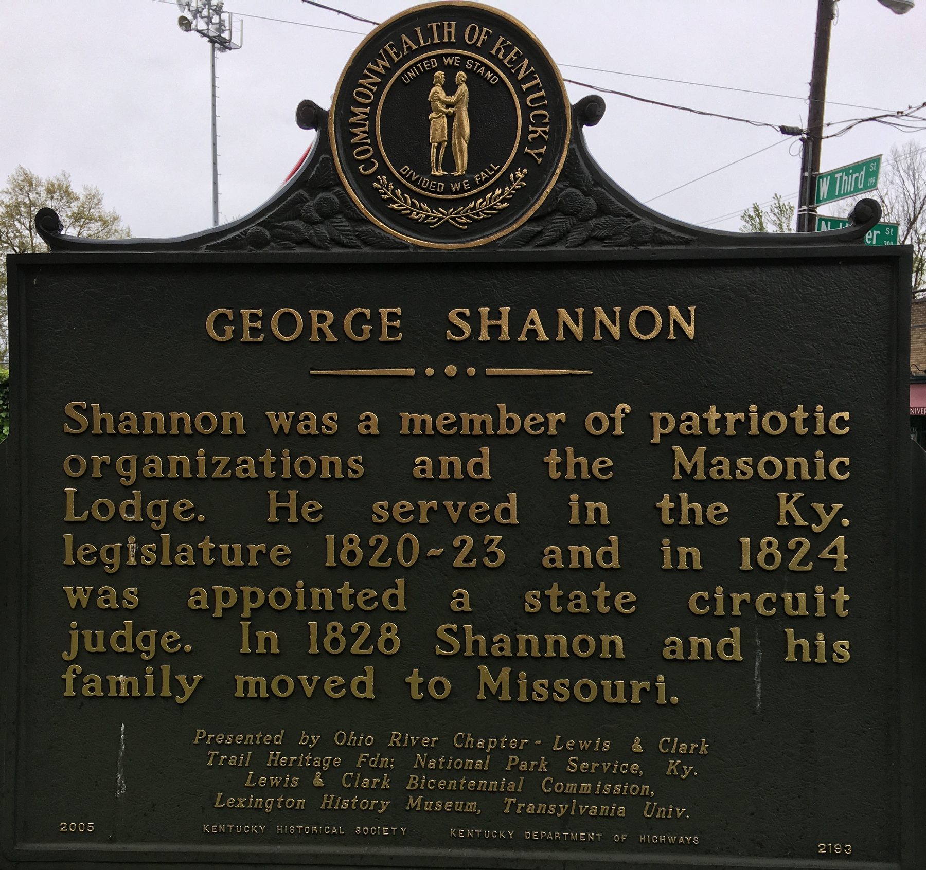
While in Lexington, William met with George Shannon, a member of the western exploration, paying him $39.69 (entry under expense is 40.00.. (5) George had lost a leg while serving the Federal Government trying to return Sheheke, the Mandan Chief, to his home in present-day North Dakota. With the loss of the leg above the knee, George would need a skill other than strength to make a living. Clark assisted George in securing a place to study at Transylvania Seminary (later University), an institution of higher learning chartered in 1780 while Thomas Jefferson was Governor and Kentucky was a county of VA. George went on to “read-law” and became a successful attorney, state legislator, judge and was active in civic affairs. His marriage to Ruth Snowden Price, a prominent Lexington family, aided his opportunities. (6) One of the many facts in Carolyn Denton’s George Shannon of the Lewis and Clark Expedition: His Kentucky Years is a reference to a letter received by Stephen Austin from Isaac Barker stating the “Shannon started for Philadelphia the 12th ult.” (12 June 1810). (7) George would have been going to the City of Brotherly Love to assist Nicholas Biddle with the Lewis and Clark Journal editing.

William Clark’s 1809 Journal

William Clark’s 1809 Journal

Courtesy: State Historical Society Missouri

George Shannon Historical Marker, Transylvania University Campus, West 3rd and North Upper Streets, Lexington, KY

George Shannon Historical Marker, Transylvania University Campus, West 3rd and North Upper Streets, Lexington, KY (picture 1 of 2)
George Shannon Historical Marker, Transylvania University Campus, West 3rd and North Upper Streets, Lexington, KY (picture 2 of 2)

Courtesy: Lewis and Clark Trust

Clark’s stay in Lexington was short, less than 24 hours, but he was active while in the Athens of the West. His letter to brother Jonathan Clark dated 30 October, he states that he had written to Judge Overton of Nashville to locate and secure the possessions of Governor Meriwether Lewis. He also reminded Jonathan that he needed the bundle of letters he had received in Louisville, especially the “New Madrid Letter” written by Lewis. Clearly, William is focused on preservation of the expedition journals and defending Lewis’ administrative and financial honor. (8)

Source:

(1) Holmberg, James, Dear Brother: Letters of William Clark to Jonathan Clark, Yale University Press, New Haven, 2002, page 19.

(2) https://mcconnellsprings.org/

(3) https://npgallery.nps.gov/AssetDetail/NRIS/83002765 (William McConnell House and National Register)

(4) https://www.lexingtonky.gov/townbranchcommons

(5) Denton, Carolyn, George Shannon of the Lewis and Clark Expedition: His Kentucky Years, We Proceeded On, May 1992, page 16.

William Clark Journal, State Historical Society o of Missouri, page 13 V.

(6) Hopkins, James F. & Hargraves, Mary editor, The Papers of Henry Clay, Vol. 2- The Rising Statesman 1815-1820, UK Press, Lexington, page 29

(7) Denton, Carolyn, George Shannon of the Lewis and Clark Expedition: His Kentucky Years, We Proceeded On, May 1992, page 17.

(8) Holmberg, James, Dear Brother: Letters of William Clark to Jonathan Clark, Yale University Press, New Haven, 2002, page 224.

Stop 11 of 37

South on the Lexington Branch of the Wilderness Road, 31 October 1809

Leaving Lexington on 31 October, Clark travels along present-day Upper Street, crossing Town Branch, then following the Nicholasville Road, past the future site of the University of Kentucky, US 27, south toward the Kentucky River. Travel for the day was 24 miles over rolling hills, except for the Kentucky River palisades section. They passed though Nicholasville and the future Camp Nelson Civil War Supply Depot and Hospital (37°79710N, 84°60251W), now a National Park Service -National Monument. Camp Nelson also served at one of three recruiting stations for U. S. Colored Troops during the Civil War with 40% of the 23,703 African American recruits passing through Camp Nelson (1) The Camp Nelson National Cemetery adjoins the National Monument.

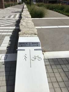
Town Branch Trail, Lexington, KY after renovation as an Urban Trail.

Town Branch Trail, Lexington, KY after renovation as an Urban Trail. (picture 1 of 2)
Town Branch Trail, Lexington, KY after renovation as an Urban Trail. (picture 2 of 2)

Courtesy: Lewis and Clark Trust

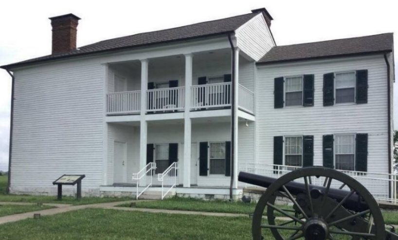
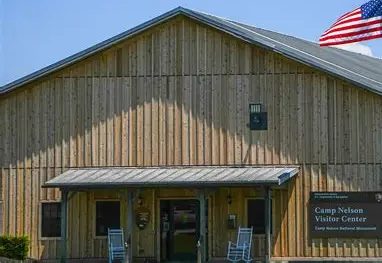
National Park Service Camp Nelson National Monument

National Park Service Camp Nelson National Monument (picture 1 of 2)
National Park Service Camp Nelson National Monument (picture 2 of 2)

https://www.nps.gov/cane/camp-nelson-national-cemetery.htm

Courtesy: NPS, Camp Nelson National Monument

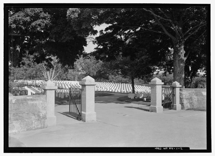
Camp Nelson National Cemetery

Camp Nelson National Cemetery (picture 1 of 2)
Camp Nelson National Cemetery (picture 2 of 2)

These Honored Dead

This cemetery is located adjacent to Camp Nelson National Monument, Jessamine County, Kentucky.

Courtesy: National Park Service

The difficulty in crossing the Kentucky River by the Clark party can be seen on both sides of the river at the 121-acre Hickman Creek Nature Center Preserve or the 908- acre Tom Dorman Nature Preserve on the South side of the Kentucky River. Both preserves are accessible from U S 27.

Hickman Creek Conservancy Dorman State Nature Preserve

Hickman Creek Conservancy Dorman State Nature Preserve (picture 1 of 2)

Courtesy: Hickman Creek Conservancy

Hickman Creek Conservancy Dorman State Nature Preserve (picture 2 of 2)

Courtesy: Nature Conservancy

https://hickmancreek.org/ https://www.nature.org/en-us/get-involved/how-to-help/places-we-protect/thomas-dorman-state-nature-preserve/?en_txn1=bl.ch_ky.eg.x.g

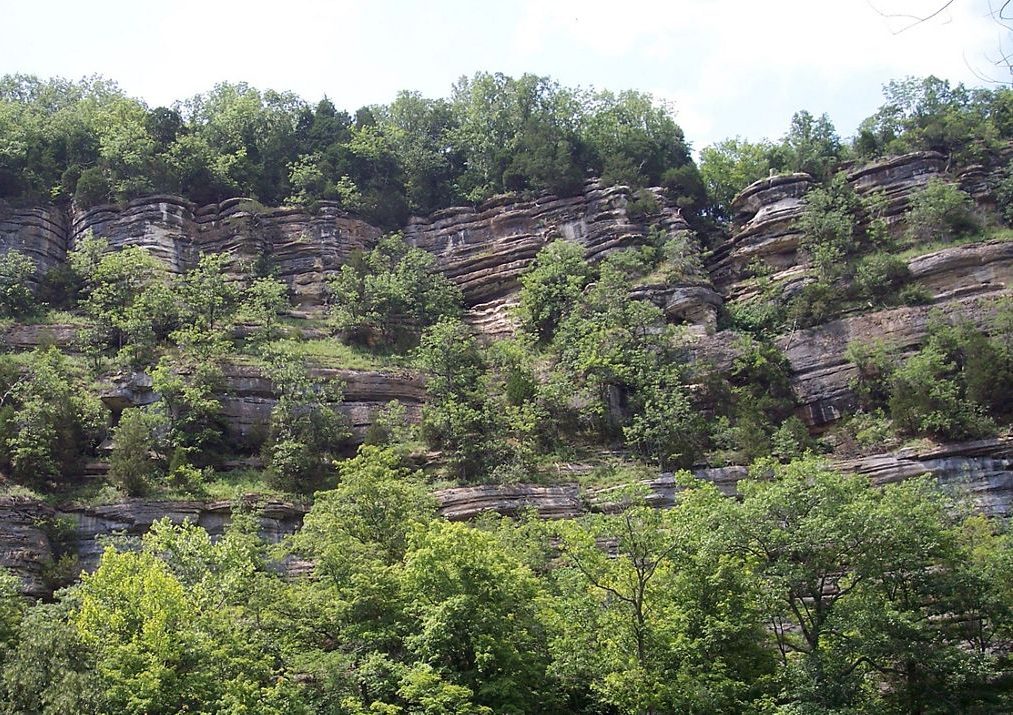
The river crossing or ford, used by the Clarks, was the result of stones being pushed into the river for millennia by rain water. The water was approximately 18 inches at the ford and 220 feet below the top of the palisades, considered the Grand Canyon of the East.

South on the Lexington Branch of the Wilderness Road, 31 October 1809

Courtesy: hmbd.com

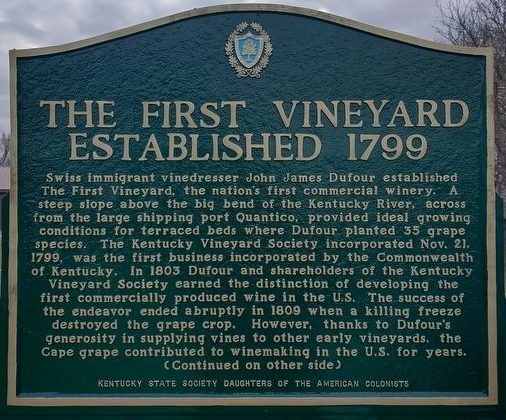
Travelers going to the Hickman Creek Nature Preserve from U S 27 on KY 1268 (Sugar Creek Road) (37°81571N, 84°59824W), will find signs to First Vineyards a restored vineyard and winery, first chartered in 1799 by Kentucky General Assembly. The vineyard was established by John James Defour, a Swiss emigrant, on the site overlooking the Kentucky River. (2)

Clark said, Crossed at Mr. Hickman and stayed all night at Mr. Hagins (James Hagin) Bryantsville, KY, cost 4.00.

Stop 12 of 37

A Broken Carriage Strap Caused Delay

On 1 November, the Clarks traveled 15 miles. One of the leathers of the carriage broke which detained several hours. Dined at Mr. Buford’s in Lancaster – 1.25 and stayed all night a Capt. Taylors on the Dicks (Dix) River- cost 2.25 (near 37.57177N, 84.61332W- near Old Lancaster Road #2). The exact site is unknown.

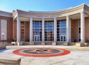
Mr. Buford’s Tavern was in the heart of Lancaster, KY and the present-day Garrard County Judicial Center (37°61807N, 84°57905W) bound on the south by West Buford Street, west by the US Post Office, north by the Garrard County Court House and the east by U. S. 27. We can appreciate Clark’s lack of comment because his mind was no doubt on the replacement of the leather strap for their carriage.

Garrard County (KY) Judicial Center

Garrard County (KY) Judicial Center

Courtesy: Lewis and Clark Trust

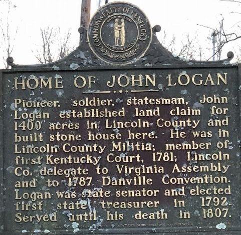
Reaching Stanford, KY on 2 November they stopped at John Logan’s stone house, -Servant .75- Pr. Gloves Mrs. Clark 1.00. KY Historical Marker number 1561, on KY 78, (37°53090N, 84°64234W).

John Logan House

John Logan House (picture 1 of 2)
John Logan House (picture 2 of 2)

Courtesy: Lewis and Clark Trust

Located at 65 Goshen Church Road (KY-642), north of Wilderness Trail (KY-78), on the left when traveling north. It is near the intersection of US 150 and Goshen Road, about one mile east of Stanford.

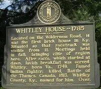
John Logan was the brother of Benjamin Logan founder of Stanford and Logans Fort (37°31.841’ N, 84°40.678’ W). While the fort was no longer in use in 1809, it was already a monument to the Logan brothers, Kentucky militiamen and leaders that served the First West. A few miles to the east along US 150 they passed the William Whitley House, the first brick house west of the Allegheny Mountains (37.46866N, 84.54937W). The Whitley house was not listed in the Clark journal but within sight of the road. William Whitley is one of the most recorded protectors of the Old Wilderness Road and the pioneers that traveled into the Bluegrass via the Cumberland Gap. (1)

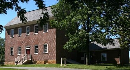
William Whitley House, built 1794

William Whitley House, built 1794 (picture 1 of 2)
William Whitley House, built 1794 (picture 2 of 2)

Courtsey: https://www.lincolnky.com/departments/william_whitley_house.php

625 William Whitley Rd, Stanford, KY 40484,

The house and race track were near the road the Clark’s were traveling. It is worthy of visiting for a prospective on frontier life along the Wilderness Road.

William Clark commented, Breakfast at Mr. Pleasants at the Crab Orchard, bad house, cost 1.50. Lodged a the Stone house very bad, cost 1.50.we could not get admittance at Mr. Smiths .

Crab Orchard, approximately 7 miles from the Whitley House, was named for the large number of wild crab apple trees near the Wilderness Road and a gathering place for people traveling East along the Wilderness Road. There was safety in traveling in large groups through the 130 miles wilderness. Notices of groups being formed at Crab Orchard appeared in the Kentucky Gazette, edited by John Bradford. The Gazette was “the” newspaper west of the Allegheny Mountains and covered a 500-mile radius. In 1793 Reverend Francis Asbury described the organizing of an east bound group at the Crab Orchard. (2) The Louisville Branch and the Lexington Branch of the Wilderness Road met at the Crab Orchard making it a significant geographic location for east bound travelers. In Meriwether Lewis’ 23 September 1806 letter to President Jefferson, the “Return Letter”, Lewis listed Crab Orchard as one of the reference points in the trip to Washington. (3) From the 1820’s to the 1920’s the 8 large mineral springs at Crab Orchard became the center of social and health spas with resort hotels having 250 rooms in one structure. (4)

That night, lodged at stone house, very bad, we could not get admittance at Mr. Smith’s 26 miles. This was the first time that the Clark party could not find a room where they wanted to stay. They are on the Wilderness Road in the vicinity of Mt. Vernon, KY and approaching the Boone Trace where the two historic trails merge. (5)

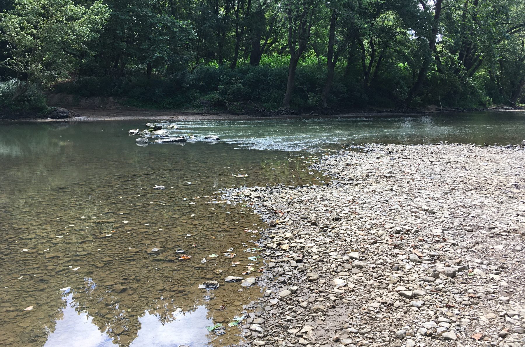
Rockcastle River Ford, Southern edge of Mt. Vernon, KY

Rockcastle River Ford, Southern edge of Mt. Vernon, KY

Courtesy: Lewis and Clark Trust

Rockcastle River, 55-miles long, named by Dr. Thomas Walker, Loyal Land Company explorer, the Lawless River. Renamed, Rockcastle River in 1767 by Issac Lindsey Rockcastle County founder.

Recreation opportunities include fishing and kayaking. https://fw.ky.gov/Education/Pages/Rockcastle-River.aspx

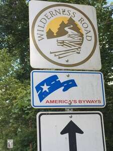
Boone Trace, Wilderness Road, America Scenic Byways used by Lewis and Clark on several occasions.

Rockcastle Co. KY

Rockcastle Co. KY

Courtesy: Lewis and Clark Trust

This section of the Boone Trace, Wilderness Road is in the Daniel Boone National Forest.

This section of the Boone Trace, Wilderness Road is in the Daniel Boone National Forest.

https://www.fs.usda.gov/r08/danielboone

Courtesy: U S Forest Service

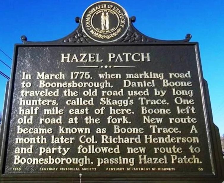
On the 3 November, the Wilderness Road turned into a muddy path, rained all last night and today, proceeded on to Rockcastle at Mr. Farris, 6 miles- cost 6.00. John Farris Tavern was located south of Old Hazel Patch at the Fork of the Wilderness Road and Boone Trace. (6) The short travel distance clearly shows the conditions of the road they were traveling.

A Broken Carriage Strap Caused Delay

Courtesy: hmdb.org

Source:

(1) https://stateparks.com/william_whitley_house_state_historic_site_in_kentucky.html

(2) Asbury, Francis, Rev., The Journal of the Rev. Francis Asbury: Bishop of the Methodist Episcopal Church, Applewood’s Books, New Bedford, MA, original 1821, page 164.

(3) Jackson, Donald, Letters of the Lewis and Clark Expedition with Related Documents 1783-1854, University of Illinois Press, Urbana, 1978, page 324.

(4) https://craborchard.ky.gov/Pages/history-and-tourism.aspx

(5) https://www.outragegis.com/boonetrace/_v2/web/#close

(6) Kincaid, Robert, The Wilderness Road, Bobbs-Merrill Co., Middlesboro, KY, 1966, page 196

Stop 13 of 37

Rain and Mud in the Wilderness

Warm Tavern and Good Company

4 November, rained last night and all this morning road bad, set out and proceeded all on horseback to Mr. Bulls- .50 & then proceeded on to Mr. Freemans- cost 2.83.
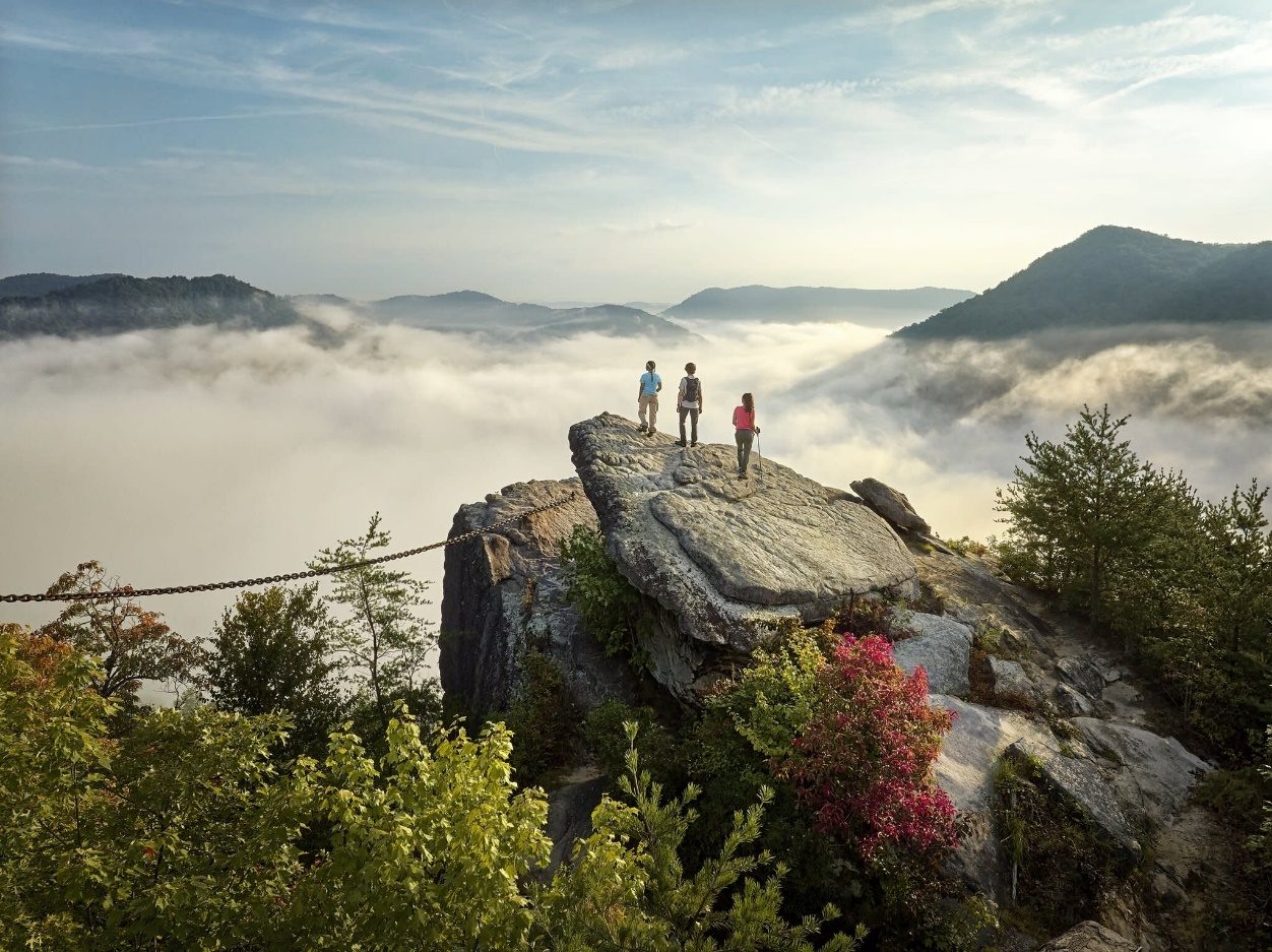
The Clarks have crossed the Rockcastle River Ford approximately 3/4 mile below Livingston, KY (37.29301N, 84.22066W) on U S 25. Today the old trail and U S 25 passes through the U. S. Forest Service Daniel Boone National Forest. (1) The Sheltowee Trace, a 254-mile hiking and biking trail runs through the Daniel Boone National Forest from Morehead, KY to Pickett State Park, TN. Sheltowee, Big Turtle, is a Shawnee Indian name given to Daniel Boone by Chief Black Fish. While the trail does not follow the historical Boone Trace, it is a grand example of the sense of adventure that Boone experienced in the wilderness. (2)
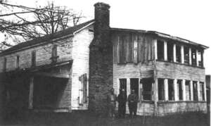
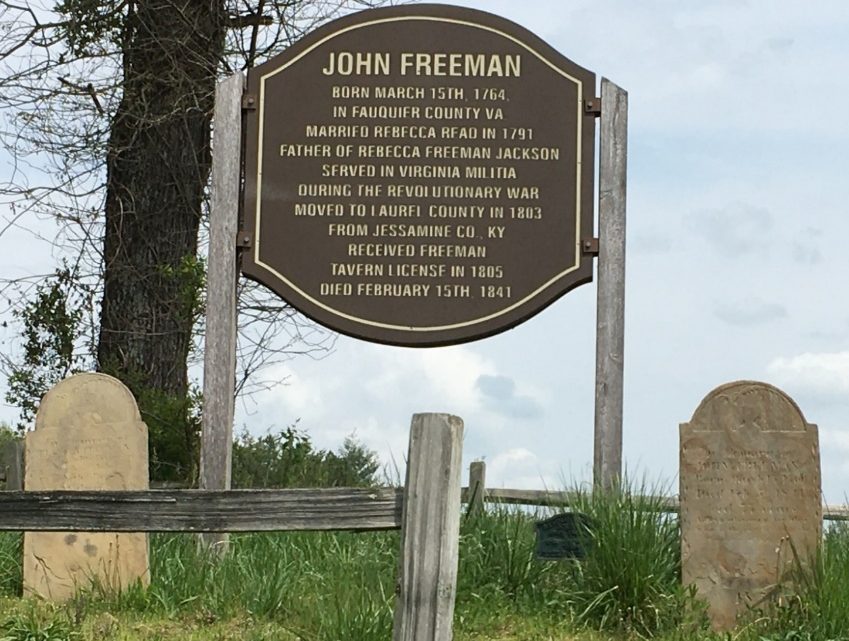
The Clark party stopped at Mr. Bulls (John, Sr.; John, Jr.; Robert or Izaah) (3) then proceeded to Mr. Freemans Tavern. The Freeman-Jackson Tavern site (37.073276N, 84.038751W) on KY 229 was built in 1804 and survived until it burned in 1962. Today the tavern site is near the Levi Jackson Wilderness Road Park, owned and managed by the City of London, KY (4)(5) The Tavern was a refuge from the rain and muddy road Clark had traveled. An added benefit was meeting Kentucky Congressman Benjamin Howard (6), Mr. and Mrs. (Jesse) Bledsoe (7) and Mr. Mankin, (unidentified).

Benjamin Howard was appointed Governor of the Upper Louisiana Territory in 1810 filling the office after Governor Lewis’ death. Did William Clark and Congressman Howard discuss the death of Governor Lewis? Did Clark describe the political confusion created by Frederick Bates? Howard’s appointment allowed Clark time find an editor and arrange for the publication of the Lewis and Clark Journals before being appointed Governor of the Missouri Territory in 1812.

Freeman-Jackson Tavern (Circa 1940) and Freeman Cemetery

Freeman-Jackson Tavern (Circa 1940) and Freeman Cemetery (picture 1 of 2)

Courtesy: Sentinel-Echo. Editor, Russell Dyche

Freeman-Jackson Tavern (Circa 1940) and Freeman Cemetery (picture 2 of 2)

Courtesy: Lewis and Clark Trust

Source:

(1) https://www.fs.usda.gov/r08/danielboone

(2) trace.org/https://www.sheltowee

(3) Knox County Kentucky Tax List 1809- (Comteck)- The Tax Lists records John Bull, Sr., John Bull, Jr., Robert Bull and Izaah Bull, Tavern or house site and exact owner is unidentified with certainty.

(4) https://levijacksonpark.com/ https://visitlondonky.com/

(5) Holmberg, James, Dear Brother: Letters of William Clark to Jonathan Clark, Yale University Press, New Haven, 2002, page 250, note 6.

(6) https://history.house.gov/People/Listing/H/HOWARD,-Benjamin-(H000834)/

(7) https://en.wikipedia.org/wiki/Jesse_Bledsoe

Stop 14 of 37

A Wilderness with Cold Muddy Roads

The Clarks are truly in the wilderness when they left Mr. Freemans on the morning on 5 November 1809. Cold last night a heavy frost this morning, set out early, breakfast at Mr. (Daniel or William) Anderson- cost 1.50. (1) Stayed all night at Mr. (Joseph) Rileys- cost 3.00 (2) our company left us Roads vey muddy and bad- made 20 miles. Even under difficult weather and road conditions they still made 20 miles.

6 November, Set out early, cold and heavy frost, breakfast at Mr. (Richard or John) Herndons -cost - 1.50 (3) at Big Stinkin, good house. (Stinking Creek and Old Flat Lick a.k.a. Big Flat Lick are very near each other). The Herndon House could have been at Old Flat Lick. (4) Stayed all night (at) Mr. (William, Thomas, Richard, & Hendrick) Whites (5) 20 miles – cost - 4.50.

Today the heavy wooded area that the Clark party had passed through can be seen at Pine Mountain State Resort Park, Pineville. (6) Lilly Cornett Woods, (37°05’51” N 82°59’03”.4 W) Letcher Co, KY, is a 554 AC preserve with 252 AC of old growth forest with seasonally-led tours. (7) The magnificent wildlife that roamed through the Boone Trace-Wilderness Road area of Southeastern Kentucky can be seen at the Boone Ridge Wildlife Center near Pineville, KY (under construction).

Pine Mountain State Park, Pineville, KY

Pine Mountain State Park, Pineville, KY

https://parks.ky.gov/parks/find-a-park/pine-mountain-state-resort-park-7799

Courtesy: Kentucky State Parks

For the general route of travel today from the Levi Jackson Wilderness Road Park to Middlesboro, follow KY 229 to US 25E South. The Boone Trace-Wilderness Road was little more than a trail large enough for a horse until 1795 when Kentucky’s First Governor Isaac Shelby and the General Assembly authorized the improvement and relocation of the horse path that became the Wilderness Road. The State had no public fund for road improvement so leading citizens, including Gov. Shelby, “passed the hat” to secure funding for improvements. (8) Historians, surveyors, geographers including Fox, Hammon, Jones, Kincaid, Meyer, Pusey, Shattuck, and others have researched and written tirelessly to define the Warriors Path, Boone Trace, and Wilderness Road with its many branches and “cutoffs”. In all their writings there are varying degrees of un-certainty in describing the road that had many paths much like the braided streams William Clark had observed in the West. After three days of travel in the mud and rain through the wilderness the Clark party is now facing two mountains.

Source:

(1) Knox County, KY Tax List 1809 - (Comteck)– The Tax List records William and Richard Anderson.

(2) Knox County, KY Tax List 1809- Joseph Ryley.

(3) Knox County, KY Tax List 1809 –The Tax List records Richard and John Herndon.

(4) https://explorekyhistory.ky.gov/items/show/414

(5) Knox County, KY Tax List 1809- Tax List Records William, Thomas, Richard & Hendrick White.

(6) https://parks.ky.gov/pineville/parks/resort/pine-mountain-state-resort-park.

(7) https://naturalareas.eku.edu/lilley-cornett-woods-appalachian-ecological-research-station.

(8) Kincaid, Robert, The Wilderness Road, Bobbs-Merrill Company, Middlesboro, KY, 1966, page 185.

Stop 15 of 37

A Night at the edge of a Meteorite Strike

During William Clark’s life, he spent the night in many varied locations but none more interesting geologically than on the evening of 6 November 1809. Mr. (William) White’s Tavern was in Ferndale, KY, present-day intersection of Old U S 25 E and KY 1534, (1) at the edge of a meteorite impact crater having a diameter of 3-miles. This geological significance was not determined until 1962 by USGS Scientist Englund and Roen. (2)(3)

On 7 November the Clark party had breakfast at Mr. White’s then traveled through the impact crater and along a road that today is US 25E to Avondale Ave. in Middlesboro, KY. This route crossed Little Yellow Creek in more than one location during a season already described by Clark as rainy and cold before reaching the “saddle” and crossing Cumberland Mountain. William was traveling a trail he had used before, a trail first recorded by Dr. Thomas Walker in his journal. (4) Dr. Walker had learned of the “gap” in the limestone barrier from the Indians. Cave Gap, re-named by Dr. Walker as Cumberland Gap, would be celebrated by Frederick Jackson Turner in his 1893 “Frontier Thesis”, a thesis in which William Clark played a central figure in opening of the West. (5)

“Stand at Cumberland Gap and watch the procession of Civilization, marching single file—the buffalo following the trail to the salt springs, the Indian, the fur-trader and the hunter, the cattle-raiser, the pioneer farmer—and the frontier has passed by. Stand at South Pass in the Rockies a century later and see the same procession with wider intervals between.”

Gateway to the West: Daniel Boone Leading Daniel Boone Escorting Settlers through the Cumberland Gap Settlers Through the Cumberland Gap painted 1852 painted 2005

A Night at the edge of a Meteorite Strike (picture 1 of 2)
A Night at the edge of a Meteorite Strike (picture 2 of 2)

Courtesy: David Wright Courtesy: Washington University Gallery of Art, St. Louis https://davidwright.com

The Cumberland Gap Area Guidebook - Tom N. Shattuck - Google Books

Courtesy: Tom Shattuck https://www.bellcountyhistorical.org/

Today the route over the “saddle” can be followed through Cumberland Gap National Historical Park. (6) The 24,536-acre park across the corner of Kentucky, Tennessee, and Virginia, established in 1941, is a monument to perseverance of human spirit and fortitude. Fortunately for today’s traveler, a twin bore tunnel cut through the mountain barrier and finished in 1996, allows vehicle passage on U S 25 E to move quickly through the great limestone barrier. The tunnel permitted restoration of the old road for walkers, hikers, runners so the wilderness can be experienced once again. In-reality, there are two versions of the trail up to the “saddle” on the North side of Cumberland Gap. From the Thomas Walker Parking Area, take the Object Lesson Road to follow the Clark route of 1809 or the Boone Trace-Wilderness Road Trail -see signs in the parking lot- used for horse or foot travel in the early days. at Cumberland Mt. .75, shoeing horse.75.

Stop 16 of 37

South on the Old Kentucky Road to Bean Station

The evening of 7 November the Clarks stayed in Tazwell Court House, Claiborne Co. TN after traveling 20 miles over the Cumberland Mountain (Cumberland Gap).

Goodspeed’s History of Claiborne County Tennessee records court license for two public houses, Reuben Rose-tavern 1806 and John Bristoe-ordinary1806. Either of these could have been the site where the Clark party spent the night - cost – Taswell C. House- 4.25, gloves & socks $1.62 (1)

Clearly, William was taking the newer and easier route for his family, servants, and carriage to Bean Station, TN instead of the Boone Trace -Old Wilderness Road through the mountains, todays US 58/421, passing through Jonesville and Gate City, VA. The old route was used by Lewis and his group and later by Clark and York in 1806.

View of Cherokee Lake, Granger Co. TN from US 25 E South (Wilderness Road 1809) from Clinch Mountain

The evening of 7 November the Clark’s recorded staying at Mr. Evins on Clinch Mountain, Grainger Co. TN - location of the tavern or home is unknown, at Evins on Cllinch 1.38, at Turnpike on Clinch M. 1.68.

After traveling 16 miles from Mr. Evins on Clinch Mountain, William arrived at Bean Station managed by James Kennedy. He told Jonathan in his letter of 8 November, a letter that he misdated, The roads are very bad thro’ the wilderness and more particularly on the Turn pike of Clinch Mountain, we have been all day Comeing 16 miles, over what they Call a turnpike road, (for) which pleasant traveling I payed 162 ½ cents. at Beans station. Kenedys 3.82 2 pair socks. 1 surcingle (horse harness) $2.35. apples & (word uncertain) 50. (2) Improvements on the road were started in 1785 to upgrade the horse path and Indian Trail # 33. (3)(4) William also told Jonathan that his son, Lewis, was still very bad with a cold and he had written William P. Anderson while in Lexington to try and secure Gov. Lewis’ papers. (5)

During the past two days the Clark party had crossed Clinch Mountain, a noted location for travelers of any era. The rugged road conditions Clark depicts has been replaced for travelers today with a modern highway having beautiful vistas of the mountain with Cherokee Lake in the valley below, a worthy subject for photographers and artist. The music of the region is captured in the 17th century Scottish ballad, recorded by Woody Guthrie as Rye Whiskey and was included in Carl Sandburg’s 1927 American Songbag, as Way up on Clinch Mountain.

Bean Station TN- Intersection of U S 25 E and U S 11 W

Bean Station TN- Intersection of U S 25 E and U S 11 W (picture 1 of 2)
Bean Station TN- Intersection of U S 25 E and U S 11 W (picture 2 of 2)

Courtesy: Waymarking.com

Bean Station, TN was established by William Bean in 1769, the first permanent white settlement in Tennessee. Bean Station became a thriving settlement at the intersection of the Wilderness Road (running generally north and south) and the Old Stage Road between New Orleans and Washington DC. The grand old hotel was used by three Presidents, Jackson, Johnson, and Poke, in addition to Henry Clay and countless other travelers. Bean Station Hotel became a “Distributing Post-Office”, a designation of the Post Master General, where stage coach passengers and mail have a temporary rest. (6) The Clark visit was before the grand old hotel was built but very likely near the same site. The original community of Bean Station is under Cherokee Lake today. The historic old hotel, pictured above, was to be dismantled by Tennessee Valley Authority in 1940 with plans to be rebuilt but sections were lost and the reconstruction was never completed.

Source:

(1) Goodspeed's History of Claiborne County (joepayne.org) (Abstract: paragraph 8)

(2) Holmberg, James J., Dear Brother: Letters of William Clark to Jonathan Clark, Yale University Press, New Haven 2002, page 225.

(3) Meyer, William E, Indian Trails of the Southeast (Forty-second annual report of the Bureau of American Ethology), Gustavs Library, 2009, page 772.

(4) Holmberg, James J. Dear Brother: Letters from William Clark to Jonathan Clark, Yale University Press, New Haven, 2002, page 226, note 3.

(5) Ibid, Page 226, note 4.

(6) Coleman, J. Winston, Jr., Stage Coach Days in the Bluegrass, Standard Press, Louisville, KY, 1936, page 214 note 3.

Stop 17 of 37

East to Rogersville

Traveling through the former State of Franklin

9th Thursday – Set out after Breakfast & Stayed all night at Co. Rogers (1) at Rogersville rodes (roads) fine made 23 miles – Cost - at Rogersville 3.75, servant .12. The road Clark was following is the corridor for today’s U S 11-W, designated as a Tennessee Scenic By-Way. The Holston River was to their right with the Clinch Mountain range on their left. The wide valley is picturesque today with a fine road.

This area of East Tennessee was organized as the independent State of Franklin in 1784 till 1789, negotiating treaties with the Overhill Cherokee and other Tribal People. Today the eight eastern counties of Tennessee compose the bulk of the State of Franklin. (2)

Joseph Rogers was an Irish- born veteran of the Revolutionary War and supporter of the State of Franklin. After the State of Franklin collapsed, Joseph, along with support of his father-in-law Thomas Amis, founded Rogersville. (3)

Col. Joseph Rogers Tavern, photo April 2019

Col. Joseph Rogers Tavern, photo April 2019 (picture 1 of 2)
Col. Joseph Rogers Tavern, photo April 2019 (picture 2 of 2)

Preservation and restoration of historic Colonial Joseph Rogers Tavern, June 2026

Preservation and restoration of historic Colonial Joseph Rogers Tavern, June 2026 (picture 1 of 2)
Preservation and restoration of historic Colonial Joseph Rogers Tavern, June 2026 (picture 2 of 2)

Front view Rear View

Detached Kitchen at Rear of tavern

June 2026, Restoration of Joseph Rogers Tavern, 1800 Property ownership, Rogersville Historic District. Rogersville, TN.; Detached kitchen f (picture 1 of 2)
June 2026, Restoration of Joseph Rogers Tavern, 1800 Property ownership, Rogersville Historic District. Rogersville, TN.; Detached kitchen f (picture 2 of 2)

June 2026, Restoration of Joseph Rogers Tavern, 1800 Property ownership, Rogersville Historic District. Rogersville, TN.

Detached kitchen found during demolition. The Clark significance was unknown until 2019.

National Register Site

Courtesy: Kim Ross

Col. Joseph Rogers Tavern is one of the few extant structures that Lewis or Clark visited or stayed in 1803-1810. The Tavern, built circa 1800 is a recognized landmark in Tennessee History and is recorded in William Clark’s 1809 Journal which adds to the history of the tavern and the city of Rogersville, TN. (4) Joseph Rogers Tavern is within the historic Rogersville, TN district listed in the National Register of Historic Places, authorized by the National Preservation Act of 1966. (5) In September 2019, the historic structure was evaluated by Dr. Carrol Van West and Ms. Savannah Grandey, CHP, Middle Tennessee State University Center for Historic Preservation. The recommendations verify the building’s historical significance and that the structure has potential for restoration to the 1800-1810 appearance. A later addition has potential for modern day use to sustain the historical structure. A copy of the full report is available from CHP MTSU Center for Historic Preservation, the Lewis and Clark Trust or Rogersville Heritage Association.

Source:

(1) Rogersville, TN Tourism, Heitman, Francis, Historical Register of Officers of the Continental Army during the revolution April 1775 to 1783. Page 471.

(2) https://www.smithsonianmag.com/smart-news/true-story-short-lived-state-franklin-180964541/

(3) https://en.wikipedia.org/wiki/Rogersville,_Tennessee

(4) Report from CHP, MTSU Center for Historic Preservation History. Education. Architecture, Dr. Carrol Van West and Savannah Grandey.

(5) https://npgallery.nps.gov/GetAsset/f17524bd-b15d-4207-975e-4d9099815073/

Stop 18 of 37

Miles to Go With Little Rest

10th Friday- Set out early B.f. (breakfast) at Mr. Armstrongs, cost – 1.50. crossed the N. Fork of Holsten and stayed all night at Mr. Wm. Sniders at Kingslanding on the Holston – cost – 4.50, cakes .62, a good fair made 26 miles.

Historic Netherland Inn

Historic Netherland Inn

Listed on the National Register of Historical Sites, the Netherland Inn rises above the Holston River. The restored Inn faces the Old Stage Road in the heart of Kingsport’s Boat Yard Park, an area along the Holston River that served as migratory spot for settlers to build boats for their westward trip during the mid-1700s.

Courtesy: https://netherlandinnhistoricsite.com/

The Clark party had arrived at the William King’s Inn, managed by William Snider, in Christiansville, todays Kingsport, TN. (1)(2)(3) John Lynn, manager of the Wm. King Boat Yard built the boarding house, circa 1803, at the head of navigation on the Holston River to support King’s many enterprises, including storage and shipment of salt from the salt works at Saltville, VA. The boat yard and related businesses were located on the North side of the Holston River across from the 814-acre Cherokee Indian’s sacred Long Island.

William King died at an early age and left a very entangled estate that was not settled until 1818. At the estate sale, Richard Netherland purchased the boat yard and inn which became the Netherland Inn. (4)(5)

“11th Nov Breakfast at Mr. (Stephen) Easley (6) place -cost- 1.75, Stephen Easley had moved his family from VA in 1783 to a 1320-acre Horse Creek plantation overlooking the Holston River and Long Island. Two sons, Robert and Peter, settled on their father’s land and build large log homes and became prominent members of the Horse Creek Community. Are the log houses in the Bays Mountain Park one of the cabins where the Clarks had breakfast? (7)

stayed all night at Capt. Goodman’s, good fair - 28 miles – cost- 3.25. Robert Goodman, was a member of the North Carolina Militia. (9) The location of Robert Goodman’s home is uncertain but near Bristol TN.

John Preston House Robert Preston House

John Preston House Robert Preston House (picture 1 of 2)
John Preston House Robert Preston House (picture 2 of 2)

https://www.dhr.virginia.gov/historic-registers/095-0021/

https://www.bristolhistoricalassociation.com/robert-preston-home

Courtesy: Children’s Advocacy Center at Preston’s Grove Courtesy: Bristol Historical Association

12th Breakfast at Col. John Preston’s – servant at Col. Preston .25cents. The Clark party had breakfast at Col. John Preston’s on the Walnut Grove Plantation the morning of 12 November. The current structure is owned by the Children’s Advocacy Center, pictured above, and is believed to be built on or near the foundation of the original brick house.

John Preston was born 8 July 1781 on the plantation and received a law degree from Princeton, a profession he never pursued. John farmed the plantation and was appointed Justice of Washington County, VA and later County Judge in 1820. He served as a Captain in the War of 1812 and a Colonel in the 105 Regiment of the Virginia Militia.

Leaving Col. Preston’s home, the Clarks pass the home of the late Col. Robert Preston, father of John Preston. The Robert Preston house, pictured above, is extant and meticulously restored by the Bristol Historical Association with guidance by Jan Rainero. The Clark Family and the Preston Family had a long friendly relationship and as we will see, William and Julia, stayed or visited with other members of the Preston Family as they traveled the Great Wagon Road.

William is entering the western end of the Great Wagon Road, a bottleneck of geography and history. With mountains on both sides of the great valley and the Powell, Clinch and North Holston Rivers running parallel to the road, todays US 11 W and I-81, the Clark party was facing November’s cold, wet and snowy lower Shenandoah Valley weather.

Source:

(1) Spoder, Muriel Miller Clark, The Netherland Inn Chronicles, Spoden Associates, Kingsport, TN 1999, page 4 (map).

(2) Ibid, page 32.

(3) Spoden, Muriel M. C, Kingsport Heritage: The Early Years 1700 to 1900, The Overmountain Press, Johnson City, TN, 1991, page 172 & 173.

(4) Spoden, Muriel Miller Clark, The Netherland Inn Chronicles, Spoden Associates, Kingsport, TN, 1999, page 35.

(5) Spoden, Muriel M. C., Kingsport Heritage: The Early Years 1700-1900, The Overmountain Press, Johnson City, TN, 1991, page 160.

(6) Spoden, Muriel M. C., Kingsport Heritage: The Early Years 1700-1900, The Overmountain Press, Johnson City, 1991, page 160-161.

(7) https://www.baysmountain.com/

(8) Heitman Francis B., Historical Register of Officers of the Continental Army during the war of revolution April 1775 to December1783, page 252.

(9) https://www.waymarking.com/waymarks/wm3HF6_The_Grove_Bristol_Virginia

Stop 19 of 37

The Western End of the Great Valley Road

Snow and Winter Weather

12th Passed through abbingdon (Abingdon) stopping at Logans –1.00 (purchase unknown) and stayed all night at the Bush (1) house, good fair- cost - 3.25, met Mr. Minor and his wife (2) and Capt. Barber (John, NC Militia 1776, George, Georgia Militia 1781,) (3)- 21 miles.

The exact location of the Bush or Burk house is uncertain but the miles traveled would locate it near Glade Spring, VA.

The Clarks were passing through the northern muster center where the Overmountain Militia Men gathered for their march to Kings Mountain during the Revolutionary War. (4) Today the Overmountain Victory Trail Association, in partnership with the NPS Overmountain Victory Trail, is educating and preserving the history of the 1780 patriots.

Overmountain Victory Trail Association

Overmountain Victory Trail Association (picture 1 of 4)
Overmountain Victory Trail Association (picture 2 of 4)
Overmountain Victory Trail Association (picture 3 of 4)
Overmountain Victory Trail Association (picture 4 of 4)

https://www.nps.gov/ovvi/index.htm

Courtesy: Overmountain Victory Trail Association

Abingdon is well known for the Barter Theater and the Martha Washington Inn both in the center of town. Lewis and Clark traveled through Abingdon on several occasions and is commemorated with two brass 12” NOAA disk, one is in the sidewalk in front of the Abingdon Municipal Building on Main Street, U S 11 W, and the other is in Veterans Memorial Park, 425 Lt. Billy Webb Avenue. (5)

The Virginia Creeper Trail, ending trail head is in Abingdon, is a Rail-To-Trail recreational opportunity of 34 miles. Starting at Whitetop, near the North Carolina state line, allowing for an easy downgrade peddle to Abingdon. (6)

Virginia Creeper Trail

Virginia Creeper Trail

https://www.vacreepertrail.org/

Courtesy: Virginia Creeper Trail

William Clark’s stop in Abingdon, formerly Wolf Hills, was short they needed to travel before the weather deteriorated.

Source:

(1) https://freepages.rootsweb.com/~cwbush/genealogy/bushx.htm

(2) Heitman, Francis B., Historical Register of the Officers of the Continental Arny 1775-1783, page 395.

(3) Ibid, page 86.

(4) https://ovta.org/page-1462846

(5) https://bartertheatre.com/

(6) https://www.vacreepertrail.org/

Stop 20 of 37

Rain, Cold and Wet, Again

13th (Nov.) Breakfast at house one mile east of the 7mile ford, (1) rained all morning, stayed all night at young Atkins, Good fair 23 mile - cost- 4.62, grain straw .25, whiskey grog 62.

Cullop Stone House

Cullop Stone House

Courtesy: David Edwards

The 23 miles would put Clark in the vicinity of present-day Atkins, Smyth Co. VA less than 5 miles from the Wythe Co. line. Frederick Cullop built the Old Stone Tavern a.k.a. Rock House before 1815 (36°51’51” N -81°26’12” W). The distance and location are reasonable for the house that the Clark party stayed in on 13 November 1809. (2)(3) Cullop appeared in the Wythe County tax records in 1797 and acquired the tavern property in 1806 and 1808. (4)

Kent House, razed, date uncertain

Kent House, razed, date uncertain (picture 1 of 2)
Kent House, razed, date uncertain (picture 2 of 2)

Kent House, east of Wethville, built 1794

Courtesy: Wytheville Community College, Kegley Library, Wytheville, VA

On the 14th the Clarks passed through Wytheville and stayed all night at Capt. (James) Kent. (5) Chloe, Scott and presumably Rachel, their daughter, were sent to the Kent’s Tavern near the main road to spend the night. They traveled 29 miles – cost- unknown.

Shot Tower State Park, Wythe Co. VA

Shot Tower State Park, Wythe Co. VA

https://www.virginia.org/listing/shot-tower-state-park/7866/

During the day of 15 November, they passed near Ft. Chiswell. The fort was built 1758 -1760 by Col. William Byrd III as an out-post during the French and Indian War and named for John Chiswell the owner of the nearby lead mine. The (lead) Shot Tower Historic Site is 8 miles south of I-81 on I-77. (6)(7) Unfortunately, the old fort and related building were lost during the construction of I-77 and I-81. (8) Today, there is a pyramid monument erected near the fort site. (9)

Stop 21 of 37

Preston Hospitality

Arriving at the Preston’s late at night, 15 November

After 25 miles of travel in the cold and on muddy roads the Clarks had arrived at the home of Capt. William Preston (later Major) and Caroline Hancock Preston, Julia’s sister.

Fifteen (15) words is all we have from William Clark for the 15th of November 1809. He was never a man of many words but this date is unusually brief. This can be interpreted several ways but the most logical explanation is his energy and thinking was focused on reaching the Preston home.

William Clark and William Preston had served together in Gen. Anthony Wayne’s Army during the early 1790’s and Wm. Preston had served as a marriage bondsman for William Clark on 5 January 1808. The marriage bond to Julia Hancock is written as Judith Hancock, like the western river Clark named for his hoped-for future bride. (1)(2)

The Preston home was on the Robinson Tract, Wythe Co. VA, present-day Pulaski Co, VA. The Tract was a Royal Land Grant issued by the Colonial Governor and not directly by the King of England. William Preston had moved to the tract in 1803 after his marriage to Caroline Hancock on 24 March 1802. (3) Surely, there was a great deal of joy and excitement on their arrival and during the next four days. Julia had a new baby, Meriwether Lewis Clark, now ten months old, to show her sister. This was the first place they had stopped for longer than one night since leaving Jonathan Clark’s Trough Spring home on 26 October and no doubt rest was needed by everyone in the Clark party.

On the 16 November, Congressman Benjamin Howard arrived but left the next morning. This is the same Benjamin Howard that William met on the Wilderness Road at Freemans Tavern (see page 40.) William reports that it rained during the night of the 17th and next morning. On 19 November Dr. and Mrs. Floyd arrived. Letitia Floyd was a sister of William Preston and Dr. Floyd was the child of Col. John Floyd and a cousin to Charles Floyd of the Lewis and Clark Expedition. Dr. Floyd would be elected Virginia’s Governor in 1830 after serving as a Member of the Virginia House of Delegates and Member of the U.S. House of Representatives. Dr. Floyd did not forget his youth on the frontier of Kentucky. During his tenure in the U. S. Congress, he introduced bills and strongly advocated for ownership of Oregon. Floyd’s bill was enacted by the House in 1828 but failed in the Senate. However, his strong voice advanced the cause for admission of the Oregon Territory in 1848 and eventual statehood in 1859. (4)(5)(6)(7)

The assemblage of families at the William Preston home represented the Who’s Who of prominent frontier families of the 1700’s and early 1800’s.

Library of Congress: Map of Craig, Giles, Montgomery, and Pulaski Co, VA – Robinson Tract

Library of Congress: Map of Craig, Giles, Montgomery, and Pulaski Co, VA – Robinson Tract

https://www.loc.gov/resource/gvhs01.vhs00368/?r=0.668,0.711,0.329,0.198,0

Courtesy: Library of Congress

Virginia Atlas and Gazetteer, DeLorme Mapping Company, page 40

VA Highway 732 (arrow) Robinson Tract Road, crosses the historic Robinson Tract north of the city of Pulaski.

VA Highway 732 (arrow) Robinson Tract Road, crosses the historic Robinson Tract north of the city of Pulaski.

Courtesy: Lewis and Clark Trust

The Lewis and Clark story, like the rivers they followed during the western exploration, have many twist and turns. While the Clarks are passing through Montgomery Co. VA of 1809, they are near the home of William Werner. While most of the Corps of Discovery stayed in the West, Werner spent the balance of his life in the Southern Shenandoah Valley, present-day Pulaski Co, VA. If Werner returned with the Lewis group in 1806, hurrying to Washington to report to President Jefferson, he is not recorded as part of the Lewis group. In 1807 William Clark met with Werner in Charlottesville and paid him $100.00 with an additional $30.75 to be paid in Fincastle. (8) Meager records indicate where Werner lived or is buried in Pulaski Co., VA.

Source:

(1) Botetourt, Co. VA Marriage Bond Book - Ministers Return B-page 7.

(2) Holmberg, James J., Dear Brother: Letters from William Clark to Jonathan Clark, Yale University Press. New Haven, 2002, page 125, note 8.

(3) Ibid, page 125, note 8.

(4) Ibid, page 233, note 8.

(5) https://www.loc.gov/resource/lhbcb.06949/?sp=34

(6) Hammond, Neal O., John Floyd: The Life and Letters of a Frontier Surveyor, Butler Books, Louisville, 2013 (Floyd Family History).

(7) Clark, Thomas D., Frontier America, Charles Scribner’s and Son, New York, 1959, page 495.

(8) Jackson, Donald, Letter of the Lewis and Clark Expedition, University of Illinois Press, Urbana, 1978. page 387.

Stop 22 of 37

On the Road Again

20th Set out after Breakfast with Dr. and Mrs. Floyd crossed at English Ferry (Ingles Ferry) arrived at Christiansburg late at night some snow top of the Allegheny Mt. 25 miles. List of expense: at River Canhaway (New River) .75; Maj. P. Servant 25; at Christion Burg 50; at (word unknown) 25; at Horse Showing 75.

English Ferry (1)(2) a.k.a. Ingles Ferry is a historic site on the New River operated by William Ingles after 1763. (3)(4) History reports the ferry with two names but it is more famous as the Ingles Ferry. (5) The William Ingles received the land by deed in 1747. William and Mary Draper Ingles moved to the site in 1750. The name of Mary Draper Ingles was enshrined in history after the Shawnee attack on Draper Meadow with Mary being captured, the subsequent birth of her daughter and being taken cross the Ohio River by the Shawnee Indians. Mary escaped from the Shawnee while the Indians were camped at Big Bone Lick, Kentucky where the Indians were boiling mineral water for salt. (6) The late historical fiction writer James Alexander Thom re-told the story of Mary Draper Ingles in the 1981 best seller Follow the River, ISBN 9780345338549 (7) The Ingle Ferry House and ferry crossing was uses by thousands of emigrants traveling the Great Valley Road including Rev. Francis Asbury. (8) Today, the location has been recognized as a Lewis and Clark Site by the Lewis and Clark Eastern Legacy Trail of Virginia. (9)

William and Mary Ingles Home and Ferry House, New River, Pulaski Co, VA

William and Mary Ingles Home and Ferry House, New River, Pulaski Co, VA

Courtesy: Lewis and Clark Eastern Legacy Trail

Note: Exterior and Interior Details for the William Ingles House, See Note 1 “Where Did the Clark’s Stay in Christiansburg” Narrative 23, WPA Report.

After crossing the New River and while traveling to Christiansburg, the Clarks were near Historic Smithfield Plantation, the ancestral home of the Preston dynasty. Col. William Preston, an Irish emigrant, and his wife Susanna Smith, moved to the Smithfield in 1774. The home was a mansion compared to the log cabins found along the Great Valley Road in the lower Shenandoah Valley. (10) Col. William Preston and Susanna Smith had twelve children (12) before his untimely death in 1783. Susanna ran the plantation successfully for the next forty (40) years. Today Historic Preston-Smithfield Plantation is an outstanding example of Colonial America life with excellent interpretation.

Historic Smithfield

Historic Smithfield (picture 1 of 2)
Historic Smithfield (picture 2 of 2)

https://www.historicsmithfield.org/

Courtesy: Historic Preston-Smithfield Foundation

From Smithfield Plantation Col. William Preston served as County Surveyor for Botetourt County which covered all or part of seven (7) present-day states, including most of Kentucky. When Fincastle Co. VA was formed out of Botetourt Co. in 1772, Col. Preston was appointed surveyor and sheriff for the new county. The massive territory required deputy surveyors trusted by Col. Preston. He appointed John Floyd who had served as a clerk in the surveyor’s office. Floyd has been commissioned as an assistant surveyor on 11 August 1772 by the College of William and Mary. Floyd surveyed for Col. Preston and other people in Kentucky and eventually moved his extended family to the Falls of the Ohio Region in 1779. (11) (12) Robert Clark Floyd, father of Lewis and Clark Expedition member Charles Floyd, was part of the Floyd migration from Virginia to the future state of Kentucky. Col. Preston’s office was at his Smithfield Plantation home, indirectly connecting Smithfield Plantation to the Lewis and Clark Expedition.

Source:

(1) Haywood, John, Civil and Political History of the State of Tennessee, Publishing House Methodist Episcopal Church, Richmond, VA, 1915, Page 40.

(2) Pusey, William Allen, The Wilderness Road to Kentucky Its Location and Features, George Doran, Co., NY, 1921, page 28. (Reprint of Brown’s Journal 1782)

(3) . https://www.dhr.virginia.gov/historic-registers/077-0013/

(4) Kincaid, Robert l. The Wilderness Road, Bobbs-Merrill Co., NY, 1966 ed., page 64.

(5) https://www.radfordva.gov/501/Ingles-Farm

(6) Kincaid, Robert, The Wilderness Road, Bobbs-Merrell Co., NY, 1966 ed., page 58-61.

(7) http://www.jamesalexanderthom.com/river.html

(8) Asbury, Francis, Rev., The Journal of the Rev. Francis Asbury, Applewood Books, Bedford, MS, (Reprint 1821, page 391.

(9) https://pcpatriot.com/ingles-ferry-added-to-lewis-clark-eastern-legacy-trail/

(10) https://www.historicsmithfield.org/

(11) Hammon, Neal, Editor, John Floyd: The Life and Letters of a Frontier Surveyor, Butler Books, Louisville, KY. 2013, page 3.

(12) Holmberg, James J., Editor, Exploring with Lewis and Clark: The 1804 Journal of Charles Floyd, University of Oklahoma Press, Norman, OK, 2005, page 6.

Stop 23 of 37

Where did the Clarks Stay in Christiansburg?

Where the Clarks stayed in Christiansburg is not recorded in the 1809 journal but the Works Progress Administration (WPA) Project identified structures in and near Christiansburg, Montgomery Co, VA licensed as “Houses of Entertainment”, “Ordinary” or “Taverns”, all in the category of “public houses”, during the late 1700s and first half of the 1800s. Three structures in the report are extant and within or near the present-day center of Christiansburg. The excellent WPA Report provides pictures, drawings, cost of services and a list of furnishings that travelers could expect in the early 1800s. (1) The Montague House, originally known as the Morrison Red House, East Main Street is a possible candidate for the place the Clarks stayed. (2)(3)

Montague House

Montague House

Private Home: Please respect private property.

Courtesy: Virginia Center for Civil War Studies

21st (November) ground covered with snow and continued snowing, set out after breakfast and proceeded on in the snow, met Col. Hancock, (4) George (Jr.), James Preston, (5) Capt. Payton (6) on the turnpike much fog Col. H and George returned and we stayed all night at Botts, at Fotheringay (7) 12 ms.

The custom of traveling to meet an approaching guest or traveling with departing guest is a tradition of highest respect for friends and family. The custom occurred at least three times during Clarks 1809 journey to Washington D C and when the Lewis and Clark Expedition departed from the Falls of the Ohio in 1803, Jonathan Clark traveled with the keel boat down river for a few miles. We can be sure there was an emotional reunion when Col. Hancock met his daughter, new grandchild Meriwether Lewis Clark, and son-in-law, William Clark.

Fotheringay, Montgomery County Home of George Hancock

Fotheringay, Montgomery County Home of George Hancock

https://www.dhr.virginia.gov/historic-registers/060-0005/

Private Home: Please respect private property.

Courtesy: David Edwards

Their overnight stop at Fotheringay and stay with “Botts” is a small mystery. Col Hancock had purchased the Fotheringay property in 1796, from Col. Joseph Kent. (8) Exactly when the Fotheringay house was constructed is uncertain but as we will see in Clark’s entry of the 22 November, the Hancock family was living in Fincastle at Santallaine. The Original Santallaine house burned in January 1812. “1812 Jan. 11, Col. George Hancock to George Hancock (Jr.), Hancock’s house burned last Thursday, most of the furniture was saves, due to the help of the people of Fincastle. The family is now living in the old house. As soon as possible they will move to Fotheringay” (The original two-page letter is in Joyes Collection at the Filson Historical Society.) (9)

The original Fotheringay house was unbalanced. (10) In the late 1950s, the south facade was added to balance the house. (11)(12) (The VA DHR Report, note # 9 below, is an excellent description of the architecture of the house.) The mystery remains, did the Clark party stay in the Fotheringay house or a tavern on the George Hancock property, as recorded in the Montgomery Co. VA Court Order Book 12, 1801, 169, “On the motion of John Bond a license is granted him to keep an [Ordinary] at Col. George Hancock’s house on [Roan oak] he having entered in to bond with security as the law directs”. (13) Furthering the mystery, William Clark clearly wrote “Botts” while the license to keep an ordinary is to “Bond”.

The Fotheringay home became the residence of Col. Hancock and his family and the final resting place of some family members. The story of Lewis and Clark and their related families is filled with interesting facts and in some instances even strange. The story of the crypt at Fotheringay is described by Francis Hunter in a clear and factional manner. (14)

Readers and travelers are cautioned: Fotheringay is a private home and property. We urge respect for private property and the ownership of this historic home and property.

Stop 24 of 37

A Contagious Disease

Santallaine and the Joyous Homecoming

22nd Set out after breakfast verry cold proceeded on to Mr. William Lewis New Salem & stayed all night, his children have the Hooping cough. Tied a string around my childs nake to prevent his taking it very cold made 15 miles.

Clark is clear that the temperature was very cold. In the 40-word entry for the day, he comments twice on the temperature but the road was certainly an improvement from the section through the Kentucky Wilderness and over Cumberland and Clinch Mountains he had already traveled. In 1805, the Virginia General Assembly passed an act to upgrade the “Wilderness Road from the head waters of the Roanoke River (near Lafayette, VA) across the Alleghany Mountains’. Christiansburg was at the top of the mountain and Col. George Hancock was the low bidder, posting a $20,000 bond to complete the improvements in 4 years. A part of the road the Clarks traveled on the 22nd was on the new Alleghany Turnpike. (1)

Great Wagon Road, including the Wilderness Road and Boone Trace

Wilderness Road, Montgomery County, VA- Roanoke River to Alleghany Mountain at Christiansburg

A Contagious Disease

Courtesy: The Great Wagon Road, by Parker Rouse, Jr.

William Lewis, where the Clarks stayed the evening of 22 November, became a trustee of Salem when it was founded in 1802. He had served in the Revolutionary War and rose to the rank of Major. (2)(3) The Lewis children had Whooping Cough (Pertussis) a highly contagious respiratory disease in any era. (4) The string Clark tied around Meriwether Lewis Clark’s neck “worked”. The “luck of Lewis and Clark” sure held true that evening and Julia’s first child did not contract “hooping cough”.

23rd Set out after an early breakfast, verry cold begun to snow and continued all day arrived at Col. Hancocks at dusk-great joy- 21 miles.

Santillane, Fincastle, VA

Santillane, Fincastle, VA

Courtesy: David Edwards, Virginia Department Historic Resources

They had arrived at Santallaine where Julia had grownup and married William Clark in January 1808. (5) Julia was at home and William Clark was familiar with the family and enslaved servants from visits in December 1806 and their marriage in 1807. The love and care for 11-month-old Meriwether Lewis Clark is beyond imagination. William Clark’s “great joy” would be an understatement of happiness.

William recorded: 24, 25, 26, and 27 at Col. Hancocks ; 28 dined with Mr. griffin’s (6); 29th at Col. Hancocks ; 30th at Mr. Lockhart Dined (7)(8) 2nd Dec. at Col. Hancocks went to town & enjoyed a play on the stage.

Col. Hancock gave me in Bank Notes & Silver $700 to have changed and sent to gen. Preston of Richmond

The hospitality of Fincastle and the entire lower Shenandoah Valley is a key to understanding Julia and William Clark’s lifestyle and respect for the people William served as a Federal Agent. Today the historic community of Fincastle and Botetourt County is a mirror to the era in which the Clarks lived. Fincastle was the jumping-off point on the Wilderness Road into the first west of Kentucky and beyond. Today the Botetourt County Historical Society and Museum is the nucleus of historical preservation and education in Botetourt County. (9)

Unfortunately, the antebellum home of Col. Hancock burned in 1812, See page 50. Fortunately, the house was rebuilt in 1830 at the same site and today is a beautifully restored and open for celebrations.

Source:

(1) https://vtechworks.lib.vt.edu/bitstream/handle/10919/31781/Ch1.pdf?sequence=11&isAllowed=y Page 4

(2) http://genealogytrails.com/vir/roanoke/history_salem.html

(3) https://archive.org/details/franheitmanreg00bernrich/page/350/mode/2up page 350

(4) https://www.cdc.gov/pertussis/index.html

(5) https://www.dhr.virginia.gov/historic-registers/011-0032/

(6) Exact Griffin is uncertain, Genealogy websites report William Griffin (1750-1826) living in Fincastle.

(7) Exact Lockhart is uncertain. Capt. Patrick Lockhart lived in Botetourt Co, VA and was is listed in correspondence with Thomas Jefferson 8 Nov. 1780 –

(8) https://founders.archives.gov/documents/Jefferson/01-04-02-0127

(9) https://bothistsoc.wordpress.com/

Stop 25 of 37

To Washington by Horse

3rd. Dec sat out at 3 0clock with Scot (Scott) & 2 horses Stayed all night at Mr. Conkeys (McConkey) 21 mi, arrived there late at night. Samuel McConkey received a tavern license in 1793. (1)

4th Dec Sat out at Day light and Breakfast at Mr. Shield in Lexington (2) (Court Day) proceded on to Col McDowells stayed all night.

The Virgina Lewis and Clark Legacy Trail, Inc. installed a 12” Brass NOAA Disk across the street from the Shield Tavern, commemorating the visit of William and Scott’s on December 1809. (GPS 37.782938° 79.445198°) (3)

Lewis and Clark Trust, NOAA Brass Disk, Court House Square, Lexington, VA

Lewis and Clark Trust, NOAA Brass Disk, Court House Square, Lexington, VA

Courtesy: Lewis and Clark Trust. Inc.

William Clark’s comment (Court Day) reveals a major event for Lexington, VA on Monday, 4 December 1809. (4) In addition to being a day for judicial proceedings, Court Day brought people from all over Rockbridge County to the county seat to transact business and have fun. The day included trading horses and other livestock, selling produce, purchasing needed supplies for their farm or home and a general holiday for social interaction. It was a festive day in Lexington, overflowing with humanity.

Col. McDowell’s home was 1.1 miles south of present-day Fairfield, VA on US 11 (37.867766° 79.310182°). Willian and Scott had arrived at a well-known Red House in the in the mid Shanandoah Valley on the Great Valley Road. Capt. John McDowell built a log house in the 100,000-acre Borden Grant, (5) he had received 1000 acers as payment for surveying the grant. (6)

Red House- Home of the McDowell Family Birth Place – Dr. Ephriam McDowell (picture 1 of 2)
Red House- Home of the McDowell Family Birth Place – Dr. Ephriam McDowell (picture 2 of 2)

Red House- Home of the McDowell Family Birth Place – Dr. Ephriam McDowell

Courtesy: VA Historical Society Courtesy: Kathy Walker

The McDowell family were leaders in the region and later in Kentucky. Col Samuel McDowell served in the Revolutionary War. (7) After the war he moved to Mercer County Kentucky where he was a surveyor and judge in Kentucky County. As a leading proponent for Kentucky independence from Virginia he was the presiding officer of the First Constitutional Convention. (8) Dr. Ephraim McDowell, grandson of John McDowell and son of Samuel McDowell, was born in Rockbridge County, VA. (9) At age 20, Ephraim entered medical school in Staunton VA and later Edenborough, Scotland. After completing his medical training, he returned to Danville, KY and opened a practice on the frontier. On Christmas Day 1809, Dr. McDowell preformed the first abdominal surgery to remove a tumor. (10) Today, Dr. McDowell is honored with a statue in the Kentucky Capitol Rotunda and in the Statuary Hall of the U. S. Capitol. (11)

McDowell’s Family Cemetery and historical markers are the only physical sign of the Red House and the historic site on the Great Valley Road. There is a pull-off to read the markers but the cemetery is on private property. Please respect the property.

5th Dec Set out early, Dined at Greenville, stayed all night at Mr. Blacks, made a long ride rained all day.

William and Scott ate in Greenville, a community of 162 in 1809, founded in the Borden Grant. Benjamin Boden, Sr. a New Jersey land speculator and friend of Lord Fairfax, receive nearly 100,000 acres. The early stage-coach stop on the Great Valley Road accommodated travelers going in three directions. Today, Greenville is known as the home of Kate Smith, born 1907, and best known for singing Irving Berlin’s God Bless America. Ms. Smith followed William Clark’s dedicated service to the United States and was the leading War Bond Salesperson during World War II. She was awarded the Freedom Medal for her service. (12)

As William and Scott traveled to Staunton, they passed near the birthplace of expedition member John Colter, the “First Mountain Man”, born in Stuart Draft, VA. A Virginia historical marker is at intersection of US 340 & VA 608 (38°2.11’N -79°2.108’ W). (13)

John Colter

John Colter

Courtesy: Lewis and Clark Trust

The location of Mr. Blacks ordinary in Staunton or Augusta County is uncertain, but the cost for the night was $1.75. However, on 25 December 1809, James Black was granted a license to keep an ordinary in his house. Was the license a renewal or was Black hosting guest even before having a license granted? (14) Edgar Woods, History of Albemarle Co. VA states that George Rogers Clark stayed in James Black’s Tavern in 1777, is this the same James Black Tavern where Willian Clark and Scott stayed in 1809? (15)

Stop 26 of 37

Facing a Difficult Conversation with the Marks Family

6 Dec Set out early at Daylight Breakfast at Rockfish gap and stayed all night at Mrs. Marks Gov Lewis mother she was not at home. The family much Distressed- Showed young Mr. marks all the letters I had about his Brothers situation. And told him my opinion on that subject. He distressed-

The December trip from Staunton to Ivy would have been difficult in any season of the year over Rockfish Gap. The elevation increases from present-day Waynesboro, at the foot of the Blue Ridge Mountains, to Rockfish Gap is 617 feet in only 6 miles. This is a very considerable climb for a horse and rider. The bigger burden that William Clark would have carried that day was anticipating the emotional meeting with the Meriwether Lewis’ mother, Lucy Marks. Meriwether’s mother was not at home and the discussion was with John Marks, Meriwether Lewis’ half-brother. We only have Clarks limited comments about the evening and the conversation but the fact is clear, the Lewis and Marks family was very distressed about the death of Meriwether Lewis.

Sketch – Historic Locust Hill, Birthplace of Meriwether Lewis

Sketch – Historic Locust Hill, Birthplace of Meriwether Lewis

Sketch: Artist unknown

Courtesy: Meriwether Anderson Sale, Sr.

During the day of 6 December 1809, Willian and Scott had traveled the Three Notch’ Road first marked in 1740 from Richmond to the Shenandoah Valley. The Corridor today is US 250 and I-64. (1)

The entire region surrounding Rockfish Gap is unique in scenery and provides recreational opportunities on the water and trails. The Rockfish Gap is the head water for the north branch of the Rockfish River that drains into the James River and Atlantic Ocean. Before dams were built on the James River, Atlantic Rock Fish would spawn in the head waters of the Rockfish River, like the salmon that Lewis and Clark found on the Columbia River drainage. Today the Rockfish River is a recreational paradise for fishing and canoes or other light water craft, though dams have prevented the Atlantic Rock Fish (Striped Bass) from returning to the headwaters of the South or North Fork of the Rockfish River. (2) Hiking and bicycling sports in the region of Rockfish Gap include the Appalachian Trail, Blue Ridge Parkway, the Skyline Drive, and the Blueridge Tunnel Trail which accommodates U S Bicycle Route 76. (3)(4) Where the George Washington National Forest recreational opportunities end just south of Rockfish Gap the Shenandoah National Park starts. (5)(6) All of these natural resources explain why the Monacan Indians lived and thrived in the region for thousands of years before the Colonial Period of America. (7)(8)

The History of Afton Mountain

The History of Afton Mountain

Courtesy: virginialiving.com

The high elevation and cool breeze in the summer have made Rockfish Gap and Afton Mountain resorts a destination from the Colonial Period to the present-day. Rockfish Inn was established in 1770 by the Leake brothers and survived until burning in 1909. The inn was the meeting site to select the location for the University of Virginia. (9) The unique location with winds passing through the gap in the Blue Ridge Mountains provides opportunities for bird watchers to see a large number raptures soaring through the gap during the Fall migration.

Stop 27 of 37

Guidance from Mr. Jefferson

7th December 1809. Soon after I got to Charlot(t)sville Saw Mr. Tho.(mas) Jefferson he invited me to go and stay at his house, an I went with him and remained all night, Spoke much on the af(air)s. Of gov Lewis & c, & c, & c.

8th at 11oclock left Mr. Jeffersons dined at Mr. W. D. Meriwethers he was on the assembly at Richmond, it being absolutely necessary for to see him to make arrangements to get my papers from among gov. Lewis an to make some for the security of his property, & c. I concluded with the advice of Mr. Jefferson see him, and concluded to pass by way of Richmond and proceeded on to a little Tavern at Linseys store and stayed all night. Bad fair.

Willian Clark was focused on the work facing him, primarily securing the expedition journals. He had spent 40 day and nights collecting his thoughts and developing a plan to secure the journals and see that other possessions of Governor Lewis were protected and distributed as necessary.

Monticello, Home of Thomas Jefferson

Monticello, Home of Thomas Jefferson

Courtesy: virginia.org

After six (6) years William Clark and Thomas Jefferson are meeting to discuss several things but most important was securing the Lewis and Clark Journals from Meriwether Lewis’ possession. Thomas Jefferson’s counsel clearly reinforced the necessary steps to secure the journals and see them published. William Clark had already expressed doubt in his ability to make the final journal edit and see the journals through the publication process. Jefferson suggested possible editors and the financial arrangements to complete the publication. (1)(2) Clark knew that W. D Meriwether was the executor of Lewis’ estate and Jefferson assured Clark that it was necessary to secure Mr. Meriwether permission to take the expedition journals and related material.

William Clark was the guest of Thomas Jefferson (https://www.monticello.org/) and there was no charge for lodging or meals but William did tip Mr. Jeffersons boy ($) .50. Did Thomas Jefferson show William Clark the “Indian Hall” filled with Lewis and Clark Expedition specimens or the mastodon teeth from Big Bone Lick that Clark sent to the President in 1807? Was the weather favorable for a walk in the vegetable garden?

Jefferson’s Indian Hall at Monticello

Jefferson’s Indian Hall at Monticello

A special salute to Kat Imhoff and the staff at Monticello for the 2003 re-creation of the original collection with assistance of Tribal People.

Courtesy: Thomas Jefferson Foundation

Thomas Jefferson is noted for keeping a record of weather conditions, yet there are lapses in the records and none are found for 7 or 8 December 1809. Jefferson did write to Nathaniel Chapman on 11 December 1809, concerning climate change for a report Chapman was preparing for the Linnean Society. (3) Jefferson had also been an avid recorder of vegetables he planted and harvested. Stating in 1776, he made meticulous recordings in his “Kalendar” of vegetable planted and production. The terrace garden had been designed and during early 1809 it was advanced in construction so much so that it was planted in the Spring of 1809, although with little success. (4) Again, we have no record of Jefferson showing Clark his new garden.

In addition to Monticello and the Thomas Jefferson connection to William Clark and his 1809 visit to Charlottesville, the Lewis and Clark Exploratory Center is an excellent place to learn and experience the Virginia connection to the Lewis and Clark Story (https://lewisandclarkvirginia.org/).

Lewis and Clark Exploratory Center, 1490 Darden Towe Park, Charlottesville, VA

Lewis and Clark Exploratory Center, 1490 Darden Towe Park, Charlottesville, VA

Courtesy: Visit Charlottesville

The need to speak to William D. Meriwether, executor of Lewis’ estate, was very important and William Clark made the trip to the Cloverfield plantation quickly on 11 December only to find the Col. Meriwether in Richmond, VA attending to duties as a Member of the General Assembly. William dined at the Meriwether’s and tipped Mr. Meriwethers boy .25 cents. The roads today follow the corridor of the old roads of 1809. From the David Rubenstein Visitor Center at Monticello follow VA 53 (Thomas Jefferson Parkway) to VA 762, U S 250, left, to VA 22).

The original grant by the Royal Governor and King’s Council of Virginia to Nicholas Meriwether totaled 17,952 Acres plus an additional 1,020 acres. The land passed to William Douglas Meriwether (1761-1845). (5)(6) A description of life on the plantations in the area is available in the Journal of Southern History, 1952. (7) Cloverfield lies along the Southwest Mountains and approximately 8 miles east of Charlottesville, VA. (8)

Cloverfield

Cloverfield

Courtesy: Lewis and Clark Trust

Private residence, Please respect private property.

U. S. 22 and parallel with Southwest Mountains is a delightful scene of pristine historic Piedmont plantations first developed during the Colonial and Revolutionary Periods. (9) Cloverfield is a private home and continues as a working farm and shown as “Meriwether” in the map below. Please respect the private property.

Details from Joshua Fry and Peter Jefferson’s 1775 Map of Virginia

Details from Joshua Fry and Peter Jefferson’s 1775 Map of Virginia

Courtesy: Ehrenberg and Herman, Mapping the West with Lewis and Clark

Library of Congress

William and Scott stayed all night at the Bentivolio Tavern near Lindsay’s Old Store. The tavern stood on the south side of the public road approximately ¼ mile South of Turkey Sag, a public road running northwest over Southwest Mountain. The tavern was built by Honorable Francis Walker, son of Dr. Thomas Walker of Castle Hill, (see Walker above). The tavern disappeared long ago, today the site is only a depression in the ground. (10) (11) The cost for William and Scott was $2.25, but the Clark rating for the Tavern and food was Bad fair, certainly not an acceptable grade. In the 1830’s the tavern is listed as a boys’ school. (12) Reuben Lindsay’s Store was near the tavern and was listed in the Court Order Book, 2 February 1795, and 5 June 1809. In 1838 Lindsays Store served as a US Post Office. (13) (14)

Source:

(1) Jackson, Donald, Letters of the Lewis and Clark Expedition with Related Documents 1783-1854, University of Illinois Press, Chicago, 1978, Vol 1, page 10-14.

(2) Jones, Landon Y(1), William Clark and the Shaping of the West, Hill and Wang, New York, 2004, page 183.

(3) https://founders.archives.gov/documents/Jefferson/03-02-02-0044

(4) Hatch, Peter J. A Rich Spot of Earth: Thomas Jefferson’s Revolutionary Garden at Monticello, Yale University Press, New Haven, 2012, page34 & 35.

(5) Anderson, Sarah Travers Lewis (Scott), Lewises, Meriwethers and Their Kin, Genealogical Publishing Co., Richmond, VA, 1938, Page 153.

(6) https://www.monticello.org/sites/library/exhibits/lucymarks/lucymarks/bios/colnicholasmeriwether.html

(7) https://www.jstor.org/stable/2954413?read-now=1&refreqid=excelsior%3A2ebd400f2de54570b3ebb850a53b782c&seq=12#page_scan_tab_contents

(8) https://www.dhr.virginia.gov/historic-registers/002-1832/

(9) https://www.hmdb.org/m.asp?m=17447 Picture # 5

(10) Ablemarle Court Order Book 1783-1816, pages 147 & 184 (reference the “Bentivolio” Tavern).

(11) Douglas Valentine, Private letter November 2021.

(12) Mead, Edward, Historic Homes of the South-West Mountains Virginia, J. B. Lippincott, Co, Philadelphia, 1893, page 225-228.

(13) Alblemarle County Court Order Book 1783-1816, page 171, 303.

(14) Journal of Southern History, 1952, A New Englander’s View of Plantation Life: Letters of Edwin Hall to Cyrus Woodman 1838, Vo 18, No. 3, pages 343-354. (See source # 7 above for digital copy.)

Stop 28 of 37

To Richmond, VA

William Douglas Meriwether, Executor of the Meriwether Lewis Estate

9th Breakfast 17 mi at Louisa Court House I Staid all night at Mr. Dukes a drunken man bad fair.

10th Sunday Breakfast at Brown Ordinary I Stayed all night with Rich Thompson, met several old school mates who appeared very glad to see me and have old talk.

Monday 11 Dec. 1809, Stayed all night with Cozen Sam Red, saw Mr. Fitahugh and others, much inquiry wife son & family.

Col. Boswell Tavern, VA Green Springs Landmark District

Col. Boswell Tavern, VA Green Springs Landmark District

Courtesy: Scenic American, Deborsh Myerson

https://home.nps.gov/grsp/learn/historyculture/boswell-tavern.htm

The morning of 9 December, William and Scot crossed the Albemarle and Lousia County line and passed the Boswell Tavern. The Boswell Tavern, built in the 18th century by Col. John Boswell, is an extant private residence at the intersection of VA 22 and U S 33. While Willian and Scot did not indicate they stopped, the tavern is noted for being a camp for Marquis de Lafayette during the Revolution War. (1) Clark was passing through the historic region of Green Springs, settled during the last half of the 1700s. The soil was rich and favorable for growing tobacco, cotton, and corn. (2)(3) Today the Green Springs Loop is a driving route developed by the Virginia Department of Wildlife Resources. In addition to the wildlife viewing opportunities, the James Madson’s Montpelier and the Historic Town of Louisa anchor each end of the driving loop. (4)

They had breakfast at Louisa Courthouse, paying $1.12 & 1/2. The ordinary in Louisa was near to the Court House, established by Major Thomas Johnson in 1782. While Clark did not comment on the quality of the meal, the ordinary had a reputation for poor food, service, and cleanliness. (5)(6)

To Richmond, VA

Courtesy: Lewis and Clark Trust

When William and Scot arrived at the intersection of US 33 (Jefferson Highway a.k.a. Mountain Road) and US 522, they were at the Cockoo Tavern owned by John Jouett. Sr. While Clark makes no note of stopping, this is the June 1781, site where 27-year-old John “Jack” Jouett, Jr. started his famous 40-mile ride to Monticello. Jouett followed a shorter cross-country trail to warn Thomas Jefferson and the Virginia Assembly that British Lieutenant Colonel Banastre Tarlton, ‘Bloody Ban’, was approaching. (7)(8) After the Revolutionary War, John “Jack” Jouett moved to Mercer County, Kentucky and married Sallie Robards. Their son, Matthew Harris Jouett, studied law but had a more famous career as a portrait painter. (See # 9 for more on Matthew Harris Jouett)

The evening of 9 December William and Scott stayed at Mr. Dukes, cost was $2.25, commenting, bad fair and had to put-up with a drunk man (37.86718N 77.78750W). The 1863 Hotchkiss Map of Louisa County shows a T. Duke at the Locust Creek Post Office. Today this is the intersection of US 33 (Jefferson Highway, Mountain Road, Richmond Road) and VA 655 (Windyknight Road), approximately 2.8 miles east of the Louisa and Hanover County line. (9)

Sunday morning, 10 December, William, and Scott proceeded along present-day US 33 to Beaver Dam Road, VA 715, stopping for breakfast at Brown’s Ordinary, cost $1.25. Brown’s Ordinary was in the vicinity of the present-day intersection of VA 684 and VA 738. Family and local oral tradition reports that the present-day private residence is built on or near the foundation of Brown’s Ordinary, confirmed by Robert Selig, Revolutionary War Roads and Transportation Survey in the Commonwealth of Virginia 1781-1782. (10)

Historic Coin Collection of William Dabney Terrell, IV (deceased)

Mr. Terrell collected the coins at the Brown’s Tavern site before construction of his home

on the tavern foundation. Are any of the coins part of the $1.25 paid for breakfast?

on the tavern foundation. Are any of the coins part of the $1.25 paid for breakfast?

Courtesy: William Dabney Terrell, IV

At digital page 25 in William Clarks 1809 Journal there is an undated entry written upside down from other entries that gives us a glimpse of the interpersonal relation of William Clark to his wife, Julia. Clearly William is missing his wife and son. William wrote:

Art thou a husband? To treat thy wife with tenderness and respect reprove her faults with gentleness, be faithful to her love; give up thy heart to her confidence, and alleviate her cares. Read this often my Dear Love.

Filigree

The only duty of a wife is to be obedient to the will her husband, in all respects.

The Sycamore Tavern in Montpelier is an outstanding example of the ordinaries and stage coach stops during the Colonial Period, located approximately 100 yards east of intersection of US 33 and Beaver Dam Road, VA 715. The tavern was the 4th stage coach stop on the Charlottesville-Richmond Road a.k.a. Mountain Road or Jefferson Highway. Sycamore Tavern was built before 1804 and today serves as the Florence L. Page Library (37.82282N-77.68698W) This historic building is an example of Tidewater - Piedmont Architecture, National Register Number 42-0085. (11)

Florence L. Page Library

Florence L. Page Library

Courtesy: Lewis and Clark Trust

Clark was nearing Caroline County where he was born 1 August 1770 and lived until the age 14. (12) He will spend the night with friends and family associates on the night of 10 and 11 December. On the 10th he stayed with Rich(ard) Tompkins. The Tompkins family had purchased part of the Clark plantation after the Clark family moved to Kentucky. (13) The night of 11 December, William and Scott stayed with Clark’s first cousin Samuel Redd. (14) Clark paid Mr. Redd’s servant Boy $1.50 but he did not explain the service provided.

Composite Topographical Maps of VA Quadrangles

Lake Ann East 1973, revised 1978

Ladysmith 1966, revised1979

Hewlett 1969, revised 1985

Beaverdam 1969, revised 1985

Note: Brown’s Ordinary, Clark Birth Site (1809 owned by Richard Tompkins), Samuel Redd House (Ceder Vale), and York Historical Marker are located on the four quadrangles listed above. Caroline, Hanover, and Spotsylvania Counties join in the Clark Family area. Composite Map Courtesy: Sarah Watson, Map & Geospatial Services Manager, University of Kentucky.

To Richmond, VA

Courtesy: Lewis and Clark Trust

An extremely well researched and detailed article by the late Dr. Robert E. Gatten, Ph. D. describes the home site of William Clark in We Proceeded On, May 1993, with a follow-up in May 1999. (14) The area is in the southwestern corner of Caroline Co. VA near the Spotsylvania and Hanover County line on VA 603. (15)(16)

York Birth County, VA

York Birth County, VA

Courtesy: Devry Becker Jones

The 1809 journal clearly records Scot as William Clark’s enslaved servant and traveling partner at this point of the journey. However, this is also the birth area of York, Clark’s enslaved servant that had traveled to the Pacific Ocean and back with the Lewis and Clark Expedition. York is the first recorded African American crossing the North American Continent, coast to coast. (17)

Pamunkey Pottery

Pamunkey Pottery

Courtesy: Collection of Kevin Brown, Virginia Humanities

Virginia is the home of Indigenous People dating 8,000-6500 BC. The American Indians found on first contact with the Europeans spoke Algonquian, Iroquoian, or Siouan language, though each group could to a degree understand each other. There were several Tribal Groups that live well and in relative peace with each other. (18) William had grown to the age of 14 along the rivers and fields where the Indigenous People had lives for centuries. Did William recognize the relationship between the American Indians he was serving as Superintendent of Indian Affairs in the west and the American Indians that lived in Virginia? Did he meet any of the remaining Tribes that resided in VA? While we will never know, or at least William did not comment on the First People in Virginia, their societies were the foundation for Virginia pre-contact history and their ancestors still survive today in Virginia. (19)

Source:

(1) https://www.dhr.virginia.gov/historic-registers/054-0007/

(2) Architectural History Identification and Assessment of Louisa County, VA, Thomas Jefferson Planning District, VA Dept. of Historic Resources, 1993 Rev. 1995, page 46.

(3) https://www.dhr.virginia.gov/pdf_files/SpecialCollections/FV-006_AH_ID_Survey_Fluvanna_County_1993_TJPDC_report.pdf

(4) https://dwr.virginia.gov/vbwt/piedmont-trail/pgs/

(5) https://www.louisatown.org/community/town-history/

(6) Cooke, Pattie, Louisa County Virginia: A Brief History, Historic Press, Charleston, SC, 2008, Chapter 4, page 1.

(7) https://explorekyhistory.ky.gov/items/show/469?tour=32&index=4

(8) Haley, Gail, Jack Jouett’s Ride, Viking Press Books for Young Readers, 1973.

(9) https://www.arcgis.com/home/we, Mountain Road, Richmond Roadbmap/viewer.html?webmap=403d70d6eccd464ba5089c358fd96acd&extent=-78.1091,37.9413,-77.8382,38.1187

(10) https://drive.google.com/drive/folders/1TFIWei0L7qOjzjVbchA00iXgGVVYxjvN , Chapter 8-page 150.

(11) https://www.dhr.virginia.gov/VLR_to_transfer/PDFNoms/042-0085_Sycamore_Tavern_1974_Final_Nomination.pdf

(12) Tubbs, Stephenie Ambrose and Jenkinson, Clay Straus, The Lewis and Clark Companion: An Encyclopedic Guide to the Voyage of Discovery, Henry Holt and Company, New York, 2003, page 62.

(13) Holmberg, James J., Dear Brother: Letters of William Clark to Jonathan Clark, Yale University Press, New Haven, 2002, page 240, note 6.

(14) Ibid, page 240, note 5.

(15) Gatten, Robert E. Jr., Clark Land in Virginia and the Birthplace of William Clark. We Proceeded On, Lewis and Clark Trail Heritage Foundation, May 1999, page 6-11.

(16) Virginia Atlas & Gazetteer, DeLorme Mapping Co, Freeport, Maine, 1989, Page 70.

(17) https://www.hmdb.org/m.asp?m=47378

(18) https://encyclopediavirginia.org/entries/indians-in-virginia/

(19) https://www.nps.gov/articles/000/debra-martin.htm

Stop 29 of 37

Merry Oaks to Richmond

12th Dec. proceeded on to the Merry Oaks 16 miles from Richmond. Met with the stage going there left scot & my horse & took the stage at Sun set arrived at Richmond before bedtime met some angls (angels). Feel myself much fatigued.

On 12 December William and Scot left the Samuel Redd, Jr. (1764-1841) house and traveled the corridor of present-day VA 603 south to VA 738 (Old Tree Road) to VA 667 (Blunts Bridge Road) through Ashland, VA to the VA 657 (Ashcake Road). The Merry Oaks Tavern was located at the intersection of VA 656 (Sliding Hill Road) and VA 657 (Ashcake Road).

Merry Oaks Tavern Site in Red

Merry Oaks Tavern Site in Red

Courtesy: Deborah T. Parks

Differences of opinion concerning the location of Smith’s Tavern and/or Merry Oaks Tavern has been conclusively settled by Anne Geddy Cross in an article written for the Hanover County Historical Society. The location of Merry Oaks Tavern was the only tavern at the location. (1)(2) An extensive archaeological examination, conducted by Dutton + Associates, September 2021 through March 2022, Site 44HN0326, for the Timmons Group based on Memorandum of Agreement between Wegmans Food Markets Inc., The Virginia State Preservation Office and The Norfolk District, Corps of Engineers, located the foundation and dependency buildings as defined in the 1801-1806-1815 Mutual Assurance Society (Insurance Policies). The exact site has been secured and all excavated artifacts preserved for future study and possible public display. (3)

William Clark’s statement, ….left scot and my horse at the Merry Oaks Tavern is of significant importance. This may be the only time an enslaved servant’s name is recorded at the Merry Oaks Tavern.

The name Ashcake Road originated from the hogsheads, large round barrels, used for transporting tobacco to Hanovertown on the Pamunkey River during the Colonial and Revolutionary Period. Mud would build up on the tobacco hogshead as it was rolled to port for shipment. The large mud cakes resembled “ashcakes”. (4)

Tobacco Hogshead Transported to Market

Tobacco Hogshead Transported to Market

Courtesy: Rappahannock Colonial Heritage Society

Richmond, 13 December, William met with General Thomas Preston and delivered the money sent by Col. Hancock. General John Preston was the first son of William and Susanna Smith Preston, born at Greenfield in Botetourt County. John Preston was first elected to the House of Delegate in 1783 from Botetourt County and later elected from Montgomery County, VA. (5)

General Preston introduced William to Governor John Tyler, Sr., father of John Tyler, Jr. future Virginia Governor and President of the United States. William was honored by consent of the Speaker James Barbour (Delegate from Orange County 1809-1812 and future Governor of Virginia) to sit in the House of Delegates. He saw Col. Mosses Green, Democratic Republican, Culpeper Co. serving on the Armory, Proposition & Grievance Committee; Col. William C. Holt, Norfolk Co., Court of Justice, Executive & Expenditure Committee; Major William Lewis, Federalist, Botetourt Co., Claims Committee; Mr. William Douglas Meriwether, Federalist, Albemarle Co., Armory Committee; Thomas L. Preston Democratic Republican, Rockbridge Co., Finance Chairman & Court of Justice Committee. (6)

Virginia Commonwealth Capitol and Old House of Delegates

Virginia Commonwealth Capitol and Old House of Delegates (picture 1 of 2)
Virginia Commonwealth Capitol and Old House of Delegates (picture 2 of 2)

Courtesy: Virginia General Assembly

Meriwether Lewis by John Lanzatolli (2000)

Meriwether Lewis by John Lanzatolli (2000) (picture 1 of 2)
Meriwether Lewis by John Lanzatolli (2000) (picture 2 of 2)

Bronze bust and bronze plaque placed in Old Hall of the House of Delegates, Virginia State Capitol, Richmond, 2008, (37.5387°N-77.4346°W) by Lewis Family, Friends, and the Home Front Chapter-Lewis and Clark Trail Heritage Foundation.

Courtesy: Frances Hunter

William’s short visit in the historic Capitol of Virginia, located on Shockoe Hill overlooking the James River, was filled with several needs. He met with Mr. (William Douglas) Meriwether executor of Meriwether Lewis’ estate and received permission to remove the Lewis and Clark Journals and take such papers as concerned me out of Governor (Lewis) papers if they were brought to the City (Washington). William was invited to dine with Mr. William Wirt and several other but declined the invitations. William Wirt was a preferred potential editor for the Lewis and Clark Journals but declined the opportunity due to lack of time. (7) In the future, Wirt would write the biography of Patrick Henry and was a member of the team prosecuting Aaron Burr for “high misdemeanors”. In 1816, Wirt would become the U. S. Attorney General and a candidate for President of the United States in 1832. (8)

After declining dinner William set out in the rain at dark, proceeded to where I had left my horse, night very dark.

William took the stage coach back to Merry Oaks Tavern where he had left Scot and his horses on the night of 13 December. His expense to Richmond and back to Mr. Redds totals $13.75.

Did William Clark know or remember that his brother, George Rogers Clark, served as a leader in the 1781 defensive efforts in Richmond, when traitor Benedict Arnold invaded the Virginia Capitol? George Rogers Clark, using limited troops and resources under the direction of temporary Commander Major General Baron von Steuben, set a trap he had learned from the Shawnee Indians and ambushed the daring British Captain John Graves Simcoe. The ambush was of little importance in the overall raid on Richmond but it pricked the ego of the arrogant Captain Simcoe and his leadership of the Queen’s Rangers. “The American poured in a heavy fire and the Rangers suffered heavily,” Captain Simco reported. More significant to George Rogers Clark, the raid on Richmond resulted in the burning of his $14,000 in vouchers and related expense documents for the Revolutionary War in the West. The loss of those documents caused financial ruin for George Rogers Clark and extreme work for William Clark in trying to settle law suits against brother George. (9)

Richmond, the city on the James River, would survive the fire and continue as the state capitol, become a financial center and the tobacco capitol of the United States with worldwide operations. (10)

Willian Clark’s focus was on returning to the Merry Oaks to retrieve Scot and his horse before proceeding to Mr. Redds. It is doubtful that William gave thought to Henry Clay or his birth near Merry Oaks on 12 April 1777. The future attorney, politician, Speaker of the U. S. House, Senator from Kentucky, U. S. Secretary of State, and three-time Presidential Candidate was born at Clay Spring in Hanover County, VA (intersection of US 301 and Stumpy Road (37°7309763 N-77° 4013704 W). (11)(12) Young Henry’s initiative showed great promise and through his step-father’s connections a place was secured as assistant clerk in Virginia High Court of Chancery. The position steered Clay to a law degree on 6 November 1797, and eventual move to Kentucky. In addition to practicing law, Clay taught law at Transylvania College and was mentor for expedition member George Shannon. Clay and Shannon became more involved in a business dealing when Shannon signed a power-of-attorney on 2 November 1815, transferring the 320 Acre Land Warrant he had received as a member of the expedition to Henry Clay. In the same document, Clay is authorized to receive back pension pay for Shannon. (13) The pension resulted from the loss of a leg during the return of Sheheke to the Mandan villages. On 18 October 1816, George Shannon signed a receipt in the amount of $288.00 acknowledging receipt of three years of back pension pay delivered by Henry Clay. (14)

Source:

(1) Hanover County Historical Society BULLETI, Number 105, Spring 2002

(2) Personal letter and research from Lorna Hainesworth, 2017.

(3) Phase III Data Recovery of Site 44HNo326 Hanover County, Virginia, March 2002 (Dutton + Associates 1115 Crowder Drive, Midlothian, VA 23113

(4) https://www.dhr.virginia.gov/pdf_files/SpecialCollections/HN-042_Survey_Historic_Resources_Hanover_1990_LCA_report.pdf page 40

(5) https://ead.lib.virginia.edu/vivaxtf/view?docId=wcc/viwyc00004.xml entry # 12

(6) https://history.house.virginia.gov/members?session=106

(7) Large, Arlen, History’s of Two Nicholas Biddles, We Proceeded On, May 1990, page 5.

(8) https://www.justice.gov/ag/bio/wirt-william

(9) Bakeless, John, Background to Glory: The Life of George Rogers Clark, J. B Lippincott Co., Philadelphia, 1957, page 271.

(10) Duke, Maurice & Jordan, Daniel P., Tobacco Merchant: The Story of Uuniversal Leaf Tobacco Co., University of Kentucky Press, Lexington, KY, 1995, page 11.

(11) Heidler, David and Heidler, Jeanne, Henry Clay: The Essential American, Randon House, NY, 2010, page 5.

(12) https://www.nps.gov/people/henry-clay.htm

(13) Clay, Henry, Editor Hopkins, James F., The Papers of Henry Clay: The Rising Statesman 1815-1820, Vol 2, UK Press page 90-91.

(14) Ibid, page 239

Stop 30 of 37

From Merry Oaks to Washington

14th Set out on horse back early returned to Mr. Reds before dark, stayed all night. He promised t make me a gig by my return of a superior strength and convenance.

Willaim and Scot spent the night at Merry Oaks Tavern then left early returning to Samuel Redd’s home where they spent the night of 11 December.

Samuel Redd House, Caroline Co, VA 19th Century two wheeled Gig

Samuel Redd House, Caroline Co, VA 19th Century two wheeled Gig (picture 1 of 2)

Courtesy: Lewis and Clark Trust

Samuel Redd House, Caroline Co, VA 19th Century two wheeled Gig (picture 2 of 2)

Courtesy: Peter Francis, UK

Please respect private property.

The gig Samuel Redd promised to build for William Clark was a two-wheel carriage, nicer built than a farm cart, pulled by one horse. (1)(2)(3)

14 December Dined with Berret (Berrett)Thompkins (4) on my rout and arrived a Tho(mas) Rogers at Dark Stayed all night Faired well Two small muns live with him.

William has left Scot and one horse in Caroline County with Samuel Redd and rode to Thomas Rogers, a first cousin on his mother’s side of the family. (5) He spent the night before riding to Fredericksburg to catch a stage coach to Washington.

Fredericksburg, VA (1830)

Fredericksburg, VA (1830)

Courtesy: Dickinson College

15th Saturday proceeded to Fredericksburg- the stage had set out and I am compelled to stay found many friends and friendly people. Dined with Mr. (Joseph) Herndon with many. Mr. Rogers sent a Boy to take my horse to his house. I wrote to my Dear wife.

(Note: William Clark is off on the day of the week. 15 December 1809, on the Georgian Calendar, is a Friday not Saturday.)

The corridor of travel from the Redd house would have been today’s VA 603- Landora Bridge Road, VA 639, and Ladysmith Road to U. S. 1 into Fredericksburg.

Joseph Herndon was a friend of the Clark family before they left for Kentucky and had received copies of the map and other documents William Clark sent from Ft. Mandan in 1805. (6) The Herndon family was large, at least 12 children. On 16th December William dined with Dabney Herndon, and member of the family.

As William Clark traveled to Fredericksburg, did he think about York when they were young and lived in Caroline County? (7) (8) Had they fish in the streams he was crossing or hunt in field he was traveling through? Did William remember the meals or the medical services York served during the expedition? Of course, we will never know what he was thinking but the fact that York was born in the same area and grew up with William Clark must be considered to understand the full story of Lewis and Clark in which York is significant person. York’s agitating for his freedom had broken the bond between master and enslave servant. Clark’s decision in early 1809 to sell or “hire-out” York had taken place, leaving a vague if not uncertain history of York. (9)(10)

Conflicts in cultural thinking and values are clearly seen in the situation with York. In the Anglo-American and some American Indian cultures York was an African slave, chattel owned by Clark and only having a tangible value. However, in other societies York’s black skin made him a highly respected individual. In-addition to William Clark’s statements about York, we have another record from William Bratton, made to Isaac Davis after Bratton had moved to Crawfordsville, IN.

“In the party was a colored man by the name of York, the attendant of Captain Clark. Mr. Bratton said that in conferring with or dealing with the Indians York was always given the place of honor by the Indians, they believing, on account of his color, that he was the leader of the party. They carried him about on their shoulders and when making presents of furs and skins to the party they always delivered them into the hands of York.” (11)

Compass Pointing Home: The Adventurous Life of Willaim Bratton of the Lewis and Clark Expedition

From Merry Oaks to Washington

Courtesy: Amazon

Source:

(1) Felton, William, A Treatise on Carriages: Comprehending Coaches, Chariots, Phaetons, Curricles, Whiskeys & C, London,1796, page 46-48.

(2) http://dgmweb.net/FGS/R/ReddSamuel-LucyRogers-KeziahBurnley.html

(3) https://en.wikipedia.org/wiki/Gig_(carriage) (see picture)

(4) Holmberg, James J., Dear Brother: Letters of William Clark to Jonathan Clark, Yale University Press, New Haven, 2002, page 240-note 6.

(5) Ibid, page 239, note 5.

(6) Ibid, page 89.

(7) https://www.nps.gov/lecl/york.htm%20%20https://www.nps.gov/lecl/york.htm)

(8) Betts, Robert B., In Search of York: The Slave Who Went to the Pacific with Lewis and Clark, Revised Edition with a New Epilogue by James J. Holmberg, University of Colorado Press- Lewis and Clark Trail Heritage Foundation, 2002, page 84.

(9) https://www.nps.gov/articles/000/york-s-early-life-before-the-lewis-and-clark-expedition.htm

(10) Bratton-Chisterson, Maud J., William Bratton: His Service in Lewis and Clark Expedition 1804-1806 and in the War of 1812 Address to the Daughters of War of 1812, April 31, 1931, page 6. Indiana State Library, Greenwood Library, call # ISLO923 b824 # 1 text

(11) Cox, Amie Kunkle, A Compass Pointing Home: The Adventurous Life of William Bratton of the Lewis and Clark Expedition, Amie Kunkle Cox, 2022, page 215.

Stop 31 of 37

Sunday with Old Friends at Fredericksburg

16th Sunday -all day at Fredericksburg, dined with Dabny Herndon in a Crowd - returned to the Tavern and found Maj(or) (George) Armisted and others, we set up until 11 O’clock, This is a fine Day & I lamet losing of it.

Meriwether Lewis’ death and lack of rest during three months of travel would have been stressful for William Clark. His day of rest and visiting with old friends was richly deserved.

Dabney Herndon (1783-1824) married Elizabeth Hull and served as a magistrate of Fredericksburg, cashier of the Farmers Bank, vestryman of St. George Church and treasurer of the Fredericksburg Classical Academy. (1)

Major George Armistead (1780-1818) was born in Caroline County, William’s birth county, and one of five brothers that eventually fought in the War of 1812. As an artillery officer at Ft. Niagara, NY he distinguished himself and was given the honor of delivering the captured British flag to President James Madison. He took command of Ft. McHenry, at the entrance to the Baltimore harbor, in 1813 and ordered a large American Flag, the flag that inspired the Star-Spangled Banner written as a poem by Francis Scott Key. (2)

Star-Spangle Banner George Armistead, brevet Lt. Colonel

born in Caroline Co. VA

born in Caroline Co. VA (picture 1 of 2)

Courtesy: Smithsonian Museum of American History Painter: Rembrandt Peal

born in Caroline Co. VA (picture 2 of 2)

Courtesy: Maryland Historical

William was familiar with Fredericksburg, VA, a city he has visited during the 1798 business trip to New Orleans and circuitous boat trip across the Gulf of Mexico, along the U S east cost to Newcastle, DE. By stage coach from New Castle, he traveled through Baltimore and Washington, before arriving in Fredericksburg at the Indian Queen Tavern. (3) Additionally, it is likely he visited Fredericksburg before the Clark family moved to Kentucky.

No painting or sketch of the Indian Queen Hotel is known, but the extremely descriptive report, Where Drink was Deep and Play was High: The History of the Indian Queen Tavern and 616-622 Caroline Street, Fredericksburg, Virginia (Part I) by Kerri S. Barile, Dovetail Cultural Resource Group is masterful in providing a textural picture of the tavern. (4) Fredericksburg’s, Courtyard by Marriott Hotel, present-day site of the Indian Queen Hotel, displays artifacts found during the archeological excavation of the Indian Queen Site, see niches either side of lobby bar.

The expense sheet of William Clark’s 1809 Journal clearly shows that he paid the Herndon Tavern $ 6.25 for services on 15 December. Further confirming that he was staying at the Indian Queen in Fredericksburg.

The nearby Rappahannock River powered mills that ground wheat and corn as well as lumber mills, making Fredericksburg an early industrial center. The dams that were built later to increase water power have been removed, making the Rappahannock the longest free flowing river in the eastern U S. (5)(6) The slack river water below the falls made an excellent harbor for the loading of ships that traveled to distant ports. William Clark’s 1809 visit was to a thriving commercial center. (7)

Canal Path -Paved Trail along Rappahannock River

Canal Path -Paved Trail along Rappahannock River

Courtesy: Fredericksburg Parks, Recreation, and Events

Today recreational opportunities start near Caroline Street along the Rappahannock River Heritage Trial. The Kid Friendly 1.6-mile paved trail connects with the 3.4-mile Canal Path for a loop hike or bike experience with educational interpretive panels and canoeing and kayaking on the adjoining river. (8)

Rising Sun Tavern Historic Museum

Rising Sun Tavern Historic Museum

Courtesy: Library of Congress

The Rising Sun Tavern, 1304 Caroline Street built by Charles Washington in 1760, is a beautiful preserved colonial period tavern listed as a National Landmark (38°306795N - 77°461615W). (9) The approximate ½ mile walk along Caroline Street from the Fredericksburg Visitor Center, 706 Caroline St., is a delightful tour of the historic homes and antique shops. (10)

Ferry Farm- George Washington Boy Hood Home

Ferry Farm- George Washington Boy Hood Home

Courtesy: Library of Congress

Ferry Farm, the George Washington Boyhood Home Site, is located across the Rappahannock River. Officially in Stafford County, access from Fredericksburg is well marked. In addition to the boyhood history of George Washington, archaeological finds confirm the area was used 10,000 years ago by Native Tribal People. The historic site is located within the boundaries of the George Washington’s Ferry Farm, a private historical and archaeological park owned by the Kenmore Association, Inc.” (11)(12)(13)

Stop 32 of 37

All Night on A Stage Coach

OR

“The Red Eye to Washington”

17th Set out in the mail stage at 10 Oclock, Breakfast Dined at Stafford C. (Court) House, supped at acckoquan (Occoquan), got to Alexanda (Alexandria) at one at night and at Georgetown at 4 Oclock A.m came 32 mi. same night went to bed and slept two Hr.

Expense, Stage here to Alexand(ria) $7.50.

William left Fredericksburg, VA on Sunday evening, 17 December. The U. S. Mail Stage Coach had a schedule that it must maintain and the amenities were few. The route was rolling hills following the corridor of today’s U S Highway 1 through Alexanderia, VA to Georgetown and Washington D. C. Horses were changed every 12-15 miles and passengers ate quickly while a change of horses was made. (1) Clark had traveled the same route in 1798 as he went south to Fredericksburg passing through the same communities.

This is the same route used by Washington and Rochambeau as they rushed to Yorktown to trap British General Cornwallis. (2) Today the Washington Rochambeau National Historic Trail (Virginia Section) follows the corridor of

U. S. 1, the same corridor Clark is following.

All Night on A Stage Coach (picture 1 of 2)

Courtesy: National Park Service

All Night on A Stage Coach (picture 2 of 2)

Courtesy: Washington Rochambeau Trail Association

The first stop was Stafford Court House. He wrote that he dined after striking Breakfast, but did not mention a change in horses.

Government Island and Capitol Quarries, Park,

Government Island and Capitol Quarries, Park,

Courtesy: Government Island: Take a Hike at “America’s Historic Stone Quarry” in Stafford County

Stafford Court House is approximately 9 miles from Aquia Creek Quarries that provided the sand stone for the White House, the center portion of the United States Capitol and other federal buildings. Today the quarry is a park. (3) Sandstone was removed from the quarry near the Potomac River then transported to the Federal City (Washington D. C.) by boat for carving and fitting before being set in place in the buildings. (4)

Expense, Diner at Stafford C.H. $.75, Driver-.25

Daytime Smoker (Hal-lah-too-kit)

Daytime Smoker (Hal-lah-too-kit)

Moulton, Journals of Lewis and Clark, Vol. 7, Page 241, note 5.

Courtesy: https://wildwestnewsletter.com/p/daytime-smoke

Stafford Court House will be linked to William Clark in another way that he would never know. President Abrahan Lincoln traveled to Stafford Court House to confer with General Oliver Otis Howard concerning an appointment to head the Refugees, Freedmen and Abandoned Lands Bureau following the Civil War. The bureau will lead to the founding of today’s Howard University (Washington D.C.) and Lincoln Memorial University (Harrogate, TN). (5) In 1876 General Howard was appointed to command the Army Department of Columbia and U. S. Senior military leader during the Nez Perce War. (6) William Clark’s alleged Nez Perce son, Daytime Smoke(r) (Halahlokit) was one of the Nez Perce that surrendered at Bear Paw Mountain, MT in October 1877, to Colonel Nelson Miles, a subordinate of Oliver Otis Howard. (7)(8) The Nez Perce had moved far and fast but Nez Perce children, women and the remaining warriors were over taken from lack of food and lack of winter clothing, the U S Army just caught up with the Nez Perce. The Nez Perce were moved to Ft. Leavenworth, KS and eventually Oklahoma.

Clark’s stagecoach crossed numerous runs, small stream, and rivers draining into the Potomac River, today’s U S 1. Those same streams turned the grist meals, saw mills, and provided a place to fish or trap fur bearing animals. Today these streams are recreational opportunities of all types and continue to be a place for recreational fishing. (9)

Captain John Smith Chesapeake National Historic Trail

Captain John Smith Chesapeake National Historic Trail (picture 1 of 2)

Courtesy: NPS- Captain John Smith Chesapeake NHT

Captain John Smith Chesapeake National Historic Trail (picture 2 of 2)

Courtesy: travelstamps.com

William Clark is traveling near the Potomac River Segment of the Captain John Smith Historic Trail. This is an excellent opportunity to follow another historic trail and experience the history of the Indigenous People met by Captain John Smith. (10)

Mill House Museum, Occoquan, VA

Mill House Museum, Occoquan, VA (picture 1 of 2)
Mill House Museum, Occoquan, VA (picture 2 of 2)

Courtesy: occoquanva.gov and Occoquan Historical Society

The stop in Occoquan would have allowed the change of horses as well as the opportunity to get a drink and something to eat. Like other early towns located on a stream, the water power for the mill(s) was the life blood of the early industrial community. In the case of Occoquan, VA the grist mill was automated and may have been the first automated mill in America. (11)

Expense, Ockaquan Suped- 1.00.

The distance from Occoquan to Alexandria is 14 miles and continues as a rolling “hilly” road. If there were stops to change horses, Clark did not comment. The 8000-year history of precontact with Indigenous People in Virginia and a rich military history of American Armed Forces is along the route.

Today the route passes very near the National Park Service - Prince William Forest Park. Prince William Forest Park, 18170 Park Entrance Road, Triangle, VA 22172 (38.5910055, -77.382850) VA 619 (12)

Prince William Forest Park

Prince William Forest Park

Courtesy: NPS-Prince William Forest Park

https://www.nps.gov/prwi/index.htm

The entrance to the National Museum of the Marine Corps, 18900 Richmond Highway (U S 1), Quantico, VA 22134 (38.54322 N -77.33878W). (13) (Note: the USMC Museum is between I-95 and U S 1).

National Museum of the Marine Corps

National Museum of the Marine Corps

Courtesy: National Museum of the Marine Corps

https://www.usmcmuseum.com/

The United States Army Museum, 1775 Liberty Drive, Ft. Belvoir, VA 22060, maintains an exhibit about the Lewis and Clark Corps of Discovery. (14) A virtual Field Trip, “Corps of Discovery: Lewis and Clark Expedition” includes the impact and effect of Lewis and Clark is available for classrooms through registration. This is an excellent tribute to the Lewis and Clark Expedition and the services it continues to provide the American people.

United States Army National Museum

United States Army National Museum (picture 1 of 2)
United States Army National Museum (picture 2 of 2)

Courtesy: National Museum United States Army

https://www.thenmusa.org/class/virtual-field-trip-corps-of-discovery-the-lewis-and-clark-expedition/

(Note: Give Special Attention to the Corps of Discovery: Lewis and Clark Expedition Educational Opportunity, link above.)

Visit the Museum and see the original Lewis Air Rifle

A bonus opportunity in the region is U S Bicycle Route 1. The USB Route 1 crosses U S Highway 1, Richmond Highway, in several locations and follows the East Coast Greenway and Mt. Vernon Trail through Alexandria along the Potomac River. Traveling via bicycle or automobile along US Route 1 at VA 235 allows an easy access to George Washington’s Mount Vernon. (15)

U S Bicycle Route 1, VA Mount Vernon

U S Bicycle Route 1, VA Mount Vernon (picture 1 of 2)
U S Bicycle Route 1, VA Mount Vernon (picture 2 of 2)

Courtesy: American Association of State Highway Courtesy: George Washington’s Mount Vernon

And Transportation Officials and VDOT

Mt. Vernon Trail

Mt. Vernon Trail

The Mount Vernon Trail is an 18-mile paved multi-use trail that stretches from George Washington's Mount Vernon to Theodore Roosevelt Island. The trail links Fairfax County and the City of Alexandria, to Arlington County and major Potomac River bridge crossings into the District of Columbia. The Mount Vernon Trail is a popular recreation resource and critical regional transportation connection. The trail hosts over one million pedestrians and bicyclists annually. During peak periods, the trail north of Alexandria is one of the most heavily used multi-use trails in the country. The National Park Service originally constructed the Mount Vernon Trail in the 1970s and 1980s.

Potomac Heritage National Scenic Trail

Potomac Heritage National Scenic Trail (picture 1 of 2)

Courtesy: National Park Service

Potomac Heritage National Scenic Trail (picture 2 of 2)

Courtesy: Potomac Heritage Trail Association

A bonus trail in the area is the Potomac Heritage National Scenic Trail (PHNST), assisted by the Potomac Heritage Trail Association. The PHNST runs from Fredericksburg, VA through Washington, Harpers Ferry, Cumberland, MD to Ohiopyle, PA and only 14 miles from Ft. Necessity, a Lewis and Clark Site. The several trails in the area overlay each other and provide excellent recreational and historic interpretation.

https://www.nps.gov/pohe/index.htm

https://www.nps.gov/pohe/index.htm

William Clark did not specify the tavern or stage coach stop in Alexandria, VA but the historic Gadsby’s Tavern, designated as a National Landmark, is very likely. (16) The historic tavern built in 1785 by John Wise, was operated by several tavern keepers but the most famous keeper was John Gadsby. Gadsby relinquished his lease in 1808, and moved his hotel business to Baltimore and eventually to Washington D. C.

Gadsby’s Tavern Entrance, Gadsby’s Tavern

Gadsby’s Tavern Entrance, Gadsby’s Tavern (picture 1 of 2)

Courtesy: VA Department of Historic Preservation

Gadsby’s Tavern Entrance, Gadsby’s Tavern (picture 2 of 2)

Courtesy: Lewis and Clark Trust

Gadsby’s Tavern is located at 134 North Royal Street, Alexandria VA 22314 (38°48’20.3508” N, 77° 02’ 36.456” W) was a convenient location for business and celebrations by founding fathers, including Washington, Jefferson, Madison, Monroe, and General Marquis de Lafayette. (17)(18) Today the Museum and Tavern is no longer available for overnight guest but available for dining and celebratory occasions.

Reconciling the time and distance between Alexandria, VA and Georgetown, Washington, D. C., is problematic for the 19-miles. Clark said the stage coach arrived in Alexandria at 1 AM. From the expense report, there was another stage coach or an additional expense from Alexandria to Georgetown of $1.50 with an additional .25, which is likely a tip to the driver.

Fortunately, Clark’s recording of “Georgetown” in his journal gives a clue to the corridor of travel and the bridge the stage coach crossed. The Chain Bridge, across the Potomac River, had been rebuilt in 1808, replacing a covered bridge built at the same site in 1797. (19)(20)(21) The present-day truss bridge at that same site is still called the Chain Bridge.

Chain of Rocks Bridge Arlington, VA to Georgetown, Washington, DC

Note: see Potomac River on the picture, upper right

Note: see Potomac River on the picture, upper right

Courtesy: Arlington Historical Association

Today the Mather Gorge and the Potomac River, above and below the Chain Bridge, is a canoe and kayaker’s playground. (22) The gorge is named for Stephen Mather, First Director of the National Park Service.

Kayaking the Potomac George

Kayaking the Potomac George

Courtesy: National Park Service

Exp.(ense) at g.Town 1.11. arrived at Washington 18 Dec see other book.

William Clark had arrived in Washington. From his journal entry of 18 December 1809, we learn: took my board at Mr. W(illiam) Oneals at 10 dollars for week with Mr. Epps, Mr. Giles, Mr. Howard.

Historic Map of Washington, D.C. -1801-02

Historic Map of Washington, D.C. -1801-02

Courtesy: Library of Congress

http://hdl.loc.gov/loc.gmd/g3850.ct004387

William O’Neal is first recorded operating a hotel in 1805 on the North side of I Street between 20th and 21st Streets. (23)(24) (Note: Lot number 78, map above, was the O’Neal Hotel). William Clark and Representative Benjamin Howard had stayed in the same home/tavern during Clark’s trip to Washington, and it is probable that Howard had informed Clark where there was a place to stay in Washington. The tailor shop Clark visited is uncertain but the War Office where Clark visited with Secretary Eustis was in the Crocker House, today the site of the Eisenhower Executive Office Building within the White House secure area. (25)

Source:

(1) https://www.nps.gov/teachers/classrooms/upload/unit-3-508.pdf page 1

(2) https://www.nps.gov/people/charles-cornwallis.htm

(3) https://gohikevirginia.com/government-island-virginia/

(4) https://www.virginia.org/listing/government-island/4090/

(5) https://www.nps.gov/places/general-oliver-otis-howard-house.hthttps://www.hmdb.org/m.asp?m=76366m

(6) https://www.hmdb.org/m.asp?m=76366

(7)

(8) http://npshistory.com/publications/nepe/index.htm

(9) Ronda, James P., Lewis and Clark Among the Indians, University of Nebraska Press, Lincoln, NE, 1988, page 233; West, Elliott, The Last Indian War:The Nez Perce Story, Oxford University Press, NY, 2009, page 302.

(10) https://www.tourstaffordva.com/attraction-category/outdoors/canoeingkayaking/

(11) https://www.chesapeakeconservancy.org/what-we-do/explore/find-your-chesapeake/about-the-trail/

(12) https://www.occoquanva.gov/visitors/mill-house-museum/

(13) https://www.nps.gov/prwi/planyourvist/maps.htm

(14) https://www.alltopsights.com/attraction-national-museum-of-the-marine-corps-virginia-va/

(15) https://www.thenmusa.org/class/virtual-field-trip-corps-of-discovery-the-lewis-and-clark-expedition/

(16) https://www.mountvernon.org/

(17) https://www.nps.gov/places/gadsby-s-tavern.htm

(18) https://gadsbystavernrestaurant.com/

(19) https://washington.org/visit-va/things-do-old-town-alexandria-waterfront

(20) http://arlingtonhistoricalsociety.org/wp-content/uploads/2017/02/1957-Bridges.pdf

(21) https://www.mdhistory.org/resources/bridge-at-little-falls-of-the-potomac-river-above-georgetown/

(22) http://arlingtonhistoricalsociety.org/wp-content/uploads/2020/02/1991-2-Chain.pdf

(23) https://www.nps.gov/grfa/planyourvisit/kayaking.htm

(24) https://www.jstor.org/stable/pdf/40066842.pdf Pages 104 and 105.

(25) https://www.loc.gov/resource/g3850.ct004378/

(26) https://about.usps.com/who-we-are/postal-history/headquarters-sites.pdf See location description 1 & 2

Stop 33 of 37

Meeting with the Secretary-of -War

18 December (Note: Handwriting for the date only is questionable). my lodging at Mr. O Neels Rooming house (1)(2) at 10 dol. Pr Week and went to see the Secretary of War had a long talk abt. gov. Lewis, pointed out his intentions, & views for his protest, Declaired (declared) the gov. had not lost the confidence of the gov.

(Note at the bottom of page)

Hask 1.25. post S. $3.75. hand for Letters

Source:

(1) https://doc.genealogyvillage.com/hotels_of_washington_dc_prior_1814.html (No page numbers but near end of document)

(2) Bryan, W. B., Hotels of Washington DC Prior to 1814, American History and Genealogy Project- District of Columbia, Read before the Society March 9, 1903.

Editorial Note: A second page dated, 18 December 1809, has similar information but in greater detail. Apparently, William wanted to amplify on that day’s events and the meeting with Secretary William Eustis. After concern for his family, including Scott, Chloe, and Rachel, Willam had three missions in Washington. One, settlement of his rejected bill-of-exchange, Two, settle Meriwether Lewis’ rejected bill-of-change, Three, secure the expedition journals. Clark’s meeting with the Secretary of War would start the process of justifying the rejected bill-of-exchange for himself and Lewis before securing the journals.

18th Dec. 1809 Tuesday arrives at City of Washington and took my Board at Mr. W. (William) Oneals (O’Neal) (1) at 10 Dol. for week with Mr. (John Wayles) Epps. (2) Mr (William Branch) giles (3) Mr. (Benjamin) Howard (4)

Visited the Secy of War (5) as stated on the other side. Recved letters 3 Maj(or) (William) Christy. (6) 1 Judge Coburn, (7) 1 Col. Edgar (8). 1 W.(illiam) Morrison. (9) 1 Bro(ther) Jon(athan) (10). 1 John Croghan. (11) Dr. Hale (12) Statement inclosed in a record of Mr. W(illiam) Pope (13) and one from my Angel (14) which. Concerned me much to find that She was uneasy the reports of various persons but as I feel the rectitude of my own conduct, I fear nothing that can be paid by malignant packs.

For the transactions after this I shall enter in another Book. Comence today (See Book. 6). The entry “See Book 6” is in an unknown handwriting).

Source:

(1) https://doc.genealogyvillage.com/hotels_of_washington_dc_prior_1814.html (No page numbers but near end of the document)

(2) Possible, https://encyclopediavirginia.org/entries/eppes-john-wayles-1772-1823/

(3) Possible, https://history.house.gov/People/Listing/G/GILES,-William-Branch-(G000183)/

(4) https://history.house.gov/People/Listing/H/HOWARD,-Benjamin-(H000834)/

(5) https://history.army.mil/books/sw-sa/Eustis.htm

(6) https://dynamic.stlouis-mo.gov/history/peopledetail.cfm?Master_ID=1646

(7) http://files.usgwarchives.net/ar/state/history/terr/pet11.txt

(8) Jackson, Donald, Letters of the Lewis and Clark Expedition and related documents, University of Illinois Press, Urbana, 1978, Page 486-notes. (John Edgar- Kaskaskia merchant, trader and judge.)

(9) http://www.mtmen.org/mtman/html/mfc/artassoc.html (see partners in the St. Louis Missouri Fur Co.)

(10) Holmberg, James J., Dear Brother: Letters from William Clark to Jonathan Clark, Yale university Press, New Haven, 2002

(11) Potts, Gwynne T. & Thomas, Samuel W., George Rogers Clark: Military Leader in the Pioneer West & Locust Grove: The Croghan Homestead Honoring Him, Historic Locust Grove, Inc,.China, 2006, page 95; https://locustgrovelouisville.wordpress.com/tag/dr-john-croghan/

(12) Unidentified

(13) https://www.kygenweb.net/history/ff_louisville/c6.htm (The Pope Family. Chapter VI. # 69)

(14) Julia Hancock Clark, William Clark’s wife.

Stop 34 of 37

Bills-of-Exchange Settled and Expedition Journals Secured

William Clark’s 1809 Journal ends on 18 December 1809, “Book 6”, which he records as being the next journal, has never been found. However, we can continue to follow Clark’s travels and business activities through extant primary source letters.

As previously stated, the memorandum book has at two sections, day-to-day narrative front to back and memos and expenses back to front. In State Historical Society of Missouri Digital Scan Page 43 V, of the Memorandum Book, Clark’s entry dated Dec 31,1809 reads.

Sundry articles taken from the papers of the Late Gov. Lewis, with Mr. Coles Dec 31 1809. (Mr. Coles was the private secretary of President Thomas Jefferson and President James Madison.)

1 Book & Estimates of the W. Ind(ian)s

1 sea otter skin

2 Small bundles silk Dresses

9 Memorandum Books

16 note Books. Red Morocan (Moroccan)

6 Note Books unbound

1 Bundle of maps

1 Do (ditto) Lewis on Wn (Western) Expedition a Vocabulary

1 Bundle maps & charts

1 sketch of the R(iver) St. Francis

1 Bundle of papers Containing plats of the Missouri.

William finely has the journals and related documents in his control and can start to Philadelphia. His route of travel to Philadelphia is unknown but more than likely via the stage coach route through Baltimore, and Wilmington from Washington. Letters dated “Philadelphia” start 26 January 1810 and end 20 February 1810 “near Fincastle”, indicates nearly two weeks in the City of Brotherly Love, searching for an editor for the journals and locating the material and persons Lewis had engaged in 1807 to make engravings or write portions of the journals was of paramount importance.

The 1809 Journal included a note from Julia Clark to William requesting some purchases for her in Washington or Philadelphia. There is no certainty that the purchases were made. As Landon Jones said, “Then like any other wife instructing a clueless husband”, she sketched a drawing of braided hair necklace with a label stating, “This is hair”.

Memorandum for Mrs. Clark if you get my silks died (dyed) have the handsomest one made up in a raper if not get what ever is fashionable to make it of. also fashionable dress anything but thin Muslin.. Pair of short gloves and 1 pair of shoes the color of the fabric. 1 dark silk shall as large as possible. And a twisted link a necklace and bracelet of linked hair if you have would have JHC put in gold letters in the clasp it would be much handsomer, this is the shape this is hair

Julia Hancock Clark Drawing for a necklace and bracelet

Bills-of-Exchange Settled and Expedition Journals Secured

Courtesy: William Clark 1809 Journal owned by the State Historical Society Missouri

Stop 35 of 37

Homeward Bound via the Kanawha River (Present-day West Virginia)

On 8 March 1810, from Fincastle VA, William wrote Jonathan Clark, his brother.

“….I have not much reason to Complain of my Suckcess or prospects, they are flattering as I Expected and not more so. My public accounts were all Settled- Govr. Lewis’s gave me Some trouble – and his neglecting to write our Journal has given me a great deel of trouble and expense – and will give me Still more.”. (1)

In Washington, William Clark did not look forward to a meeting with Secretary of War Eustis, a man he did not have confidence in, but the meeting went well. The rejected “Bills-of -Exchange was no longer a concern to William Clark. However, the matter of Lewis’ accounts was not officially settled until 4 March 1812, when War Department Accountant William Simmons wrote,

“I certify that there is due to the Estate of the late Merewether Lewis, deceased – the Sum of six hundred & thirty-six Dollars 25/100 being the balance of Account for disbursement made for the conveyance of the Mandan Chief, and his family to his Village on the Missouri River – including the Damages, Interest and Cost of Protest of these Bills of Exchange drawn by him on the Department, in May 1809”. (2) It took over 800 days to complete a statement settling a credit of $636.25.

William Clark’s 8 March 1810, letter continues to be very revealing when Clark states,

“I have made a bargain with Messer. A. Conrad & Co. Booksellers in Philadelphia publish the work, they are to pay all the expenses & to receive 20 pr. Cent- Docr. Bartin will write the Scientific part and I expect to get Mr. Biddle to write the narrative- The map I Shall improv on myself.” (3)

Nicholas Biddle

Nicholas Biddle - Discover Lewis & Clark

Painting: William Inman

Courtesy: lewis-clark.org

Unfortunately, William Clark’s trip to Philadelphia and the arrangements he made for editing the expedition journals and the related printing did not go as he had planned. Nicholas Biddle, after rejecting the opportunity to edit the journals, changed his mind, and traveled to Fincastle where he spent the better part of three week working with William Clark on the journals and understanding the story of exploration. (4)

William Clark’s good fortune in securing Nicholas Biddle to edit the journals was an interesting turn of events going back to 1803. Biddle had graduated from Princeton at the age of 15 and became the secretary to Robert Livingston. In 1801 Livingston was appointed United States Minister to France. During the 1803, Livingston and Monroe negotiations for the Louisiana Purchase, 17-year-old Nicholas Biddle took part in the discussion and secretarial responsibilities. The Biddle connection the Lewis and Clark Story continued even before the expedition returned to the east. In 1805, Washington Irving, the interviewer of William Clark in 1832, was introduced to Nicholas Biddle in Paris. Biddle was serving as secretary for John Armstrong, Jr., Minister to the Court of the Tuilleries. We have found no record of communications between Irving and Biddle. (5)

Leaving Fincastle, Nicholas Biddle returned to Philadelphia and continued editing the journals. Biddle may be the first person to be inspired by the Lewis and Clark story. On 7 July 1810, Biddle reported to Clark, “….since my return to Philadelphia I have been engaged seven or eight and even more hours a day on your work”. (6) Biddle is fully engaged in the editing process and in addition to the lengthy notes taken in Fincastle writes Clark for additional information. He advises Clark that he has written to book sellers in France to secure books to further aid him in understanding the Lewis and Clark Exploration, and the Indians they met. Biddle is also reading the Patrick Gass Journal and John Ordway’s field note. Biddle likes the Ordway field notes better than the Gass Journal.

To further aid Biddle, on 22 May 1810, Clark advised Biddle that George Shannon was being sent to Philadelphia too assist with the editing process. (7)

Unfortunately, due to financial insecurity of the U. S. in general and specifically the publishing business, A. & C. Conrad Publishing Company went out of business followed by Bradford and Inskeep, the second editor secured by Biddle. Washington Irving stated that 15 publishers were bankrupt or simply went out of business. Of the 2000 copies printed by Bradford and Inskeep, the first $500.00 was to be paid to General Clark. But like any bankruptcy, everything got messy and the creditors list was long. (8) To make the situation even worse, it appears Lucy Meriwether Lewis Marks believed there was a revenue stream from the journals. William Clark sent a copy of the publishing “statement of accounts” to Mrs. Marks and requested her “assent to the arrangements”, accepting the claim of creditors. William Clark and the Lewis family receive nothing from the publication of the Lewis and Clark Journals. Clark advised Jefferson of the same. (9)

On 31 March 1816, William Clark wrote Nicholas Biddle from St. Louis. “I must request the favor of you to inform me what has been done with the Book specimens & c.” William Clark had not received a copy of the published journals. He furthers states, “Doctr. Marks (the half Brother of Governor Lewis) has expressed to me in a letter some concern about his brother’s interest in the Books and asked of me for a power of atty. to receive the Books, I must request you to deliver to the order of his (Lewis’) Mother, Mrs. Marks, such Books Papers & C. as you may think Govr. Lewis Heirs should receive at least fully the one half of my part.” (10) William Clark continues to work on behalf of Meriwether Lewis’ estate to secure all financial resources and credit deserved by his partner in discovery, Meriwether Lewis, even at Clark’s own expense.

Clark’s letter of 8 March 1810, to Jonathan Clark, his brother, gives us additional information about his work and return to St. Louis.

“The Secty. Of War has no objection to my Delaying here (Fincastle, VA) until April to prepare my papers for the work to be written but I feel anxious to get to my place of residence and Shall Set out as Soon as I can fix and get off after the 1st of April my rout will be land to the Canhaway (Kanawha), there take water and decend to the mouth of Ohio and assend the Mississippi” (emphasis added). (11)

Clark did not leave Fincastle, VA until after 15 April 1810. On the 15th, he wrote Henry Knox from Fincastle requesting approval of his 1810, Indian Department Budget and described his activities relevant to the Lewis and Clark Journals and their publication. (12)

Using his carriage (see note 25, below) the Clark party would be following today’s U S 220 from Fincastle, VA to US 60 at Clifton Forge, VA. Then west along U S 60, the James River & Kanawha Turnpike. In 1913, the James River and Kanawha Turnpike became part of the transcontinental Midland Trail. They would have traveled through White Sulphur Springs, VA, now WV, established circa 1750. White Sulphur Springs elevation is 1875 feet, starting a steady incline to the top of the Allegheny Mountains. White Sulphur Springs is the home of the Greenbrier Resort near the Greenbrier River. (13) The White Sulphur Springs National Fish Hatchery is a free tour and provides recreational opportunities. West Virginia’s Greenbriar River Trail is crossed by U S 60 with a trail head near U S 60. (14)(15) Lewisburg, WV, elevation of 2080 feet, has lots of charm with historic inns, antique shops, craft shops and dinning opportunities for every taste. (16) The communities of Clifton Forge, White Sulphur Springs and Lewisburg would have provided homes or taverns for the Clark Party to spend the night. Leaving Lewisburg, U S 60 increases in elevation as it passes through Rainelle at elevation 2,405 feet, and becoming a true mountain road. At Alta, WV, intersection of U S 60 and WV 12 (38°13.091 N 81° 25.585W), elevation 2,582 feet, there is a historical marker recognizing the Colonial Militia Army march to Point Pleasant, VA on the Ohio River, and the battle with Shawnee Indians. (17) At this point their road generally start downgrade. For access to the New River Gorge National Park and Preserve from US 60, take US 19 South 5-miles. The Park is a wonderland of outdoor activities for all ages and interest. (18)(19) Hawks Nest State Park at Ansted, WV, over-looks the New River Gorge from an elevation of 1,257 feet. West Virginia’s Hawks Nest Park Lodge is an example West Virginia’s hospitality. There is an overlook west of the lodge (38°.122197 -81°.127820) that explains why Clark could not use a boat until he traveled to Cedar Grove.

Militia March to Point Pleasant

Militia March to Point Pleasant

Courtesy: West Virginia Culture and History 1982

New River Gorge National Park

New River Gorge National Park

https://www.nps.gov/neri/index.htm

Courtesy: National Park Service

Hawk Nest State Park, WV

Hawk Nest State Park, WV

Courtesy: hawksnestsp.com

The bucolic scenery in the West Virginia mountains has long been appreciated as a comfortable place to live and work. The Halfway House a.k.a. Tyree Tavern, originally built as a log house in 1800 could have been an overnight stop for the Clark party in 1810. William and Julia stopped at the “Halfway House/Tyree Tavern on 14 September 1819, as William and Julia traveled east. The expense was $1.75. (20)(21)

Tyree Tavern Historic Route

Tyree Tavern Historic Route (picture 1 of 2)

Courtesy: National Park Service

Tyree Tavern Historic Route (picture 2 of 2)

Courtesy: Lewis and Clark Trust

The confluence of the New River and the Gauley River is the beginning of the Kanawha River (38.167815, -81.197079). The Kanawha River is a Euro American designation, American Indians described the New River and the Kanawha as one river. US 60, the Midland Trail, follows historic Indian Trails listed as part of number 31 and 48 in Indian Trails of the Southeast. (22)

The exact location where Willian Clark purchased the boats for the water portion of the trip is uncertain. River transportation and boats moved people and products in the 1700 and 1800. Boatyards were a necessity part of the transportation system that shipped salt produced along the Kanawha River, especially Malden, VA, now WV. (23) Ceder Grove, VA (now WV) would be the first boat yard the Clarks encountered.

Ceder Grove Boat Yard

Ceder Grove Boat Yard

Courtesy: HMDB

Did William and Julia purchase salt? Did they take the expensive mineral to Louisville too share it with the large Clark family? Salt springs on Campbell Creek were known to American Indians and used by large game animals for thousands of years. By 1814 the industry had grown sufficiently that wagons were transporting salt east along the James River and Kanawha Turnpike, later the Midland Trail. Today, J. Q. Dickinson Salt Works, Malden, WV produces salt through evaporation, like the methods used in 1810. (24)(25)

J. Q. Dickinson Salt Works, Malden, WV

J. Q. Dickinson Salt Works, Malden, WV (picture 1 of 2)
J. Q. Dickinson Salt Works, Malden, WV (picture 2 of 2)

Courtesy: J Q Dickinson Salt Works

By 1829 the salt industry needed 300 flat boats each year to transport salt to cities along the Ohio and Mississippi Rivers. Average cost of a flatboat in 1829 was $400.00, each. It would be reasonable to assume that at least one of the boats that William purchased had a cabin and stove to provided warmth and for cooking. (26)

On 22 May, 1810, William Clark wrote Benjamin Smith Barton and Nicholas Biddle from Louisville, KY. The contents of the letters include Clark’s gratitude for Barton’s agreeing to write the “Scientific part of my work” and advising Biddle that George Shannon was on his way to Philadelphia to assist with editing the journals. (27) This confirms the Kanawha and middle section of the Ohio Rivers had been successfully navigated.

We are further able to follow the boat trip on the Ohio and Mississippi Rivers with William’s letter to Jonathan Clark written on 3 July 1810, “Opposite Kaskaskia” on the Mississippi River. (28) Clark describes the trip including the river, weather and people met along the trip from Louisville to St. Louis. He also advises that Rachel, the child of Scot and Chloe, “fell between the boats (emphasis added) and drowned”. In addition to the tragic loss of life, please notice that Clark said boats. Apparently, he had purchased two boats on the Kanawha or some other port along the rivers. Clark’s letter of 16 July 1810, to Jonathan Clark, says they arrive in St. Louis on 7 July. (29) William advises that Julia was sick and he has learned of the duplicity of the Frederick Bates, “I am at Some loss to determine how to act with this little animal whome I had mistaken as my friend, however I shall learn a little before I act.”

William, Julia, Meriwether Lewis Clark, Scot, and Chloe had been away from St. Louis for over 10 months. During that time, he has learned of Meriwether Lewis death, settled his and Lewis’ rejected Bill-of-Exchange and started the editing and publication of the Lewis and Clark Journals; all while taking care of his family. The previous 10 months was in many ways as extreme and difficult as the 1803-1806 exploration across the lands west of the Mississippi River.

Source:

(1) Holmberg. James, Dear Brother: Letters from William Clark to Jonathan Clark, Yale University Press, New Haven, 2002, page 236.

(2) Jackson, Donald, Letters of the Lewis and Clark Expedition with related documents, University of IL Press, Urbana, 1978, Vol. 2, page 576.

(3) Holmberg, James, Dear Brother: Letters from William Clark to Jonathan Clark, Yale University Press, New Haven, 2002, page 236.

(4) Cutright, Paul Russell, A History of the Lewis and Clark Journals, University of Oklahoma Press, Norman, 1976, page 59.

(5) Campbell, Tom W., Two Fighters and Two Fines: Sketches of the Lives of Matthew Lyon and Andrew Jackson, Pioneer Publishing, Little Rock, 1941, page 446; Jones, Brian J., Washington Irving: An American Original, Arcade Publishing, NY, 2008, page 38.

(6) Jackson, Donald, Letters of the Lewis and Clark Expedition with related documents, University of Illinois Press, Urbana, 1978, Vol. 2, page 550.

(7) Ibid, 549.

(8) Ibid, page 600-607.

(9) Ibid 629 & 630.

(10) Ibid. 609-610.

(11) Holmberg, James, Dear Bother: Letters from William Clark to Jonathan Clark, Yale University Press, New Haven, 2002, page 237.

(12) Jackson, Donald, Letters of the Lewis and Clark Expedition with related documents, University of Illinois Press, Urbana, 1978, page 546.

(13) https://wvtourism.com/company/greenbrier/

(14) https://www.fws.gov/fish-hatchery/white-sulphur-springs

(15) https://www.google.com/maps/place/Greenbrier+River+Trail,+West+Virginia/@37.7776439,-80.3651326,16z/data=!4m5!3m4!1s0x884c7ce7441a9bcb:0x728dacf1f38ffb32!8m2!3d38.1065095!4d-80.1747426?hl=en-US

(16) https://visitlewisburgwv.com/staying/

(17) https://www.hmdb.org/m.asp?m=55819

(18) https://www.nps.gov/neri/planyourvisit/maps.htm

(19) https://www.nps.gov/neri/index.htm

(20) https://www.nps.gov/places/the-tyree-house.htm

(21) Clark, William, Journal of trip to Washington, November 1817-March 1820 | Missouri Historical Society (mohistory.org), Page 34

(22) Meyer, William E., Indian Trails of the Southeast: Extract from the Forty-Second Annual Report of the Bureau of American Ethnology, Gustavus Library, 2009, page 753.

(23) https://www.hmdb.org/m.asp?m=50406

(24) https://archive.wvculture.org/history/wvhs/wvhs1401.html paragraph 3

(25) https://www.jqdsalt.com/

(26) Rice, Otis, K., The Allegheny Frontier: West Virginia Beginnings, 1730-1830, University of Kentucky Press, Lexington, 1970, page 318.

(27) Jackson, Donald, Letters of the Lewis and Clark Expedition with related documents, University of Illinois Press, Urbana, 1978, page 548 & 549.

(28) Holmberg, James, Dear Brother: Letters from Willam Clark to Jonathan Clark, Yale University Press, New Haven, 2002, page 244-245.

(29) Ibid. page 248.

Stop 36 of 37

Securing and Protecting the Lewis and Clark Journals for future Generations

The Lewis and Clark Journals, Field Notes, Financial Records, artifact collections, maps, and drawings are the “backbone” of the Lewis and Clark story. These records are a rich heritage for present and future generations to explore. Some scholars and writers have concluded that Thomas Jefferson lost interest in the exploration after the Northwest Passage was found to be only a dream. Their conclusion is inaccurate, at the age of 73, Jefferson was actively engaged in trying to secure the Journals and related material, especially the astronomical observations. (1) Nicholas Biddle had the bulk of the journals and many of the other documents that included the astronomical observations and the Indian statistical table developed by William Clark. Through the repeated request of Thomas Jefferson and William Clark much of the material in the hands of Nicholas Biddle was delivered to the American Philosophical Society, on 8 April 1818:

Fourteen volumes of the Pocket Journals of Messrs. Lewis and Clark.

A volume of astronomical observations & other matter by Captain Lewis.

A small copy book containing some notes by Captain Lewis.

A rough draft of his letter to the President from St. Louis announcing his return.

Two statistical tables of the Indian tribes west of the Mississippi River made by Governor Clark.

This was a significant collection of the Lewis and Clark documents for the American Philosophical Society (APS), locates in National Park Service - Independence Park, Philadelphia. (2) The collection is open to researchers having advance appointments. The Lewis and Clark Trust, Inc. is grateful to the National Park Service and the many other institutions and archives that protect the thousands of documents from the Lewis and Clark Expedition and post exploration activities. The preserved journals and documents assure us the daily highs and lows, excitements, victories, and failures anchor us to the reality of the expeditions day-by-day. They also vividly remind us, even today, that perseverance, shared responsibility, and pride in accomplishment will win success in every endeavor.

Source:

(1) Cutright, Paul Russell, A History of the Lewis and Clark Journals, University of Oklahoma Press, Norman, 1976, page 67- 70.

(2) https://www.nps.gov/places/000/library-of-the-american-philosophical-society.htm

Stop 37 of 37

The End of an Era

On 1 September 1838, William Clark died at the age of sixty-eight. He had out lived two wives, Julia Hancock and Harriet Kennerly Radford and children, Mary Margaret, and infant- son and John Julius. (1) Unlike Meriwether Lewis who did not receive a military burial for 200 years, William Clark was honored with a true out-pouring of respect by the citizens of St. Louis. His long life and service to his fellow-man was recorded by the Missouri Republican.

“He was sixty-eight years of age when he died, and was probably the oldest American settler residing in St. Louis. Through a long, eventful, and useful life, he has filled the various stations of a citizen and officer with such strict integrity and in so affable and mild manner, that at the day of his death, malice nor distraction had not a blot to fix upon the fair scroll which the history of his well-spent life leaves as a rich and estimable legacy to his children, and the numerous friends who now morn his death.” (1)(2)

Jerome Steffen, William Clark: Jeffersonian Man on the Frontier, details the extensive service and burial on John O’Fallon’s, Clark’s nephew’s, farm. In 1850 the Clark Children purchased a lot in Bellefontaine Cemetery over-looking the Missouri River. Clark, his wife Harriet, and their deceased children in St. Louis were reinterred at Bellefontaine Cemetery, 4947 West Florissant Avenue, St. Louis, MO 63115. (3)(4) The Clark original monument was rehabilitated in 2004, by the Clark descendants. Today the grave is a High Potential Historic Site on the Lewis and Clark National Historic Trail. (5)(6)

Willian Clark Grave Site, Bellefontaine Cemetery

Willian Clark Grave Site, Bellefontaine Cemetery

Courtesy: National Park Service

William Clark’s legacy is deep and broad going far beyond the exploration of the Louisiana Purchase and the future states of Idaho, Oregon, and Washington. His 1807 excavation of pre-historic bones at Big Bone, Kentucky and the 11-page report to President Thomas Jefferson is another lifetime accomplishment; the report and excavated material is the Birthplace of American Vertebrate Paleontology.

Clark’s 1 March 1826, letter to Secretary of War James Barbour is a classic letter to a superior. The letter and Clark’s recommended actions are recorded in full below:

“The obligation which is imposed upon this government to save then (The Indian People) from extinction….and to make persevering exertions to improve their condition. Is equally the dictate of magnanimity and justice. The events of the last two or three wars, from Genl. Wayne’s campaign in ’94 to the end of the operations against the southern tribes in 1818, have entirely changed our position regarding the Indians. Before these events, they were a formidable and terrible enemy; since then there power has been broken, their war like spirit subdued, and themselves sink into objects of pity and commiseration. While strong and hostile it was our policy and duty to weaken them; now that thy are weak and harmless, and most of their lands fall into our hands, justice and humanity require us to cherish and befriend them.”

Clark went on to lay out for the secretary a series of precise proposals for implementing federal removal policies and helping for the beleaguered American Indian Tribes.

  • “employment of commissioners personally acquainted with the Indians”.
  • “the creation of specific territories for commissioners personally acquainted with the Indians.”
  • “the creation of specific territories for each of the tribes to occupy.”
  • “the creation of programs to assist Indians during a transitional period.”
  • “the establishment of common schools in the villages.”
  • “the formation of governments designed to inculcate the idea of submission to the authority of a civil government.”
  • “the establishment of military post adjacent to the Euro-American settlement frontier.”
  • “the replacement of smaller permanent annuities with larger temporary payment to encourage the abandonment of old tribal ways, avoid the creation of a permanent dependency and rescue the U. S. treasury from a long-term financial burden.”

Clark based his plan on the assumption that the Indians had to choose either assimilation or extinction. But he also acknowledged that previous attempts to promote assimilation had failed, in large measure because the Indians had not been provided with the material and assistance they needed to succeed. After describing the miserable state of many of the trans-Mississippian tribes, he cautioned Secretary Barbour, “It is vain to talk to people in this condition about learning and religion; they want a regular supply of food, and until that is obtained the operations of the mind must, like the instinct of mere animal, be confined to warding off hunger and cold. Author, William Foley said, “Clark’s proposed benevolence came with a price. The Indians must submit to U. S. authority and abandon their old ways, but tragically the terms he proposed were among the best that were on the table.” (7)

These significant accomplishments were in-addition to being a husband, and father. A father that ran a business and saw that his children were educated, all a considerable accomplishment.

Today, Clark’s proposals, outlined above, are condemned and he is vilified as a “slave owner and mistreating York’. When taken out of the context of time, his actions are reprehensible. However, when viewed through the lens of time, William Clark was making every effort to care for the Tribal enslaved people in the best way he knew. Remembering that William Clark was a product of his time and a problem solver is a better view of the courageous man. For individuals still wishing to transport Clark to a time of different societal values, they should first remember that they will be judged for their failures in a future era.

Source:

(1) Steffen, Jerome O., William Clark Jeffersonian Man On The Frontier, University of Oklahoma Press, Norman, 1977, page 151.

(2) Missouri Republican, 3 September 1838.

(3) Steffen, Jerome O., William Clark: Jeffersonian Man On The Frontier, University of Oklahoma Press, Norman, 1977, page 154.

(4) Ibid. page 155, 156, 157.

(5) https://www.nps.gov/places/bellefontaine-cemetery.htm

(6) https://www.nps.gov/lecl/learn/historyculture/places.htm

(7) Foley, William E., Wilderness Journey: The Life of William Clark, University of Missouri Press, Columbia, 2004, page 241-242.

The whole expedition, in the Research Library

The Trust’s research library, lewisandclarkresearch.org, is a separate website. Its Story page follows the expedition from start to finish, with the journals, the trail map and the nations along the route.

Read Phase 5 of The Story (opens lewisandclarkresearch.org in a new tab)