Subject 2 Reporting to President Jefferson and Tribal Diplomacy

Reporting to President Jefferson and Tribal Diplomats, 1806

1806–1807 10 stops, all on this page

Start at stop 1

From stop 8: Hospitality for Lewis & Clark in the Presidents HouseTop - Courtesy: Lewis and Clark Trust; Map – Courtesy: Mapping the West with Lewis and Clark, Library of Congress, Levenger Press, 2015, page 68
Jump to a stop 10
  1. 1St. Louis to Vincennes, 19 October 1806
  2. 2Vincennes to Louisville 5 November 1806
  3. 3Into the Bluegrass and Wilderness, 11 November 1806
  4. 4Mountains smaller than the Rocky Mountains
  5. 5Christmas with Family in Ivy, VA, December 1806
  6. 6William Clark and York at Cumberland Gap, 1806
  7. 7William Clark Courting Julia Handcock, December 1806
  8. 8Hospitality for Lewis & Clark in the Presidents House
  9. 9Congressional Compensation for a Job Well Done, January 1807
  10. 10New Responsibilities for the Successful Explorers

The Exploration by the Lewis and Clark Expedition ended 23 September 1806, but the work was not finished.

Stop 1 of 10

St. Louis to Vincennes, 19 October 1806

There is common misconception that the Lewis and Clark Story ended on September 23 1806, on their return to St. Louis. At least some excellent historians and authors - Ambrose, Brakeless, Buckley, Dillon, Foley, John Fox, MD & Jones - read Jefferson's Instructions to Lewis and got it right. After providing compensation for back pay, and discharging the men no longer required for the mission, Lewis and Clark and the Tribal Delegation plus interpreters, departed St. Louis for Washington, D. C. on 21 October1806. (1)

Immediately on return to St. Louis, Lewis wrote President Jefferson of his return and that he would travel by way of Cahokia, Vincennes, Louisville, the Crab Orchard (near Stanford, KY), Abingdon, Fincastle, Stanton and Charlottesville, VA to Washington, D. C.

The large party traveled to Vincennes in 9 days following the Cahokia-Belleville Mail Route established in 1805. The route across Illinois followed the Buffalo Trace from St. Louis to Vincennes then the Old Buffalo Trace to the Falls of the Ohio at Louisville. (2)(3)(4)
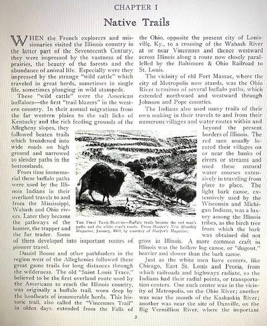
St. Louis to Vincennes, 19 October 1806

Carlton J. Corliss, Trails to Rails- A story of Transportation Progress in Illinois, Illinois Central System, Abraham Lincoln Library & Museum, Springfield, IL, 1934, page 3.

Clearly, Lewis had been raising cash to pay expedition members accrued wages and provide for transportation to Washington. In Vincennes, 30 October 1806, Lewis wrote Bill of Exchange # 113 in favor of George Wallace, Jr. Wallace was a merchant and contractor for U. S. Army rations. He accepted the bill in exchange for $500.00 cash. Territorial records for Knox County, IN detail transactions and court cases in the early 1800's involving Wallace. (5)(6)

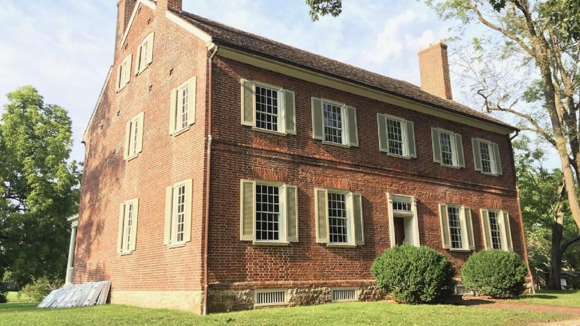
The stay in Vincennes was an opportunity to thank Indiana Territorial Governor, General William Henry Harrison, for the maps and information the Governor had graciously provided Lewis and Clark before the exploration of the west. It gave William Henry Harrison an opportunity to show off his new home, built 1802-1804. (7)

Grouseland, Home of William Henry Harrison
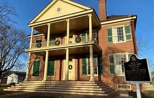
Grouseland, Home of William Henry Harrison

3 West Scott StreetVincennes, IN 47591

The St. Louis to Vincennes Buffalo Road followed by the Lewis and Clark party is present-day corridor of U.S. 50 from Cahokia, IL to Vincennes, IN. Urban highway development in the area between Cahokia and O'Fallon has obliterated the old road.

Source:

(1) Chouteau, Pierre, Pierre Chouteau 's Letter Book, Chouteau Family Papers, Missouri Historical Society, St. Louis, page 79.

(2) White, Mary, Historical Notes On Lawrence County Illinois, Journal of the Illinois State Historical Society 1908-1984, V-IO # 3(0ct. 1917, page 367-393.

(3) Carlton. J. Corliss, Trails to Rails- A story of Transportation Progress in Illinois, Illinois Central System, Abraham Lincoln Library & Museum, Springfield, IL, 1934, page 7.

(4) Carey, H. C. and Lea, l. Geographical, Historical and Statistical Map of Illinois #33, David Rumsey Maps, http://www.davidrumsev.con1/maps5 194. html

(5) Montana Historical Society Library, George Wallace, Jr. Bill of Exchange 113.

(6) Jackson, Donald, Letters of the Lewis and Clark Expedition, Second Printing, University of Illinois Press, Urbana, 1978, page 349-350.

(7) Ibid, page 135.
Stop 2 of 10

Vincennes to Louisville 5 November 1806

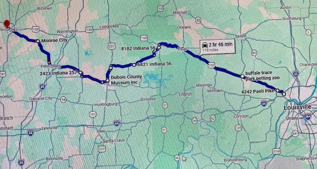
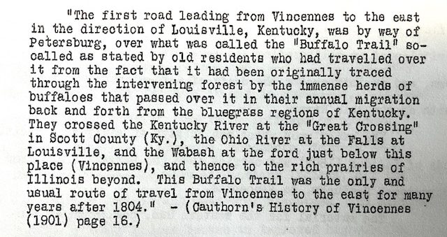
Lewis and Clark and the East bound traveling party's return to Louisville was joyous on November 5 1806, even in the rain. (1)(2) Their route from Vincennes to Louisville is not defined like the daily Lewis and Clark Journals. However, the only trail corridor in the region was the Buffalo Trace, a.k.a., The Louisville Trace, Clarksville Trace, and the Old Indian Road, or Harrison Road, surveyed shortly after the Vincennes Treaty of 1804, connecting Vincennes with the Clark Grant at the Falls of the Ohio. The treaty line followed within 1/2 mile of the most northerly bend of the road. (3) For centuries, the Buffalo had traversed the trail corridor East to West and vise-versa, adjusting their trail based on seasonal weather conditions, food and water.

Editor Note: The Kentucky River Crossing was at Frankfort, not Great Crossing.; George R. Wilson, Chairman

Editor Note: The Kentucky River Crossing was at Frankfort, not Great Crossing.

Courtesy: 1936 Report of the Buffalo Trace Commission (Indiana)

George R. Wilson, Chairman

https://maps.app.goo.gl/5RjJyHdtZPmaUAT4A

https://maps.app.goo.gl/5RjJyHdtZPmaUAT4A

Courtesy: Google Maps for non-commercial use.

The Lewis and Clark Trust acknowledges the tremendous assistance of Mr. David Drake, Indiana Registered Land Surveyor in determining the Buffalo Trace Corridor.

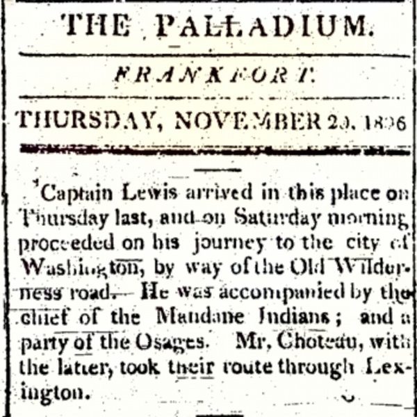
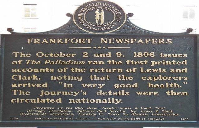
We urge the use of an active Google Map in following the corridor of the Buffalo Trace. The many turns and use of Indiana County Roads makes navigation challenging and a clear understanding of how Patrick Gass missed the Lewis and Clark party traveling to the Falls of the Ohio as described in Holmberg's, Getting Out the Word. (4) From the Patrick Gass reply to Lyman Draper 1866, there was an uncertainty of the trail. Patrick Gass had traveled back toward Vincennes to meet the Lewis and Clark Party after delivering the “Safe Arrival” messages Lewis wrote to President Jefferson and William Clark’s wrote to Gen. Jonothan Clark in Louisville. As William Clark anticipated, the letter to Jonathan was published in the Palladium, a Frankfort, KY newspaper, on 2 October 1806. Travel time to the Falls was at least 5 days but the trail had few stations or places to stay over-night for shelter, a situation that Governor Harrison corrected in 1809. (5) (6)(7)

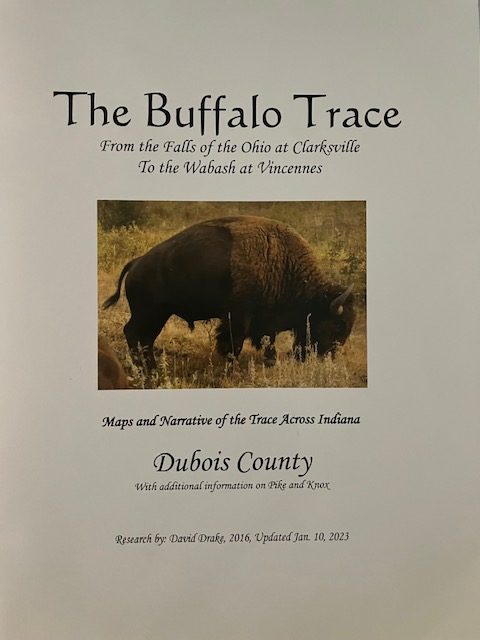
The Buffalo Trace

The Buffalo Trace

Courtesy: David Drake, 10 January 2023

Published by: The Dubois County Historical Society, 2023

270 Newton Street

Jasper, IN 47546

812-634-7733

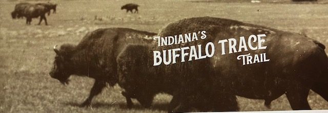
Indiana’s Buffalo Trace Trail- Postal History- website, adds to the Lewis and Clark historical significance on the Trace with Charles Floyd carrying mail from Louisville to Vincennes before the joining the Corps of Discovery. The site is an an excellent historical foundation for understanding the Indiana’s Buffalo Trace. (8)

Courtesy: Indiana’s Historical Pathways National Scenic Byways.

The USFS, USDA, Hoosier National Forest describes recreation opportunities on portions of the Buffalo Trace.

The USFS, USDA, Hoosier National Forest describes recreation opportunities on portions of the Buffalo Trace.

https://www.fs.usda.gov/r09/hoosier

https://www.fs.usda.gov/r09/hoosier

A case study funded by USDA Forest Service-Hoosier National Forest based on previous research is an excellent read to learn the history of the Buffalo Trace that includes a historic map.

https://npshistory.com/publications/usfs/region/9/hoosier/buffalo-trace.pdf

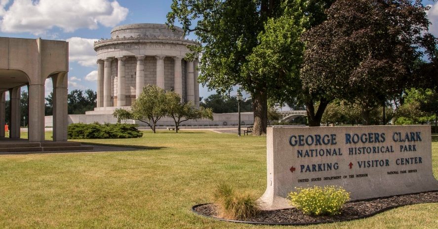
A tour of the Indiana Buffalo Trace starting in Vincennes is a foundational experience to understand William Clark’s training by Big Brother General George Rogers Clark. In addition to the French influence in the city on the Wabash River, the NPS George Rogers Clark National Historical Park and Fort Sackville (https://www.nps.gov/gero/index.htm) describes George Rogers Clark tactical capture of the British Fort and the winning of the west during the American Revolution.

George Rogers Clark National Park

George Rogers Clark National Park

Courtesy: National Park Service

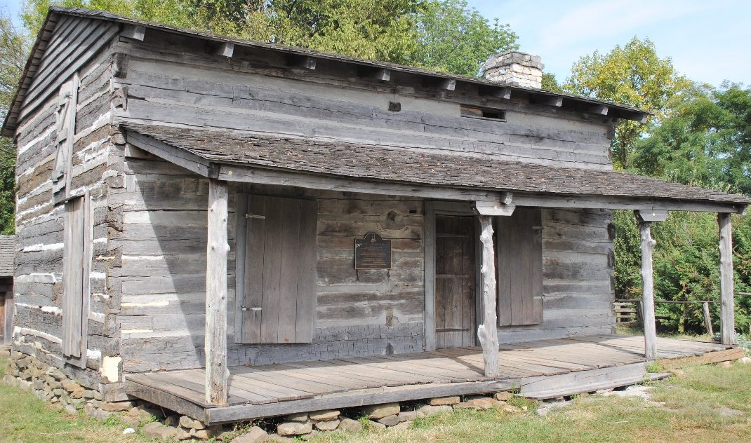
Did the Lewis and Clark party stop at Point of Rocks, see below, and visit with General George Rogers Clark before going to Trouth Springs and Gen. Jonathan Clark?

George Rogers Clark Cabin

George Rogers Clark Cabin

Courtesy: Lewis and Clark Trust

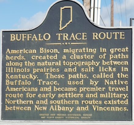
As we depart Indiana’s Buffalo Trace with it’s many twist and turns, the Indiana Marker at 2212 State Street, New Albany, Indiana will be visited again in 1808 by Governor Meriwether Lewis as he travels back to St. Louis. The Indiana Buffalo Trace Story is not over.

Vincennes to Louisville 5 November 1806

Courtesy: Waymarking.com

On 8 November 1806, the captains, members of the traveling party, including Sheheke his family and the Osage delegation, enjoyed a Clark Family homecoming at Locust Grove, the home of William and Lucy Clark Croghan. The elder statesman and leader, General George Rogers Clark, enjoyed seeing the success of his younger brother as box after box was opened to reveal the expedition collection. (9)(10)

Historic Locust Grove

Historic Locust Grove

Historic Locust Grove

561 Blankenbaker Lane

Louisville, KY 40207

Courtesy: National Park Service

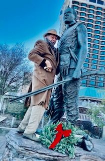
York's return home was no doubt an occasion for celebration and an opportunity to tell of the wonders of the West that included the Tribal People they met and their respect for his black skin.

York Bronze, with Sculpture Ed Hamilton

York Bronze, with Sculpture Ed Hamilton

Belvedere, Louisville, KY

Courtesy: Lewis and Clark Trust.

In-addition to festivities, in Louisville, Lewis continued to secure cash to finance the traveling party headed to Washington. On 9 November 1806, he wrote Bill of Exchange #117 in the amount of $400.00, to Thomas Procter, a Louisville merchant. (11)

Source:

(1) Jonathan Clark Day Book, Personal Papers of Jonathan Clark, Filson Historical Society, Louisville, KY.

(2) Jones, Landon, William Clark and the Shaping of the West, Hill and Wang, NY 2004, page 153.

(3) Wilson, George, Early Indian Trails and Surveys, Indiana Historical Society, 1919, page 75.

(4) Holmberg. James, Getting Out The Word, We Proceeded On, Journal of the Lewis and Clark Trail Heritage Foundation, August 2001, page 12-17.

(5) Jacobs, J. G., The Life and Times of Patrick Gass, Cone Wolf Press, Mansfield Center, CT, 2000, page 107-109.

(6) Ibid, page 107.

(7) The Palladiun, 2 October 1806, Frankfort, KY Historical Society.

(8) https://bt.indianashistoricpathways.org/postal-history/

(9) Jones, Landon, William Clark and the Shaping of the West, Hill and Wang, NY, 2004, page 153.

(10) Jacobs, J. G. The Life and Times of Patrick Gass, Lone Wolf Press, Mansfield Center, CT, 2000, page 108.

(11) Jackson, Donald, Letters of the Lawis and Clark Expedition, Second Edition, University of Illinois Press, Urbana, 1978, Vol. l, page 351.

Stop 3 of 10

Into the Bluegrass and Wilderness, 11 November 1806

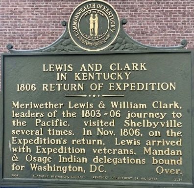
Lewis and his party, including Pierre Chouteau and the Osage Indian delegation, departed Louisville on 11 November 1806, following today's U. S. 60 to Frankfort, KY. The party would pass through Middletown, founded 1797, Shelbyville, founded 1792, to Frankfort, founded 1786.

November 15, 1806 - Discover Lewis & Clark

Courtesy: Filson Historical Society

Into the Bluegrass and Wilderness, 11 November 1806 (picture 1 of 2)
Lewis and Clark in Kentucky Field Brothers Historical Marker (picture 2 of 2)

Courtesy: Lewis and Clark Trust

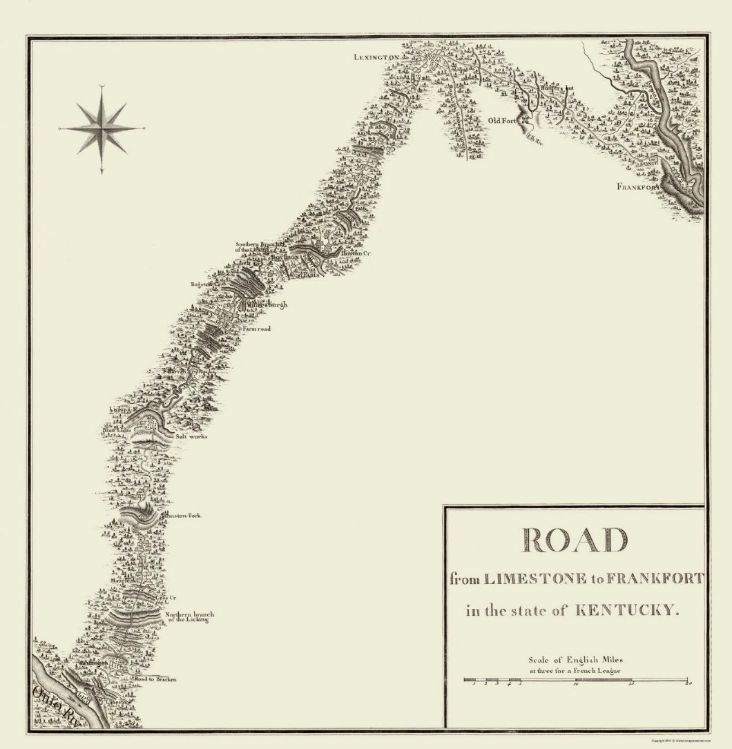
The party of Osage Indians and Pierre Chouteau left Frankfort and traveled to Lexington, KY then followed the Buffalo Trace to Maysville, KY, taking the northern route to Washington, D. C. via Wheeling and Winchester, VA. We have found no reason why the two groups separated. Possibly it was easier to find food and lodging for the smaller groups.

Road from Limestone to Frankfort in the state of Kentucky

Victor Collot, 1797. https://www.davidrumsey.com/maps5601.html

Historic State Map - Kentucky Limestone Frankfort Roads - Bertrand 179 ...

Courtesy: Historic Maps of Kentucky, University of Kentucky 1979

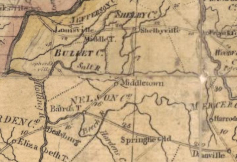
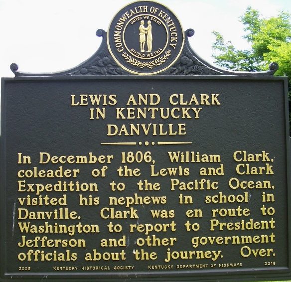
Clark did not leave Louisville until early December. He was preparing for his courtship with Julia Hancock when he reached Fincastle, Virginia. With York, Clark would travel the Wilderness Road from Louisville through Middletown, founded 1797, Shelbyville, founded 1792, Bardstown, founded 1770, Springfield, founded 1782, to Danville, founded 1785, where Clark checked on his nephew John O'Fallon, attending school.

Abraham Bradley, Jr. Postal Map 1804

Abraham Bradley, Jr. Postal Map 1804

https://www.loc.gov/resource/g3700.ct004551/?r=0.32,0.345,0.065,0.039,0Courtesy

Courtesy: Library of Congress

At some point in their travel and possibly at Danville, York was directed to return to Louisville and purchase corduroy or dark velvet for of sherryvallies, overalls that buttoned on the outside to cover other clothing.

Constitution Square, MainStreet, Danville, KY

Constitution Square, MainStreet, Danville, KY

Courtesy: Lewis and Clark Trust

Lewis, Sheheke and party had traveled through Danville, KY a few weeks earlier on their way to Washington. (1)

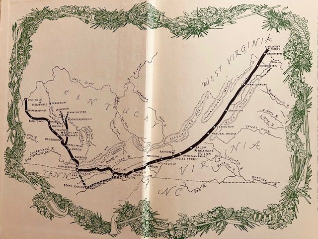
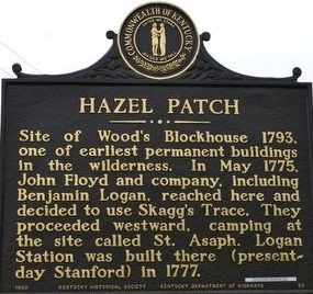
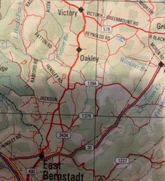
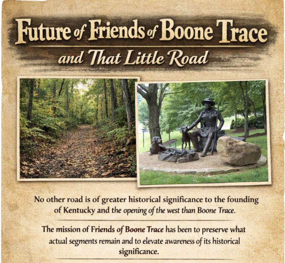
Following the Wilderness Road, US 150, Clark and York would have joined the Boone Trace, the first trail into Kentucky cut by Daniel Boone and his group of axmen in March 1775. The Wilderness Road and Boone Trace join at Hazel Patch, South of Oakley and near KY490, in Laurel County following the corridor of U. S. 25, KY 229, and U. S. 25 E, South through the Cumberland Gap. (2)(3)(4)

Boone Trace- Wilderness Road

Boone Trace- Wilderness Road

The Wilderness Road, by Robert Kincade, Map inside cover

Courtesy: Lewis and Clark Trust

Kentucky Historical Marker

Kentucky Historical Marker

Courtesy: Duane Hall

Intersection KY 490 & Patton Road 37°13.794’N 84° 6.132W

Hazel Parch A.K.A. Wood’s Blockhouse

(Location under historical marker, above)

Into the Bluegrass and Wilderness, 11 November 1806

Courtesy: Danny Hinton

https://www.boonetrace1775.com/

https://www.boonetrace1775.com/

Courtesy: Friends of Boone Trace

Lewis was leading his party along a route he had traveled before. On 24 July 1797, Lewis wrote to his mother, Lucy, from Shelbyville, KY and advised that he would be in Frankfort the next day to arrange payment for property tax on land in present day Estill and Powell County, KY. This was land inherited by the children of William Lewis. Meriwether further explained that he would “set out for Georgia the next day.” His trip to Georgia would be related to settling John Mark’s estate and property owned by the Marks children. (5)

In 1806, Lewis and his party, including Sgt. John Ordway, arrived at Cumberland Gap on or before 20 November 1806. Revolutionary War veteran, Col. Arthur Campbell, on learning of the Lewis party being in the area visited with them and provided John Ordway with a letter of introduction to Jedidiah Morse, geographer, concerning the publication of Ordway's Journal, a journal later purchased by Lewis and Clark. (6)

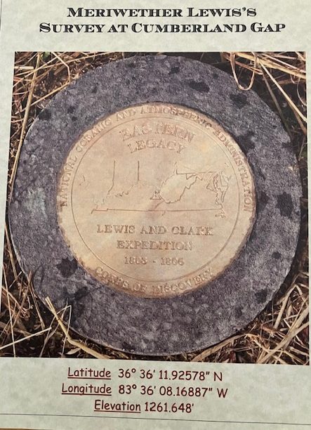
Lewis may have thought that his celestial observations were over when he reached the mouth of the Columbia River. While at Cumberland Gap, Col. Campbell prevailed on Lewis to make a celestial observation to help settle a dispute concerning the location of the Walker Line, the state line between Virginia and North Carolina and Kentucky and Tennessee. With Lewis' Survey Certificate we know that he was still at Cumberland Gap on 23 November 1806, one of the most hallowed historic locations on the North American Continent. (7) (8)

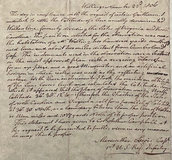
“This day in compliance with the request of certain gentlemen, I undertook to settle the latitude of a line usually denominated Walker’s line, formerly dividing the states of Virginia and North Carolina. The position selected for this observation was near the habitation of a Mr. E. Walling, two hundred yards south of said line, and about two miles distant from Cumberland Gap. The instruments used in this observation were a Sextant on the most approved plan, with a reversing Telescope for an eye piece [sic], and a good micrometer, and artificial horizon, in which water was used as the reflecting surface. With these instruments, I took the meridian altitude of the sun’s lower limb, and calculated the latitude; from which it appeared that the place of observation was in North latitude 36° 38’ 12 1-10; if, therefore, the charters of the states of North Carolina and Virginia call for a parallel of latitude at 36° 30’ N. as a boundary between them, the line of Walker is nine miles and 1,077 yards North of its proper position.

This statement, I have given to Colonel Arthur Campbell, at his request, to be presented to the public view, in any manner he may think proper.”

As we will see, Meriwether Lewis and William Clark crossed this impediment to travel on numerous occasions during their public service to the America people.

Cumberland Gap

Cumberland Gap

Cumberland Gap from Entrance at Cumberland Gap National Historical Park.

Courtesy: Lewis and Clark Trust

Today, we can follow Clark and York corridor from Louisville, through Bardstown, Springfield, Danville, Stanford, Crab Orchard, KY along U. S.150, connecting to U. S. 25 in Mt. Vernon, KY, Kentucky 229 to U. S. 25 E Southeast of Corbin, KY, Barbourville, and Middlesboro, through the Cumberland Gap National Historical Park.

Source:

(1) Jones, Landon, William Clark and the Shaping of the West, Hill and Wang. NY, 2004, page 154.

(2) Kincaid, Robert, The Wilderness Road, Bobbs-Merrill Co., 1966, Page Map on inside covers.

(3) Myer, William, Indian Trails of the Southeast, Extract from the Forty-second Annual Report of the Bureau Of American Ethology, 1924-1925, page 760.

(4) Delorme, Kentucky Atlas & Gazetteer, Yarmouth ME, 1997, page 87.

(5) Letter, Meriwether Lewis to Lucy Meriwether Lewis Marks, Missouri Historical Society-St. Louis, ML Papers, Collection A0897, Box 5.

(6) Oman, Kerry Serendipity, We Proceeded On, Journal of the Lewis and Clark Trail Heritage Foundation, November 2001, page 8.

(7) Hainesworth, Lorna, Meriwether Lewis 's Survey at Cumberland Gap, self-published by Lornalment Press, 2011, 18 pages.

(8) https://www.academia.edu/24183110/Meriwether_Lewis_Survey_at_Cumberland_Gap

Stop 4 of 10

Mountains smaller than the Rocky Mountains

Cumberland Gap to Staunton, VA

Lewis and his traveling party left few notes during their travels of November and December 1806 to report to President Jefferson. However, today we can follow the Boone Trace, later the Wilderness Road, from Cumberland Gap eastbound along U. S. 58/U. S. 421 to US 11 to understand the difficulties of 1806 travel. The Daniel Boone Wilderness Road Interpretive Center, Duffield, VA is an excellent source to learn the difficulties of travel on the Boone Trace -Wilderness Road.

Daniel Boone Wilderness Trail Interpretive Center

Daniel Boone Wilderness Trail Interpretive Center

U S 23, Duffield, VA 24244, Phone 276-431-1979

Courtesy: Virginia Department of Conservation and Recreation

https://www.dcr.virginia.gov/state-parks/daniel-boone-center

There is a long gap in documentation for the route of travel after Cumberland Gap until 11 December 1806, when Lewis wrote Bill of Exchange 119, to Heiskell and Sowers in Staunton, VA for $200.00. (1) Then crossed the Blue Ridge to Locust Hill, his mother’s home near Ivy, VA, on 13 December 1806. (2)

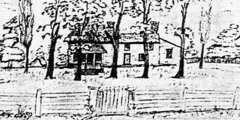
Locust Hill

Locust Hill

Drawing Source: Unknown

Courtesy: Meriwether Anderson Sale, Sr.

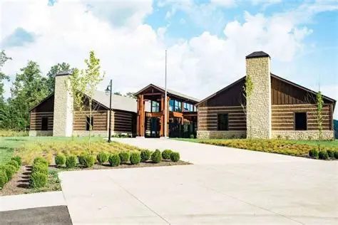
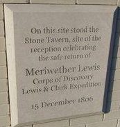
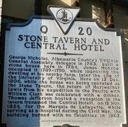
Lewis' arrival became public knowledge and on 15 December 1806, he was celebrated with a dinner in nearby Charlottesville, VA at the Stone Tavern (3)

Stone Tavern, Charlottesville, VA

Stone Tavern, Charlottesville, VA (picture 1 of 2)
Stone Tavern, Charlottesville, VA (picture 2 of 2)

High Street between 4th Ave. NE and Park Street Charlottesville, VA 22902

Lewis, Sheheke and the traveling party had traversed the Great Valley Road, today's U. S. 11. At Stanton, VA they turned East across the Blue Ridge following today's U. S. 250 through Ivy and into Charlottesville, VA.

Source:

(1) Jackson, Donald, Letters of the Lewis and Clark Expedition, Second Edition, University of Illinois Press, Urbana, 1978, page 353.

(2) Ambrose, Stephen, Undaunted Courage Meriwether Lewis, Thomas Jefferson and the Opening of the West, Simon & Schuster, NY, 1996, Page 408.

(3) Ibid, page 408.

Stop 5 of 10

Christmas with Family in Ivy, VA, December 1806

After spending Christmas with his family, Lewis and his party arrived at the Presidents House on 28 December. The annual New Year's Day Reception at the President's Home included Sheheke and his family, the Osage Chiefs, and their interpreters. (1) The Chouteau and Osage Delegation had arrived in Washington on 24 December after taking the Northern route from Lexington, KY through Ohio, Pennsylvania, and Virginia. (2)

Lewis’ letter to President Jefferson on 23 September described the route of travel in terms of town he would pass through. (3) While the route of travel from Charlottesville to Washington D. C. was not described, the U. S. Postal Road, detailed on the Abraham Bradley, Jr. 1804 map, is the logical and most direct route. (4) That route today from Charlottesville is VA 20 through Orange connecting with VA 3 at Wilderness to Fredericksburg then U. S. 1 through Alexandria to Washington. (5)(6) Another route of travel from Charlottesville to Washington, D. C. but having more overnight stops was used by Thomas Jefferson. (7) The bridge over the Potomac River is also uncertain but most likely near the historic “Chain Bridge” between Pimmit Run and Georgetown. The first bridge at this location, completed in 1797, was a covered bridge built of wood, designed by Timothy Palmer. However, that bridge collapsed in 1804 and the second was not finished until 1808, thus the crossing location is uncertain.

The route Lewis and his group traveled through Virginia passes through the region of explorers and founders of democracy. Fry, Henry, Jefferson, Lewis, Madison, Meriwether, Monroe, and Walker are among the family names emblazoned in American history living in the region. Today there are countless Bed and Breakfast and other present day “ordinaries” allowing for modern-day explorers. Joshua Fry, friend, and co-surveyor with Peter Jefferson, surveyed and drew the “Map of the Inhabited Parts of Virginia,” more commonly known as the Fry-Jefferson Map. In 1726 Fry patented the land and build the Meanders Plantation. Today, The Inn and Tavern at the Meanders, Locust Dale, VA 22193 is an opportunity to visit and dine in the Fry home. Make your own exploration and understand the importance of this segment of the Lewis and Clark Story. (8)(9)(10)

Fry-Jefferson Map: https://www.loc.gov/resource/g3880.ct000370/?r=0.442,0.257,0.137,0.079,0

The Inn and Tavern at the Meanders

The Inn and Tavern at the Meanders

Dale, VA 22193

540-672-4912

Courtesy: The Meanders

Source:

(1) Jones, Landon, William Clark and the Shaping of the West, Hill and Wang, NY, 2004, page 155.

(2) Dillion, Richard, Meriwether Lewis, Coward-McCann, NY 1965, page 265.

(3) Jackson, Donald, Letters of the Lewis and Clark Expedition with Related Documents 1783-1854, University of Illinois Press, Urbana, 1978Vol. 1, page 324.

(4) https://www.loc.gov/resource/g3700.ct002344/?r=0.488,0.335,0.157,0.091,0

(5) DeLorme Mapping Co., Virginia Atlas and Gazetteer, Freeport, ME 1989, page 68, 69, 70, 76, & 77.

(6) https://www.virginiadot.org/vtrc/main/online_reports/pdf/80-r44.pdf page 8.

(7) https://www.monticello.org/site/research-and-collections/route-washington-dc

(8) http://arlingtonhistoricalsociety.org/wp-content/uploads/2017/02/1957-Bridges.pdf page 43

(9) https://innatmeander.com/

(10) https://www.monticello.org/site/research-and-collections/joshua-fry

Stop 6 of 10

William Clark and York at Cumberland Gap, 1806

Cumberland Gap National Historical Park

The exact date Clark and York passed through the Cumberland Gap in 1806 is uncertain. However, Col. Arthur Campbell, the gentleman Lewis made the celestial observation for on 23 November, states in a letter to Virginia's Governor Cabell dated 23 February 1807, "I have showed the paper (meaning the Certificate of Observation made by Lewis) to General Clarke”. Campbell attached a second copy of the certificate to the letter sent to Cabell. (1)

With a special salute to Lorna Hainesworth for her very factual report and background explanation for Col. Campbell’s celestial observation request, conducted by Meriwether Lewis, a likely location of the observation, and the historical marker placed near the site in the Cumberland Gap National Historical Park, we urge the reading of Meriwether Lewis’ Survey AT Cumberland Gap, 2011.

https://www.academia.edu/24183110/Meriwether_Lewis_Survey_at_Cumberland_Gap

Lewis’ Certificate, typed cope page 3, above. (picture 1 of 2)
Lewis’ Certificate, typed cope page 3, above. (picture 2 of 2)

Lewis’ Certificate, typed cope page 3, above.

In addition to Lorna’s excellent report, we owe a debt of gratitude to Col. Arthur Campbell for his perseverance in communications with the Governors of Kentucky and Virginia. Today, we have Meriwether Lewis’ handwriting in a certificate of celestial observation made at Cumberland Gap, and the fact that all the equipment used during the exploration of the west was not sold in St. Louis. Presently, the location of that sextant and related equipment is unknown but another research project future Lewis and Clark Explorers.

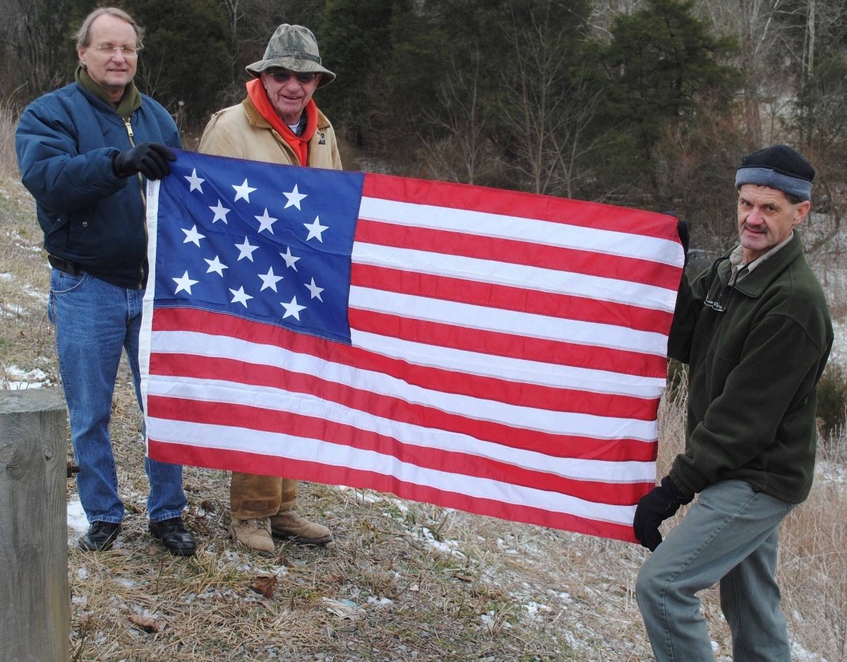
Search for “Mr. Walling’s Cabin

Search for “Mr. Walling’s Cabin

2010 Field Research Team Located “Mr. Walling’s Cabin” site for Meriwether Lewis’ Celestial Observation at Cumberland Gap.

L to R: Wayne Bussell, Attorney and Lewis and Clark Historian - John Russell, Property Owner - Steve Roark, Tennessee State Forster.

Courtesy: Lewis and Clark Trust

Source:

(1) Calendar of Virginia State Papers and Other Manuscripts from Jan, I, 1799 to Dec, 31, 1807, Vol. 9, Page 504.

Stop 7 of 10

William Clark Courting Julia Handcock, December 1806

Fincastle, VA

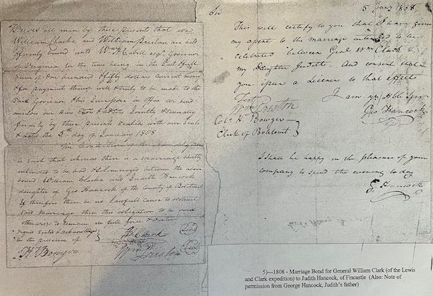
Clark and York were heading East, along the Great Valley Road, today's U. S. 11. After 28 months in the wilderness of the West, Clark was intent on courting young Julia Hancock in Fincastle, VA. He would visit with his Army friend Major William Preston and his wife Caroline, the older sister of Julia, during the courtship. Love was in the air during the 1806 Christmas Holidays. In-addition to Clark's wooing of Julia, a double wedding occurred - Mary Hancock to John Griffin and Harriet Kennerly to John Radford. (1)

William Clark Marriage Bond

William Clark Marriage Bond

Courtesy: Botetourt County, VA County Court Clerk

Clark's courtship with Julia Hancock was successful. George Hancock gave his consent for marriage with the stipulation that the wedding take place the next year. William and Julia were married 5 January 1808 (2)

A courtship was only part of Clark's activities while in Fincastle. On 8 January 1807, the citizens of Fincastle arranged a dinner and salute to William Clark and Meriwether Lewis, although Lewis had already arrived in Washington. With a protracted address to the Captains, Fincastle citizens expressed the gratefulness for a successful exploration and record of the expedition. Clark's response showed his respect for the community, and the safe return of members of the expedition. A portion of Clark's response is worthy of quoting,

To respect the rights of humanity has and ever will be the leading principal of my life, and no reflection is more pleasing to me than that of effecting the objects we have in view with the effusion of so small a portion of human blood. (3)

Clark assured the citizens of Fincastle that he would deliver their sentiments to Lewis and started to Washington.

Source:

(1) Jones, Landon, William Clark and the Shaping of the West, Hill and Wang. NY. 2004, page 155.

(2) Marriage Bond and License, William Clark to Judith Hancock, Botetourt, Co. VA, Circuit Court Clerk, Marriage Book 1808.

(3) Jackson, Donald, Letters of the Lewis and Clark Expedition, Second printing, University of Illinois Press, Urbana, 1978, Vol. l, page 359.

Stop 8 of 10

Hospitality for Lewis & Clark in the Presidents House

Washington, DC

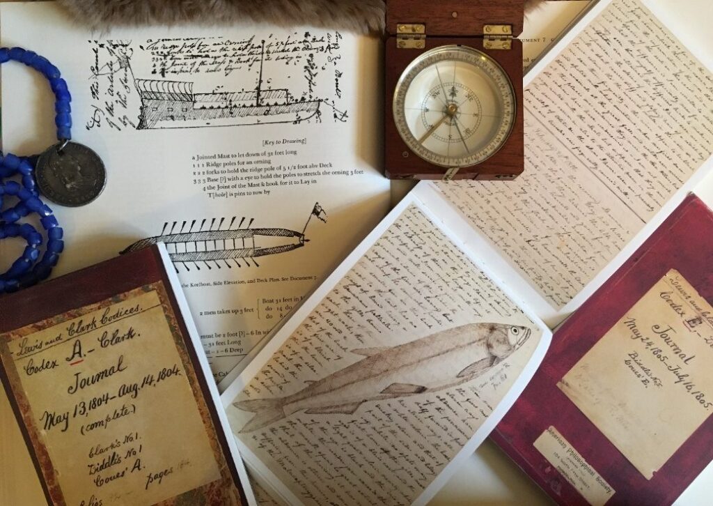
When Lewis arrived in Washington he moved into the President's House. Where the other members of his party stayed is unknown. The de-briefing and reporting phase of the expedition started immediately. Journals, maps, and material collected in the West were examined with great interest by the President. (1)

New Years, 30 December 1807, President Jefferson opened the doors of the Presidents House and welcomed Cabinet Members and Foreign Diplomats. As special guest, President Jefferson gave the following welcome to Sheheke-shote, (Big White):

My Children, The Wolf and People of the Mandan Nation: I take you by the hand of friendship and give you a hearty welcome to the seat of the government of the United States. The journey which you have taken to visit your fathers on this side of our island is a long one, and your having undertaken it is proof that you desire to become acquainted with us. I thank the Great Spirit that he has protected you through the journey and brought you safely to the residence of your. (2)

Lewis had completed another point President Jefferson had made in his instructions to Lewis on 20 June 1803, If a few of their influential chiefs, within practicable distance, wish to visit us arrange such a visit with them……. (3)

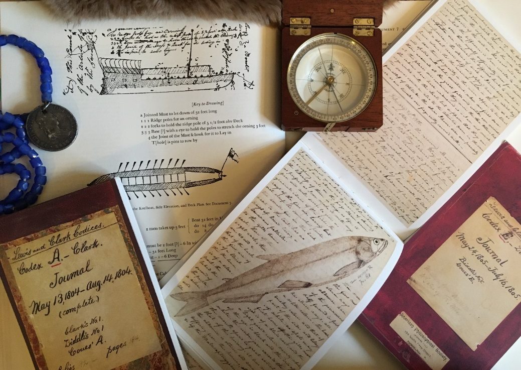
Our imagination is insufficient in comprehending the excitement of President Jefferson during Lewis’ “show and tell.” There were maps, journals, skins and the collection Lewis and Clark had brought to the Presidents House from the previously unknown west. The National Intelligence, a Washington News Paper, hailed the return with “high satisfaction.” the expedition was “conducted with more patients, perseverance, or success” than any in human history. (4)

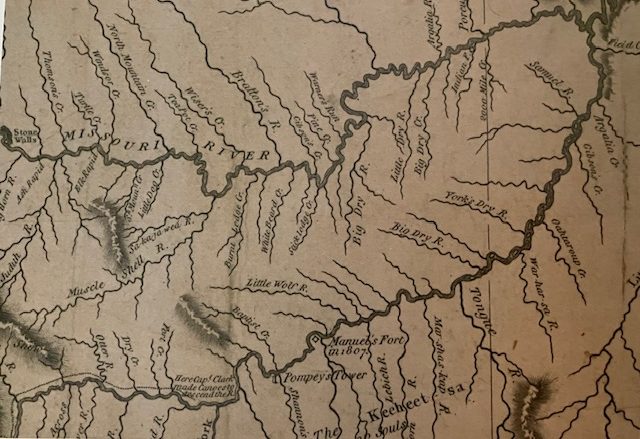
Hospitality for Lewis & Clark in the Presidents House (picture 1 of 2)
Hospitality for Lewis & Clark in the Presidents House (picture 2 of 2)

Top - Courtesy: Lewis and Clark Trust

Map – Courtesy: Mapping the West with Lewis and Clark, Library of Congress, Levenger Press, 2015, page 68

(Note: Tributaries of Yellowstone: York Dry R.- Gibson’s Cr.- Baptiste Cr.- Pompey’s Tower,

Missouri River: Field Cr.- Gibson’s Cr.- Bratton’s R, -Wiser’s Cr.-Winsor’s Cr.-Thompson’s Cr.)

Clark arrived in Washington on 18 January 1807, after the postponed Presidential Dinner for the explorers. The Washington officials and social elite were interested in "rubbing shoulders" with Lewis and Clark. Showing true leadership, Lewis and Clark went about the business of providing the necessary reports and evaluations of their men so Congress could provide compensation. (4) The captains followed the Army Creed, “Mission, Men, Self”.

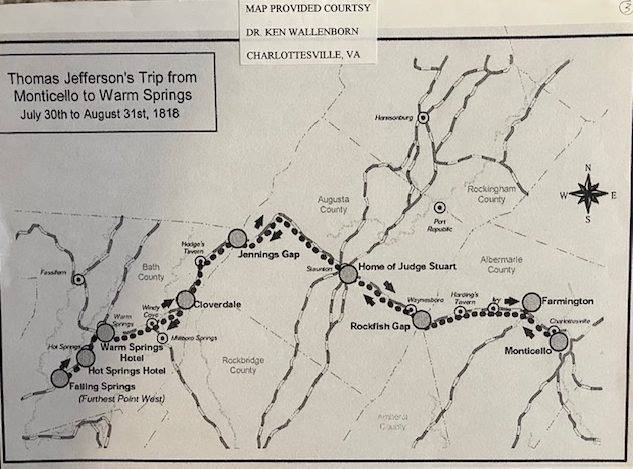
In the Summer of 1818, Thomas Jefferson traveled to Falling Springs, present day Bath Co. VA. The trip is believed to be the most westward location Jefferson ever visited. "Taking the baths" in the many hot springs in the region was a treatment for numerous maladies. Did Jefferson remember the debriefing stories told by Lewis and Clark about healing of the Indian Chief and William Bratton in 1806? (5)(6)

Hospitality for Lewis & Clark in the Presidents House

Source:

(1) Ambrose, Stephen, Undaunted Courage: Meriwether Lewis, Thomas Jefferson, and the Opening of the American West, Simon & Schuster, NY, 1996, page 419.
(2) Peterson, Merrill D., Thomas Jefferson Writings, The Library of America, New York, 1984, Page 564-566. (Note: full message available in Writings.)

(3) Jackson, Donald, Letters of the Lewis and Clark Expedition, Second printing, University of Illinois Press, Urbana, 1978, Vol 2, page 63.

(4) Ambrose, Stephen, Undaunted Courage: Meriwether Lewis, Thomas Jefferson, and the Opening of the American West, Simio and Schuster, NY 1996, page 409.

(5) Jackson, Donald, Letters of the Lewis and Clark Expedition, Second printing, University of Illinois Press, Urbana, 1978, page 364.

(5) Personal Letter from, Dr. McKenzie White Wallenborn, Thomas Jefferson Trip from Monticello to Warm Springs, (VA) July 30 to August 31, 1818.

(6) Jefferson, Thomas, Autograph of Thomas Jefferson, Caste de Voyage for his Journey to and from the Warm Springs starting from Stanton. Travel and Distance.

Stop 9 of 10

Congressional Compensation for a Job Well Done, January 1807

Washington, DC

On 15 January 1807, Lewis sent a list of the expedition members with comments concerning their "merits & service" during their enlistment to Henry Dearborn, Secretary of War. (1) On 3 March 1807, Congress passed "The Act of Compensation for Lewis and Clark and their Companions". The act included land west of the Mississippi River and cash payments based on the enlisted men’s term of service. Land grants to Lewis and Clark were 1600 acres each and the men received 320 acres each. Pay was doubled. (2)

Clark's pay was adjusted to be equivalent to Lewis by order of the President. The additional payment amounted to $4,931.50 for Clark. (3)

The President nominated Meriwether Lewis, Governor of the Upper Louisiana Territory to replace General James Wilkinson, who’s term had expired. Clark was nominated for promotion to Lieutenant Colonel. The Senate quickly approved the Lewis nomination but the promotion in rank for Clark violated the War Department procedure and the Senate vote was 20-9 against promotion. With Clark’s nomination back in the Presidents control, William Clark was appointed Superintendent of Indian Affairs for the Louisiana Territory and Brigadier General of the Missouri Militia. (4)

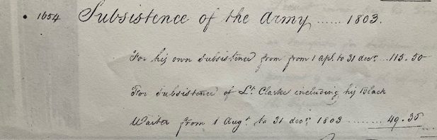
Additional payments were made for "subsistent rations that included York, described as "Clarke Black Waiter". However, York's subsistence pay was made to Clark. (5)

War Department Account Journal “N”, 5 August 1807, page 6967

War Department Account Journal “N”, 5 August 1807, page 6967

(“For subsistence of Lt. Clarke including his Black Waiter from 1 Aug. to 31 Dec.1803….49.35”)

Courtesy: National Archives

Sources:

(1) Jackson, Donald, Letters of the Lewis and Clark Expedition, University of Illinois Press, Urbana, 1978, vol. 1, Page 364- 373.

(2) Ibid, 377-378.

(3) War Department Account, Journal N, 5 August 1807, page 6940, NARA, Maryland.

(4) Tubbs, Stephenie Ambrose & Jenkinson, Clay Straus, The Lewis and Clark Companion, Henry Holt & Co. NJ, 2003, page 67.

(5) War Department Account, Journal N, 5 August 1807, page 6967, NARA, Maryland.

Note: For a full review of the known financial records of the Lewis and Clark Expedition, see abstract in the Letters of the Lewis and Clark Expedition by Donald Jackson, page 419-431.

Stop 10 of 10

New Responsibilities for the Successful Explorers

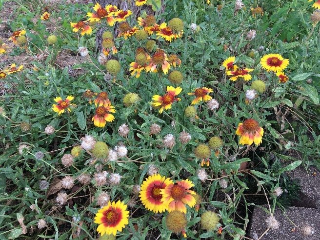
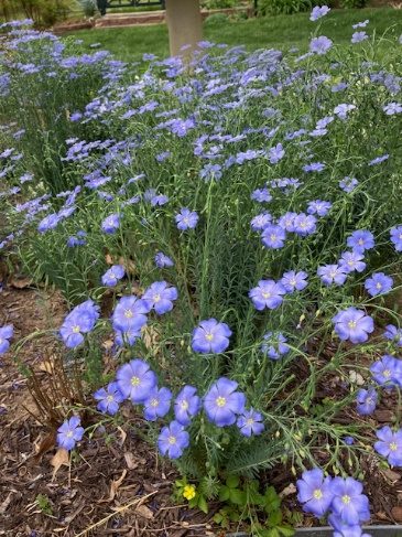
The duties of Governor Lewis and General Clark increased with their new government responsibilities. Lewis went to Philadelphia in early April 1807, after being detained in Washington longer than he anticipated. In Philadelphia Lewis secured assistance in publication of the Journals that included a volume for the botanical collection, one of the most important records of discovery in the history of man. (1) Unfortunately, the botanical collection volume was not published until the Moulton Edition of the Journals, Herbarium Vol. 12. Other publications, Plants of the Lewis and Clark Expedition by Wayne Phillips and Lewis and Clark's Green World by Earle and Reveal present the collections in vivid color.

Botanical Collection

Botanical Collection (picture 1 of 2)
Botanical Collection (picture 2 of 2)

Left: Common Gaillardia Right: Blue Flax

Courtesy: Lewis and Clark Trust

Lewis was still in Philadelphia on 27 June 1807 (2) then returned to Washington to settle more War Department Accounting question.

On 28 October 1807, Lewis is back in Ivy, VA, no doubt staying at Locust Hill with his mother, where he is accepting advanced payments for the Lewis and Clark Tour (Lewis and Clark Journals). (4) Lewis was a successful explorer but his personal life, including failed courtships, was very complicated.

Clark had returned to Fincastle on 15 March 1807, this time staying with Col. Hancock, Julia's father. He proceeded to St. Louis and was in the city on the Mississippi River on 18 May 1807. (8)

Fortunately for Governor Lewis and Superintendent of Indian Affairs Clark, Congress had divided the Louisiana Territory at the 33 Parallel in 1804 making the administration of the Upper Louisiana Territory most of area they had explored along the Missouri River. (9) Even with the reduced area, they will have a multitude of situations to deal with as administrators.

Source:

(1) Jackson, Donald, Letters of the Lewis and Clark Expedition, Vol. 2-University of Illinois Press, Urbana, 1978, page 393.

(2) Ibid, page 418.

(3) Ibid, page 424-431.

(4) Ibid, page 438-439.

(5) Kentucky Gazette & General Advertiser, Vol. XXI- NO. 1 164, Tuesday 6 Feb, 1 808, page University of Kentucky W. T. Young Library, Reel # S-8 # 16.

(6) Library of Virginia, Lewis Family Papers, 1776-1841, Accession # 20902, BC # 7408573, 4/B/10/1/5.

(7) Bakeless, John, Lewis and Clark Partners in Discovery, Dover Press, Mineola, NY, 1 947, page 390.

(8) Jackson, Donald, Letters of the Lewis and Clark Expedition, Second Edition, University of Illinois Press, Urbana, 1978, Vol. 2, page 411.

(9) Ambrose, Stephen, Undaunted Courage, Meriwether Lewis, Thomas Jefferson and the Opening of the American West, Simon and Schuster, NY, 1996, page 415.