Subject 1

Preparation: Plan, Supply, Staff for Success, 1803 Washington, DC to St. Louis

1803–1806 16 stops, all on this page

Start at stop 1

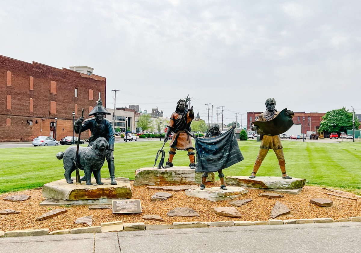
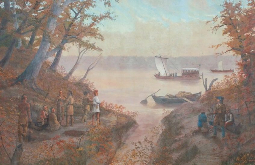
From stop 14: Against the Current, 20 November 1803Courtesy: City of Cape Girardeau
Jump to a stop 16
  1. 1Plan, Supply, and Staff for Success (1803 Washington to St. Louis)
  2. 2Traveling from Washington DC to Harpers Ferry and Pittsburgh
  3. 3First Dilemmas with Transportation - 6 July to 22 July 1803
  4. 4Troubles and More Troubles with Transportation, 30 August 1803
  5. 5Heavy Boat in Low Water, 6 September 1803
  6. 6Federal Agents on the Ohio River, 7 September 1803
  7. 7Marietta 13 September and a visit with Col. Griffen Green, Postmaster
  8. 8Limestone (Maysville), KY- Blanks in the Lewis’ Journals
  9. 9By Horse to Big Bone, 28 September 1803
  10. 10Co-Commanders Meet, 14 October 1803
  11. 1126 October 1803 Camp Site
  12. 12Ft. Massac and "A Man of Much Merit", 11 November 1803
  13. 13Celestial Observations and Ft. Jefferson 15, November 1803
  14. 14Against the Current, 20 November 1803
  15. 15Trouble with the Spanish, 12 December 1803
  16. 16Joyous Return to St. Louis, 23 September 1806

Stop 1 of 16

Plan, Supply, and Staff for Success (1803 Washington to St. Louis)

18 January 1803-4 July 1803

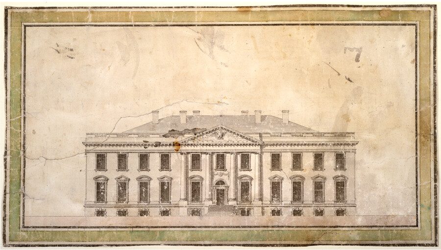
Presidents House, by James Hoban, Architect,1793

Presidents House, by James Hoban, Architect,1793

Courtesy: Maryland Historical Society

In 1803, President Thomas Jefferson was the President and no longer just providing verbal support with small amounts of finance for exploration of the Western America. The publication and public knowledge of Alexander Mackenzie's trans-continental crossing of Canada in 1789-1793 became the catalyst that brought the President to action. (1) Using commerce as the primary reason to secure funding from Congress on 18 January 1803, planning for the expedition was fully underway. (2)

Early planning considerations included, traveling to Ft. Southwest Point, present-day Kingston, TN where troops would be selected then continue overland to Nashville, TN. Lewis’ thought process went so far as to send $50.00 to Dr. (William) Dickson in Nashville for a down payment to procure boats to transport supplies and men via the Cumberland and Ohio Rivers. (3)

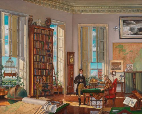
A Bird the Whistles by Peter Waddle

A Bird the Whistles by Peter Waddle

Courtesy of White Houste Historical Association.

By June Lewis had learned that qualified men could not be found at Ft. Southwest Point and securing a boat in Nashville was not a good option. He would travel by the Ohio River from Pittsburgh, PA selecting men at post along the Ohio and Mississippi Rivers. (4)

While members of the Jefferson Administration were securing maps, and passports for the foreign lands to be crossed, Lewis travels to the U. S. Arsenal at Harpers Ferry to secure rifles, knives, and tomahawks, etc. Much of his time at Harpers Ferry was spent superintending the construction of an iron frame boat. He planned to cover it with animal skins where wood was unavailable for canoes in the dryer western climate.

Jefferson arranged with the leading scholars and scientist in Philadelphia to provide a "crash course" for skills that Lewis would need during the expedition. Traveling through Lancaster, PA, Lewis stayed with Andrew Ellicott for instruction on using instruments to determine longitude by using a sextant, artificial horizon, and chronometer. In Philadelphia, he was tutored by Robert Patterson, professor of mathematics; Benjamin Smith Barton, author of Elements of Botany; Casper Wistar, paleontologist; and Benjamin Rush, physician. During his "idle time" Lewis secured supplies at the Schuylkill Arsenal and purchased material that included $696.00 in "Indian presents" (5) (Note, for a full list of supplies purchased in Philadelphia see: www.lewis-clark.org/article/2977.

Lewis was back in Washington by 19 June 1803, having completed the basic education skills and securing supplies. He turned his thoughts to additional leadership then wrote his friend and former ranking Army Office, William Clark. (6) This was the most important decision made during the planning. The combined strengths of the two men made the expedition successful. Clark’s response, dated 18 July 1803, was a firm “yes” to Lewis’s offer to be a co-leader. We can almost hear Lewis’ audible sigh of relief in Pittsburgh, where he was trying to get the keel boat built. (7)

The combined strengths of the two Captains had been developed through life experiences with little formal education. Lewis has served and traveled between the Army Post west of the Allegheny Mountains and served as the President’s personal secretary, a position of great importance with an unlimited opportunity to learn. Clark had traveled and served admirably during the Indian Wars of 1792-1796, attempted to sort-out the tangled financial affairs of his brother, General George Rogers Clark and made two successful commercial trips from the Falls of the Ohio to New Orleans, the east coast and back to Louisville. Clarks extensive travel and cultural experiences that included a basic understanding the French and Spanish language, and attending theater productions had elevated him to “cosmopolitan explorer” with the ability to live in the wilderness and communicate with Tribal people. William Clark was ready for the challenge when he received Lewis’ invitation to be a Co-Commander. (8)(9) Planning and equipping was complete, with only minor adjustments as the mission was carried out. Senior Leadership was selected, now it was time to select the crew and produce results.

With President Jefferson's Instructions to Lewis, dated 20 June 1803, clearly defining the mission that Lewis and Clark are about to undertake, the mission is nearly ready to launch. (10) On 2 July, Lewis wrote to his mother, Lucy Marks. (11) The letter is worthy of reading and hearing a son reassure his mother of his good health, wellbeing and safety in the coming months then turning to educational concerns for his siblings. On 4 July 1803, Thomas Jefferson personally wrote a Letter of Credit backed by the United States Government to support the expedition when it reached the Pacific Ocean and on the 5th of July, Lewis leaves the White House on a 28-month expedition across the North American continent.

Source:

(1) Mackenzie, Alexander, Sir, The Journals of Alexander Mackenzie: Voyages from Montreal, on the River St. Laurence: Through the Continent of North America, To the Frozen and Pacific Oceans; in the Years, 1789 and 1793, Narrative Press, 2001.

(2) Jackson, Donald, Letters of the Lewis and Clark Expedition, University of Illinois Press, Urbana, 1978, Vol. I, page 10.

(3) Ibid, page 38.

(4) Ibid, page 53.

(5) Ambrose, Stephen, Undaunted Courage: Meriwether Lewis, Thomas Jefferson, and the Opening of the West, Simon & Schuster, NY, 1996, page 78.

(6) Jackson, Donald, Letters of the Lewis and Clark Expedition, University of Illinois Press, Urbana, 1978, Vol. l, page 57.

(7) Ibid, page 110.

(8) https://www.jstor.org/stable/pdf/1897611.pdf

(9) https://collections.shsmo.org/manuscripts/Columbia/c1075

(10) Jackson, Donald, Letters of the Lewis and Clark Expedition, University of Illinois Press, Urbana, 1978, Vol. 1, page 61.

(11) Ibid, page 100.

Stop 2 of 16

Traveling from Washington DC to Harpers Ferry and Pittsburgh

5 July — 31 August 1803

Thomas Cartwright, G. Beck. I. N. Pheleps Stokes Collection

Courtesy: N Y Public Library, Georgetown and Federal City, Washington, 1801.

Thomas Cartwright, G. Beck. I. N. Pheleps Stokes Collection

Today the route from the President’s House to Harpers Ferry would follow 17th Street, Connecticut Ave. to Massachusetts Ave. crossing Rock Creek to I-495 to I-270 to US 340.

Meriwether Lewis left the President’s House, now the White House, on an exploration that would establish the first transcontinental road coast-to-coast. As a parallel event, in 1919, 116 years after the first transcontinental crossing of the future United States, the U. S. Army, Motor Transportation Corps, traveled 3239 miles across the Nation, sometimes crossing the Trail of Lewis and Clark. American Road: The Story of an Epic Transcontinental Journey at the Dawn of the Motor Age, by Pete Davies describes the experience. While the 1919 route is shorter, the Lewis and Clark Journals are a parallel experience and challenges include a dog and other animals, extreme weather, lack of passable roads or terrain by an Army unit. Davies even describes participants “fun around the evening campfire” by future President and Military General Dwight D. Eisenhower, similar-to Drouillard’s story of the snake that gobbled like a turkey. Of course, there are differences in the two epic adventures, Lewis left the Presidents House without a record of any kind of ceremony and in-fact left hurriedly leaving a “pocketbook” and other items. (1)

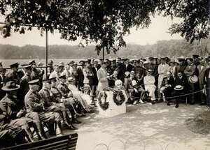
The Motor Transportation Corps adventure started south of the White House Ellipse with a grand ceremony. Today there is large stone marker at the Ellipse along Constitution Avenue commemorating the starting point of the Motor Transportation Corps. There is no marker commemorating the Lewis and Clark Exploration that was planned and started at the White House.

Starting Point of 1919 U. S. Army Motor Transportation Journey at the Dawn of the Motor Age.

Marker with wreaths, center.

Traveling from Washington DC to Harpers Ferry and Pittsburgh

Courtesy: American Road by Pete Davis

Source:

(1) Jackson, Donald, Letters of the Lewis and Clark Expedition, University of Illinois Press, 1978, Vol. 1, page 111.

Stop 3 of 16

First Dilemmas with Transportation - 6 July to 22 July 1803

Harpers Ferry

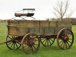
Lewis arrived at the Harpers Ferry Arsenal on 6 July, and learns that the supplies had not been taken by the wagon from Philadelphia. Arranging for another wagon, Lewis examined the supplies, "shot my guns and found the quality be good". (1)

Small Wagon

Small Wagon

Courtesy: National Park Service

Leaving the United States Arsenal at the confluence of the Potomac and Shenandoah Rivers, he traveled a familiar road and arrived in Pittsburgh on 15 July to learn that the keel boat was not complete. Disappointment would be an understatement, Lewis' letters for more than a month tell the frustration he experienced with the boat and boat builder (2)

A Visitor’s Guide To Harpers Ferry In The Summer - Mountain Mama

David Gilbert, National Park Service’s, masterful research, and brochure, https://www.nps.gov/hafe/learn/historyculture/route-from-harpers-ferry-va-to-pittsburgh-pa.htm provides the historic route traveled by Lewis. Today the route would follow the corridor of WV 9 to US 40 (National Road) to PA 43 passing near Elizabeth and into Pittsburgh.

At Uniontown, Lewis would have been approximately 15 miles for Albert Gallatin’s Friendship Hill.

Albert Gallatin Sculpture

Albert Gallatin Sculpture

Courtesy: National Park Service- Friendship Histional Historic Site

Albert Gallatin is almost forgotten in the Lewis and Clark Story, except for the river named for him in 1805. Lewis remembered and recognized the behind-the-scenes energy of the Swiss-born secretary of treasury had devoted to the planning of the expedition. (3)

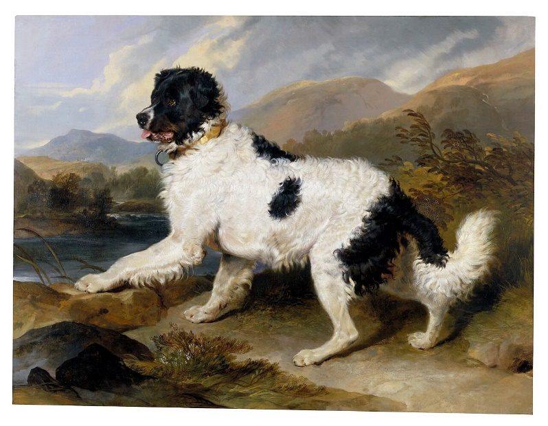
With the water falling in the Ohio River, the only positive event was the receipt of Clark's acceptance to be the co-Captain of the expedition. Clark's immediate judgement concerning the qualifications for the expedition men was pleasing to Lewis. Surely, Seaman, Lewis' newly purchased Newfoundland Dog, gave him some diversion from the slow progress with the keel boat delayed construction.

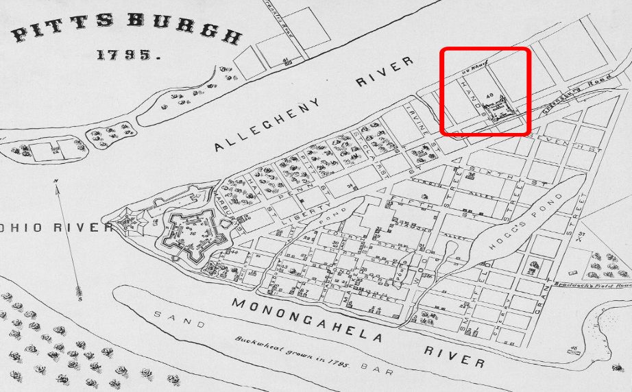
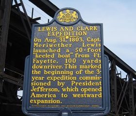
Ft. Fayette in Red, Pittsburgh, 1795 Courtesy: Waysidemarking.com (picture 1 of 2)
Ft. Fayette in Red, Pittsburgh, 1795 Courtesy: Waysidemarking.com (picture 2 of 2)

Ft. Fayette in Red, Pittsburgh, 1795 Courtesy: Waysidemarking.com

Seaman

Seaman

Sir Edwin Henry Landseer Lion Dog, Newfoundland Dog, 1824

An outstanding recreational opportunity is the Great Allegheny Passage Trail (https://gaptrail.org/) with a Trail-head at the confluence of the Allegheny-Monongahela-Ohio Rivers (36 AC Point State Park, 601 Commonwealth Place, Pittsburgh). The Trail Head is approximately one mile from the location of Old Fort Fayette, along the Allegheny River, within Pittsburgh, see map above. Biking and hiking along the 150- mile GAP Trail to the southern trail head, Cumberland Maryland, is an outstanding historical and recreational exploration. The Three Rivers Trail (https://friendsoftheriverfront.org/homepage/three-rivers-heritage-trail/) follows the Monongahela and is part of the Great Allegheny Passage Trail.

Source:

(1) Jackson, Donald, Letters of the Lewis and Clark Expedition, University of Illinois, Urbana 1978, Vol. l, page 106-107.

(2) Ibid, page 111 & 112.

(3) Tubbs, Stephenie Ambrose, & Jenkinson Clay Straus, The Lewis and Clark Companion: An Encyclopedic Guide to the Voyage of Discovery, Owl Books - Henry Holt & Company, New York, 2003, page 123.

Stop 4 of 16

Troubles and More Troubles with Transportation, 30 August 1803

Pittsburgh, PA

The keel boat was finished at 7 AM, Lewis, with pilot T. Moore, and 11 men -7 soldiers & 3 men on trial basis - load the boat and head down the Allegheny and Ohio River at 11 AM. (1) T. Moore was paid $70.00 as a river pilot to guide Lewis to Louisville. (2)

Note: There is a discrepancy between Lewis' Journal entry for 30 August and his letter to Jefferson of 8 September where he states they left on 31 August at 10 AM.

Getting the keel boat loaded with supplies by the temporary crew was extremely important to Lewis but he did not mention an important member of the expedition, Seaman his Newfoundland dog. In a few days Seaman was catching Squirrels as they swam across the Ohio River. Seaman had cost Lewis $20.00, a wise investment. Seaman's importance to the expedition is shown as a guard dog and when Lewis named a creek for him in Montana. (3)(4)

Lewis understood the challenges he was facing with low water levels in the Ohio River. His letter to Jefferson on 15 July 1803, immediately after arriving in Pittsburgh, noted the dry conditions and “extremely dusty” roads. (5) Subsequent letters to the President before the departure from Pittsburg clearly show Lewis’ concern for the water level in the river.

Lewis was wise to employ a pilot for the trip to Louisville. Zadock Cramer was not the first to describe the Ohio River and the land on either side of the “la Bell River” or “Oyo” as it was called by the Iroquois Indians but he was the most prolific publisher. Cramer produced the first Ohio and Mississippi Navigator in 1801 with 12 updated editions that followed through the 1824 version. The Navigator was the bible for navigating the Ohio River gravel bars and falls. We have no firm record of Moore or Lewis having a copy but failure to have a copy would be foolish for a pilot earning $70.00 for the trip with all of Lewis’ exploration supplies. The updated 6th edition of The Navigator even contained information, from William Clark’s letters and the Patrick Gass Journal about the Lewis and Clark Exploration.

The Navigator by Zadoc Cramer

The Navigator by Zadoc Cramer

Courtesy: Library of Congress

It is unfortunate that Lewis did not have the maps and narrative description developed by French General George Henri Victor Collot. In March 1796, Collot traveled overland from Philadelphia to Pittsburgh then followed the Ohio, Mississippi, and a portion of the Missouri Rivers before traveling to New Orleans via the Mississippi. Collot’s cartographic information was very accurate, even if recorded by a French spy. Unfortunately, Collot’s maps and narrative were not published until 1826. (6)

The Ohio River has been a transportation artery for emigrants and industry through-out recorded history. Almost 100-years after Lewis and Clark used the “interstate highway” of 1803, Reuben Gold Thwaites, with his family of four, started at Brownsville, PA, on the Monongahela River, and traversed the Ohio River in a skiff equipped with a sail. Afloat on the Ohio was first published in 1897. (7) Was Thwaites already thinking about editing the Lewis and Clark Journals?

For a more modern-day view of the Ohio River that Lewis faced with his untried crew, and exploration supplies in a new keel boat, Always a River: The Ohio River and the American Experience is an excellent collection of scholarly essays edited by Robert L. Reid. (8)

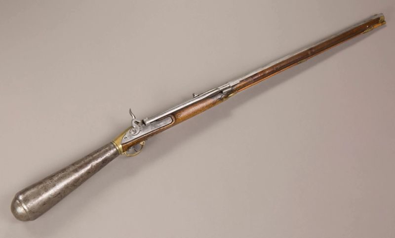
The Lewis and Clark Journals, and documents are filled will lessons. One of the first teachings was entered in the second sentence of the Ohio River Journal- Treat all Firearms with Caution. Arriving at Bruno’s Island, only three miles after departure from Pittsburg, Lewis showed-off his air gun to a group of gentlemen and allowed Mr. Blaze Cenas to examine the gun. Unfamiliar with the gun, Cenas accidentally shot a woman approximately forty yards away. Fortunately, the wound to the head was superficial and only drew blood. (9) In future demonstrations of the air rifle for the Tribal People, Lewis fires the rifle with caution.

Girardoni Air Rifle

Girardoni Air Rifle

Courtesy: National Museum of the U. S. Army: Ft. Belvoir, VA

owned and used by Meriwether Lewis

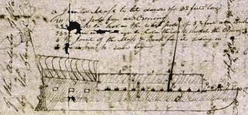
Keel Boat, The Field Notes of Captain William Clark, by Ernest Osgood, page 22

Keel Boat, The Field Notes of Captain William Clark, by Ernest Osgood, page 22

Source:

(1) Quaife, Milo, The Journals of Lewis and Ordway, The State Historical Society, Wisconsin, Madison, page 3; Moulton, Gary, The Journals of the Lewis and Clark Expedition, University of Nebraska Press, Lincoln, page 65.

(2) National Archives & Records Administration, War Department Journal L, 20 Feb. 1805, page 5625 - Lt. Hook at Pittsburgh to T. Moore.

(3) Moulton, Gary, The Journals of the Lewis and Clark Expedition, University of Nebraska Press, Lincoln, 1986, Vol.-2, page 89

(4) Ibid, 1993, Vol. 5, page 92. (Note: Seamans' Creek is today's Monture Creek, MT.

(5) Jackson, Donald, Letters of the Lewis and Clark Expedition with Related Documents 1783-1854, University of Illinois Press, Urbana, 1978, Vol. 1, page 110.

(6) Cohen, Paul, Mapping the West: America’s Westward Movement 1524-1890, Rizzoli International Publications, Inc., New York, 2002, page, 68-73.

(7) Thwaites, Reuben Gold, Afloat on the Ohio: An Historical Pilgrimage of a Thousand Miles in a Skiff, from Redstone to Cairo, Southern Illinois University Press, Carbondale, 1999, page 1-2.

(8) Reid, Robert L., editor, Always a River: The Ohio River and The American Experience, University of Indiana Press, Bloomington & Indianapolis, 1991.

(9) Quaife, Milo, The Journals of Lewis and Ordway, The State Historical Society, Wisconsin, Madison, page 3; Moulton, Gary, The Journals of the Lewis and Clark Expedition, University of Nebraska Press, Lincoln, page 65.

Stop 5 of 16

Heavy Boat in Low Water, 6 September 1803

East Liverpool and Steubenville, OH

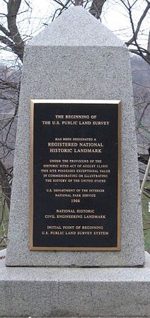
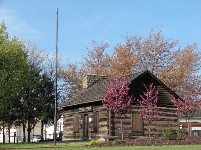
Curtesy: East Liverpool, OH City Government; Thomas Hutchins, U S Surveyor, Beginning Point for Northwest Territory Survey.

Curtesy: East Liverpool, OH City Government

Thomas Hutchins, U S Surveyor, Beginning Point for Northwest Territory Survey.

Lewis, 4 August 1803, ….passed line….visible from timber having been felled about sixty feet wide. (1)

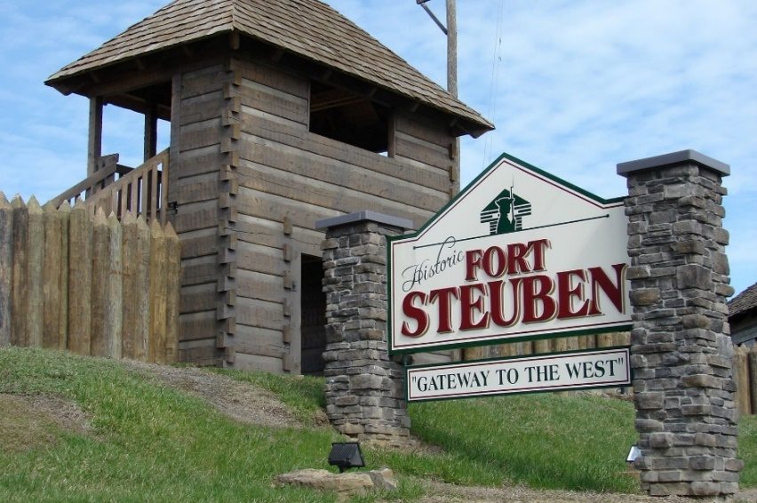
"got on pretty well to Steubenville which we past at 2 OC." 2 miles below stuck on riffles again and returned to Steubenville in search of horses or oxen to pull boat over riffle”. (1)

First Federal Land Office, Ft. Steuben, OH

First Federal Land Office, Ft. Steuben, OH

Courtesy: Old Ft. Steuben

Ft. Steuben, 1st. location on 3rd. Street approximately 2 blocks from the Ohio River.

Ft. Steuben, 1st. location on 3rd. Street approximately 2 blocks from the Ohio River.

Courtesy: Old Ft. Steuben

Source:

(1) Quaife, Milo, The Journals of Lewis and Ordway, The State Historical Society of Wisconsin, Madison, page8 and 9. Moulton, Gary, The Journals of the Lewis and Clark Expedition, V-2, University of Nebraska Press, page71 and 73.

Stop 6 of 16

Federal Agents on the Ohio River, 7 September 1803

Charlestown, VA

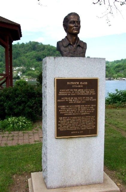
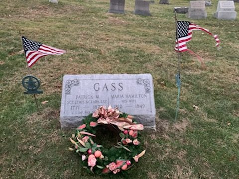
Lewis passed Charlestown, present day Wellsburg, Brooke Co. WV, and future home of expedition member Patrick Gass.

Sgt. Patrick Gass Bronze Bust Patrick Gass Grave. Brook County Cemetery (picture 1 of 2)
Sgt. Patrick Gass Bronze Bust Patrick Gass Grave. Brook County Cemetery (picture 2 of 2)

Sgt. Patrick Gass Bronze Bust Patrick Gass Grave. Brook County Cemetery

Courtesy: Lewis and Clark Trust Ohio River Park, Wellsburg, WV

Courtesy: Paul Zuros

Lewis reached Wheeling, VA, present-day WV, in the evening. At Wheeling Lewis met Col. Thomas Rodney, Judge for the Mississippi Territory appointed by President Jefferson. From Rodney's Journal we learn that the keel boat drew 2 1/2 feet of water when loaded and that Lewis was extremely proud of the air rifle. Lewis departs Wheeling on 9 September 1803 after eating water melon and having a departing drink with Rodney. (1)

Federal Agents on the Ohio River, 7 September 1803

Courtesy: Lewis and Clark Trust

Source:

(1) Rodney, Thomas, A Journey through the West, ed. Smith and West, Ohio University Press, Athens, 1997, page 50 - 51.

Stop 7 of 16

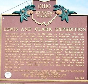
Marietta 13 September and a visit with Col. Griffen Green, Postmaster

“. . . arrived at Marietta, the mouth of the Muskingum river, at 7 OClock in the evening”.

Lewis recorded his observations of pigeons and squirrels continuing to cross the Ohio River northwest to southeast and the temporary crew firing and hirings. In the evening, he visited with Col. Green. (1) Col. Griffen Green was Postmaster and one of the founders of Marietta, Ohio.

Campus Martius Museum has the Rufus Putnam House, part of the original stockade, within the museum. Putnam was the First Surveyor General of the United States and drew many of the Old Northwest Territory maps within the preserved house.

https://www.mariettamuseums.org/campus-martius-museum/

https://www.mariettamuseums.org/campus-martius-museum/

Marietta 13 September and a visit with Col. Griffen Green, Postmaster

Courtesy: Waysidemarking.com

Recreational opportunities in Marietta and the surrounding area include the Ohio River Islands National Wildlife Refuge, entered from Williamstown, WV.

https://www.fws.gov/refuge/ohio-river-islands/visit-us/locations/ohio-river-islands-national-wildlife-refuge

https://www.fws.gov/refuge/ohio-river-islands/visit-us/locations/ohio-river-islands-national-wildlife-refuge

Source:

(1) Moulton, Gary, The Journals of the Lewis & Clark Expedition, University of Nebraska Press, Lincoln, 1986, Vol. II, page 80-81.

Stop 8 of 16

Limestone (Maysville), KY- Blanks in the Lewis’ Journals

A blank in Lewis’ journals occurred 19 September through 10 November 1803. The 39 blank pages in Lewis’ Ohio River Journal are a debated mystery that will never be fully understood by scholars. Eight of the blank pages are truly “blank” with 31 filled with notes pertaining to other expedition activities and locations. (1) (2)

More importantly, Lewis and his temporary crew would have stopped or passed Limestone (Maysville). The Ohio and Mississippi Navigator, 1802, Third Edition, page 33, clearly list the Limestone Creek confluence with the Ohio, “The Landing is a good one, lying in the bend of the river”. The 1814 edition has similar description of the “landing” and interestingly has an abridged version of the Lewis and Clak Expedition, pages 343-349. Limestone was the entrance to the Bluegrass country with a road leading to Lexington making Limestone a significant overnight stop.

There are records indicating expedition member John Colter lived in Mason County and met Lewis at Maysville, even though Colters enlistment date is 15 October 1803 at the Falls of the Ohio. (3)

John Colter

John Colter

Courtsey: Kentucky Gateway Museum Center, Maysville,

Painted by Steve White

Additionally, in 1806, the Lewis and Clark party traveling to Washington DC, as President Jefferson detailed in the Instructions to Lewis in 1803 (4), there was a delegation of Osage Indian Chiefs led by Pierre Chouteau. The Osage Delegation separated from the Lewis party in Frankfort and traveled through Lexington and Limestone taking the northern route to Washington, arriving before Lewis, who took the southern route through Cumberland Gap. (5)(6)(7)

The collective history of Limestone (Maysville) is part of the Lewis and Clark Story and today can be explored through the Kentucky Gateway Museum Center, Sutton Street, Maysville, KY. The excellent 1822 Map of Maysville by Owen, Surveyor, shows the Limestone Creek confluence with the Ohio River and the harbor described in The Navigator.

Source:

(1) Quaife, Milo M., The Journals of Captain Meriwether Lewis and Sergeant John Ordway Kept on the Expedition of Western Exploration, 1803-1806, The State Historical Society of Wisconsin, Madison, 1916, page 19.

(2) Moulton, Gary, The Journals of the Lewis and Clark Expedition, University of Nebraska Press, Lincoln, 1986, Vol. II, page 85.

(3) Jackson, Donald, Letters of the Lewis and Clark Expedition, University of Illinois Press, 1978, Second Printing, Vol. II, page 378.

(4) Jackson, Donald, Letters of the Lewis and Clark Expedition, University of Illinois Press, 1978, Second Printing, Vol. II, page 61.

(5) Chouteau Pierre, Pierre Chouteau Letter Book, Chouteau Family Papers, Missouri Historical Society, St. Louis, page 79.

(6) Jackson, Donald, Letters of the Lewis and Clark Expedition, University of Illinois Press, 1978, Second Printing, Vol. II, page 353, # 224.

(7) Potter, Tracy, Sheheke: The Mandan Diplomat, Ft. Mandan Press, 2003, page 125.

Stop 9 of 16

By Horse to Big Bone, 28 September 1803

Cincinnati, OH

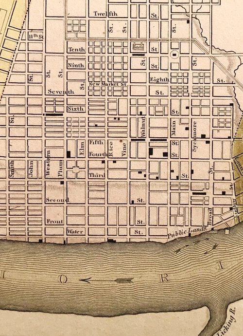
Ft. Washington was built in 1789-1790 at Losantiville, later renamed Cincinnati, across from the Licking River. Lewis wrote to Jefferson 3 October 1803, advising that he had arrive in Cincinnati on 28 September with a need to resupply the keel boat and rest his men. On 1 October he sent his men and the boats to Big Bone Creek, on the south side and down the Ohio River. (1)

cincymapcollection — The Cincinnati Map Collection

Cincinnati, Covington, & Newport at confluence of Ohio and Licking Rivers. Ft. Washington located between Ludlow & Broad at Third Street & Across from Licking River

Courtesy: Cincinnati Public Library

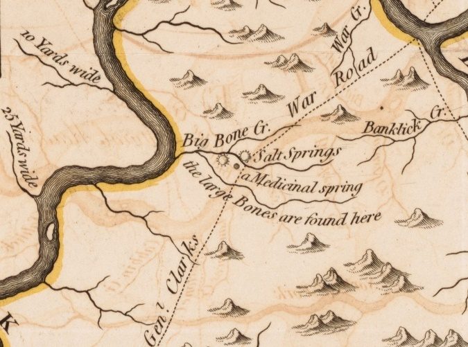
Thomas Jefferson’s curiosity was insatiable, including hopes of finding living Mammoths and Megatherium during the expedition. Information describing Big Bone Lick was first recorded by French Captain Longueil in the 1729 Map of Jacques Nicolas Bellin and noted by traveler Nicholas Cresswell in 1775. (2) More broadly disseminated information by John Filson’s 1784 Map of Kentucke and Filson’s best-selling book, The Discovery, Settlement and Present State of Kentucke, significantly raised the interest in Big Bone Lick and the Mammoth bones. George Turner, a member of the American Philosophical Society, further stirred interest of Dr. Caspar Wistar, Charles Wilson Peale, and Thomas Jefferson in securing a complete skeleton of the Mammoth for a full examination. (3) Dr. Goforth, of Cincinnati, was a source for securing the large bones and knew their location. The Doctor guided Lewis to Big Bone Lick for the purpose of securing mastodon bones for President Jefferson.

Big Bone Lick

Big Bone Lick

https://www.nps.gov/places/bi-g-bone-lick-state-historic-site.htm

Courtesy: Library of Congress showing William Clark route in 1807

The route Lewis and Goforth followed was not recorded but most likely followed the old Bison (Buffalo) Trail which followed the incline from the Ohio River, in the vicinity of today’s Roebling Bridge and Licking River, to Union, KY then Big Bone Lick. Bison Trails were recorded being as much as 15 feet wide and as hard as stone from continuous use by the 800-2000-pound animals. Even with urban development and Interstate highways, the route today can be traced by using: West Pike Street though Covington connecting with U. S. 25 (Dixie Highway) through Park Hills, Ft. Wright, Erlanger, Florence, to U.S. 42 in Union then to KY 338 (Beaver Road) to the Big Bone Historic Site. (4)

The letter Lewis wrote Jefferson, on 3 October 1803, fully describes the investigation before going to Big Bone Lick and the on-sight finding at Big Bone Lick. Clearly, the length of the letter and detailed description of preparation to travel to Big Bone Lick describes the importance of the trip Thomas Jefferson had requested. (5)

Lewis would have followed Big Bone Creek to his crew and the keel boat at present day Big Bone Landing, Boone County, KY. KY 338, and KY 1925, follow the drainage to Big Bone Landing. (6) By road today, the distance is approximately 3 miles.

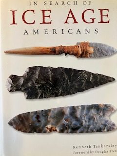
Unfortunately, the Lewis collection of bones was lost in a boating accident near Natchez. President Jefferson never gave up and directed Wm. Clark to return to Big Bone in 1807. Clarks' excavation crew included his brother Gen. George Rogers Clark and York. The three (3) weeks dig resulted in an eleven (11) page letter to Jefferson detailing the findings and a conclusion about the collection and site. The 1807 excavation and report became the foundation of vertebrate paleontology as a science. (7) (8) During Clark's excavation, attended by Dr. Goforth, flint points were found and retained by the Doctor. The unquestionable provenance for the points can be seen in In Search of Ice Age Americans. Similar flint points were later found near Clovis, NM thus their name. In reality, the flint arrow points should be called Big Bone Points. (9)

By Horse to Big Bone, 28 September 1803

Courtesy: Lewis and Clark Trust

Note: Big Bone Points (A.K.A. Clovis Points) found by William Clark and preserved by Dr. Goforth are available for viewing by appointment at the Geier Center of the Cincinnati Museum, 760 West 5th Street, Cincinnati, OH 45203

Source:

(1) Jackson Donald, Letters of the Lewis and Clark Expedition, Second Printing, V-l page 126 & 127. Thwaites, Reuben G., Original Journals of the Lewis and Clark Expedition, V-7, Arno Press, NY, pages 274-279.

(2) Cresswell, Nicholas, The Journal of Nicholas Creswell 1774-1777, The Dial Press, New York, 1924, page 87.

(3) Tankersley, Kenneth, In Search of Ice Age Americans, Gibbs Smith Publisher, 2002, pages 49; Hedeen, Stanley, University of Kentucky Press, Lexington, 2008, page 73-84. https://digitalcommons.unl.edu/cgi/viewcontent.cgi?article=1002&context=etas

(4) https://maps.kytc.ky.gov/activehighwayplan

(5) Jackson, Donald, Letters of the Lewis and Clark Expedition….., Second Printing, V-1 page126-132.

(6) https://www.boonecountyky.org/departments/parks/boone_s_landing_marina/index.php

(7) https://founders.archives.gov/documents/Jefferson/99-01-02-6406

(8) https://lewis-clark.org/the-trail/down-the-ohio/big-bone-lick/

(9) Tankersley, Kenneth, In Search of Ice Age Americans, Gibbs Smith Publishingm2002, page 52-55.

Special Gratitude: The Lewis and Clark Trust appreciates the on-site research for Lewis and Dr. Goforth’s route of travel from the Licking River-Ohio River confluence to Big Bone Lick by Ralph G. Wolf and Woodrow Schuster.

Stop 10 of 16

Co-Commanders Meet, 14 October 1803

Louisville, KY

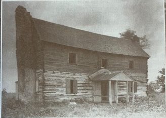
When Meriwether Lewis finely arrived in Louisville, he was in the city founded by General George Rogers Clark during the American Revolution. William Clark had grown to manhood in Louisville after his parents and the younger Clark children moved from Caroline County, VA 1785.

Mulberry Hill: The Clark Family Home at Louisville, Kentucky, 1890

Mulberry Hill: The Clark Family Home at Louisville, Kentucky, 1890

Courtesy: Dr. Ernest M. Ellison, DMD

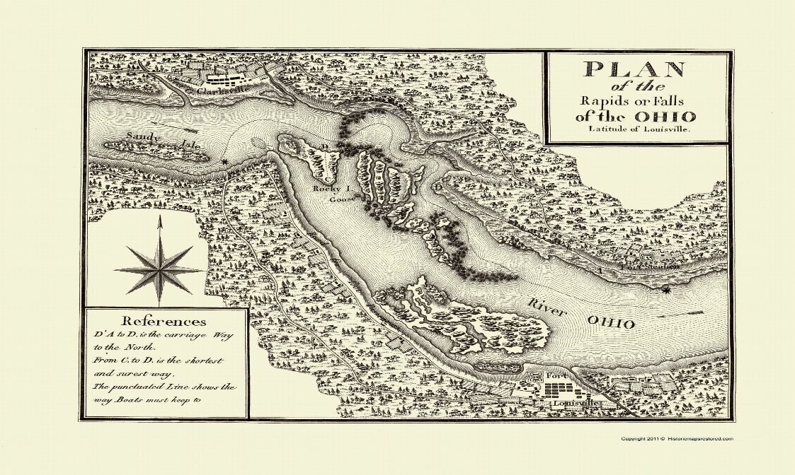
Falls of the Ohio, by J. Brooks, engraved by John Goodman, 1806

Falls of the Ohio, by J. Brooks, engraved by John Goodman, 1806

Courtesy: University of Kentucky Historic Maps # 9

The 1802, 3rd edition of The Ohio and Mississippi Navigator by Zadok Cramer states that Louisville was the port of entry. On a cloudy Friday, 14 October, Lewis brought the keel boat and pirogue in to the natural harbor formed by Beargrass Creek and Corn Island. (1)

On 15 October the keel boat and pirogue were moved through the "Indian Chute" to the mouth of Mill Creek below the Point of Rocks where George Rogers Clark and William Clark were living in the Clark Grant, Old Northwest Territory. The most likely pilot was James Patten a highly respected and Kentucky licensed pilot. The pilot's legal fee was $2.00. (2)

James Patten, Licensed Pilot

James Patten, Licensed Pilot

Courtesy: Army Corps of Engineers

At the mouth of Mill Creek, near the future Clarksville, IN, the Lewis and Clark recruiting station was established. During the next 12 days the nucleus of the expedition members were recruited and sworn into the First Regiment of Infantry.

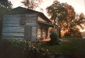
View from “Point of Rocks”, Clarksville, IN George Rogers Clark Cabin

View from “Point of Rocks”, Clarksville, IN George Rogers Clark Cabin (picture 1 of 2)
View from “Point of Rocks”, Clarksville, IN George Rogers Clark Cabin (picture 2 of 2)

Courtesy: Richard Prestholdt, Prestholdt Images. Courtesy: Lewis and Clark Trust

For more information on the expedition recruits see:

Lewis and Clark in Kentucky: https://lewisandclarkinkentucky.org/

Along with the goodbyes and last-minute packing, there were considerations of a more serious matter. On 26 October 1803, William Clark filed a Power of Attorney at the Jefferson Co. KY County Court Clerk Office. In September William had appointed Jonathan Clark, his older brother, as his power of attorney. (3) Clearly, Clark recognized the dangers of the journey he and the new members of the expedition were about to face.

Today the Falls of the Ohio State Park and Interpretive Center is an excellent place to learn about Lewis and Clark at the Falls of the Ohio. https://www.in.gov/dnr/state-parks/programs/nature-centers/falls-of-the-ohio-interpretive-center/

Source:

(1) Jones, Landon, William Clark and the Shaping of the West, Hill and Wang, NY 2004, page 18.

(2) U. S Army Corps of Engineers Louisville, District, Triumph At The Falls: The Louisville and Portland Canal. Leland R. Johnson and Charles E. Parish, page 8-10.

(3) Jonathan Clark Papers- Temple Bodley Collection, The Filson Historical Society.

Stop 11 of 16

26 October 1803 Camp Site

West point, KY

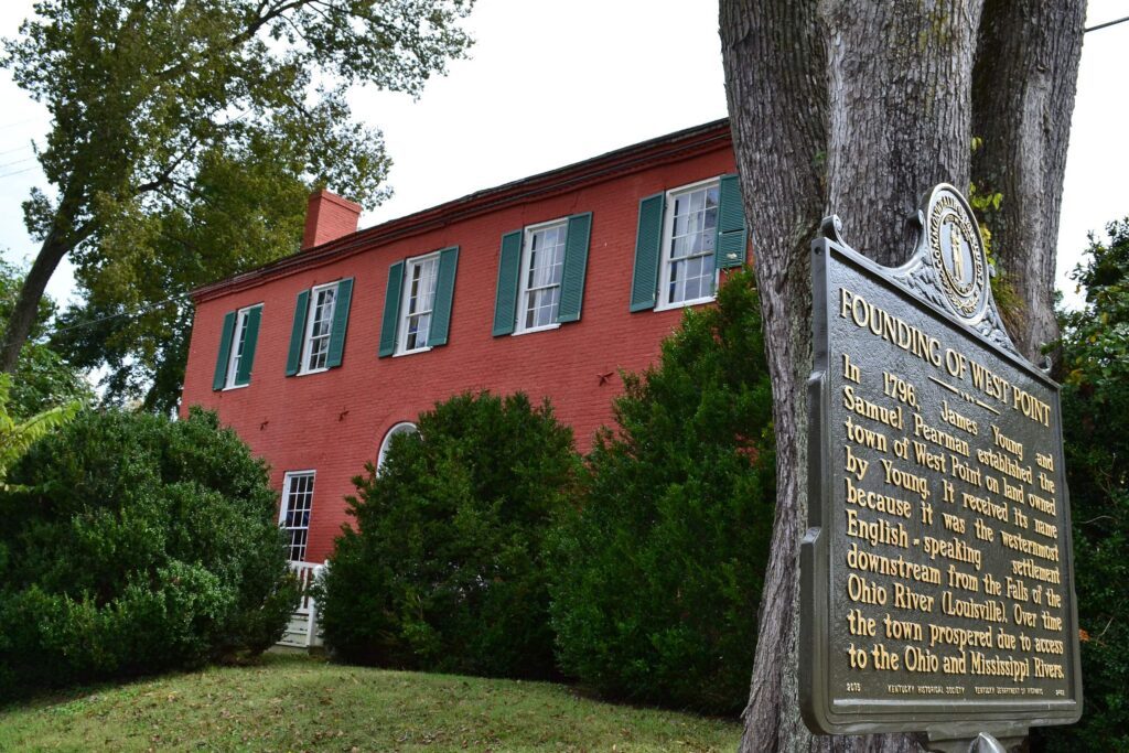
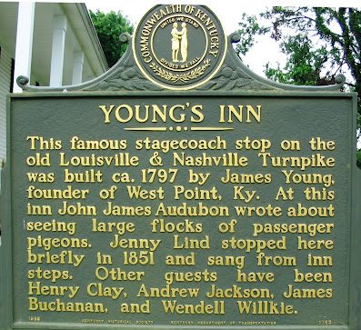
Leaving the Mill Creek Camp in the afternoon would be a “Hudson Bay Start,” making that night’s camp not far along the Ohio River. (1) While there is no primary source describing the camps location, the reasonable location is West Point, KY, and the mouth of the Salt River. James Young, founder of West Point, established a ferry at the mouth of the Salt River in 1797. The James Young Inn was less than a hundred yards from the ferry and public wharf and Young’s home was across the street. (2) The captains could have visited either house. (3)(4) The Salt River ferry landing would provide a safe place for the keel boat and red pirogue that night.

James Young House, West Point, KY

James Young House, West Point, KY

Courtesy: Lewis and Clark Trust

Young's Inn historical trees in West Point, Kentucky | The Historical ...

Courtesy: Lewis and Clark Trust

West Point was the home of expedition blacksmith John Sheilds. (5) Joseph and Reubin Field lived near-by in Southwestern Jefferson County, today’s Jefferson Memorial Forest area. (6)(7) The three members of the Corps of Discovery were essential and involved in every momentous event during the 28-month exploration of the American West.

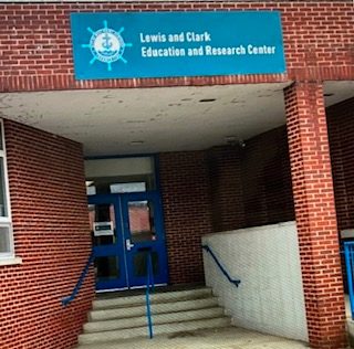
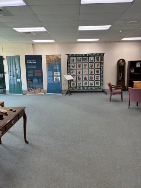
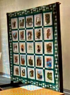
The Lewis and Clark Education & Research Center, at West Point, KY is the newest center along the Trail and focused on John Shields and the Field Brothers. This excellent addition to the “string of pearls centers” is ready for your exploration.

Lewis and Clark Education and Research Center, West Point, KY

Lewis and Clark Education and Research Center, West Point, KY (picture 1 of 3)
Lewis and Clark Education and Research Center, West Point, KY (picture 2 of 3)
Lewis and Clark Education and Research Center, West Point, KY (picture 3 of 3)

209 North Main Street, West Point, KY 40177

Courtesy: Richard Ciresi

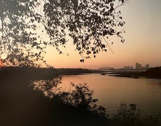
Veterans Park, West Point, KY (Ohio River in background)

The West Point, Lewis and Clark Urban Health Walk passes through the park.

26 October 1803 Camp Site

Courtesy: Gary Masterson

Stop 12 of 16

Ft. Massac and "A Man of Much Merit", 11 November 1803

Ft. Massac State Park, IL

Leaving West Point on 27 October and traveling to Ft. Massac, present day Massac Co. IL, was uneventful except for Clark's health. Digestive ailments were an old situation but it did not stop Clark from his duties. (1)

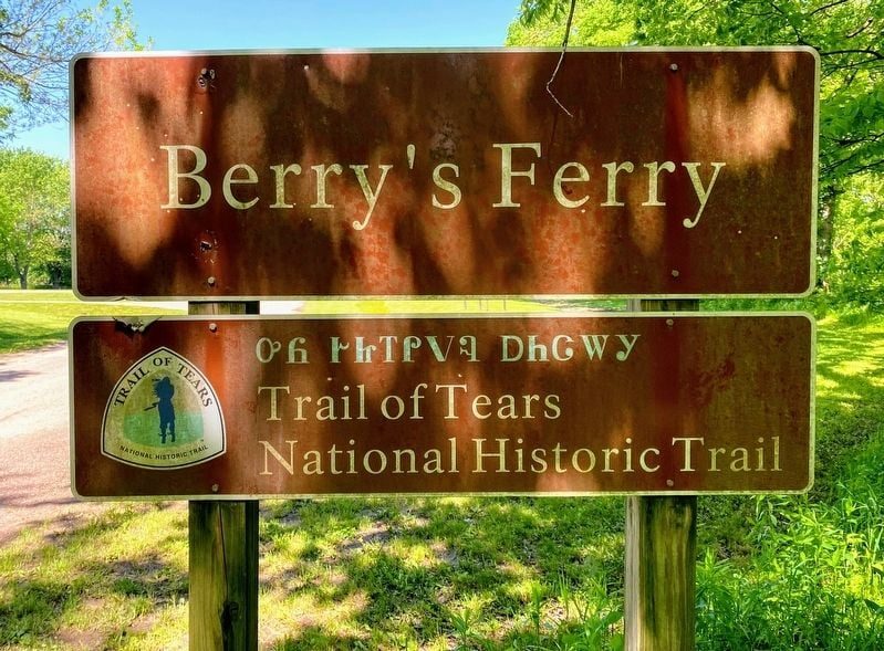
During the 15-day passage to Ft. Massac they passed the future Trail of Tears site at Berry's Ferry and the future site of Paducah, KY, another Trail of Tears Crossing. Immediately on arriving at Ft. Massac, Lewis "engaged" George Drouillard, a man of French/Indian parentage, to travel to Ft. Southwest Point, TN. George’s mission was to escort the 8 soldiers to the expedition winter encampment in IL. (2)

They Passed This Way Historical Marker

Courtesy: National Park Service

After the selection of William Clark, as co-commander of the expedition, the hiring of George Drouillard was the wisest decision Meriwether Lewis made to bring about a successful expedition. George's total payment was $833.331/3 for 33 months of service. In Lewis' report to Secretary of War Dearborn, 15 January 1807, Lewis used 124 word to define his appreciation for George's service as a civilian contractor. (3)

Lewis and Clark Bronze Statue, National Quilt Museum, Paducah, KY

Commissioned by Bill and Meridth Schroder

George Lundeen, Sculpture

George Lundeen, Sculpture

Courtesy: National Quilt Museum

Flood Wall Paintings, Paducah, KY

Flood Wall Paintings, Paducah, KY (picture 1 of 2)
Flood Wall Paintings, Paducah, KY (picture 2 of 2)

Lewis and Clark Keel Boat and Red Pirogue William Clark, Surveyor

Courtesy: Robert Dafford, Painter

At the Mouth of the Tennessee River, William Clark had passed the future site of Paducah, a city he would survey and establish in 1827.

Ft. Massac, Metropolis, IL

https://dnr.illinois.gov/parks/park.fortmassac.html

fort massac

Courtesy: Lewis and Clark National Historic Trail, National Park Service

Ft. Massac, in 1757 the French erected a fort and named it Fort Ascension near the mouth of the Tennessee River. It was strengthened in 1759 and renamed Fort Massac in honor of a French minister. In 1765, under terms of a recently signed treaty, they surrendered it to the British. In 1778, George Rogers Clark, the older brother of William Clark, and his men captured the fort. In 1794 President George Washington ordered that Fort Massac be fortified and rebuilt, and it was renamed an anglicized “Massac.” It became a major port of entry for settlers entering Illinois country.

Source:

(1) Jones, Landon, William Clark and Shaping the West, Hill and Wang, New York, 2004, page 120.

Moulton, Gay, The Journals of the Lewis and Clark Expedition, University of Nebraska Press, Lincoln, 1986, page 85.

(2) Jackson, Donald, Letters of the Lewis and Clark Expedition, Second Printing. University of Illinois Press, 1978, V-l, P-368.

(3) Ibid, p-368.

Stop 13 of 16

Celestial Observations and Ft. Jefferson 15, November 1803

Confluence of the Ohio and Mississippi River

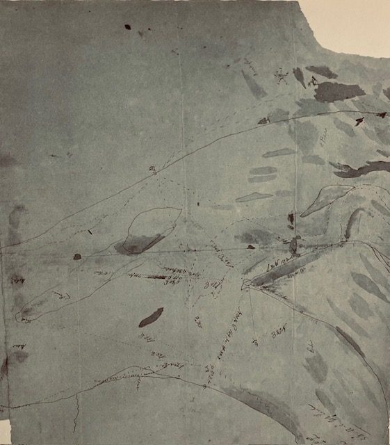
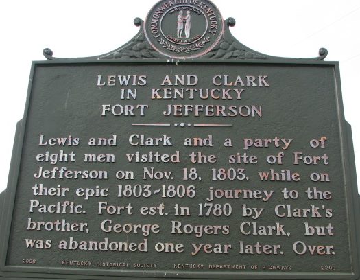
During five (5) days at the Mouth of the Ohio River Lewis and Clark made celestial observations, drew maps, wrote reports, and described how eastern American Indians were already migrating west of the Mississippi River. The captains visited Old Ft. Jefferson, built by George Rogers Clark, William's older brother, during the Revolutionary War. (1)(2)

Clark had previously surveyed and drawn a map of the confluence of the Mississippi and Ohio Rivers in 1796 and had been at the confluence on other occasions. (3)

William Clark’s 1803 Drawing of Ohio and Mississippi River Confluence.

William Clark’s 1803 Drawing of Ohio and Mississippi River Confluence.

Source: The Field Notes of William Clark: 1803-1805, Edited Ernest Staples Osgood, Yale University Press, 1964, Page 195, Survey and distances, page 196.

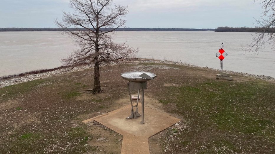
The present-day confluence of the Ohio and Mississippi Rivers is close to a mile further west, a result of floods, especially the 1937 Flood. The view of the joining of the two mighty rivers is seen below:

Fort Defiance, Caro, IL

Fort Defiance, Caro, IL

Courtesy: NPS- Lewis and Clark National Historic Trail

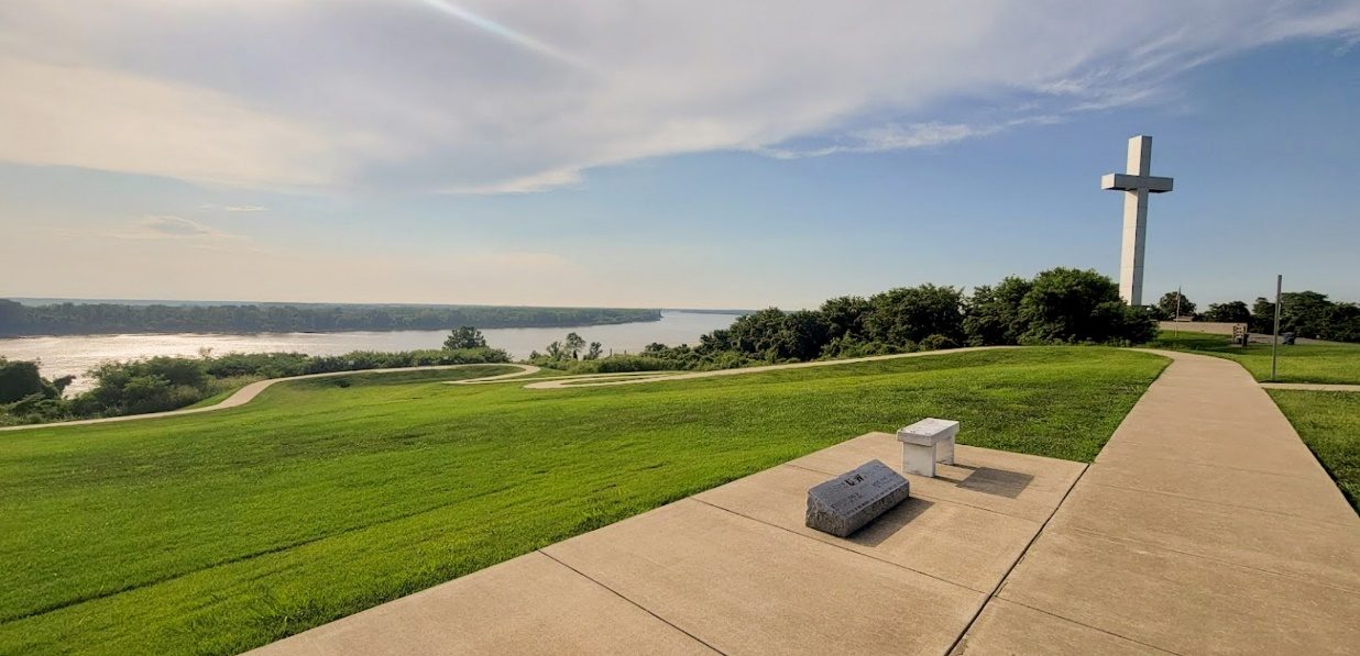
The Cross Overlook, Wickliffe, KY (US 62) is another view of the Mississippi and Ohio River Confluence and Lewis and Clark in Kentucky Historical Marker.

Cross Over Look (confluence of Ohio and Mississippi Rivers)

Cross Over Look (confluence of Ohio and Mississippi Rivers)

Old Ft. Jefferson was at near the mouth of Mayfield Creek. The site is on private property and inaccessible.

Snug Harbor Bay: Ft. Jefferson, Ky.

Courtesy: Lewis and Clark Trust

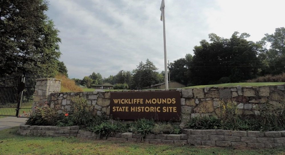
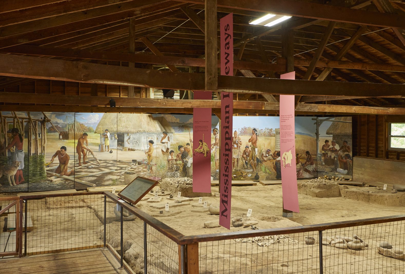
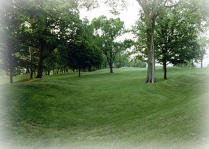
Wickliffe Mounds Historical Site (US 60 & Green Street) Wickliffe, KY. A Mississippian Archeological Site dated A. D. 1100-1350.

tps://parks.ky.gov/wickliffe/parks/historic/wickliffe-mounds-state-historic-site. (picture 1 of 2)
tps://parks.ky.gov/wickliffe/parks/historic/wickliffe-mounds-state-historic-site. (picture 2 of 2)

tps://parks.ky.gov/wickliffe/parks/historic/wickliffe-mounds-state-historic-site.

Courtesy: Terrain360

The Ballard-Carlile Co. Historical and Genealogical Society, 257 N. 4th Street, Wickliffe, KY, 270-335-5059, Fort Jefferson Room, contains Dr. Kenneth Carstens, Emeritus Professor of Antropology and Archaeology, Murray State University, life time collection and books on Ft. Jefferson. This excellect research collections is the finest in the Nation on the Ft. Jefferson history, including the Tribal people that struggled at Thomas Jefferson fort, the most western fort during the American Revolution.

Source:

(1) Moulton, Gary, The Journals of the Lewis and Clark Expedition, University of Nebraska Press, Lincoln, V-2, page 87.

(2) Osgood, Ernest, The Field Notes of Captain William Clark 1803-1805, Yale University, Hartford, CT, 1964, page 195.

(3) Ehrenberg, Ralph and Viola, Herman, Mapping West with Lewis & Clark, Library of Congress. Levenger Press, Delray Beach, FL, page 76.

Stop 14 of 16

Against the Current, 20 November 1803

Up the Mississippi River

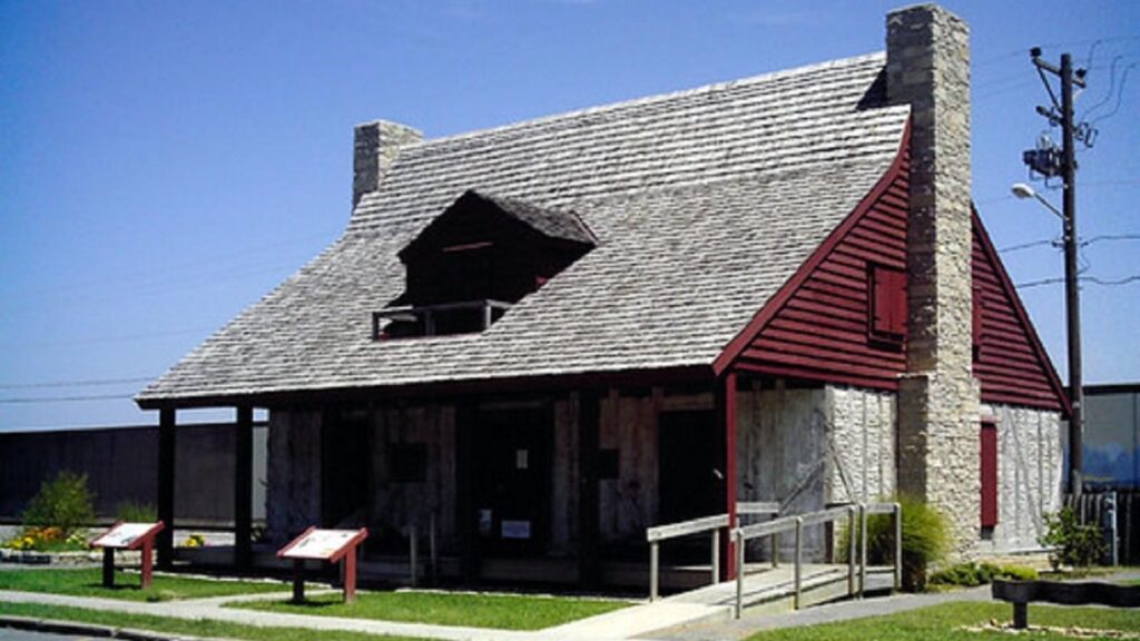
Lewis and Clark turned the boats against the Mississippi River current and experienced a new challenge. Traveling against the current would last until the expedition reached Camp Fortunate, in today's Clark Canyon Reservoir, Southwestern Montana (near 44 0 59' 36" N, 1 12 0 51 ' 43" W). At Cape Girardeau, Lewis met and dined with Louis Lorimier, a former Ohio trader and uncle of George Drouillard, Expedition interpreter and hunter. Lorimier is credited with founding Cape Girardeau. (1)

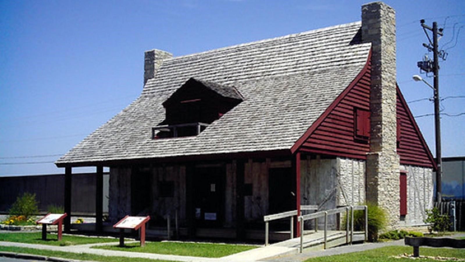
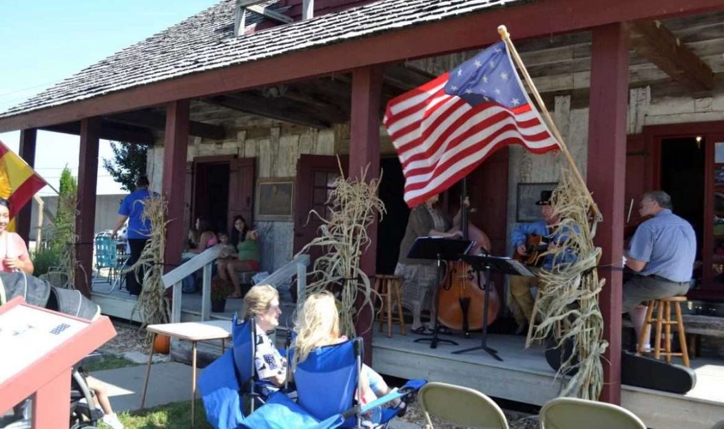
Red House

Red House (picture 1 of 2)
Red House (picture 2 of 2)

128Aquqmis Street, Cape Girardeau, MO 63703, Phone 573-335-1631

Courtesy: City of Cape Girardeau

https://www.cityofcapegirardeau.org/departments/government/boards-commissions/red-house-interpretive-center-committee/

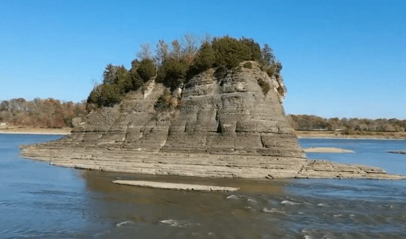
Their camp of 25 November 1803 was at the Grand Tower Rock, a four-million-year-old rock formation near the west bank of the Mississippi River. The Grand Tower was first noted by Jacques Marquette in 1673 but was measured and mapped by William Clark. (2)

Tower Rock

Tower Rock

GPS 39.06499, -98.99999

https://mdc.mo.gov/discover-nature/places/tower-rock-natural-area

At Kaskaskia, Lewis leaves the crew and boats in Clark's care after recruiting more members for the expedition, including John Ordway and Patrick Gass, two of the more prominent members of the expedition. The White Pirogue was purchased to transport the additional men.

Fort Kaskaskia

Fort Kaskaskia

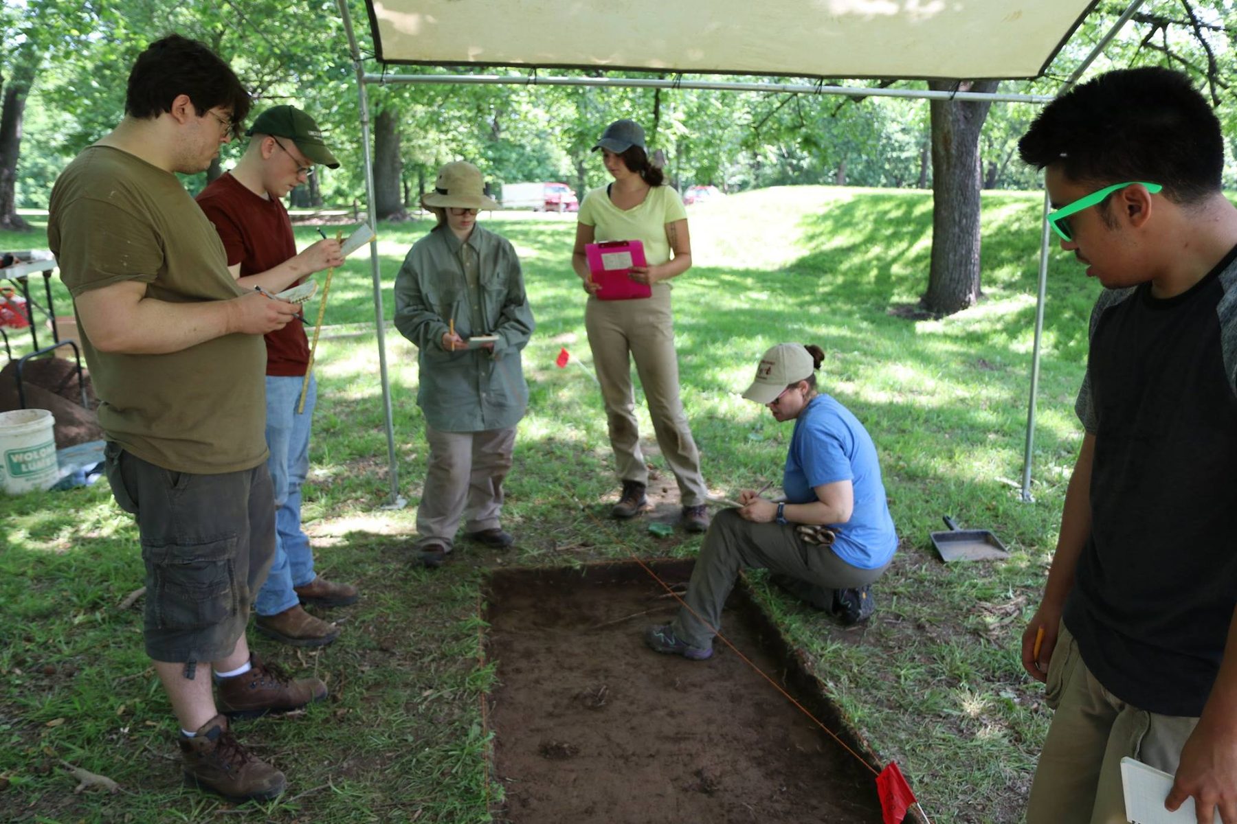
The Southern Illinois University Center for Archeological Investigation’s new research is determining the exact location of the 1803 American Ft. Kaskaskia.

https://news.siu.edu/2018/05/053118-unknown-american-fort-found-by-archaeological-field-school.php

Archaeological Field School

Courtesy: Southern Illinois University

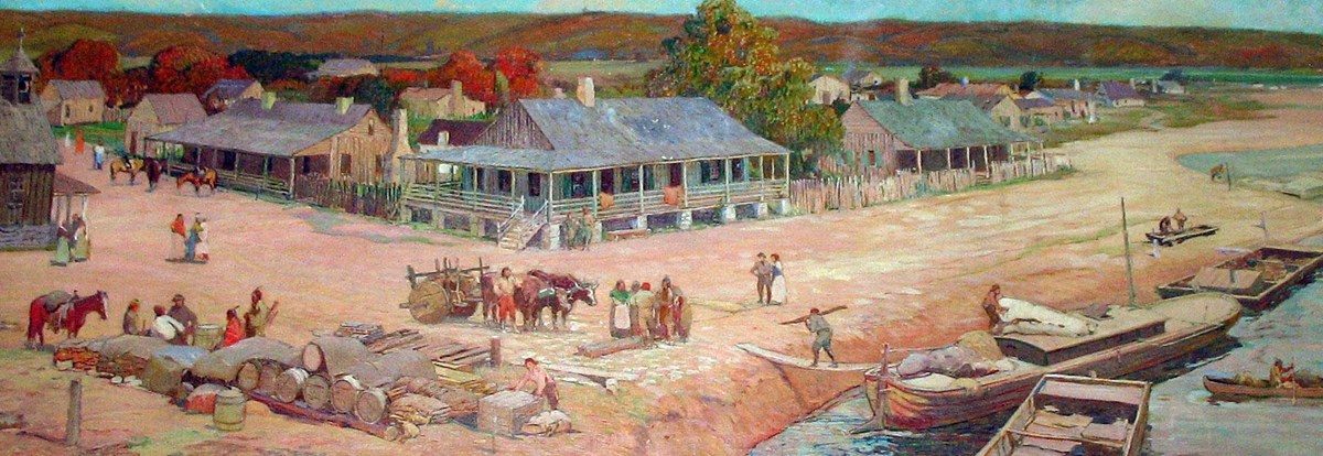
Clark reported they crossed the river to St. Genevieve and later back across the river to Old Ft. de Chartres, built in the French Colonial Period. On 7 December they arrived at Cahokia, a US Post Office site and center of communication during the Lewis and Clark Expedition. (3)

St. Genevieve

St. Genevieve

Courtesy: St. Genevieve, National Historical Park, MO

Cahokia Court House

Cahokia Court House

Courtesy: National Park Service Lewis and Clark National Historic Trail

Sources:

(1) Quaife. Milo, The Journal of Lewis and Ordway, State Historical Society of Wisconsin, Madison, page 24-46. Moulton, Gary, The Journals of the Lewis and Clark Expedition, University of Nebraska Press, V-2, pages 95-127.

(2) Quaife, Milo, The Journal of Lewis and Ordway, State Historical Society of Wisconsin, Madison, page 37 & 38.

(3) Ibid, pages 40-46.

Stop 15 of 16

Trouble with the Spanish, 12 December 1803

St. Louis, MO

The Spanish Government would not permit the expedition to spend the winter West of the Mississippi River. "Monday the 12th of December opposite the mouth of the Missouri River I came to the mouth of a little river called Wood River about 2 o'clock," William Clark. Shortly after arriving the wind started to blow with hail and snow at the location of Camp River Dubois, the first winter camp of Lewis and Clark. (1)

Historically, enlisted men in the Army do not like garrison duty and so it was with this camp. The building of cabins was the first-priority. While the expedition exploration journals had not been started, from Osgood's Field Notes of Captain William Clark and Jackson’s Letters we learn that the camp was a busy place. The young recruits started learning military discipline when they broke protocol, that included killing live stock or visiting the local source of liquor in the Great American Bottom where the camp was located. (2)

John Hay, the Post Master at Cahokia, and his wife and others visited the camp and provided information about the region and Missouri River the expedition would confront in the spring. Being friends with the Post Master helped communications with the East and President Jefferson or his Cabinet. (3)

Lewis spent the greater part of the winter in St. Louis gathering information and material for the exploration. However, Clark traveled to St. Louis on ceremonial occasions especially for the transferring of the Louisiana Territory to the United States. Clark's faithful recording of the weather and evaluation of the men during the winter training clearly explains why garrison duty is not appreciated by the recruits.

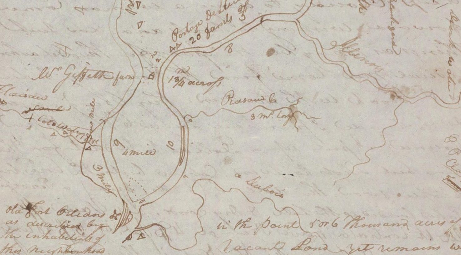
William Clark Map of Camp Dubois

William Clark Map of Camp Dubois

Triangle, immediately above, South of the DuBois River is the site of Camp Dubois.

Courtesy: Beinecke Rare Books and Manuscripts Library, Yale University

An additional Map Number 6, The Lewis and Clark Expedition, Vol. 1 (Atlas) by Gary Moulton, shows the location of Camp Dubois on the southside of the River Dubois and next to the Mississippi Riveras a black rectangle with a note: “The winter encampment in the year 1803-4 of the party sent out by the Government of the United States for the purpose of exploring the Missouri River”.

Lewis and Clark Historic Site Interpretive Center

Lewis and Clark Historic Site Interpretive Center

Courtesy: Illinois Department of Natural Resources

1 Lewis and Clark Trail, Hartford, IL 62048

Source:

(1) Osgood, Ernest, Field Notes of Captain William Clark, Yale University Press 1964, p. 3-38.

(2) Quaife, Milo, The Journal of Lewis and Ordway, The State Historical Society of Wisconsin, 1916, P. 48.

(3) Jones, Landon, William Clark and The Shaping of the West, Hill and Wang, New York, 2004, P. 122 - 123.

Editorial Note: The Lewis and Clark Story has many stories within the story. Deviating from date sequence, let us pause and look at one of the internal stories connecting Ft. Mandan, St. Louis, New Orleans, Baltimore, and Washington D. C. in 1805. While the exploration of the Missouri River and its principal tributaries was underway, the story is also very alive and active in the East.

On 7 April 1805 the keel boat, under the command of Corporal Warfington, departed Ft. Mandan, the 1804-1805 winter fort in North Dakota. The boat arrived back in St. Louis late May or very early June 1805, containing the collection of material, observations, and messages collected between St. Louis and Ft. Mandan in 1804-1805. (1) The list of items sent to President Jefferson is well detailed. (2) Fortunately, we can follow the collection to the White House through the research of Scott S. Sheads, NPS Ranger-Historian (Retired). Mr. Shead’s excellent report clearly points to the fact that Baltimore is one of the eastern points on the Lewis and Clark Story.

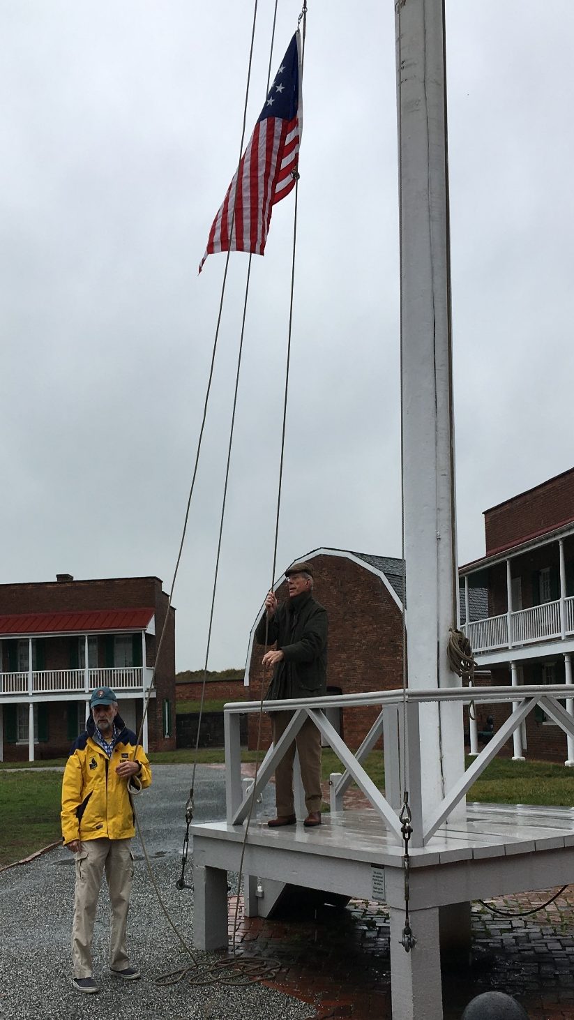
Lewis and Clark Trust 15 X 15 Flag Flies at Ft. McHenry

Lewis and Clark Trust 15 X 15 Flag Flies at Ft. McHenry

Courtesy: Lewis and Clark Trust

Scott Sheads in Yellow jacket.

Historical document

Curiosities from the Corps of Discovery: by Scott Sheads

Baltimore, August 1805

Meriweather Lewis (1774-1809) & William Clark (1770-1838)

(National Park Service)

” “We learn that a part of the collection of the curiosities collected by captain Lewis on the Missouri, has reached Baltimore.” 1

A year before the formal United States acquisition of the Louisiana Territory from France for $15 million, President Jefferson sent a confidential letter to Congress on January 18, 1803 to fund $2,500 for a scientific expedition up the Missouri River to open a passage to the Pacific through the uncharted north-western frontier.2 To lead the expedition known as the “Corps of Discovery” he appointed his personal secretary Meriweather Lewis for what became and remains the most celebrated natural scientific exploration in American history. While historians and the media have focused on the historic journey from St. Louis to the Pacific, little is known of the Baltimore connection in regards to the valuable shipment that was sent eastward a year after their keelboat named “Discovery” and crew pushed northward on the Missouri.

On April 3, 1805, Captains Merriweather Lewis and William Clark prepared to leave their camp at Fort Mandan (present day Washburn, ND) at the confluence of the Knife and Missouri Rivers for the Upper Missouri to continue their passage to the Pacific coast, since leaving St. Louis on May 14, 1804. 3

The celebrated thirty-one member expedition that later historians called the “Corps of Discovery” spent their days packing their shipment of “curiosities” collected so far to be forwarded to President Jefferson in Washington. The shipment consisted of 4 boxes, 2 large trunks and 5 cages containing a variety of scientific observations, maps, Mandan bow & quiver, botanical specimens, animal skins, and a live prairie dog – in all an impressive inventory of the natural landscape specimens and Native American tribal cultures they were passing through.

While historians have documented the “Corps of Discovery” expedition from St. Louis, up the Missouri and Columbia Rivers to the Oregon pacific coast - little has been written on the final phase – the arrival of the shipment of “curiosities” in August 1805 to Baltimore. This is the untold Baltimore connection.

Baltimorean’s first detailed notice of an expedition to be led by Captain Lewis, the personal secretary of President Jefferson appeared in the Federal Gazette on Sept 20, 1803 followed by the Frederick-Town Hornet that winter informing their readers that a corps of soldiers and hunter-guides were “to proceed to the source of the Missouri, and thence to endeavor by following the course of the great river, to reach the pacific ocean.

This, no doubt, is an expedition of great difficulty and hazard, at the same time, if successful, as we wish it may, [be] of great national importance.” 4 Lewis and Clark were already in St. Louis by May 1804 preparing to shove off up the Missouri.

On April 7, 1805 Captain Lewis sent four men and two interpreters under Corporal Richard Warfington down the Missouri from Fort Mandan in the Dakota’s to St. Louis on the Mississippi.5 Here Captain Amos Stoddard (1762-1813) 2nd U.S. Regiment of Artillerist and Engineers, Captain Lewis’ agent, was responsible for forwarding the shipment to New Orleans then to Washington, via the Gulf Coast to the Chesapeake. 6

The Orleans Gazette informed its readers of the shipment as it passed through the Port of New-Orleans:

“The curiosities sent by Captains Lewis and Clark, to the president of the United States, were received by Governor Claiborne, some days ago – they were put on board the Comet, Captain McNeil, who sailed yesterday for Baltimore. The animal and birds, were in good health.” 7

The Baltimore built Comet, described as “a strong, fast-sailing vessel, and in all respects well found; burthen 197 tons…a constant Trader of freight…” with extensive accommodations for passengers. In addition to her cargo of “curiosities” was 120 Hogsheads of “fine New Orleans sugar” destined for merchant William Taylor. 8

The final passage was entrusted to a Captain John McNeil who had arrived at New Orleans on July 22nd then left on July 23rd for Baltimore 1,750 nautical miles away in the Chesapeake. 9 After a fifteen-day passage they arrived in the Patapsco River on August 10th off Fort McHenry. The long four month navigable journey from Fort Mandan down the Missouri, the Mississippi to New Orleans and finally Baltimore on August 12 was some 4,500 miles with Captain McNeil informing Jefferson by mail of his arrival.10

Across from the Fort on the opposite shore lay the Lazaretto Quarantine Station (est.1801) for vessels arriving from out of the country before entering Baltimore to prevent the introduction of contagious diseases and arriving shipments. A Dr. William Stewart (1741-1821) earlier that Spring been appointed Baltimore’s second Public Health Officer whose duty was “to give his attendance at Fort McHenry every day from eight o’clock in the morning until six o’clock in the evening…” during the quarantine season to check arriving vessels.11

Fort McHenry, November 9, 1803

1803 map showing the Tavern (A) outside the walls of Fort McHenry and outer post gate.12 (National Archives, Record Group 77, Drawer 51, Sheet 1; College Park, Md.)

Dr. Stewart’s office was at Philip Schwartzauer’s Tavern (c.1797-1836) outside the military boundary gate of the fort.13 Walking down to the government dock a small boat would take him across the channel to the Lazaretto station. Upon checking the crew and shipment the Comet was allowed to proceed to the Fell’s Point waterfront wharf of Points of Interest (left to right): Chase’s Wharf, Fell’s Point; Fort McHenry and Lazaretto Quarantine Station. (author)

Thorndick Chase at Thames and Philpot Sts., on August 12th. 14 Here Robert Purviance (1734-1806), Port Collector of Baltimore engaged a local wagon drayer, Nathaniel Peck to take the shipment to the White House for a payment of $12.00 arriving on Aug.14, 1805 and placed under the care of the President’s house manager-steward, a Mr. Etienne Lemaire.15 Lewis and Clark reached St. Louis at noon on September 23, 1806, thus ending the “Corps of Discovery” epic adventure of exploration along the Upper Missouri and Columbia Rivers.

A&CDA, August 15, 1805

By May of 1814 the Baltimore bookstore of John & Thomas Vance at 178 Market Street offered readers their first literary glimpse of the expedition of the “Corps of Discovery” illustrated with maps.16 The twenty-eight-month expedition had explored the country west of the Mississippi, opening America to westward migration, and with it by the close of the 19th century the demise of the Native American lands and culture.

When Jefferson returned to Washington in October, he enumerated the shipment destined to be divided to three sites; artist Rembrandt Peale’s Natural History Museum and the American Philosophical Society (Est. 1743) both in Philadelphia, and of course his Virginia home at Monticello.17

Unfortunately, in March 1806 Jefferson was informed that a large part of the shipment in transit on the Chesapeake destined for Monticello via Richmond “that could be damaged by water was…”18 With Jefferson’s death in 1826 his “Indian Hall” collection though bequeath to the University of Virginia had by the 20th century been lost, mislaid or redistributed as interest declined. Today, only the Elk antlers have survived at Monticello, admits reproductions acquired during the 200th anniversary of the expedition.

Today, the major repository of the surviving shipment resides at the Harvard University, Peabody Museum in Massachusetts. 19

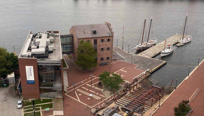
Today, the site of Thorndick Chase’s c.1803 wharf is a National Historic Landmark at Fell’s Point the oldest waterfront warehouse in Baltimore, the site of the Living Classrooms Foundation, Frederick Douglas – Isaac Meyers Maritime Park.

End

Invoice of articles forwarded from Fort Mandan to the President of the United States through Captain Amos Stoddard at St. Louis and Mr. H.B. Trist the Collector of the Port of New Orleans.

Source: National Archives, http://lewisandclarktrail.com/section2/ndcities/newtown/returnbarge.htm

Endnotes

1 Universal Gazette (D.C.), August 22, 1805.

2 The act was entitled “An Act for extending the external commerce of the United States” (approved Feb 28, 1803). The cost for the expedition far exceeded the $2500 proposed by Jefferson. Captain Lewis’s monthly army pay alone was $40, thus for 3 years equaled $1,440. Present day scholars have estimated the cost of $38 -50,000 in 1815 currency.

3 Meriweather Lewis (1774-1809) and William Clark (1770-1838)

4 The Hornet (Frederick, Md., December 13, 1803; Republican Star (Easton, Md), March 29, 1803.

5 Present day Washburn, North Dakota.

6 Stoddard was the acting territorial civil and military governor of Louisiana appointed by Jefferson in 1804.

7 Orleans Gazette and Commercial Adv., (New Orleans, La.), July 24, 1805; William Claiborne to Collector of the Port of Baltimore, July 23, 1805. Letters of the Lewis and Clark Expedition, with Related Documents, 1783-1854, by Donald D. Jackson, (University of Illinois Press, 1978), 253-254; Federal Gazette (Baltimore), August 15, 1805; American & Commercial Daily Adv. (Baltimore), August 12, 1805; Orleans Gazette, July 24, 1805.

8 Baltimore Gazette, November 19, 1803; August 16, 1805.

9 “Merchant’s Coffee-House Books,” Federal Gazette (Baltimore), August 10, 1805; “Ship News, Port of New Orleans, Arrived,” Orleans Gazette and Commercial Adv., July 27, 1805.

10 James McNeill to Thomas Jefferson, August 12, 1805. Coolidge Collection

11 “An Ordnance for the Appointment of a Health office at the Port of Baltimore…’

March 5, 1805. Baltimore Health Department has its origins in 1793 when the state authorized a commissioner of health to take preventive actions against disease. Dr. Stewart later served as surgeon at Fort McHenry during the War of 1812.

12 Nelson, Lee H. An Architectural Study of Fort McHenry, Historic American Buildings Survey, National Park Service (Philadelphia, Pa. 1961), 18-24.

13 "An Act to continue in force “An Act declaring the consent of Congress to an act of the state of Maryland, passed December 28, 1793, for the appointment of a health officer, Approved March 1, 1805. [for the port of Baltimore-town]." “An Ordinance for the appointment of a Health office at the Port of Baltimore.” American & Commercial Daily Advertiser, March 17, 1805.

14 Present day site of the Frederick Douglas-Isaac Myers Maritime Park @ 1417 Thames St.; Thorndick Chase (1755-1838). “Fell’s Point,” National Register of Historic Places Inventory, Maryland Historic Trust, No. 18BC51 (1969); also see Archeological Inventory, Phase II and Phase III, No. B-982.

15 Robert Purviance, Port Collector of Baltimore to James Madison, Secretary of State, August 12, 1805. Thomas Jefferson Papers, Library of Congress; Massachusetts Spy, August 28, 1805; Universal Gazette (D.C.), August 22, 1805; Orleans Gazette and Commercial Adv., July 24, 1805; Federal Gazette (Baltimore), August 10, 1805.

16 History of the Expedition under the Command of Captains Lewis and Clarke, To the Sources of the Missouri, Thence Across the Rocky Mountains, and Down The River Columbia To The Pacific Ocean; Performed During the Years 1804, 1805, 1806.

(Detail) of the title page of the 2-volume leather bound edition published in Philadelphia.

17 Jefferson served as the society’s president from 1797-1815.

18 Jefferson to Lewis, June 4, 1807.& Lewis to Jefferson, June 27, 1807. Jackson, 418.

19 For further information on the surviving collections see the Peabody’s “From Nation to Nation: Examining the Lewis and Clark Indian Collection.”

www.peabody.harvard.edu/node/2470; and Gary E. Moulton’s “The Missing Journals of Meriwether Lewis,” Montana: The Magazine of Western History, Volume 35, Summer 1985, pages 28-39.

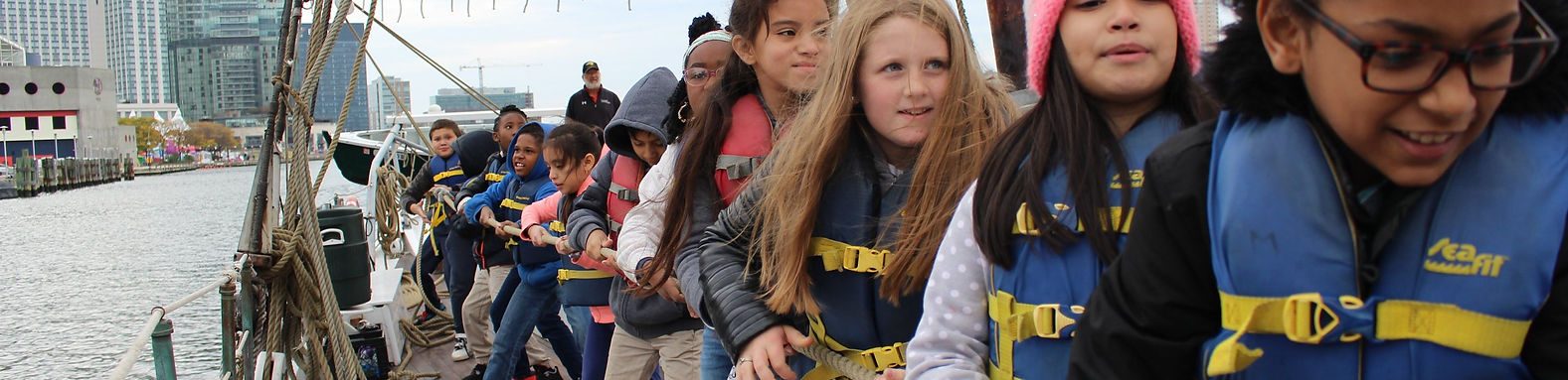
In addition to the port of entry for the first collection sent to President Jefferson, the Fells Point warehouse, located east of the Inter Harbor of Baltimore, is an excellent example of a port warehouse built during the 1800s. The Living Classrooms Maritime Park, adjoining the warehouse is an excellent site for learning by doing.

Living Classroom Foundation Marina

Living Classroom Foundation Marina

Frederick Douglas- Issac Myer Maritime Park, 802 South Caroline Street, Baltimore, MD 21231

“Learning by Doing” Living Classroom Foundation

“Learning by Doing” Living Classroom Foundation

Courtesy: Living Classroom Foundation

Walters Museum, Baltimore, MD

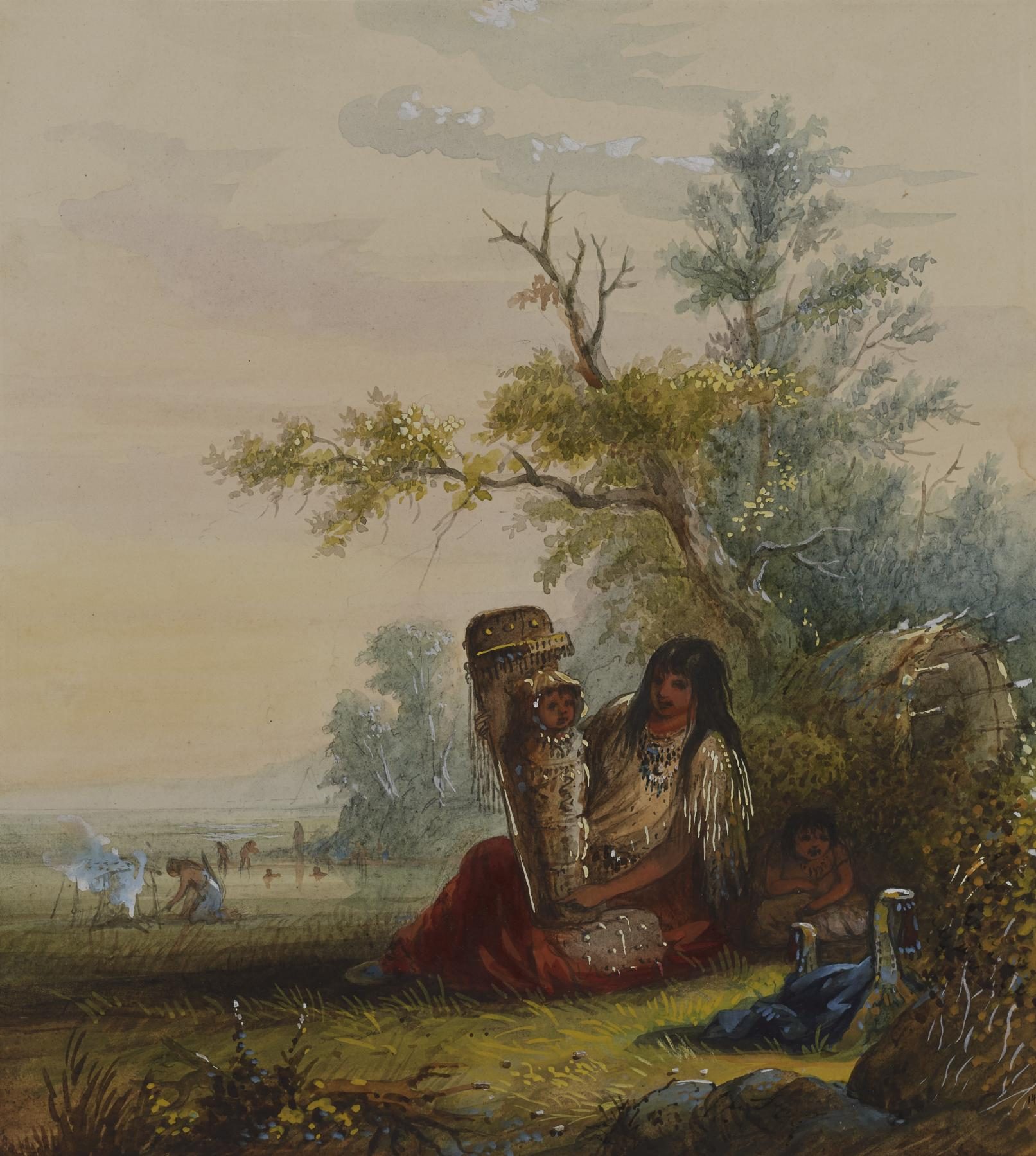
Baltimore’s Walters Museum is home for two hundred excellent water color paintings of the American West by Alfred Jacob Miller. (3) The Miller paintings, commissioned by Capt. William Drummond Stewart, are equal to or exceed any of the early western American paintings of Tribal People, animals, and landscape scenes representing the people and scenery that the expedition was viewing as they traveled toward the Rockey Mountains along the Missouri River.

Indian Mother and Children by Alfred Jacob Miller

Indian Mother and Children by Alfred Jacob Miller

Walter Art Museum, Baltimore, MD

Courtesy: Walters Art Museum

Source:

(1) Jackson, Donald, Letters of the Lewis and Clark Expedition, Second Edition, Vol.1, University of Illinois, Urbana, page 236, note 5.
(2) Ibid, page 234-236.

(3) Ross, Marvin C., The West of Alfred Jacob Miller (1837): from the Notes and Water Colors in The Walters Art Gallery with an account of the artist, University of Oklahoma Press, Norman, 1951.

Stop 16 of 16

Joyous Return to St. Louis, 23 September 1806

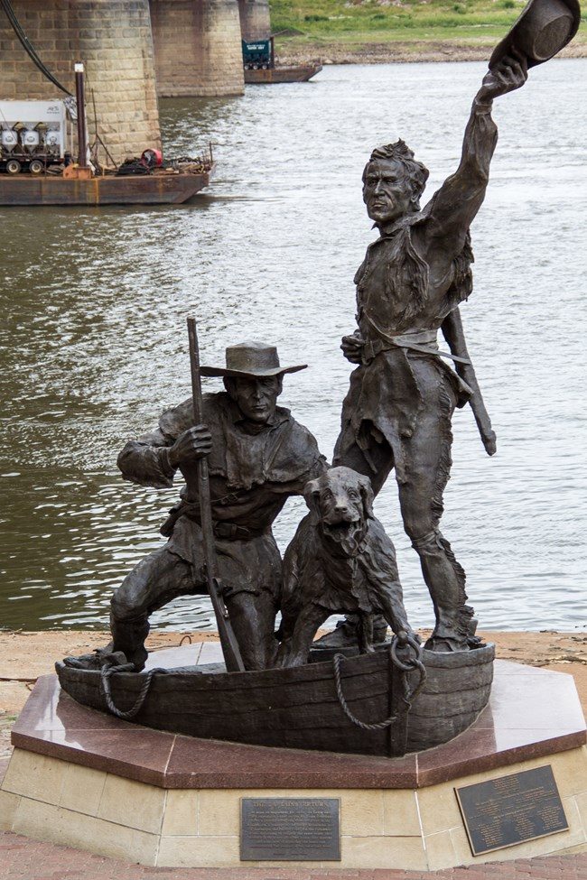
statue of Lewis and Clark (picture 1 of 2)
Joyous Return to St. Louis, 23 September 1806 (picture 2 of 2)

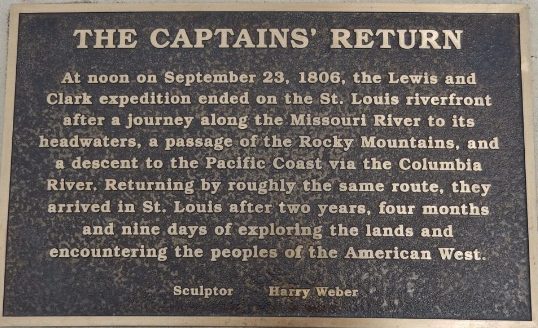
The Lewis and Clark Statue — officially titled The Captains’ Return — is a 23-foot-tall bronze sculpture by Harry Weber that commemorates the bicentennial of the explorers’ return to St. Louis on September 23, 1806. It depicts Meriwether Lewis, William Clark, and their Newfoundland dog Seaman as they arrive at the riverfront. Regional Arts Commission of St. Louis.

Commission and Significance

Commissioned by the Greater St. Louis Community Foundation in 2006, the three-and-a-half-ton statue was designed to mark the 200th anniversary of the expedition’s conclusion National Park Service+1. Weber aimed to capture the emotional moment — Lewis with a mix of triumph and reflection, and Clark embodying the soldier’s drive to take on new challenges Regional Arts Commission of St. Louis. The work is one of two National Lewis and Clark sites designated by the Federal Parks Department Wikipedia

Courtesy: Regional Arts Commission of St. Louis

Sculpture: Harry Webber

The Lewis and Clark Trust website, 1804-1806 part of the exploration, is in development process. We urge the use of www.nps.gov/lecl to explore the Lewis and Clark Expedition Story.