
Stop 6 of 37
Traveling A Well-Established Road to see the Large Clark Family in Louisville
Current day I-65 and U. S. 31 W Corridor
9 October, the Clark party was leaving the Barrens, a region in south central Kentucky known for open savannahs. Willian recorded timber increasing, and they passed the fork in the road leading to Lexington. The road to Lexington, was taken by future King of France, Louis Phillippe and his brothers as he traveled in America during 1796-1797. (1)
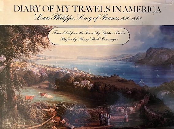
Translated from French by Stephen Becker, 1977, Delacorte Press, NY
In 1867, the same route was traversed North to South by John Muir on his 1000 Mile Walk, Indianapolis to the Gulf Coast. Muir’s route passed through Louisville then crossed the Salt River into West Point, ascended Muldraugh Hill before passing through Elizabethtown, Munfordville, Horse Cave to Mammoth Cave. (2)
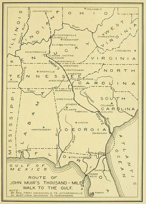
Courtesy: John Muir Legacy Trail
The road from Bowling Green (549 ft. above sea) to Elizabethtown (758 ft. above sea) is a gradual incline used by large animals including the American Bison (Buffalo). While Clark did not record seeing any Buffalo (Bison), Hart County Kentucky reported the last Buffalo in Kentucky in 1820, along the same route Clark was traveling. (3)(4)
The future Louisville and Nashville Railroad, chartered in 1850, followed the same general route. The gradual incline was important to the large animals, the railroad and assisted William Clark. The route is today’s I-65 and U. S. 31 W.
9 Oct. Monday Set out early, took the left hand road at 8 miles leaving to the right, one leading to Lexington & the other to the same per a man Southerly route 119 miles. We proceeded ot the road to Louisville, Breakfast at gills (Gills, $1.50) the 12 miles Mr. groves (Groves) and paid $1.50 proceeded on Day hot to Mr. Rich(ar)d munford (Munford) N(orth) of Green River, crossed that river at Amos’s Ferry, water about 18 inches deep
The Clarks had arrived at Munfordville, KY, named for Richard J. Munford, on the north side of the Green River (4) after crossing the Amos Ferry, operated 1790-1860s, 37°53.21’ N - 85°53.21’W. (5) The Old Munford Inn is located one block east of main Street. Based on the cost, $2.75, the Clarks stayed all night. (6)
Munfordville, KY
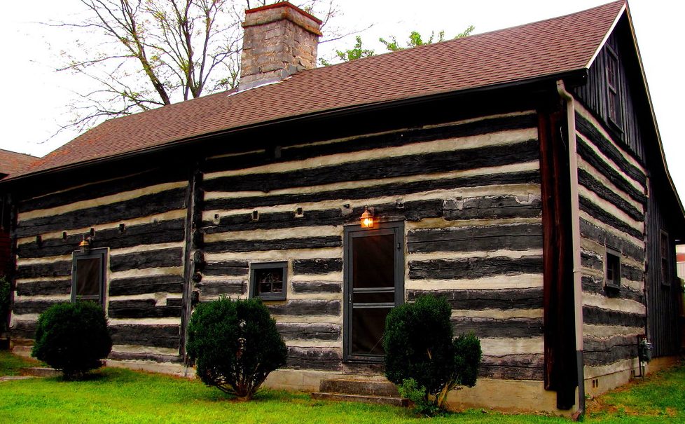
https://npgallery.nps.gov/GetAsset?assetID=09510ab5-7fe5-4ba3-95d0-fa748be27dbc
Left: Munford Inn Owned by the Munfordville Women’s Club Right: Munford Inn pre 1953, exact date unknown
10 October Breakfast at Mr. W(illiam) gages (Gages, $1.25) on nolin. Stayed all night 1 mile north of nolin, at a good little house ($2.50)
At the Nolin River crossing the Clarks were 10 miles from Hodgenville and the birthplace of Abraham Lincoln on 12 February 1809. (7)
The First Lincoln Memorial and Boyhood Home
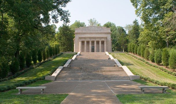
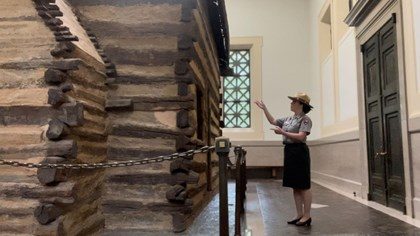
Courtesy: National Park Service
11th October Breakfast at Elizabethtown (KY) ($1.75)
While Clark did not describe the breakfast location in Elizabethtown, a list of licensed taverns removes some of the mystery. The Hardin County (KY) Sheriff issued license to operate a tavern. License records are preserved by the Hardin County, County Court Clerk in Court Order Book “B” 1805-1812. On 10 April 1809, page 298, a license was issued to Benjamin Ogden. Ogden was also the County Jailer, located on the town square adjoining the courthouse. Today the town square is at South Main Street and US 31W (KY 61) and approximately one block from the intersection of US 62 and 31W. The Clark party had been following the corridor of US 31W after leaving Bowling, KY on 8 October and passed through the center of town. Did the Clark party have breakfast at the Jail? Or the Sign of the Lion, later the Smith Hotel.
Other licenses were issued in 1808 to: Joseph Chalfan, (11 July 1808, page 234), Denton Geoghegan (28 March 1808, page 224), Jacob Vanmatre (28 January 1808, page 204), Daniel Waide (12 July 1808, page 243) and Benjamin Ogden (1808, page 206). Chalfan (Sign of the Bear), Ogden and Waide, (Eagle House) are listed as “Elizabethtown” the others are “in the county”. There is no certain location for the breakfast but we do know that the breakfast in Elizabethtown cost $1.75.
Hardin County Court Order Book Hardin County Historical Marker- Smith Hotel
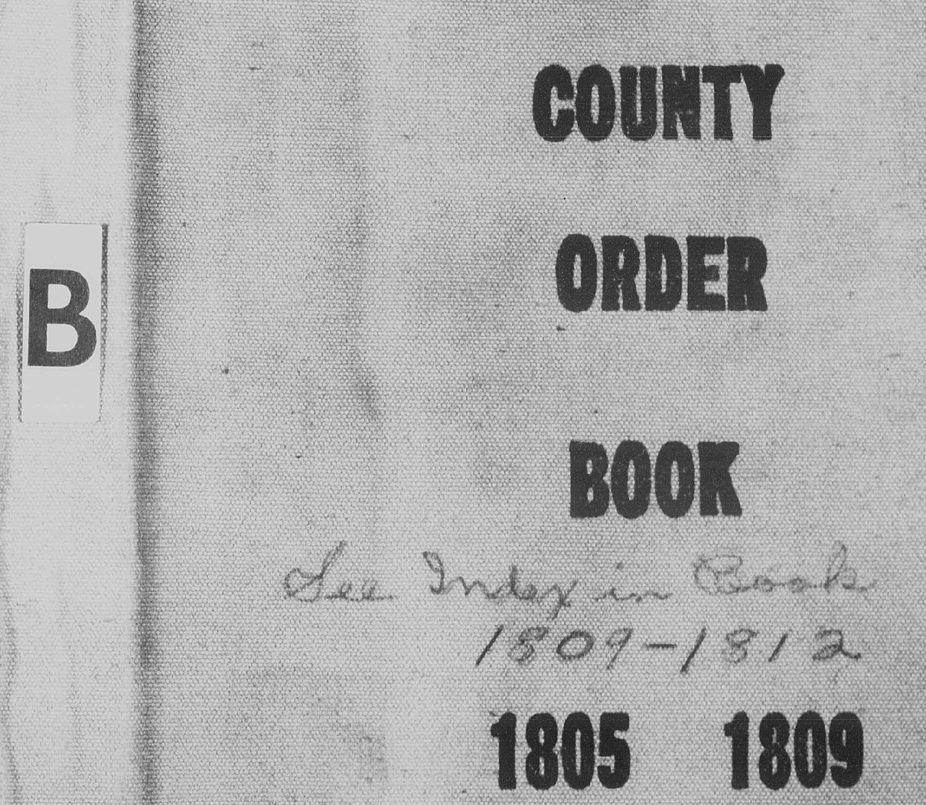
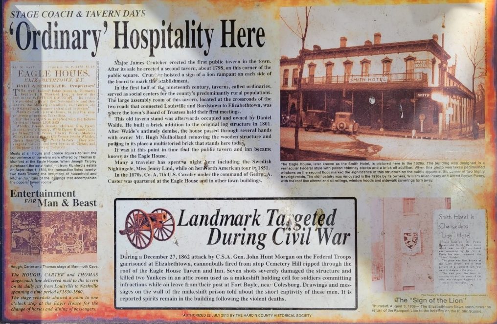
Courtesy: Harden County Court Clerk, Meranda Caswell, Deputy and Hardin County Historical Society, Ann Sipes, Docent
The morning of 11 October William Clark had no way of knowing the tragedy that had occurred with his friend and partner in discovery, Meriwether Lewis, on the Natchez Trace. They were not only separated by approximately 200 miles, but by death.
Leaving Elizabethtown, the Clarks followed the corridor of today’s KY 61/US 62. Near Boston, KY, state route, KY 61 turns to a northernly direction and is the western or Louisville branch of the Wilderness Road.
….. and stayed all night at a little house, much pestered with flies and mosquiyoes. Chentek Tavern 2.255.
William Clark’s spelling once again presents a challenge. The tavern is most likely Chapeze Tavern located on the Long Lick Creek, Bullitt County, KY near the ford on the creek crossed by KY 61.
Dr. Henry Chapeze, a French expatriate, had served as a surgeon during the American Revolution. The large Chapeze family of 10 children built an extensive business presence in the region that included 1000 acers on Long Lick Creek. Later generations built the Chapeze Distillery at Limestone Springs, (near todays Clermont, KY) producing Old Charter Bourbon.
An interesting side note for the Long Lick Creek area: in 1808 Robert Pryor, brother of Sergeant Nathaniel Hale Pryor of the recently completed Lewis and Clark Exploration, was appointed District Patroller (Deputy Sheriff).
12 Oct breakfast at Shepherdsville $1.75. The Clark’s had arrived at Shepherdsville, Bullitt County, KY, traveling along KY 61, Wilderness Road, and todays Preston Highway, crossing the Salt River on the ferry. Bullett County issued eight (8) tavern license in 1809, with two being in Shepherdsville. Did they eat breakfast in the Ben Withers or the Daniel Donaldson Tavern?
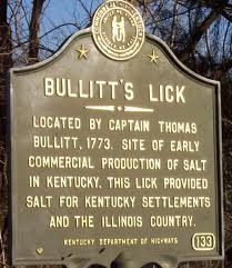
Shepherdsville was the center of the first commercial industry in Kentucky. The essential element of salt equaled the value of gold in an era of tanning hides and preserving meat for human consumption. Area salt springs had a high concentration of brine water to dry salt (1000 gallons to 3 or 4 bushel of dry salt). It was a labor intense industry requiring wood for the furnace and brine water around the clock.
Joseph Field and salt making is another “stories-within-the-story” of Lewis and Clark. Joseph was a highly efficient and productive member of the recently finished exploration of the west and is believed to have known the process of boiling salt water to produce the dry salt. He had lived in the area before the expedition and was one of the expedition members sent to the Pacific Ocean during the winter of 1805/06, to produce salt from sea water. The salt operation on the Pacific coast was as intense as the Bullitt County salt production. (8) The Bullett County History Museum -300 South Buckman St. Shepherdsville, KY- is an excellent site to learn about salt making. (9)(10)
Salt Furnaces, Bullitt Co. KY 1779-1780 Salt River Watershed, Salt Springs, and Frontier Stations
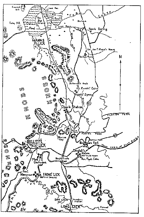
Courtesy: Filson Club History Quarterly, Vol.30, page 2240-249
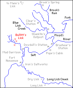
Courtesy: Library of Congress
Kentucky Historical Marker
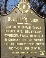
Courtesy: HMdb.org- by Duane and Tracy Marsteller
Salt making in Bullett County’s salt industry is further tied to the Lewis and Clark Expedition through the salt being shipped down the Salt River to warehouses in West Point, KY, home of the Lewis and Clark Education and Research Center.
West Point, KY Salt Wearhouse
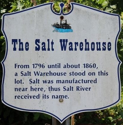
Courtesy: HMdb.org
The intense use of trees as a fuel for the salt furnaces, striped hundreds of acers of forest in the salt spring region. Early iron furnaces in the area further denuded the frontier forest. Restoration of 12,000 acers of forest began with the vision and philanthropic contribution of Issac Wolfe Bernheim, Bernheim Brothers Distilling Company. Today, the Bernheim Forest and Arboretum, originally designed by Frederick Law Olmstead, encompasses 16,000 acres of privately supported lands used for education, research, and recreation - “connecting people with nature”. The 3-mile drive along KY 61 and KY 245, (South Preston Highway) to Bernheim Forest is an opportunity to experience the “Bernheim Way”- “Curiosity-Wonder, Intentionality, and Belonging”. (11)
Bullet Salt Works, Bullett County, KY
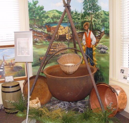
Courtesy: Bullet County History Museum
Note: The Lewis and Clark Trust extends a special salute of gratitude to the Bullett County History Museum for articles by Charles Hartley and research assistance by Jim Holmberg, Curator- Filson Historical Society.
When the Clarks reached Louisville, they had traveled more than 25 miles on a corridor that is todays KY 61, from Shepherdsville to Louisville. This route is also the final leg of the historic Wilderness Road that Bison had followed for eons to the Falls of the Ohio. A Kentucky Historical marker number 219, at the intersection of Preston Highway (KY61) and Blue Licks Road in Okolona describes the significance of the route.
Wilderness Road Historical Marker in Okolona, KY
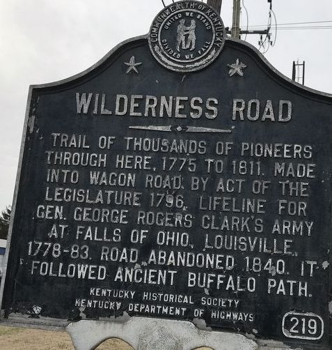
Courtesy: Kentucky Historical Society & Duaine and Tracy Marsteller
Anticipation in reaching their beloved family was incentive to keep the Clarks traveling. They arrived at Bro(ther) Jonat(han) at sun set. Can you hear the joy and excitement when they arrived at Trough Spring, the home of Jonathan and Sarah Hite Clark?
Source:
(1) Louis Phillippe, Diary of My Travels in America, Translated from French by Stephen Becker, Delacorte Press, NY, 1996, page 116-117.
(2) https://www.gutenberg.org/files/60749/60749-h/60749-h.htm#chap01
(3) Kleber, John, The Kentucky Encyclopedia, University of Kentucky Press, Lexington, 1992, page 138.
(4) Collins, Lewis, Kentucky; Its History, Antiquities, and Natural Curiosities, Geographical Statistical, and Geological Descriptions with Anecdotes of Pioneer Life, Lewis Collins, Maysville, KY 1847, page 344.
(5) Amos Ferry- https://www.hmdb.org/m.asp?m=40020
(6) https://www.hmdb.org/m.asp?m=39989
(7) Appleman, Roy E., Abraham Lincoln From His Own Words and Contemporary Accounts, U. S. DOI-National Park Service, 1946, page 1; Angle, Paul, The Lincoln Reader, Rutgers University Press, Rutgers, NJ, 1947, page 6.
(9) https://bullittcountyhistory.org/memories/saltmaking.html; The Filson Club History Quarterly, Vol 30, No. 3, p 241-269.